Metal Print > Europe > France > Maps
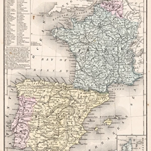
Metal Print : Antique Map of France - 19th Century


![]()
Metal Prints from Fine Art Storehouse
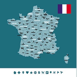
Antique Map of France - 19th Century
Vintage map of France. Vintage etching circa late 19th century
Unleash your creativity and transform your space into a visual masterpiece!
powerofforever
Media ID 15134759
© This content is subject to copyright
20"x16" (51x41cm) Metal Print
Step back in time with our exquisite Antique Map of France Metal Print from the Media Storehouse collection at Fine Art Storehouse. This vintage masterpiece, created in the late 19th century, showcases the intricate details of France's historical borders and territories in an etching that beautifully captures the essence of a bygone era. The high-quality metal print preserves the intricate lines and textures of the original antique map, adding a timeless charm to any space. Bring history into your home or office with this stunning piece of decorative art.
Your image is printed photographically and bonded to a 3.5mm thick, Dibond board (black polyethylene sandwiched between two sheets of white coated aluminium). The panel is then sealed with a gloss protective covering. Supplied complete with a wall mount which holds the print 10mm from the wall.
Made with durable metal and luxurious printing techniques, metal prints bring images to life and add a modern touch to any space
Estimated Product Size is 50.8cm x 40.6cm (20" x 16")
These are individually made so all sizes are approximate
Artwork printed orientated as per the preview above, with landscape (horizontal) or portrait (vertical) orientation to match the source image.
FEATURES IN THESE COLLECTIONS
> Fine Art Storehouse
> Map
> Historical Maps
> Maps and Charts
> Related Images
EDITORS COMMENTS
This print showcases an exquisite Antique Map of France, taking us back to the enchanting era of the 19th century. With its vintage allure and intricate details, this map is a true testament to the artistry and craftsmanship of that time. The delicate etching technique used in creating this masterpiece adds depth and character to every line and contour. As we gaze upon this historical treasure, we are transported into a bygone era when cartography was both an art form and a means of exploration. Each city, river, and mountain range is meticulously depicted with precision, offering a glimpse into the geographical landscape of France during that period. The warm sepia tones evoke a sense of nostalgia as we immerse ourselves in the rich history embedded within these faded lines. This antique map not only serves as a decorative piece but also sparks curiosity about how our world has evolved over time. Whether displayed in your study or living room, this Vintage Map of France will undoubtedly become a conversation starter among admirers who appreciate both history and aesthetics. Its timeless beauty captures the essence of an era long past while reminding us that even in today's fast-paced world, there is still value in preserving our heritage through artful representations like this one.
MADE IN THE UK
Safe Shipping with 30 Day Money Back Guarantee
FREE PERSONALISATION*
We are proud to offer a range of customisation features including Personalised Captions, Color Filters and Picture Zoom Tools
SECURE PAYMENTS
We happily accept a wide range of payment options so you can pay for the things you need in the way that is most convenient for you
* Options may vary by product and licensing agreement. Zoomed Pictures can be adjusted in the Basket.