Fraud Blocker Skip to main content

Home > Maps and Charts > World

World Collection (#26)

World maps and charts are visual representations of the Earth's surface, showing geographical features such as continents, oceans, countries, cities

6,940 Items

Background imageWorld Collection: Cartouche in North Pacific Ocean, c.1795 (papier mache, copper plate engraved, brass, wood, paper)

Cartouche in North Pacific Ocean, c.1795 (papier mache, copper plate engraved, brass, wood, paper)
7339257 Cartouche in North Pacific Ocean, c.1795 (papier mache, copper plate engraved, brass, wood, paper) by Bardin, William (18th century); 40x44x30.4 cm; National Maritime Museum, London

Background imageWorld Collection: Cartouche in North Pacific Ocean, 1776-79 (papier mache, wood, plaster, varnish, metal)

Cartouche in North Pacific Ocean, 1776-79 (papier mache, wood, plaster, varnish, metal, embossed paper, brass, paint)
7339207 Cartouche in North Pacific Ocean, 1776-79 (papier mache, wood, plaster, varnish, metal, embossed paper, brass, paint, copper plate engraved, hand-coloured) by Lane

Background imageWorld Collection: World map from the Blaeu Atlas, 17th century, c.1662 (print)

World map from the Blaeu Atlas, 17th century, c.1662 (print)
7339181 World map from the Blaeu Atlas, 17th century, c.1662 (print) by Blaeu, Joan (1596-1673); National Maritime Museum, London, UK; (add.info.: Creator: John Blaeu World map from Bleau Atlas)

Background imageWorld Collection: Earth globe represented in a 15th century atlas

Earth globe represented in a 15th century atlas
GIA5033431 Earth globe represented in a 15th century atlas.; (add.info.: Earth globe represented in a 15th century atlas.); © Giancarlo Costa

Background imageWorld Collection: The town of Boston in New England, 1723-33 (engraving)

The town of Boston in New England, 1723-33 (engraving)
8703273 The town of Boston in New England, 1723-33 (engraving) by Bonner, John (c.1643-1726); Boston Public Library, Boston, Massachusetts

Background imageWorld Collection: Geographic map of the New World, 1513, admiral map of the Caribbean and unknown lands of North

Geographic map of the New World, 1513, admiral map of the Caribbean and unknown lands of North and South America
NWI4846079 Geographic map of the New World, 1513, admiral map of the Caribbean and unknown lands of North and South America

Background imageWorld Collection: Map of South America from Sebastian Cabot's World Map, 1544. Colourful engraving of the 19th century

Map of South America from Sebastian Cabot's World Map, 1544. Colourful engraving of the 19th century
NWI4846282 Map of South America from Sebastian Cabot's World Map, 1544. Colourful engraving of the 19th century.; (add.info.: Map of South America from Sebastian Cabot's World Map, 1544)

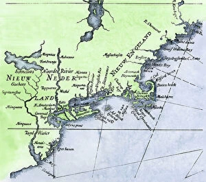
Background imageWorld Collection: Discovery of the New World (Discovery of America): Dutch map of the New Netherlands and New England

Discovery of the New World (Discovery of America): Dutch map of the New Netherlands and New England
NWI4848829 Discovery of the New World (Discovery of America): Dutch map of the New Netherlands and New England, colonies of the Netherlands and Great Britain, circa 1630

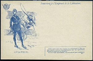
Background imageWorld Collection: First World War: France, Propaganda map showing an aviator next to his fighter plane, 1918

First World War: France, Propaganda map showing an aviator next to his fighter plane, 1918
LUX4734196 First World War: France, Propaganda map showing an aviator next to his fighter plane, 1918; (add.info.: World War I - War 14-18 (1914-1918) - World War I (WWI or WW1): France

Background imageWorld Collection: Map showing the area in the North Sea mined by the British during WWI

Map showing the area in the North Sea mined by the British during WWI, from The War Illustrated Album Deluxe, pub.1915
3502686 Map showing the area in the North Sea mined by the British during WWI, from The War Illustrated Album Deluxe, pub.1915; (add.info)

Background imageWorld Collection: Map of the world showing the colonial possessions, England, France, Portugal

Map of the world showing the colonial possessions, England, France, Portugal
ELD4932191 Map of the world showing the colonial possessions, England, France, Portugal, Spain and their colonies Engraving from "History of the world" by Ridpath 1885 Private collection;

Background imageWorld Collection: Map of the Persian Empire 588 to 536 BC (Map of empire of Persia, from 588 to 536 BC)

Map of the Persian Empire 588 to 536 BC (Map of empire of Persia, from 588 to 536 BC)
ELD4933505 Map of the Persian Empire 588 to 536 BC (Map of empire of Persia, from 588 to 536 BC) Engraving from "History of the world" by Ridpath 1885 Private Collection; (add.info)

Background imageWorld Collection: Map of the world circa 1810. Handcoloured copperplate engraving by Andrea Bernieri from Giulio

Map of the world circa 1810. Handcoloured copperplate engraving by Andrea Bernieri from Giulio Ferrario's Ancient
FLO4622350 Map of the world circa 1810. Handcoloured copperplate engraving by Andrea Bernieri from Giulio Ferrario's Ancient and Modern Costumes of all the Peoples of the World

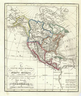
Background imageWorld Collection: Map of the European colonies in the New World (North and Central America), 1846

Map of the European colonies in the New World (North and Central America), 1846
FLO4621821 Map of the European colonies in the New World (North and Central America), 1846. Handcoloured copperplate engraving from Giulio Ferrario's Ancient

Background imageWorld Collection: Map showing the North sea and the Baltic sea at the time of the first world war (litho)

Map showing the North sea and the Baltic sea at the time of the first world war (litho)
3252859 Map showing the North sea and the Baltic sea at the time of the first world war (litho); Private Collection; (add.info)

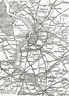
Background imageWorld Collection: Plan of the immense fortress town of Antwerp, Belgium (litho)

Plan of the immense fortress town of Antwerp, Belgium (litho)
3252881 Plan of the immense fortress town of Antwerp, Belgium (litho); Private Collection; (add.info.: Plan of the immense fortress town of Antwerp, Belgium)

Background imageWorld Collection: First World War 1914-1918 (14-18): Headquarters: Generals of the French army studying battle plans

First World War 1914-1918 (14-18): Headquarters: Generals of the French army studying battle plans
DUV4201410 First World War 1914-1918 (14-18): Headquarters: Generals of the French army studying battle plans. Engraving in " Alphabet of the Great War 1914-1916

Background imageWorld Collection: First World War 1914-1918 (14-18): Letter Q as the headquarters

First World War 1914-1918 (14-18): Letter Q as the headquarters. Generals of the French army studying battle plans
DUV4201414 First World War 1914-1918 (14-18): Letter Q as the headquarters. Generals of the French army studying battle plans

Background imageWorld Collection: First World War: France, Patriotic Map showing four young girls symbolically dressed in uniforms

First World War: France, Patriotic Map showing four young girls symbolically dressed in uniforms of the French
LUX4737808 First World War: France, Patriotic Map showing four young girls symbolically dressed in uniforms of the French, Italian, English and Belgian armed forces pose with their flag

Background imageWorld Collection: First World War: France, Patriotic Map showing a Belgian soldier

First World War: France, Patriotic Map showing a Belgian soldier and a French soldier with their flag swearing fidelity
LUX4737752 First World War: France, Patriotic Map showing a Belgian soldier and a French soldier with their flag swearing fidelity with the following sentence

Background imageWorld Collection: First World War: France, Patriotic Map showing a French soldier

First World War: France, Patriotic Map showing a French soldier and an Italian soldier with their respective flag
LUX4737707 First World War: France, Patriotic Map showing a French soldier and an Italian soldier with their respective flag and names: for the defense of the right

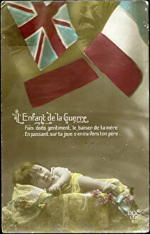
Background imageWorld Collection: First World War: France, An infant in his cradle protects by the flags of the allies

First World War: France, An infant in his cradle protects by the flags of the allies
LUX4738094 First World War: France, An infant in his cradle protects by the flags of the allies, patriotic map entitled Child of War

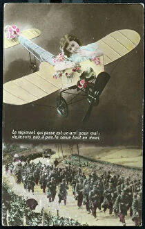
Background imageWorld Collection: First World War: France, Patriotic Map showing a little girl in an airplane

First World War: France, Patriotic Map showing a little girl in an airplane
LUX4741397 First World War: France, Patriotic Map showing a little girl in an airplane, moved by seeing the soldiers rising to the front

Background imageWorld Collection: First World War: France, Patriotic Map showing in a heart-shaped medallion the reunion between a

First World War: France, Patriotic Map showing in a heart-shaped medallion the reunion between a soldier
LUX4741292 First World War: France, Patriotic Map showing in a heart-shaped medallion the reunion between a soldier and his engagement

Background imageWorld Collection: First World War: France, Patriotic Map showing a girl, 1915

First World War: France, Patriotic Map showing a girl, 1915
LUX4741278 First World War: France, Patriotic Map showing a girl, 1915; (add.info.: World War I - War 14-18 (1914-1918) - World War I (WWI or WW1): France, Patriotic Map showing a girl

Background imageWorld Collection: First World War: France, Patriotic Map showing a woman holding her daughter in arms asking her

First World War: France, Patriotic Map showing a woman holding her daughter in arms asking her husband to go quickly to
LUX4741256 First World War: France, Patriotic Map showing a woman holding her daughter in arms asking her husband to go quickly to the front, 1915

Background imageWorld Collection: First World War: France, Patriotic Map showing an Alsatian boy

First World War: France, Patriotic Map showing an Alsatian boy and a girl returning to France with the help of a
LUX4741213 First World War: France, Patriotic Map showing an Alsatian boy and a girl returning to France with the help of a soldier in uniform, entitled en route to France

Background imageWorld Collection: First World War: France, Patriotic map showing a young Alsatian pensive with her headdress

First World War: France, Patriotic map showing a young Alsatian pensive with her headdress and traditional dress
LUX4741173 First World War: France, Patriotic map showing a young Alsatian pensive with her headdress and traditional dress and saying: Alsace dreams of the future for you France love and die, 1916

Background imageWorld Collection: First World War: France, Patriotic Map showing a young woman symbolizing the republic wearing a flag

First World War: France, Patriotic Map showing a young woman symbolizing the republic wearing a flag
LUX4741595 First World War: France, Patriotic Map showing a young woman symbolizing the republic wearing a flag and a Phrygian cap, asking a soldier in uniform

Background imageWorld Collection: First World War: France, Patriotic Map showing a sailor thinking of his fiance before the flag of

First World War: France, Patriotic Map showing a sailor thinking of his fiance before the flag of the navy or is
LUX4740722 First World War: France, Patriotic Map showing a sailor thinking of his fiance before the flag of the navy or is inscribed honor and homeland

Background imageWorld Collection: First World War: France, Patriotic Map showing a young Francaise

First World War: France, Patriotic Map showing a young Francaise and a young Russian representing France and Russia
LUX4740671 First World War: France, Patriotic Map showing a young Francaise and a young Russian representing France and Russia, each holding a flag and united before the enemy for better and worse

Background imageWorld Collection: First World War: France, Patriotic Map showing France as a girl wearing a Frigian hat

First World War: France, Patriotic Map showing France as a girl wearing a Frigian hat
LUX4740629 First World War: France, Patriotic Map showing France as a girl wearing a Frigian hat and offering a bouquet of flowers to soldiers fighting for law

Background imageWorld Collection: First World War: France, Patriotic Map showing a grandmother learning her grandson disguise in

First World War: France, Patriotic Map showing a grandmother learning her grandson disguise in Zouave
LUX4740551 First World War: France, Patriotic Map showing a grandmother learning her grandson disguise in Zouave, holding a rifle with a broom

Background imageWorld Collection: First World War: France, Patriotic Map showing a cantiniere holding a flag

First World War: France, Patriotic Map showing a cantiniere holding a flag and singing a verse of the Marseillaise
LUX4739753 First World War: France, Patriotic Map showing a cantiniere holding a flag and singing a verse of the Marseillaise

Background imageWorld Collection: First World War: France, Map draws showing the French 'D' system at the service of the hairy

First World War: France, Map draws showing the French "D" system at the service of the hairy and war, 1915
LUX4736518 First World War: France, Map draws showing the French "D" system at the service of the hairy and war

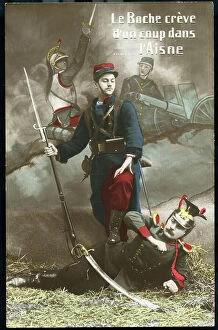
Background imageWorld Collection: First World War: France, Humorous map showing a French soldier in uniform laying down a German

First World War: France, Humorous map showing a French soldier in uniform laying down a German soldier with a comment
LUX4736264 First World War: France, Humorous map showing a French soldier in uniform laying down a German soldier with a comment: " the boche is dying in the Aisne"

Background imageWorld Collection: First World War: France, Patriotic Map showing a couple in a bed for reunion, 1916, Hours of return

First World War: France, Patriotic Map showing a couple in a bed for reunion, 1916, Hours of return
LUX4741412 First World War: France, Patriotic Map showing a couple in a bed for reunion, 1916, Hours of return, hours of drunkenness; (add.info)

Background imageWorld Collection: First World War: France, Patriotic Map showing a young nurse who thinks of the soldier she will

First World War: France, Patriotic Map showing a young nurse who thinks of the soldier she will save on the front
LUX4741285 First World War: France, Patriotic Map showing a young nurse who thinks of the soldier she will save on the front, titled "During the Action the Prayer"

Background imageWorld Collection: First World War: France, Patriotic Map showing a soldier regaining his fiancee during a leave saying

First World War: France, Patriotic Map showing a soldier regaining his fiancee during a leave saying
LUX4741785 First World War: France, Patriotic Map showing a soldier regaining his fiancee during a leave saying: our union on return will be my reward

Background imageWorld Collection: First World War: France, Patriotic Map showing a little boy offering his father at the forehead a

First World War: France, Patriotic Map showing a little boy offering his father at the forehead a bouquet of flowers
LUX4741639 First World War: France, Patriotic Map showing a little boy offering his father at the forehead a bouquet of flowers

Background imageWorld Collection: First World War: France, Patriotic Map showing a French soldier greeted by two small Alsatians

First World War: France, Patriotic Map showing a French soldier greeted by two small Alsatians carrying flowers, 1915
LUX4741091 First World War: France, Patriotic Map showing a French soldier greeted by two small Alsatians carrying flowers, 1915

Background imageWorld Collection: First World War: France, Patriotic Map showing a young nurse who thinks of the soldier she will

First World War: France, Patriotic Map showing a young nurse who thinks of the soldier she will save on the front
LUX4741017 First World War: France, Patriotic Map showing a young nurse who thinks of the soldier she will save on the front, titled "During the Action the Prayer"

Background imageWorld Collection: First World War: France, Patriotic Map showing a mother announcing to her two daughters that her

First World War: France, Patriotic Map showing a mother announcing to her two daughters that her husband at the front
LUX4740996 First World War: France, Patriotic Map showing a mother announcing to her two daughters that her husband at the front has made new conquests

Background imageWorld Collection: First World War: France, Patriotic colouring map representing three Alsatians in local costume

First World War: France, Patriotic colouring map representing three Alsatians in local costume
LUX4740938 First World War: France, Patriotic colouring map representing three Alsatians in local costume and headdress wear tricoloured bouquets, titled: Vive la France

Background imageWorld Collection: First World War: France, Patriotic map showing a soldier in uniform with a gun in a medallion

First World War: France, Patriotic map showing a soldier in uniform with a gun in a medallion surrounded by stamp of
LUX4740894 First World War: France, Patriotic map showing a soldier in uniform with a gun in a medallion surrounded by stamp of the Allied countries with their qualities; greatness, honor, value

Background imageWorld Collection: First World War: France, Patriotic Map showing a photo of the victory over the cenotaph, 1919

First World War: France, Patriotic Map showing a photo of the victory over the cenotaph, 1919, 14-Jul-19
LUX4740291 First World War: France, Patriotic Map showing a photo of the victory over the cenotaph, 1919, 14-Jul-19; (add.info.: First World War - War 14-18 (1914-1918) - World War I (WWI or WW1)

Background imageWorld Collection: First World War: France, Patriotic Map showing a helmet of the French army surrounded by flowers

First World War: France, Patriotic Map showing a helmet of the French army surrounded by flowers in front of a burning
LUX4740234 First World War: France, Patriotic Map showing a helmet of the French army surrounded by flowers in front of a burning house landscape, titled Souvenir

Background imageWorld Collection: First World War: France, Patriotic Map showing in a chaotic landscape a soldier wounds

First World War: France, Patriotic Map showing in a chaotic landscape a soldier wounds
LUX4740106 First World War: France, Patriotic Map showing in a chaotic landscape a soldier wounds and a good nurse coming to rescue him, titled: Our victory will be their rewarding


All Professionally Made to Order for Quick Shipping


-

World Collection

World maps and charts are visual representations of the Earth's surface, showing geographical features such as continents, oceans, countries, cities, rivers and mountains. They have been used for centuries to aid navigation, exploration and education. Maps can be created using various techniques including satellite imagery or hand-drawn illustrations. Charts are graphical representations of data that help people understand complex information in a simplified manner. Examples include population growth rates or economic indicators by country. Both maps and charts are important tools for understanding our world and making informed decisions about global issues such as climate change or international trade policies.
+

Our beautiful Wall Art and Photo Gifts include Framed Prints, Photo Prints, Poster Prints, Canvas Prints, Jigsaw Puzzles, Metal Prints and so much more

The World collection from Media Storehouse is a stunning array of wall art and framed prints that showcase the beauty and diversity of our planet. Featuring an extensive range of maps, charts, and diagrams, our collection offers something for everyone – from vintage world maps to modern satellite imagery. Each print is carefully crafted using high-quality materials to ensure that it looks great in any setting. Whether you're looking for a piece to decorate your home or office, or simply want to add some visual interest to your space, the World collection has something for you. With its wide variety of styles and subjects, our collection is perfect for anyone who loves travel, geography, history or science. So why not explore the world from the comfort of your own home with one of these beautiful prints?
+

What are World (Maps and Charts) art prints?

World maps and charts art prints are high-quality reproductions of historical or contemporary maps and charts that depict the geography, topography, political boundaries, and other features of different regions of the world. These prints can be used for decorative purposes in homes, offices, schools, museums, libraries or any other setting where a visual representation of global locations is needed. World maps and charts art prints come in various sizes to suit different spaces and preferences. They may feature antique designs from centuries ago or modern interpretations with updated information on countries' borders and names. Some popular styles include vintage world maps with sepia tones or muted colors; colorful political maps highlighting specific regions such as Europe or Africa; nautical charts showing ocean depths and currents; or satellite images displaying terrain details. Whether you're a history buff looking to decorate your study room with an old-world map print or a traveler seeking inspiration for your next adventure destination, World Maps & Charts Art Prints offer something for everyone's taste.
+

What World (Maps and Charts) art prints can I buy from Media Storehouse?

We offer a wide range of World Maps and Charts art prints that are perfect for decorating your home or office. You can choose from vintage maps, antique charts, modern world maps, satellite images of the earth, and many more options. These art prints come in various sizes to suit your needs and preferences. The collection includes detailed maps of different countries and continents such as Europe, Africa, Asia, North America, South America among others. The prints also feature famous landmarks like the Eiffel Tower in Paris or the Statue of Liberty in New York City. Moreover, you can find educational charts on topics like geography or astronomy that are ideal for classrooms. Our World Maps and Charts art prints are printed using high-quality materials to ensure they last a long time without fading or losing their vibrancy. They make great gifts for anyone who loves travel or wants to learn more about our planet's geography.
+

How do I buy World (Maps and Charts) art prints?

To purchase World art prints from Media Storehouse, you can browse our extensive collection of high-quality images online. Once you have found the print that you would like to buy, simply add it to your cart and proceed to checkout. At this point, you will be prompted to enter your shipping and payment information. We offer a variety of sizes for their art prints, so be sure to select the size that best fits your needs. You may also have the option to choose between different paper types or finishes. Once your order has been processed, Media Storehouse will carefully package your print and ship it directly to your doorstep. Whether you are looking for a unique piece of wall decor or a thoughtful gift for someone special, World art prints from Media Storehouse are an excellent choice for anyone who loves geography or history.
+

How much do World (Maps and Charts) art prints cost?

We offer a wide range of World Maps and Charts art prints that are available at varying prices. The cost of our World Maps and Charts art prints depends on the size, quality, and type of print you choose. We have different options such as canvas prints, framed prints, photographic prints, and poster prints. Our World Maps and Charts art prints come in various sizes ranging from small to large formats. The price also varies depending on whether you want a black-and-white or colored print. Our collection features vintage maps as well as contemporary designs that cater to different tastes. We take pride in providing high-quality products at affordable prices without compromising on the quality of our artwork. You can be sure that every piece is carefully crafted with attention to detail using premium materials. The cost of our World Maps and Charts art prints is reasonable considering their quality and uniqueness. Whether you're looking for a statement piece for your home or office space or an educational tool for your classroom, we have something for everyone's budget.
+

How will my World (Maps and Charts) art prints be delivered to me?

We take great care in delivering your World art prints to you. We use a trusted courier service to ensure that your order arrives safely and on time. Your print will be carefully packaged in protective materials to prevent any damage during transit. We offer a range of delivery options for our customers, including standard shipping and express delivery for those who need their order sooner. Once your order has been dispatched, you will receive an email with tracking information so that you can keep track of its progress. Our team is committed to providing excellent customer service, so if you have any questions or concerns about the delivery of your World art prints, please do not hesitate to get in touch with us. We are always happy to help.