Fraud Blocker Skip to main content

Home > Maps and Charts > Willem Janszoon Blaeu

Willem Janszoon Blaeu Collection

Discover the world through the eyes of cartographer Blaeu: where every detail is a testament to precision, artistry, and the enduring spirit of exploration

Choose a picture from our Willem Janszoon Blaeu Collection for your Wall Art and Photo Gifts

Willem Janszoon Blaeu, a prominent Dutch cartographer of the 17th century, left an enduring legacy in the realm of mapmaking with his meticulous craftsmanship and groundbreaking contributions. Born in Alkmaar, Netherlands, in 1571, Blaeu initially trained as a globe maker before establishing himself as a leading mapmaker and publisher in Amsterdam. Renowned for his attention to detail and commitment to accuracy, Blaeu's maps set the standard for cartographic excellence during the Dutch Golden Age.

Blaeu's most notable work includes the production of atlases such as the "Atlas Novus" and the monumental "Atlas Maior." These atlases featured beautifully engraved maps that not only captured the geographical knowledge of the time but also showcased the artistry and sophistication of Dutch mapmaking. Blaeu's maps were prized for their aesthetic appeal and scientific precision, earning him recognition and patronage from royalty and scholars across Europe. His legacy endures through the continued study and appreciation of his maps, which remain prized artifacts of both historical cartography and artistic achievement.

169 items

Background imageWillem Janszoon Blaeu Collection: BRAHE, Tycho (1546-1601). Danish astronomer

BRAHE, Tycho (1546-1601). Danish astronomer. Astronomical sphere. Illustration from the Atlas by Willem Blaeu. FRANCE. Paris. National Library

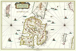
Background imageWillem Janszoon Blaeu Collection: Old Map of the Isle of Islay Scotland 1654 by Johan Blaeu from the Atlas Novus

Old Map of the Isle of Islay Scotland 1654 by Johan Blaeu from the Atlas Novus
This detailed and most attractive reproduction map of The Isle of Islay has been carefully art worked from a scan of an antique original

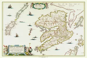
Background imageWillem Janszoon Blaeu Collection: Old Map of the Isle of Mull Scotland 1654 by Johan Blaue from the Atlas Novus

Old Map of the Isle of Mull Scotland 1654 by Johan Blaue from the Atlas Novus
This detailed and most attractive reproduction map of The Isle of Mull has been carefully art worked from a scan of an antique original

Background imageWillem Janszoon Blaeu Collection: Old County Map of Fife 1654 by Johan Blaeu from the Atlas Novus

Old County Map of Fife 1654 by Johan Blaeu from the Atlas Novus
This detailed and most attractive reproduction map of Fife has been carefully art worked from a scan of an antique original

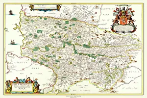
Background imageWillem Janszoon Blaeu Collection: Old County Map of Kyle and Mid Ayrshire 1654 by johan Blaeu from the Atlas Novus

Old County Map of Kyle and Mid Ayrshire 1654 by johan Blaeu from the Atlas Novus
This detailed and most attractive reproduction map of Kyle and Mid Ayrshire has been carefully art worked from a scan of an antique original

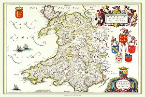
Background imageWillem Janszoon Blaeu Collection: Old Map of Wales 1648 by Johan Blaeu from the Atlas Novus

Old Map of Wales 1648 by Johan Blaeu from the Atlas Novus
This detailed and most attractive reproduction map of Wales has been carefully art worked from a scan of an antique original

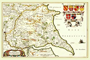
Background imageWillem Janszoon Blaeu Collection: Old County Map of the East Riding of Yorkshire 1648 by Johan Blaeu from the Atlas Novus

Old County Map of the East Riding of Yorkshire 1648 by Johan Blaeu from the Atlas Novus
This detailed and most attractive reproduction map of the East Riding of Yorkshire has been carefully art worked from a scan of an antique original

Background imageWillem Janszoon Blaeu Collection: Old Map of Galloway Scotland 1654 by Johan Blaeu from the Atlas Novus

Old Map of Galloway Scotland 1654 by Johan Blaeu from the Atlas Novus
This detailed and most attractive reproduction map of Galloway has been carefully art worked from a scan of an antique original

Background imageWillem Janszoon Blaeu Collection: Old County Map of Warwickshire 1648 by Johan Blaeu from the Atlas Novus

Old County Map of Warwickshire 1648 by Johan Blaeu from the Atlas Novus
This detailed and most attractive reproduction map of Warwickshire has been carefully art worked from a scan of an antique original

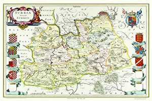
Background imageWillem Janszoon Blaeu Collection: Old County Map of Surrey 1648 by Johan Blaeu from the Atlas Novus

Old County Map of Surrey 1648 by Johan Blaeu from the Atlas Novus
This detailed and most attractive reproduction map of Surrey has been carefully art worked from a scan of an antique original

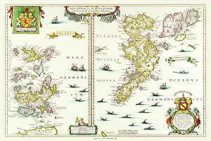
Background imageWillem Janszoon Blaeu Collection: Old Map of the Isles of Shetland and Orkney 1654 from the Atlas Novus

Old Map of the Isles of Shetland and Orkney 1654 from the Atlas Novus
This detailed and most attractive reproduction map of The Isles of Shetland and Orkney, has been carefully art worked from a scan of an antique original

Background imageWillem Janszoon Blaeu Collection: Old County Map of Renfrewshire Scotland 1654 by Johan Blaue from the Atlas Novus

Old County Map of Renfrewshire Scotland 1654 by Johan Blaue from the Atlas Novus
This detailed and most attractive reproduction map of Renfrewshire, Scotland, has been carefully art worked from a scan of an antique original

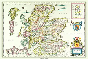
Background imageWillem Janszoon Blaeu Collection: Old Map of Scotland 1635 by Willem & Johan Blaeu from the Theatrum Orbis Terrarum

Old Map of Scotland 1635 by Willem & Johan Blaeu from the Theatrum Orbis Terrarum
This detailed and most attractive reproduction map of Scotland has been carefully art worked from a scan of an antique original

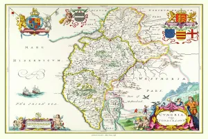
Background imageWillem Janszoon Blaeu Collection: Old County Map of Cumbria 1648 by Johan Blaeu from the Atlas Novus

Old County Map of Cumbria 1648 by Johan Blaeu from the Atlas Novus
This detailed and most attractive reproduction map of Cumbria has been carefully art worked from a scan of an antique original

Background imageWillem Janszoon Blaeu Collection: Old County Map of Gloucestershire 1648 by Johan Blaeu from the Atlas Novus

Old County Map of Gloucestershire 1648 by Johan Blaeu from the Atlas Novus
This detailed and most attractive reproduction map of Gloucestershire has been carefully art worked from a scan of an antique original

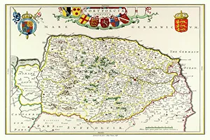
Background imageWillem Janszoon Blaeu Collection: Old County Map of Norfolk 1648 by Johan Blaeu from the Atlas Novus

Old County Map of Norfolk 1648 by Johan Blaeu from the Atlas Novus
This detailed and most attractive reproduction map of Norfolk has been carefully art worked from a scan of an antique original

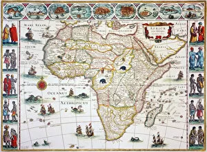
Background imageWillem Janszoon Blaeu Collection: MAP OF AFRICA, 1630. Willem Blaeus ornamental map of Africa Newly Described

MAP OF AFRICA, 1630. Willem Blaeus ornamental map of Africa Newly Described

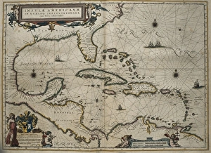
Background imageWillem Janszoon Blaeu Collection: Atlas Novus, 17th c Map of the Caribbean

Atlas Novus, 17th c Map of the Caribbean
BLAEU, Jan (1596-1673). Atlas Novus or Atlas Maior. 1635 - 1665. Insulae Americanae in Oceano Septentrionali cum Terris Adiacentibus. Map of the Caribbean islands printed in Amsterdam circa 1645

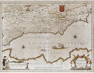
Background imageWillem Janszoon Blaeu Collection: Map of the kingdoms of Granada and Murcia (Granata

Map of the kingdoms of Granada and Murcia (Granata et Murcia regna) by W. Blaeu. Decorated with the Arms of both States, the figure of a surveyor and a naval combat. Published in Amsterdam, 1635

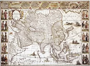
Background imageWillem Janszoon Blaeu Collection: ASIA: MAP, c1618. Engraved map of Asia published in Amsterdam by Willem Blaeu, circa 1618

ASIA: MAP, c1618. Engraved map of Asia published in Amsterdam by Willem Blaeu, circa 1618

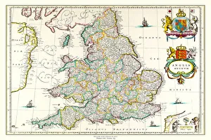
Background imageWillem Janszoon Blaeu Collection: Old Map of England 1635 by Willem & Johan Blaeu from the Theatrum Orbis Terrarum

Old Map of England 1635 by Willem & Johan Blaeu from the Theatrum Orbis Terrarum
This detailed and most attractive reproduction map of England has been carefully art worked from a scan of an antique original

Background imageWillem Janszoon Blaeu Collection: Old Map of The British Isles 1635 by Willem & Johan Blaeu from the Theatrum Orbis Terrarum

Old Map of The British Isles 1635 by Willem & Johan Blaeu from the Theatrum Orbis Terrarum
This detailed and most attractive reproduction map of The British Isles has been carefully art worked from a scan of an antique original

Background imageWillem Janszoon Blaeu Collection: Old Map of Lothian - Scottish Lowlands by Johan Blaeu from the Atlas Novus

Old Map of Lothian - Scottish Lowlands by Johan Blaeu from the Atlas Novus
This detailed and most attractive reproduction map of the Scottish Lowlands, known as Lothian, has been carefully art worked from a scan of an antique original

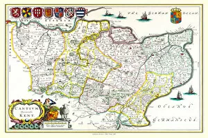
Background imageWillem Janszoon Blaeu Collection: Old County Map of Kent 1648 by Johan Blaeu from the Atlas Novus

Old County Map of Kent 1648 by Johan Blaeu from the Atlas Novus
This detailed and most attractive reproduction map of Kent has been carefully art worked from a scan of an antique original

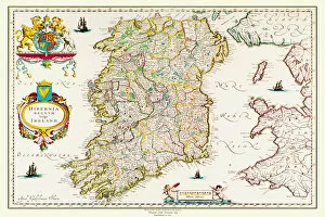
Background imageWillem Janszoon Blaeu Collection: Old Map of Ireland 1635 by Willem & Johan Blaeu from the Theatrum Orbis Terrarum

Old Map of Ireland 1635 by Willem & Johan Blaeu from the Theatrum Orbis Terrarum
This detailed and most attractive reproduction map of Ireland has been carefully art worked from a scan of an antique original

Background imageWillem Janszoon Blaeu Collection: Old Map of The Island of Bermuda 1635 by Willem & Johan Blaue from the Theatrum Orbis Terrarum

Old Map of The Island of Bermuda 1635 by Willem & Johan Blaue from the Theatrum Orbis Terrarum
This detailed and most attractive reproduction map of The Island of Bermuda has been carefully art worked from a scan of an antique original

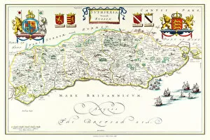
Background imageWillem Janszoon Blaeu Collection: Old County Map of Sussex 1648 by Johan Blaeu from the Atlas Novus

Old County Map of Sussex 1648 by Johan Blaeu from the Atlas Novus
This detailed and most attractive reproduction map of Sussex has been carefully art worked from a scan of an antique original

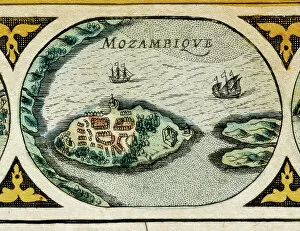
Background imageWillem Janszoon Blaeu Collection: Mozambique in Africa, 1645 (engraving)

Mozambique in Africa, 1645 (engraving)
AIS5368589 Mozambique in Africa, 1645 (engraving) by Blaeu, Willem (1571-1638); Biblioteca de Catalunya, Barcelona, Spain; (add.info)

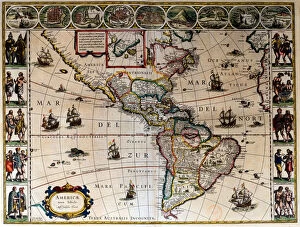
Background imageWillem Janszoon Blaeu Collection: Geographic map of America. In 'Le theatre du monde ou le nouvel atlas

Geographic map of America. In "Le theatre du monde ou le nouvel atlas
JLJ4690395 Geographic map of America. In " Le theatre du monde ou le nouvel atlas Amsterdam" produced by Willem Janszoon Blaeu (1571-1638), 1635

Background imageWillem Janszoon Blaeu Collection: Map of South America (engraving, 1635)

Map of South America (engraving, 1635)
LRI4706249 Map of South America (engraving, 1635) by Blaeu, Willem (1571-1638); Museo Navale di Pegli, Genoa, Italy; (add.info.: Map of South America - Plate from " Theatrum orbis Terrarum)

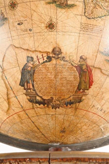
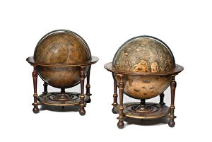
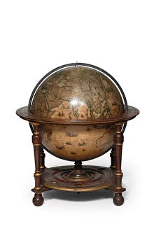
Background imageWillem Janszoon Blaeu Collection: Large pair of library globes, the terrestrial 1645 / 48, the celestial after c

Large pair of library globes, the terrestrial 1645 / 48, the celestial after c
3482878 Large pair of library globes, the terrestrial 1645/48, the celestial after c.1630 (plaster, wood & engraved paper) by Blaeu

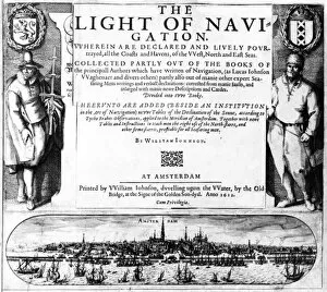
Background imageWillem Janszoon Blaeu Collection: Title Page for The Light of Navigation by William Iohnson

Title Page for The Light of Navigation by William Iohnson
498325 Title Page for The Light of Navigation by William Iohnson, published 1612 (letterpress and engraving) by English School

Background imageWillem Janszoon Blaeu Collection: Map of China, Japan and Korea. (engraving, 1638)

Map of China, Japan and Korea. (engraving, 1638)
LRI4678176 Map of China, Japan and Korea. (engraving, 1638) by Blaeu, Willem (1571-1638); Private Collection; (add.info.: Map of China, Japan and Korea)

Background imageWillem Janszoon Blaeu Collection: Atlas Willem Janszoon Blaeu (1571 - 1638), 1617

Atlas Willem Janszoon Blaeu (1571 - 1638), 1617
GIA4699171 Atlas Willem Janszoon Blaeu (1571 - 1638), 1617. by Blaeu, Willem (1571-1638); Private Collection; (add.info.: Atlas Willem Janszoon Blaeu (1571 - 1638), 1617.); eGiancarlo Costa; Dutch

Background imageWillem Janszoon Blaeu Collection: The Light of Navigation, 1608 (engraving)

The Light of Navigation, 1608 (engraving)
498324 The Light of Navigation, 1608 (engraving) by Dutch School, (17th century); Private Collection; (add.info.: The Light of Navigation by Willem Janszoon Blaeu (1571-1638)

Background imageWillem Janszoon Blaeu Collection: Representation de Macao, detail in Le Theatre du monde, 1645

Representation de Macao, detail in Le Theatre du monde, 1645
AIS5386901 Representation de Macao, detail in Le Theatre du monde, 1645, de Willem Janszoon Blaeu (1571-1638) et Jan Blaeu (1596-1673). Eau forte en couleurs

Background imageWillem Janszoon Blaeu Collection: 'Representation of the City of London '

"Representation of the City of London "
AIS5357390 " Representation of the City of London " Detail of a world map in " The Theatre of the World " by Willem Janszoon Blaeu (1571-1638), 1645

Background imageWillem Janszoon Blaeu Collection: Map of Europe. (engraving, 1638)

Map of Europe. (engraving, 1638)
LRI4678144 Map of Europe. (engraving, 1638) by Blaeu, Willem (1571-1638); Private Collection; (add.info.: Map of Europe. Plate from an Atlas by Willem Janszoon Blaeu (Guilielmus Jansonius Blavius)

Background imageWillem Janszoon Blaeu Collection: Detail of a sea monster from a terrestrial globe, 1645 / 48 (plaster

Detail of a sea monster from a terrestrial globe, 1645 / 48 (plaster
3482879 Detail of a sea monster from a terrestrial globe, 1645/48 (plaster, wood & engraved paper) by Blaeu, Willem (1571-1638); height: 99 cm; Private Collection; (add.info)

Background imageWillem Janszoon Blaeu Collection: Large pair of library globes, the terrestrial 1645 / 48, the celestial after c

Large pair of library globes, the terrestrial 1645 / 48, the celestial after c
3482890 Large pair of library globes, the terrestrial 1645/48, the celestial after c.1630 (plaster, wood & engraved paper) by Blaeu

Background imageWillem Janszoon Blaeu Collection: Large pair of library globes, the terrestrial 1645 / 48, the celestial after c

Large pair of library globes, the terrestrial 1645 / 48, the celestial after c
3482884 Large pair of library globes, the terrestrial 1645/48, the celestial after c.1630 (plaster, wood & engraved paper) by Blaeu

Background imageWillem Janszoon Blaeu Collection: View of Cartagena in Colombia (South America). Detail of a map of the Atlas '

View of Cartagena in Colombia (South America). Detail of a map of the Atlas "
GIA4805226 View of Cartagena in Colombia (South America). Detail of a map of the Atlas " Le Theatre du Monde" by Willem Janszoon Blaeu (1571-1638), 1645

Background imageWillem Janszoon Blaeu Collection: Map of the Molucca Islands east of Indonesia. (engraving, 1638)

Map of the Molucca Islands east of Indonesia. (engraving, 1638)
LRI4678184 Map of the Molucca Islands east of Indonesia. (engraving, 1638) by Blaeu, Willem (1571-1638); Private Collection; (add.info.: Map of the Molucca Islands east of Indonesia)

Background imageWillem Janszoon Blaeu Collection: Map of Ethiopia and South Africa. (engraving, 1638)

Map of Ethiopia and South Africa. (engraving, 1638)
LRI4678170 Map of Ethiopia and South Africa. (engraving, 1638) by Blaeu, Willem (1571-1638); Private Collection; (add.info.: Map of Ethiopia and South Africa)

Background imageWillem Janszoon Blaeu Collection: Large pair of library globes, the terrestrial 1645 / 48, the celestial after c

Large pair of library globes, the terrestrial 1645 / 48, the celestial after c
3482882 Large pair of library globes, the terrestrial 1645/48, the celestial after c.1630 (plaster, wood & engraved paper) by Blaeu

Background imageWillem Janszoon Blaeu Collection: Large pair of library globes, the terrestrial 1645 / 48, the celestial after c

Large pair of library globes, the terrestrial 1645 / 48, the celestial after c
3482888 Large pair of library globes, the terrestrial 1645/48, the celestial after c.1630 (plaster, wood & engraved paper) by Blaeu

Background imageWillem Janszoon Blaeu Collection: Measurement of the Earth. Detail of the atlas by Willem Janszoon Blaeu (1571-1638)

Measurement of the Earth. Detail of the atlas by Willem Janszoon Blaeu (1571-1638)
GIA4777406 Measurement of the Earth. Detail of the atlas by Willem Janszoon Blaeu (1571-1638). Amsterdam 1630. by Blaeu, Willem (1571-1638); Private Collection; (add.info.: Measurement of the Earth)

Background imageWillem Janszoon Blaeu Collection: Battle between two galleys and a caraque. Atlas by Willem Janszoon Blaeu (1571 - 1638)

Battle between two galleys and a caraque. Atlas by Willem Janszoon Blaeu (1571 - 1638)
GIA4756152 Battle between two galleys and a caraque. Atlas by Willem Janszoon Blaeu (1571 - 1638), 1617. by Blaeu, Willem (1571-1638); Private Collection; (add.info)


All Professionally Made to Order for Quick Shipping


-

Why Choose Us?

We are a leading provider of Art Prints and Photo Gifts since 2003, working in partnership with a range of Sporting Clubs, Charities, Museums and Picture Libraries. A large share of profits from any of their images will go directly towards supporting that charity or club. Our archive of images is carefully curated to bring you a wide range of subjects, including landscapes, wildlife, architecture, and more. We ship from our partner labs in the UK, USA, EU (Netherlands) and Australia.
+

How do I place an order?

Ordering is quick & easy - Just follow 5 Simple Steps:
  1. Find your image: Use our search box or browse our online photo Collections to find the image you want.

  2. Choose your print format: Select your desired product and add it to your cart.

  3. Enter your details: If you're a returning customer, simply enter your email address and password, and we'll fill in your billing and shipping address details. All personal details are held securely and are fully GDPR compliant. As standard, we remove all Personally Identifiable Information after 12 months.

  4. Pay for your purchase: We use state-of-the-art security for online shopping and do not have access to your card details.

  5. Sit back and relax: We'll email you confirmation of your order and when it's dispatched. Registered customers can also track orders in the 'My Account' area.

+

How do I pay for an order?

You can pay for your order with most of the major credit and debit cards, or PayPal. For added security, major financial institutions process payment details separately and securely on our behalf. We do not have access to your online payment card details. Online payments are preferred however we do take phone orders. For UK customers only we accept cheques issued against a UK bank.
+

Is my data safe?

We take data security very seriously. We do not have access to your full card details and all payments are requested over a fully secure connection. Additionally, we fully comply with current European and GDPR legislation, and automatically remove all personal data after at most 12 months (unless you have an account with us and have signed in recently). We also have a strict opt-in policy and would never sell your personal details. Your data is only used to fulfill your order promptly and efficiently.
+

Is wall art ready to hang?

For quick and easy installation all wall art, including framed prints, canvas prints and metal prints are supplied with a ready to hang solution on the back. Generally, saw tooth hangers are applied as they allow wall art to hang flush against the wall. The serrated edge of the hanger prevents the frame from shifting or tilting when hung.
+

Are the photo prints fade resistant?

Yes, we use archival quality photo paper photographic paper for vivid reproduction Prints are an accurate representations of the original artwork, which is preserved for artistic character and authenticity. We guarantee they match previews shown on our web site