Fraud Blocker Skip to main content

Home > Maps and Charts > Wales

Wales Collection (page 3)

Wales is a country located in the southwest region of Great Britain and has a population of approximately 3 million people...
1,292 items

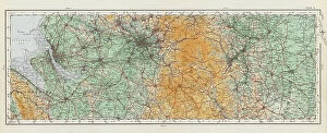
Background imageWales Collection: OS map, 1922: Flintshire, Cheshire (colour litho)

OS map, 1922: Flintshire, Cheshire (colour litho)
8645555 OS map, 1922: Flintshire, Cheshire (colour litho) by English School, (20th century); Private Collection; (add.info.: Flintshire, Cheshire)

Background imageWales Collection: OS map, 1922: Yorkshire, West Riding, East Riding (colour litho)

OS map, 1922: Yorkshire, West Riding, East Riding (colour litho)
8645553 OS map, 1922: Yorkshire, West Riding, East Riding (colour litho) by English School, (20th century); Private Collection; (add.info.: Yorkshire, West Riding, East Riding)

Background imageWales Collection: Map of the Wilds of South Wales (b/w photo)

Map of the Wilds of South Wales (b/w photo)
8648776 Map of the Wilds of South Wales (b/w photo) by English Photographer, (20th century); Private Collection; (add.info.: Map of the Wilds of South Wales)

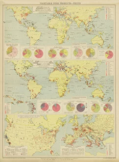
Background imageWales Collection: Vegetable Food Products, Fruits (colour litho)

Vegetable Food Products, Fruits (colour litho)
8644986 Vegetable Food Products, Fruits (colour litho) by English School, (20th century); Private Collection; (add.info.: Vegetable Food Products, Fruits)

Background imageWales Collection: India, Physical Map (colour litho)

India, Physical Map (colour litho)
8658798 India, Physical Map (colour litho) by English School, (20th century); Private Collection; (add.info.: India, Physical Map)

Background imageWales Collection: Geography Atlas: representation of Dominica Island (West Indies)

Geography Atlas: representation of Dominica Island (West Indies). Map taken from "The west indian atlas or general
VEN5030020 Geography Atlas: representation of Dominica Island (West Indies). Map taken from "The west indian atlas or general description of west indies" by Thomas Jefferys

Background imageWales Collection: Geography Atlas: representation of the archipelago of Guadeloupe

Geography Atlas: representation of the archipelago of Guadeloupe. Map taken from "The west indian atlas or general
VEN5029635 Geography Atlas: representation of the archipelago of Guadeloupe. Map taken from "The west indian atlas or general description of west indies" by Thomas Jefferys

Background imageWales Collection: Geography Atlas: representation of Cape Francais (Cap de la Republique)

Geography Atlas: representation of Cape Francais (Cap de la Republique) in Santo Domingo in the West Indies
VEN5031342 Geography Atlas: representation of Cape Francais (Cap de la Republique) in Santo Domingo in the West Indies. Map from an atlas by Thomas Jefferys, geographer of the Prince of Wales, 1760

Background imageWales Collection: Tudor nobleman (detail), from a map of England and wales by John Speed, c.1612 (engraving)

Tudor nobleman (detail), from a map of England and wales by John Speed, c.1612 (engraving)
2911212 Tudor nobleman (detail), from a map of England and wales by John Speed, c.1612 (engraving); Universal History Archive/UIG

Background imageWales Collection: Tudor nobleman (detail), from a map of England and wales by John Speed, c.1612 (engraving)

Tudor nobleman (detail), from a map of England and wales by John Speed, c.1612 (engraving)
2911211 Tudor nobleman (detail), from a map of England and wales by John Speed, c.1612 (engraving); Universal History Archive/UIG

Background imageWales Collection: Map of England and Wales, c.1900 (engraving)

Map of England and Wales, c.1900 (engraving)
532927 Map of England and Wales, c.1900 (engraving); (add.info.: Map of England and Wales, circa 1902, from the 10th edition of Encyclopaedia Britannica.); Encyclopaedia Britannica/UIG

Background imageWales Collection: Map of southeast Australia, c.1900 (engraving)

Map of southeast Australia, c.1900 (engraving)
533045 Map of southeast Australia, c.1900 (engraving); (add.info.: Map of southeast Australia with Victoria, New South Wales, and parts of South Australia and Queensland, circa 1902)

Background imageWales Collection: Map of England and Wales, c.1900 (engraving)

Map of England and Wales, c.1900 (engraving)
532905 Map of England and Wales, c.1900 (engraving); (add.info.: Map of southern England and Wales, including insets of London and Vicinity, and the Isles of Sicily, circa 1902)

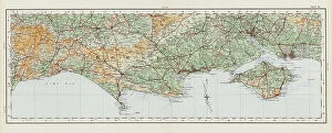
Background imageWales Collection: OS map, 1922: Dorset (colour litho)

OS map, 1922: Dorset (colour litho)
8645570 OS map, 1922: Dorset (colour litho) by English School, (20th century); Private Collection; (add.info.: Dorset. Illustration for the Ordnance Survey Map of England and Wales)

Background imageWales Collection: OS map, 1922: Worcestershire, Warwickshire, Hertfordshire (colour litho)

OS map, 1922: Worcestershire, Warwickshire, Hertfordshire (colour litho)
8645560 OS map, 1922: Worcestershire, Warwickshire, Hertfordshire (colour litho) by English School, (20th century); Private Collection; (add.info.: Worcestershire, Warwickshire, Hertfordshire)

Background imageWales Collection: OS map, 1922: Parts of Kesteven, Parts of Holland, Norfolk (colour litho)

OS map, 1922: Parts of Kesteven, Parts of Holland, Norfolk (colour litho)
8645558 OS map, 1922: Parts of Kesteven, Parts of Holland, Norfolk (colour litho) by English School, (20th century); Private Collection; (add.info.: Parts of Kesteven, Parts of Holland, Norfolk)

Background imageWales Collection: OS map, 1922: Anglesey, Carnarvonshire, Denbigh (colour litho)

OS map, 1922: Anglesey, Carnarvonshire, Denbigh (colour litho)
8645554 OS map, 1922: Anglesey, Carnarvonshire, Denbigh (colour litho) by English School, (20th century); Private Collection; (add.info.: Anglesey, Carnarvonshire, Denbigh)

Background imageWales Collection: OS map, 1922: Irish Sea, Lancashire (colour litho)

OS map, 1922: Irish Sea, Lancashire (colour litho)
8645552 OS map, 1922: Irish Sea, Lancashire (colour litho) by English School, (20th century); Private Collection; (add.info.: Irish Sea, Lancashire)

Background imageWales Collection: Roman Britain (litho)

Roman Britain (litho)
8661402 Roman Britain (litho) by English School, (20th century); Private Collection; (add.info.: Roman Britain. Following the raids of Julius Caesar in 55 and 54 BC the southern British tribes)

Background imageWales Collection: A chart of Basses Straight between New South Wales and Van Diemans Land surveyed by Lieut

A chart of Basses Straight between New South Wales and Van Diemans Land surveyed by Lieut
7340439 A chart of Basses Straight between New South Wales and Van Diemans Land surveyed by Lieut. Flinders of HMS 'Reliance', by order of

Background imageWales Collection: Geological map of England and Wales (composition and structure of the soils)

Geological map of England and Wales (composition and structure of the soils and natural resources of Great Britain)
NWI4874678 Geological map of England and Wales (composition and structure of the soils and natural resources of Great Britain), circa 1870

Background imageWales Collection: Geography Atlas: representation of the island of Hispaniola (Haiti and Santo Domingo)

Geography Atlas: representation of the island of Hispaniola (Haiti and Santo Domingo)
VEN5030000 Geography Atlas: representation of the island of Hispaniola (Haiti and Santo Domingo) and the passage of the Winds (or Under-wind) in the Caribbean archipelago. Below is a Wind Rose

Background imageWales Collection: Geography Atlas: representation of the Virgin Islands (Antilles)

Geography Atlas: representation of the Virgin Islands (Antilles). Map taken from "The west indian atlas or general
VEN5029596 Geography Atlas: representation of the Virgin Islands (Antilles). Map taken from "The west indian atlas or general description of west indies" by Thomas Jefferys

Background imageWales Collection: Geography: general view of Central and Latin America: map from 'The west indian atlas or general

Geography: general view of Central and Latin America: map from "The west indian atlas or general description of
VEN5031310 Geography: general view of Central and Latin America: map from "The west indian atlas or general description of west indies" by Thomas Jefferys

Background imageWales Collection: Geography Atlas: representation of the island of Antigua and Barbuda (Antilles)

Geography Atlas: representation of the island of Antigua and Barbuda (Antilles)
VEN5031159 Geography Atlas: representation of the island of Antigua and Barbuda (Antilles). Map taken from "The west indian atlas or general description of west indies" by Thomas Jefferys

Background imageWales Collection: Tudor noblewoman (detail), from a map of England and wales by John Speed, c.1612 (engraving)

Tudor noblewoman (detail), from a map of England and wales by John Speed, c.1612 (engraving)
2911214 Tudor noblewoman (detail), from a map of England and wales by John Speed, c.1612 (engraving); Universal History Archive/UIG

Background imageWales Collection: OS map, 1922: Huntingdonshire, Bedfordshire, Isle of Ely, Cambridgeshire, Suffolk (colour litho)

OS map, 1922: Huntingdonshire, Bedfordshire, Isle of Ely, Cambridgeshire, Suffolk (colour litho)
8645561 OS map, 1922: Huntingdonshire, Bedfordshire, Isle of Ely, Cambridgeshire, Suffolk (colour litho) by English School, (20th century); Private Collection; (add.info.: Huntingdonshire)

Background imageWales Collection: OS map, 1922: Flintshire, Shropshire, Staffordshire, Leicestershire (colour litho)

OS map, 1922: Flintshire, Shropshire, Staffordshire, Leicestershire (colour litho)
8645559 OS map, 1922: Flintshire, Shropshire, Staffordshire, Leicestershire (colour litho) by English School, (20th century); Private Collection; (add.info.: Flintshire, Shropshire, Staffordshire)

Background imageWales Collection: OS map, 1922: North Riding (colour litho)

OS map, 1922: North Riding (colour litho)
8645551 OS map, 1922: North Riding (colour litho) by English School, (20th century); Private Collection; (add.info.: North Riding)

Background imageWales Collection: Geography Atlas: frontispiece of 'The west indian atlas or general description of west indies' by

Geography Atlas: frontispiece of "The west indian atlas or general description of west indies" by Thomas
VEN5029591 Geography Atlas: frontispiece of "The west indian atlas or general description of west indies" by Thomas Jefferys, Prince of Wales geographer, 1794

Background imageWales Collection: 'Sydney et Botany-Bay; Les Terres Du Pacifique, 1914. Creator: Unknown

'Sydney et Botany-Bay; Les Terres Du Pacifique, 1914. Creator: Unknown
'Sydney et Botany-Bay; Les Terres Du Pacifique, 1914. From "Grande Geographie Bong Illustree", 1914

Background imageWales Collection: Old engraved map of Sydney (capital city of the state of New South Wales)

Old engraved map of Sydney (capital city of the state of New South Wales, Australia) and Port Jackson
Copyright has expired on this artwork. From my own archives, digitally restored

Background imageWales Collection: Carte re´duite des de´couvertes des Russes, entre l'Asie et l'Amerique, (1747?)

Carte re´duite des de´couvertes des Russes, entre l'Asie et l'Amerique, (1747?)
Carte re´duite des de´couvertes des Russes, entre l'Asie et l'Amerique, (1747?). This French map of Alaska, Siberia, and the North Pacific, published in 1747

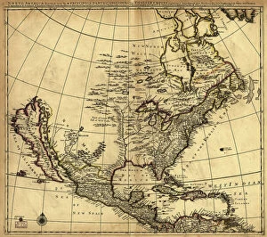
Background imageWales Collection: North America divided into its III principall [sic] parts, 1685. Creator: Philip Lea

North America divided into its III principall [sic] parts, 1685. Creator: Philip Lea
North America divided into its III principall [sic] parts, 1685. This map, North America Divided into its III Principal Parts

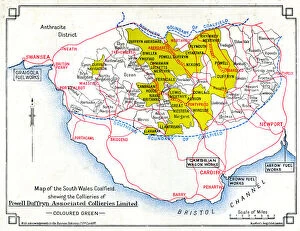
Background imageWales Collection: Map, South Wales coalfield

Map, South Wales coalfield. 1939

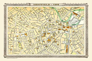
Background imageWales Collection: Old Map of Sheffield 1898 from the Royal Atlas by Bartholomew

Old Map of Sheffield 1898 from the Royal Atlas by Bartholomew
A fine very detailed plan of the City of Sheffield remastered from an original contained within " The Royal Atlas of England and Wales" ; edited by J.G

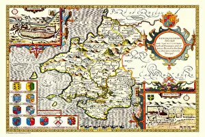
Background imageWales Collection: Old County Map of Pembrokeshire, Wales 1611 by John Speed

Old County Map of Pembrokeshire, Wales 1611 by John Speed
A facimile of John Speeds historical map of Pembrokeshire originally published for the " Theatre of the Empire of Great Britain"

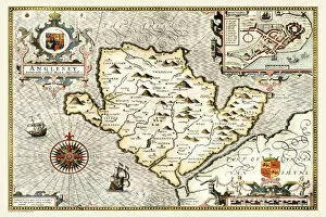
Background imageWales Collection: Old Map of The Isle of Anglesey, Wales 1611 by John Speed

Old Map of The Isle of Anglesey, Wales 1611 by John Speed
A facimile of John Speeds historical map of Anglesey originally published for the " Theatre of the Empire of Great Britain", an atlas to accompany " a history of Great Britain"

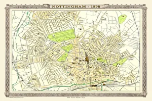
Background imageWales Collection: Old Map of Nottingham 1898 from the Royal Atlas by Bartholomew

Old Map of Nottingham 1898 from the Royal Atlas by Bartholomew
A fine very detailed plan of the City of Nottingham remastered from an original contained within " The Royal Atlas of England and Wales" ; edited by J.G

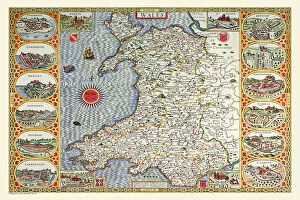
Background imageWales Collection: Old Map of Wales 1611 by John Speed

Old Map of Wales 1611 by John Speed
A facimile of John Speeds historical map of Wales originally published for the " Theatre of the Empire of Great Britain", an atlas to accompany " a history of Great Britain"

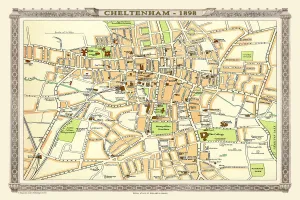
Background imageWales Collection: Old Map of Central Cheltenham 1898 from the Royal Atlas by Bartholomew

Old Map of Central Cheltenham 1898 from the Royal Atlas by Bartholomew
A fine very detailed town plan of Cheltenham from 1898 remastered from an original contained within " The Royal Atlas of England and Wales" ; edited by J.G

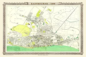
Background imageWales Collection: Old Map of Eastbourne 1898 from the Royal Atlas by Bartholomew

Old Map of Eastbourne 1898 from the Royal Atlas by Bartholomew
A fine very detailed plan of the Seaside Town of Eastbourne from 1898 remastered from an original contained within " The Royal Atlas of England and Wales" ; edited by J.G

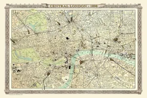
Background imageWales Collection: Old Map of Central London 1898 from the Royal Atlas by Bartholomew

Old Map of Central London 1898 from the Royal Atlas by Bartholomew
A fine very detailed plan of Central London from 1898 remastered from an original contained within " The Royal Atlas of England and Wales" ; edited by J.G

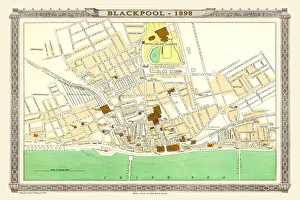
Background imageWales Collection: Old Map of Blackpool 1898 from the Royal Atlas by Bartholomew

Old Map of Blackpool 1898 from the Royal Atlas by Bartholomew
A fine very detailed plan of the Town of Blackpool remastered from an original contained within " The Royal Atlas of England and Wales" ; edited by J.G

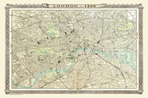
Background imageWales Collection: Old Map of London 1898 from the Royal Atlas by Bartholomew

Old Map of London 1898 from the Royal Atlas by Bartholomew
A fine very detailed plan of the City of London remastered from an original contained within " The Royal Atlas of England and Wales" ; edited by J.G

Background imageWales Collection: Old Map of Bournemouth 1898 from the Royal Atlas by Bartholomew

Old Map of Bournemouth 1898 from the Royal Atlas by Bartholomew
A fine very detailed plan of the Seaside Town of Bournemouth from 1898 remastered from an original contained within " The Royal Atlas of England and Wales" ; edited by J.G

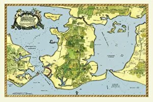
Background imageWales Collection: Early Coastal Survey Map of the Isle of Portsea and Portsmouth Harbour 1716

Early Coastal Survey Map of the Isle of Portsea and Portsmouth Harbour 1716
This is a reproduction in colour of the early chart of the Island of Portsea and Portsmouth Harbour. In January 1715/6, in the last stages of the Jacobite emergency, Talbot Edwards

Background imageWales Collection: Old Map of Birmingham 1893 from the Comprehensive Gazetteer Atlas of England and Wales

Old Map of Birmingham 1893 from the Comprehensive Gazetteer Atlas of England and Wales
This detailed reproduction plan of Birmingham has been re-worked from an antique originally published in the oComprehensive Gazetteer of England and Waleso 1893


All Professionally Made to Order for Quick Shipping


-

Wales Collection

Wales is a country located in the southwest region of Great Britain and has a population of approximately 3 million people and covers an area of around 20,780 square kilometers. The country is known for its rugged coastline, mountainous landscapes, and rich cultural heritage. Wales has two official languages: Welsh and English. Cardiff is the capital city and largest urban center in Wales. The economy relies heavily on industries such as manufacturing, tourism, agriculture, and services. Maps and charts are commonly used to navigate through the country's diverse terrain or study its demographic data or economic indicators.
+

Our beautiful pictures are available as Framed Prints, Photos, Wall Art and Photo Gifts

The Wales collection from Media Storehouse is a stunning assortment of wall art and framed prints that showcase the beauty and history of Wales. Our collection features an array of maps, charts, and illustrations dating back to the 16th century, depicting everything from Welsh castles to coastal landscapes. These high-quality prints are perfect for anyone looking to add a touch of Welsh heritage to their home or office decor. They come in a variety of sizes and framing options, making it easy for customers to find the perfect piece for their space. Whether you're a proud Welsh native or simply appreciate the country's rich culture and history, our collection has something for everyone. From antique maps that offer insight into Wales' past to modern illustrations that capture its natural beauty, these prints are sure to impress. The Wales collection is an excellent choice for anyone seeking unique artwork with historical significance.
+

What are Wales (Maps and Charts) art prints?

Wales art prints are a collection of high-quality, visually stunning prints that showcase the beauty and history of Wales. These prints feature detailed maps and charts that depict the geography, topography, and landmarks of this beautiful country. They are perfect for anyone who loves Welsh culture or wants to add a touch of Welsh charm to their home or office decor. These art prints come in a variety of sizes and styles, from vintage-inspired designs to modern interpretations. They are printed on premium quality paper using state-of-the-art printing technology to ensure vibrant colors and sharp details. Whether you're looking for a unique gift for someone special or want to decorate your own space with something truly special, Wales art prints are an excellent choice. With their timeless appeal and rich cultural heritage, they will be treasured for years to come.
+

What Wales (Maps and Charts) art prints can I buy from Media Storehouse?

We offer a wide range of Wales maps and charts art prints that are perfect for decorating your home or office. You can choose from vintage maps, antique charts, and modern designs that showcase the beauty of this stunning country. Whether you're looking for a detailed map of Cardiff or an artistic representation of Snowdonia National Park, we have something to suit every taste. Our collection includes prints featuring famous landmarks such as Caernarfon Castle, St David's Cathedral, and the Brecon Beacons. We also offer topographical maps that highlight the unique geography of Wales with its rugged coastline, rolling hillsides, and picturesque valleys. In addition to traditional paper prints in various sizes, Media Storehouse also provides canvas options for those who prefer a more durable material. With so many beautiful options available at Media Storehouse, you're sure to find the perfect Wales map or chart art print to add some Welsh charm to your space.
+

How do I buy Wales (Maps and Charts) art prints?

To buy Wales art prints from Media Storehouse, you can browse our extensive collection of high-quality prints featuring maps and charts of Wales. Once you have found the print that you like, simply add it to your cart and proceed to checkout. You will be prompted to enter your shipping information and payment details. We offer a variety of sizes for their prints, so be sure to select the size that best fits your needs. We also offer framing options if you would like your print ready-to-hang upon arrival. Their Wales art prints are perfect for anyone who loves geography or is interested in Welsh history. These unique pieces make great gifts for friends or family members who share these interests. Buying a Wales art print from Media Storehouse is easy and convenient, allowing you to enjoy beautiful artwork in no time.
+

How much do Wales (Maps and Charts) art prints cost?

We offer a wide range of Wales art prints that are available at varying prices. Our collection includes high-quality prints of maps and charts depicting the beautiful landscapes, coastlines, and historical landmarks of Wales. These prints are perfect for adding a touch of Welsh heritage to your home or office decor. Our pricing is competitive and affordable, ensuring that everyone can enjoy our stunning collection without breaking the bank. We believe in providing excellent value for money while maintaining the highest standards of quality. Whether you're looking for a small print to display on your desk or a large canvas to hang on your living room wall, we have something for everyone. So why not browse our selection today and discover the beauty of Wales through our Maps and Charts art prints?
+

How will my Wales (Maps and Charts) art prints be delivered to me?

We take great care in ensuring that your Wales art prints are delivered to you safely and securely. We use high-quality packaging materials to protect your artwork during transit, including sturdy cardboard tubes for rolled prints and flat boxes for framed or mounted prints. Our delivery partners are carefully selected based on their reliability and efficiency, so you can be confident that your order will arrive promptly and in excellent condition. Depending on the size of your print and your location, we may use a range of different couriers to ensure the best possible service. Once your order has been dispatched, you will receive an email notification with tracking information so that you can keep an eye on its progress. If you have any questions about delivery or need assistance with tracking your order, our friendly customer service team is always here to help.