
Wales Collection
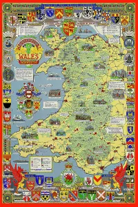
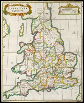
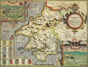
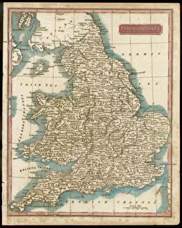
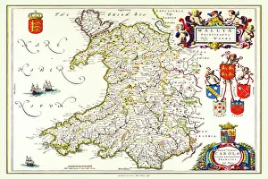
Wales is a country located in the southwest region of Great Britain and has a population of approximately 3 million people...
Choose a picture from our Wales Collection for your Wall Art and Photo Gifts
1,267 items


All Professionally Made to Order for Quick Shipping
-
Wales Collection
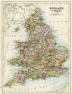
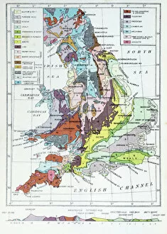
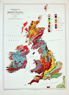
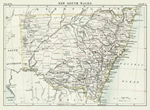
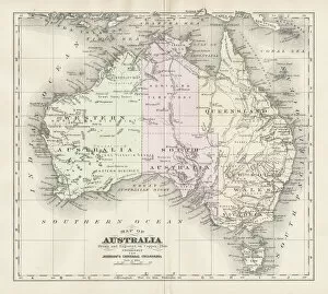
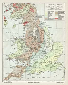
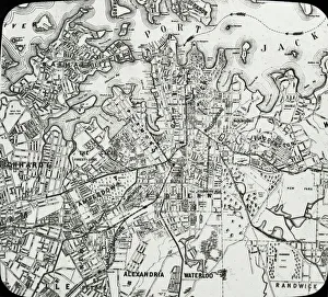
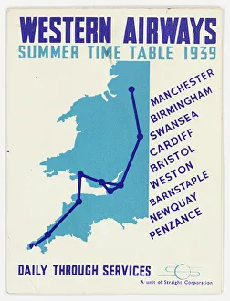
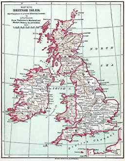
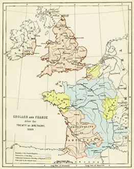
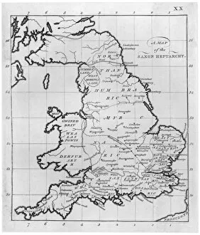
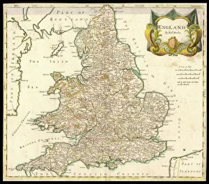
Wales is a country located in the southwest region of Great Britain and has a population of approximately 3 million people and covers an area of around 20,780 square kilometers. The country is known for its rugged coastline, mountainous landscapes, and rich cultural heritage. Wales has two official languages: Welsh and English. Cardiff is the capital city and largest urban center in Wales. The economy relies heavily on industries such as manufacturing, tourism, agriculture, and services. Maps and charts are commonly used to navigate through the country's diverse terrain or study its demographic data or economic indicators.
+
Our beautiful pictures are available as Framed Prints, Photos, Wall Art and Photo Gifts
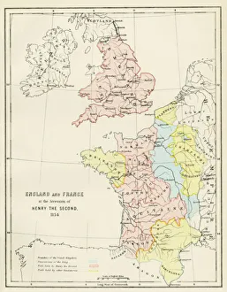
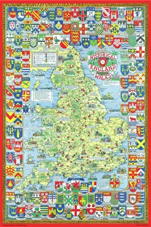
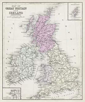
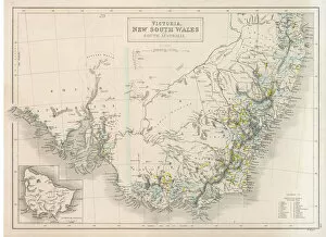
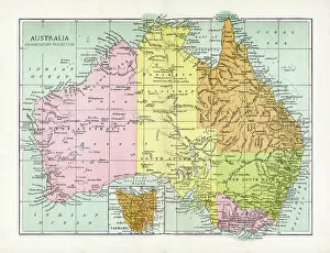
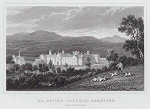
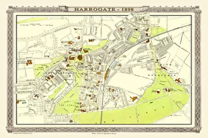
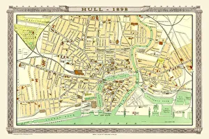
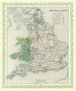
The Wales collection from Media Storehouse is a stunning assortment of wall art and framed prints that showcase the beauty and history of Wales. Our collection features an array of maps, charts, and illustrations dating back to the 16th century, depicting everything from Welsh castles to coastal landscapes. These high-quality prints are perfect for anyone looking to add a touch of Welsh heritage to their home or office decor. They come in a variety of sizes and framing options, making it easy for customers to find the perfect piece for their space. Whether you're a proud Welsh native or simply appreciate the country's rich culture and history, our collection has something for everyone. From antique maps that offer insight into Wales' past to modern illustrations that capture its natural beauty, these prints are sure to impress. The Wales collection is an excellent choice for anyone seeking unique artwork with historical significance.
+
What are Wales (Maps and Charts) art prints?
Wales art prints are a collection of high-quality, visually stunning prints that showcase the beauty and history of Wales. These prints feature detailed maps and charts that depict the geography, topography, and landmarks of this beautiful country. They are perfect for anyone who loves Welsh culture or wants to add a touch of Welsh charm to their home or office decor. These art prints come in a variety of sizes and styles, from vintage-inspired designs to modern interpretations. They are printed on premium quality paper using state-of-the-art printing technology to ensure vibrant colors and sharp details. Whether you're looking for a unique gift for someone special or want to decorate your own space with something truly special, Wales art prints are an excellent choice. With their timeless appeal and rich cultural heritage, they will be treasured for years to come.
+
What Wales (Maps and Charts) art prints can I buy from Media Storehouse?
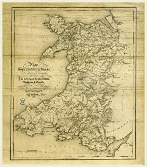
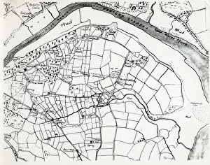
We offer a wide range of Wales maps and charts art prints that are perfect for decorating your home or office. You can choose from vintage maps, antique charts, and modern designs that showcase the beauty of this stunning country. Whether you're looking for a detailed map of Cardiff or an artistic representation of Snowdonia National Park, we have something to suit every taste. Our collection includes prints featuring famous landmarks such as Caernarfon Castle, St David's Cathedral, and the Brecon Beacons. We also offer topographical maps that highlight the unique geography of Wales with its rugged coastline, rolling hillsides, and picturesque valleys. In addition to traditional paper prints in various sizes, Media Storehouse also provides canvas options for those who prefer a more durable material. With so many beautiful options available at Media Storehouse, you're sure to find the perfect Wales map or chart art print to add some Welsh charm to your space.
+
How do I buy Wales (Maps and Charts) art prints?
To buy Wales art prints from Media Storehouse, you can browse our extensive collection of high-quality prints featuring maps and charts of Wales. Once you have found the print that you like, simply add it to your cart and proceed to checkout. You will be prompted to enter your shipping information and payment details. We offer a variety of sizes for their prints, so be sure to select the size that best fits your needs. We also offer framing options if you would like your print ready-to-hang upon arrival. Their Wales art prints are perfect for anyone who loves geography or is interested in Welsh history. These unique pieces make great gifts for friends or family members who share these interests. Buying a Wales art print from Media Storehouse is easy and convenient, allowing you to enjoy beautiful artwork in no time.
+
How much do Wales (Maps and Charts) art prints cost?
We offer a wide range of Wales art prints that are available at varying prices. Our collection includes high-quality prints of maps and charts depicting the beautiful landscapes, coastlines, and historical landmarks of Wales. These prints are perfect for adding a touch of Welsh heritage to your home or office decor. Our pricing is competitive and affordable, ensuring that everyone can enjoy our stunning collection without breaking the bank. We believe in providing excellent value for money while maintaining the highest standards of quality. Whether you're looking for a small print to display on your desk or a large canvas to hang on your living room wall, we have something for everyone. So why not browse our selection today and discover the beauty of Wales through our Maps and Charts art prints?
+
How will my Wales (Maps and Charts) art prints be delivered to me?
We take great care in ensuring that your Wales art prints are delivered to you safely and securely. We use high-quality packaging materials to protect your artwork during transit, including sturdy cardboard tubes for rolled prints and flat boxes for framed or mounted prints. Our delivery partners are carefully selected based on their reliability and efficiency, so you can be confident that your order will arrive promptly and in excellent condition. Depending on the size of your print and your location, we may use a range of different couriers to ensure the best possible service. Once your order has been dispatched, you will receive an email notification with tracking information so that you can keep an eye on its progress. If you have any questions about delivery or need assistance with tracking your order, our friendly customer service team is always here to help.