Fraud Blocker Skip to main content

Home > Maps and Charts > Turkey

Turkey Collection (page 9)

Turkey is a transcontinental country located in Southeast Europe and Southwest Asia and has a population of over 82 million people

525 items

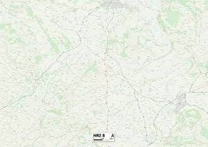
Background imageTurkey Collection: Hereford HR2 8 Map

Hereford HR2 8 Map
Postcode Sector Map of Hereford HR2 8

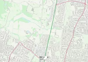
Background imageTurkey Collection: Enfield EN1 4 Map

Enfield EN1 4 Map
Postcode Sector Map of Enfield EN1 4

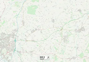
Background imageTurkey Collection: East Devon EX5 2 Map

East Devon EX5 2 Map
Postcode Sector Map of East Devon EX5 2

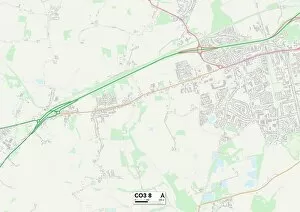
Background imageTurkey Collection: Colchester CO3 8 Map

Colchester CO3 8 Map
Postcode Sector Map of Colchester CO3 8

Background imageTurkey Collection: Colchester CO6 3 Map

Colchester CO6 3 Map
Postcode Sector Map of Colchester CO6 3

Background imageTurkey Collection: Chelmsford CM1 7 Map

Chelmsford CM1 7 Map
Postcode Sector Map of Chelmsford CM1 7

Background imageTurkey Collection: Vale of Glamorgan CF61 1 Map

Vale of Glamorgan CF61 1 Map
Postcode Sector Map of Vale of Glamorgan CF61 1

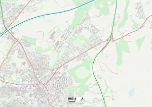
Background imageTurkey Collection: BB Blackburn, BB5 6

BB Blackburn, BB5 6
BB5 6

Background imageTurkey Collection: Map of Taverniers Travels in Europe, Persia, Turkey, 17th century. Creator: Anonymous master

Map of Taverniers Travels in Europe, Persia, Turkey, 17th century. Creator: Anonymous master
Map of Taverniers Travels in Europe, Persia, Turkey, 17th century. Found in the Collection of Bibliotheque Nationale de France

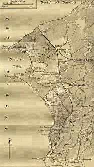
Background imageTurkey Collection: The Suvla and Anzac Line, First World War, August 1915, (c1920). Creator: Unknown

The Suvla and Anzac Line, First World War, August 1915, (c1920). Creator: Unknown
The Suvla and Anzac Line, First World War, August 1915, (c1920)....map showing approximately by the shaded portion the area occupied after the linking up of the two armies in August, 1915

Background imageTurkey Collection: Detailed Map of Gallipoli and Dardanelles, 1916. Creator: Unknown

Detailed Map of Gallipoli and Dardanelles, 1916. Creator: Unknown
Detailed Map of Gallipoli and Dardanelles, 1916. The Gallipoli campaign took place on the Gallipoli peninsula from 17 February 1915 to 9 January 1916

Background imageTurkey Collection: Route between Karaman and Kiz Kale, c1915. Creator: Stanfords Geographical Establishment

Route between Karaman and Kiz Kale, c1915. Creator: Stanfords Geographical Establishment
Route between Karaman and Kiz Kale, c1915. (Note Boyalar is about 8 miles S. of Karaman). Map showing the journey of British writer

Background imageTurkey Collection: Route from Chatal Zeitun to Kavza and from Kavak to Tash Kupri, c1915. Creator: Unknown

Route from Chatal Zeitun to Kavza and from Kavak to Tash Kupri, c1915. Creator: Unknown
Route from Chatal Zeitun to Kavza and from Kavak to Tash Kupri, c1915. Map showing the journeys of British writer, soldier and diplomatic advisor Mark Sykes in northern Turkey

Background imageTurkey Collection: Sketch between Balat and Adranos, c1915. Creator: Stanfords Geographical Establishment

Sketch between Balat and Adranos, c1915. Creator: Stanfords Geographical Establishment
Sketch between Balat and Adranos, c1915. Map showing the journey of British writer, soldier and diplomatic advisor Mark Sykes between Balat and Adranos in Turkey

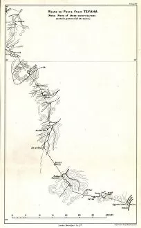
Background imageTurkey Collection: Route to Petra from Teyaha, c1915. Creator: Stanfords Geographical Establishment

Route to Petra from Teyaha, c1915. Creator: Stanfords Geographical Establishment
Route to Petra from Teyaha, c1915. (Note: None of these watercourses contain perennial streams). Map showing the journey of British writer

Background imageTurkey Collection: Detail of Rocky Maze on Map of Route from Karaman to Kiz Kale, c1915

Detail of Rocky Maze on Map of Route from Karaman to Kiz Kale, c1915. Map showing part of the journey of British writer, soldier and diplomatic advisor Mark Sykes between Karaman (in Central Anatolia)

Background imageTurkey Collection: The Western Bend of the Euphrates, c1915. Creator: Mark Sykes

The Western Bend of the Euphrates, c1915. Creator: Mark Sykes
The Western Bend of the Euphrates, c1915. Map of the River Euphrates and surrounding areas. From " The Caliphs Last Heritage, a short history of the Turkish Empire" by Lt.-Col

Background imageTurkey Collection: Section of Route from Diarbekir to Sivas and Sivas to Sinope by Aneroid readings, c1915

Section of Route from Diarbekir to Sivas and Sivas to Sinope by Aneroid readings, c1915. Map showing the journeys, with altitude above sea level, of British writer

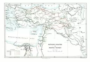
Background imageTurkey Collection: Authors Routes in Asiatic Turkey, c1915. Creator: Stanfords Geographical Establishment

Authors Routes in Asiatic Turkey, c1915. Creator: Stanfords Geographical Establishment
Authors Routes in Asiatic Turkey, c1915. Map showing the journeys of British writer, soldier and diplomatic advisor Mark Sykes (1879-1919) who travelled through Palestine, Iraq, Syria

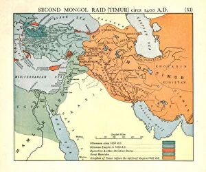
Background imageTurkey Collection: Second Mongol Raid (Timur), circa 1450 A. D. c1915. Creator: Emery Walker Ltd

Second Mongol Raid (Timur), circa 1450 A. D. c1915. Creator: Emery Walker Ltd
Second Mongol Raid (Timur), circa 1450 A.D. c1915. Map of civilisations in the Middle East during the 14th and 15th centuries: Ottomans c1350 AD, Ottoman Empire in 1400 AD

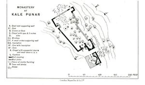
Background imageTurkey Collection: Monastery at Kale Punar, c1915. Creator: Stanfords Geographical Establishment

Monastery at Kale Punar, c1915. Creator: Stanfords Geographical Establishment
Monastery at Kale Punar, c1915. Plan of monastic buildings in Turkey, at that time part of the Ottoman Empire, showing chapels, cisterns, caves and fountains

Background imageTurkey Collection: Bath built by Sultan Bayezid I, circa 1390 A

Bath built by Sultan Bayezid I, circa 1390 A.D. at Mudurlu, c1915. Plan of baths supposedly built by the Ottoman sultan Bayezid I, showing the tank, mens and womens cooling rooms

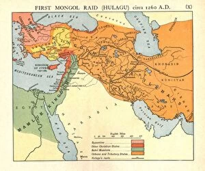
Background imageTurkey Collection: First Mongol Raid (Hulagu), circa 1400 A. D. c1915. Creator: Emery Walker Ltd

First Mongol Raid (Hulagu), circa 1400 A. D. c1915. Creator: Emery Walker Ltd
First Mongol Raid (Hulagu), circa 1400 A.D. c1915. Map of civilisations in the Middle East during the early 15th century: Byzantine, other Christian states, Bahri Mamluks

Background imageTurkey Collection: Portion of direct route between Brusa and Kutahya, c1915

Portion of direct route between Brusa and Kutahya, c1915. (Note: from Brusa to Osauk Punar & from Devrant to Kutakia is accurately surveyed)

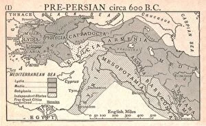
Background imageTurkey Collection: Pre-Persian, circa 600 B. C. c1915. Creator: Emery Walker Ltd

Pre-Persian, circa 600 B. C. c1915. Creator: Emery Walker Ltd
Pre-Persian, circa 600 B.C. c1915. Map of the eastern Mediterranean and near East, showing the ancient civilisations of empires of Lydia, Media, Babylonia, Independent States, and free Greek cities

Background imageTurkey Collection: Plan of Monastery of St. Anthony, c1915. Creator: Mark Sykes

Plan of Monastery of St. Anthony, c1915. Creator: Mark Sykes
Plan of Monastery of St. Anthony, c1915. Map of the Coptic Orthodox Monastery of Saint Anthony in the Eastern Desert of Egypt. It is the oldest monastery in the world

Background imageTurkey Collection: Kal at Ja abar, c1915. Creator: Mark Sykes

Kal at Ja abar, c1915. Creator: Mark Sykes
Kal at Ja abar, c1915. Map of the fortress and citadel at Ja aber, al-Tabqa city, on the left bank of the Euphrates, (Syria)

Background imageTurkey Collection: Route from Diarbekir to Zara, c1915. Creator: Unknown

Route from Diarbekir to Zara, c1915. Creator: Unknown
Route from Diarbekir to Zara, c1915. Map showing the journey of British writer, soldier and diplomatic advisor Mark Sykes between Diyarbakir and Zara in Turkey

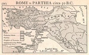
Background imageTurkey Collection: Rome v. Parthia, circa 50 B. C. c1915. Creator: Emery Walker Ltd

Rome v. Parthia, circa 50 B. C. c1915. Creator: Emery Walker Ltd
Rome v. Parthia, circa 50 B.C. c1915. Map of the eastern Mediterranean and Near East, showing the ancient empires of Rome, Parthia, Armenia, and Protected and Independent States

Background imageTurkey Collection: Persian, circa 500 B. C. c1915. Creator: Emery Walker Ltd

Persian, circa 500 B. C. c1915. Creator: Emery Walker Ltd
Persian, circa 500 B.C. c1915. Map of the eastern Mediterranean and Near East, showing the ancient Persian empire and Independent States

Background imageTurkey Collection: Post-Persian, circa 188 B. C. c1915. Creator: Emery Walker Ltd

Post-Persian, circa 188 B. C. c1915. Creator: Emery Walker Ltd
Post-Persian, circa 188 B.C. c1915. Map of the eastern Mediterranean and Near East, showing the ancient empires of Pergamum, Seleucid, Free Greek States, Gauls, Ptolemy, and Independent States

Background imageTurkey Collection: Positions of ANZAC forces on the Gallipoli peninsula in Turkey, First World War, July 1915

Positions of ANZAC forces on the Gallipoli peninsula in Turkey, First World War, July 1915
Positions of Australian and New Zealand forces on the Gallipoli peninsula in Turkey, First World War, July 1915, (c1920). Map showing approximately the semi-circular Foothold of the Australians

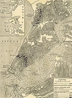
Background imageTurkey Collection: The Gallipoli Campaign, First World War, 1915, (c1920). Creator: Unknown

The Gallipoli Campaign, First World War, 1915, (c1920). Creator: Unknown
The Gallipoli Campaign, First World War, 1915, (c1920). Map illustrating the operations of the Allies under Sir Ian Hamilton from the landing on April 25 to May 30, 1915

Background imageTurkey Collection: Map illustrating the Operations in the Persian Gulf, First World War, 1915, (c1920)

Map illustrating the Operations in the Persian Gulf, First World War, 1915, (c1920)....showing the British oil pipe guarded against the Turkish attacks and the advance up the Tigris to Amara

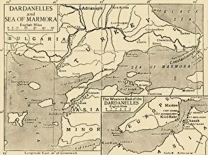
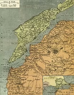
Background imageTurkey Collection: Map of the Dardanelles and Sea of Marmara, c1914, (1920). Creator: Unknown

Map of the Dardanelles and Sea of Marmara, c1914, (1920). Creator: Unknown
Map of the Dardanelles and Sea of Marmara, c1914, (1920). The coastline around parts of Turkey, Bulgaria, the Black Sea and the Aegean during the First World War

Background imageTurkey Collection: British oil pipeline in the Middle East, First World War, 1915, (c1920). Creator: Unknown

British oil pipeline in the Middle East, First World War, 1915, (c1920). Creator: Unknown
British oil pipeline in the Middle East, First World War, 1915, (c1920). Map illustrating the Operations in the Persian Gulf; showing the British oil pipe guarded against the Turkish attacks

Background imageTurkey Collection: ANZAC advance, Gallipoli peninsula, First World War, 1915, (c1920). Creator: Unknown

ANZAC advance, Gallipoli peninsula, First World War, 1915, (c1920). Creator: Unknown
ANZAC advance, Gallipoli peninsula, First World War, 1915, (c1920). Map illustrating the Plan of Attack in the Main Anzac Advance of August 6-7, 1915

Background imageTurkey Collection: Map of Sari Bair, Gallipoli peninsula, First World War, 1915, (c1920). Creator: Unknown

Map of Sari Bair, Gallipoli peninsula, First World War, 1915, (c1920). Creator: Unknown
Map of Sari Bair, Gallipoli peninsula, First World War, 1915, (c1920). The Battlefields of Anzac: The elaborate series of operations in August, 1915, began with holding attacks on Lone Pine

Background imageTurkey Collection: Map of the Black Sea including part of present-day Romania, Bulgaria, Turkey, Ukraine

Map of the Black Sea including part of present-day Romania, Bulgaria, Turkey, Ukraine, and Russia, c. 1544. Private Collection

Background imageTurkey Collection: Central Europe and the Mediterranean, 1919. Creator: London Geographical Institute

Central Europe and the Mediterranean, 1919. Creator: London Geographical Institute
Central Europe and the Mediterranean, 1919. Showing naval dockyards, fortified coastal towns, and forts. From " The History of the Great European War: its causes and effects", Vol

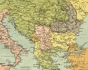
Background imageTurkey Collection: Map To Illustrate the Eastern Battle Fronts, 1919. Creator: George Philip & Son Ltd

Map To Illustrate the Eastern Battle Fronts, 1919. Creator: George Philip & Son Ltd
Map To Illustrate the Eastern Battle Fronts, 1919. Map showing areas of eastern Europe and the Balkans which saw fighting during the First World War, 1914-1919, including Italy, Austria-Hungary

Background imageTurkey Collection: The Dardanelles with its Forts, 1919. Creator: London Geographical Institute

The Dardanelles with its Forts, 1919. Creator: London Geographical Institute
The Dardanelles with its Forts, 1919. Map of the Turkish coast showing the Gallipoli peninsula which saw heavy fighting during the First World War, 1914-1919, with many casualties on both sides

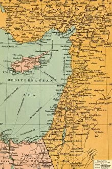
Background imageTurkey Collection: Map To Illustrate The Campaign in Palestine, 1919. Creator: London Geographical Institute

Map To Illustrate The Campaign in Palestine, 1919. Creator: London Geographical Institute
Map To Illustrate The Campaign in Palestine, 1919. Map of the Eastern Mediterrean and the Middle East, showing Cyprus, Port Said in Egypt, parts of Turkey and what are now Syria, the Lebanon

Background imageTurkey Collection: Map of the Black Sea, c. 1544. Creator: Agnese, Battista (c. 1500-1564)

Map of the Black Sea, c. 1544. Creator: Agnese, Battista (c. 1500-1564)
Map of the Black Sea including part of present-day Romania, Bulgaria, Turkey, Ukraine, and Russia, c. 1544. Private Collection

Background imageTurkey Collection: Map of Turkey and Rumania 1889

Map of Turkey and Rumania 1889
Comprehensive Geography by James Monteith - American Book Company 1882, 1889

Background imageTurkey Collection: Map of Turkey 1896

Map of Turkey 1896
Andres Allgemeiner Handatlas - Bielefeld und Leipzig 1896

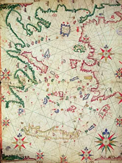
Background imageTurkey Collection: The Aegean Sea, from a nautical atlas, 1651 (ink on vellum) (see also 330926-330927)

The Aegean Sea, from a nautical atlas, 1651 (ink on vellum) (see also 330926-330927)
XOT330925 The Aegean Sea, from a nautical atlas, 1651 (ink on vellum) (see also ) by Pietro Giovanni Prunes (fl. 17th Century); 41.6x28 cm; Museo Correr, Venice, Italy; Italian, out of copyright

Background imageTurkey Collection: Map of Turkey in Asia, 1902. Creator: Unknown

Map of Turkey in Asia, 1902. Creator: Unknown
Map of Turkey in Asia, 1902. Showing the eastern Mediterranean, the coast of Egypt and parts of the Middle East. From The Century Atlas of the World. [John Walker & Co, Ltd. London, 1902]


All Professionally Made to Order for Quick Shipping


-

Turkey Collection

Turkey is a transcontinental country located in Southeast Europe and Southwest Asia and has a population of over 82 million people, making it the world's 18th most populous country. The capital city is Ankara, while Istanbul is the largest city and economic center. A diverse economy with industries such as textiles, automotive, electronics, and tourism contributing significantly to its GDP. The country also boasts of rich cultural heritage evident in its architecture, cuisine, music, and festivals. Turkey shares borders with eight countries including Greece, Bulgaria, Georgia, Armenia among others and has access to two seas; the Black Sea and Mediterranean Sea.
+

Our beautiful pictures are available as Framed Prints, Photos, Wall Art and Photo Gifts

The Turkey collection from Media Storehouse is a stunning selection of wall art and framed prints that showcase the beauty and history of Turkey. Our collection features a range of maps, charts, and illustrations that depict the country's geography, landmarks, cities, and historical events. The artwork in our collection is sourced from various archives around the world, including museums, libraries, and private collections. Each piece in our collection has been carefully curated to offer a unique perspective on Turkey's rich cultural heritage. From antique maps depicting Ottoman-era borders to modern-day satellite images showcasing Istanbul's bustling cityscape - there is something for everyone in this diverse collection. Whether you're looking to add some Turkish flair to your home or office decor or simply want to learn more about this fascinating country - the Turkey collection from Media Storehouse offers an unparalleled glimpse into its past and present.
+

What are Turkey (Maps and Charts) art prints?

Turkey art prints are high-quality reproductions of historical maps and charts depicting the country of Turkey. These prints showcase the intricate details, unique features, and geographical landmarks of Turkey that have been captured by skilled cartographers over time. These art prints offer a glimpse into the past, allowing viewers to explore how Turkey has evolved through history. They also serve as educational tools for students, historians, and geography enthusiasts who want to learn more about this fascinating country. Turkey art prints are available in various sizes and formats such as framed or unframed prints, canvas wraps or posters. They make great additions to any home or office decor with their vintage charm adding character to any space. Whether you're looking for a piece of artwork that celebrates your love for travel or simply want to add some cultural flair to your living space - these beautiful art pieces from Media Storehouse are sure to impress.
+

What Turkey (Maps and Charts) art prints can I buy from Media Storehouse?

We offer a wide range of Turkey art prints, including maps and charts. These prints showcase the beauty and diversity of Turkey's landscapes, cities, and historical sites. You can choose from vintage maps that highlight the country's geography or contemporary charts that depict its political boundaries. In addition to maps and charts, Media Storehouse also offers photographic prints featuring iconic landmarks such as Hagia Sophia in Istanbul or Cappadocia's unique rock formations. You can also find stunning images of Turkey's coastline, mountains, and countryside. Whether you're looking for a piece to decorate your home or office or a gift for someone who loves Turkey, we have something for everyone. With high-quality printing on premium paper stock, these art prints are sure to impress anyone who sees them.
+

How do I buy Turkey (Maps and Charts) art prints?

To buy Turkey art prints from Media Storehouse, you can browse our extensive collection of high-quality images online. Simply search for "Turkey Maps and Charts" in the search bar on our website to find a range of options available. Once you have found an image that you like, select the size and format that suits your needs. You can choose from a variety of print sizes, including small, medium, large or extra-large prints. After selecting your preferred size and format, add the item to your cart and proceed to checkout. You will be prompted to enter your shipping information as well as payment details. We offer secure payment methods such as credit card payments or PayPal transactions. Once your order is confirmed, they will process it promptly so that you receive your Turkey art print in no time.
+

How much do Turkey (Maps and Charts) art prints cost?

We offer a wide range of Turkey art prints at varying prices. Our collection includes high-quality prints that are perfect for adding a touch of elegance to any room in your home or office. The cost of our Turkey art prints depends on the size, framing options, and other customizations you choose. We have something for everyone's budget with affordable options as well as premium quality products. We take pride in offering exceptional value for money while maintaining the highest standards of quality. Our Turkey art prints come in various sizes ranging from small to large formats so that you can find the perfect fit for your space. Whether you're looking to decorate your living room, bedroom or office, our selection has got you covered.
+

How will my Turkey (Maps and Charts) art prints be delivered to me?

We take great care in delivering your Turkey art prints to you. Once you have placed your order with us, our team of professionals will carefully package your print to ensure it arrives safely at its destination. We use high-quality materials that are designed to protect the artwork during transit. Depending on the size of the print, we may roll it up and place it in a sturdy tube for shipping or pack it flat between two pieces of cardboard. Our delivery partners are trusted couriers who specialize in handling fragile items such as artwork. When your Turkey art print arrives, please inspect it carefully to ensure that there is no damage during transit. If you do find any issues with your order, please contact us immediately so that we can resolve them for you as quickly as possible. We hope that you enjoy your new artwork from Media Storehouse.