Home > Arts > Artists > P > Pietro Giovanni Prunes
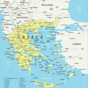
The Aegean Sea, from a nautical atlas, 1651 (ink on vellum) (see also 330926-330927)
![]()

Wall Art and Photo Gifts from Fine Art Finder
The Aegean Sea, from a nautical atlas, 1651 (ink on vellum) (see also 330926-330927)
XOT330925 The Aegean Sea, from a nautical atlas, 1651 (ink on vellum) (see also ) by Pietro Giovanni Prunes (fl. 17th Century); 41.6x28 cm; Museo Correr, Venice, Italy; Italian, out of copyright
Media ID 18255153
© Museo Correr, Venice, Italy / Bridgeman Images
Cartography Chart Compass Crete Cyclades Greek Islands Mapping Portolan Dodecanese Eastern Mediterranean Sea Sporades
FEATURES IN THESE COLLECTIONS
> Arts
> Artists
> P
> Pietro Giovanni Prunes
> Asia
> Turkey
> Related Images
> Europe
> Italy
> Veneto
> Venice
> Fine Art Finder
> Artists
> P
> Pietro Giovanni Prunes Pietro Giovanni
> Fine Art Finder
> Artists
> Pietro Giovanni Prunes
> Maps and Charts
> Italy
EDITORS COMMENTS
This print showcases "The Aegean Sea" as depicted in a nautical atlas from 1651. Created by Pietro Giovanni Prunes, a talented artist of the 17th century, this ink on vellum masterpiece measures 41.6x28 cm and is currently housed in the Museo Correr in Venice, Italy. The image transports us to the enchanting world of cartography, where every stroke of ink breathes life into the intricate details of this ancient sea. The Aegean Sea stretches out before us, revealing its timeless beauty and historical significance. From the Cyclades to the Greek Islands, from Crete to Turkey's coastlines, this map encompasses it all. With precision and artistry, Prunes captures not only geographical accuracy but also an essence that goes beyond mere mapping. The compass rose at its center guides sailors through these treacherous waters while adding an artistic touch to the composition. As we gaze upon this remarkable piece of history, we are reminded of how maps have shaped our understanding of the world throughout centuries. This print serves as a testament to human curiosity and exploration – a window into past voyages across these turquoise waters. Intriguingly detailed and beautifully preserved over time, "The Aegean Sea" invites us to embark on our own mental journey through these mythical islands and coastal regions. It stands as both an educational tool for maritime navigation enthusiasts and a work of art that celebrates humanity's quest for knowledge about our
MADE IN THE UK
Safe Shipping with 30 Day Money Back Guarantee
FREE PERSONALISATION*
We are proud to offer a range of customisation features including Personalised Captions, Color Filters and Picture Zoom Tools
SECURE PAYMENTS
We happily accept a wide range of payment options so you can pay for the things you need in the way that is most convenient for you
* Options may vary by product and licensing agreement. Zoomed Pictures can be adjusted in the Basket.


