Fraud Blocker Skip to main content

Home > Maps and Charts > Turkey

Turkey Collection (page 3)

Turkey is a transcontinental country located in Southeast Europe and Southwest Asia and has a population of over 82 million people

525 items

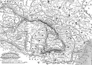
Background imageTurkey Collection: Map of the Frontiers of Austria & Russia, 1856. Creator: Unknown

Map of the Frontiers of Austria & Russia, 1856. Creator: Unknown. Map of the Frontiers of Austria & Russia, 1856
Map of the Frontiers of Austria & Russia, 1856. Map showing the area involved in the Crimean War: Black Sea, Transylvania, Hungary, Poland, Turkey, Odessa, Kiev, Bessarabia, Galicia

Background imageTurkey Collection: Plan of the Passage of the Ingour, 1856. Creator: Unknown

Plan of the Passage of the Ingour, 1856. Creator: Unknown
Plan of the Passage of the Ingour, 1856. Crimean War: map showing...the ground on which Omer Pacha's late victory took place [and] the strategy by which he succeeded in forcing the passage of a broad

Background imageTurkey Collection: Plan of Constantinople and its Suburbs, 1856. Creator: John Dower

Plan of Constantinople and its Suburbs, 1856. Creator: John Dower
Plan of Constantinople and its Suburbs, 1856. Map showing the city of Constantinople (modern Istanbul, Turkey), including the Golden Horn or the Port'; the Bosphorus or Channel of Constantinople

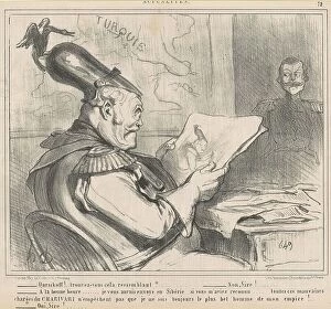
Background imageTurkey Collection: Oursikoff!..trouvez-vous cela ressemblant?, 19th century. Creator: Honore Daumier

Oursikoff!..trouvez-vous cela ressemblant?, 19th century. Creator: Honore Daumier
Oursikoff!..trouvez-vous cela ressemblant?, 19th century. Satire on the Crimean War. [Russian emperor]: Oursikoff! do you think this is a good likeness

Background imageTurkey Collection: L'histoire d'une splendide deconvenue; Anzac et Suvla; Les operations britanniques de 1915

L'histoire d'une splendide deconvenue; Anzac et Suvla; Les operations britanniques de 1915
L'histoire d'une splendide deconvenue; Anzac et Suvla; Les operations britanniques de 1915 sur la cote Ouest de la presqu'ile de Gallipoli, 1915. From "Collection de la Guerre IV

Background imageTurkey Collection: Cartoon: 'Hark! Hark! The Dogs Do Bark', c1914. Creator: Harris & Ewing

Cartoon: "Hark! Hark! The Dogs Do Bark", c1914. Creator: Harris & Ewing
Cartoon: "Hark! Hark! The Dogs Do Bark", c1914. First World War propaganda, with note by Walter Emanuel'. Map of Europe with the principal protagonists depicted as dogs

Background imageTurkey Collection: The Black Sea and the Caucasus; Map, 1854. Creator: Unknown

The Black Sea and the Caucasus; Map, 1854. Creator: Unknown
The Black Sea and the Caucasus; Map, 1854. From "Cassells Illustrated Family Paper; London Weekly 31/12/1853 - 30/12/1854"

Background imageTurkey Collection: New Russian Works, 1854. Creator: Unknown

New Russian Works, 1854. Creator: Unknown
New Russian Works, 1854. Crimean War. Map showing the besieged Black Sea port of Sebastopol. English, French and Turkish ships are ranged across the entrance to the harbour

Background imageTurkey Collection: Lieutenant Montagu O'Reilly explaining his Sketch of Sebastopol to the Sultan, 1854

Lieutenant Montagu O'Reilly explaining his Sketch of Sebastopol to the Sultan, 1854. Creator: Unknown
Lieutenant Montagu O'Reilly explaining his Sketch of Sebastopol to the Sultan, 1854. Crimean War: Royal Navy officer with Ottoman sultan Abdulmejid I

Background imageTurkey Collection: A military map depicting Russo-Turkish War of 1735-1739, 1737. Creator: Anonymous

A military map depicting Russo-Turkish War of 1735-1739, 1737. Creator: Anonymous
A military map depicting Russo-Turkish War of 1735-1739, 1737. Private Collection

Background imageTurkey Collection: A military map depicting Russo-Turkish War of 1735-1739, 1737. Creator: Anonymous

A military map depicting Russo-Turkish War of 1735-1739, 1737. Creator: Anonymous
A military map depicting Russo-Turkish War of 1735-1739, 1737. Private Collection

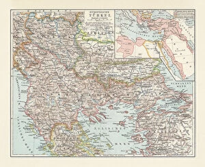
Background imageTurkey Collection: Historical map of the Ottoman Empire (Turkey), European part, 1897

Historical map of the Ottoman Empire (Turkey), European part, 1897
Historical map of European part of the Ottoman Empire (Turkey) at the end of the 19th century. Lithograph, published in 1897

Background imageTurkey Collection: Black Maps Earth Tones 35

Black Maps Earth Tones 35
Emiliano Deificus

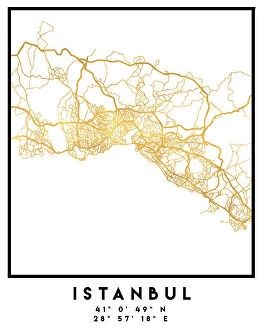
Background imageTurkey Collection: 1 Maps 3 33

1 Maps 3 33
Emiliano Deificus

Background imageTurkey Collection: 1 Maps 64

1 Maps 64
Emiliano Deificus

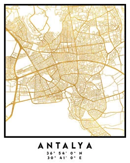
Background imageTurkey Collection: City Love Maps 35

City Love Maps 35
Emiliano Deificus

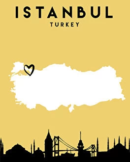
Background imageTurkey Collection: City Heart Maps 35

City Heart Maps 35
Emiliano Deificus

Background imageTurkey Collection: Black Maps 35

Black Maps 35
Emiliano Deificus

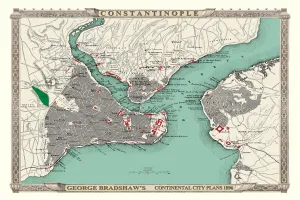
Background imageTurkey Collection: George Bradshaws Plan of Constantinople, Turkey 1896

George Bradshaws Plan of Constantinople, Turkey 1896
This is a detailed Plan of Constantinople showing the streets, canals, principal buildings, railways and railway stations

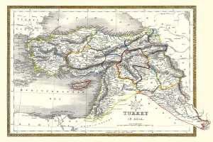
Background imageTurkey Collection: Old Map of Turkey in Asia 1852 by Henry George Collins

Old Map of Turkey in Asia 1852 by Henry George Collins
This is a finely detailed map of Turkey in Asia remastered from a rare Atlas of the World published in 1852 by Henry George Collins

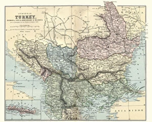
Background imageTurkey Collection: Map of Romania, Serbia, Montenegro, and Bulgaria 19th Century

Map of Romania, Serbia, Montenegro, and Bulgaria 19th Century
Vintage engraving of a Map of Romania, Serbia, Montenegro, and Bulgaria 19th Century, European Turkey

Background imageTurkey Collection: The Avenger: An Allegorical War Map for 1877, 1876-1877. Creator: Anonymous

The Avenger: An Allegorical War Map for 1877, 1876-1877. Creator: Anonymous
The Avenger: An Allegorical War Map for 1877, 1876-1877. Private Collection

Background imageTurkey Collection: Austria-Hungary and Neighbouring Lands - Map, 1920. Creator: John Bartholomew & Son

Austria-Hungary and Neighbouring Lands - Map, 1920. Creator: John Bartholomew & Son
Austria-Hungary and Neighbouring Lands, c1914, (c1920). Map of the Austro-Hungarian Empire and surrounding countries at start of the First World War

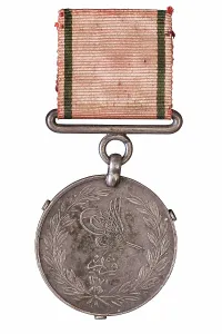
Background imageTurkey Collection: Turkish Crimea Medal 1855, Crimean War 1854-1856

Turkish Crimea Medal 1855, Crimean War 1854-1856
This medal was awarded to Colonel George Frederick Stevenson Call. It is one of 17 campaign medals awarded to members of the Call family, now in the museum collection

Background imageTurkey Collection: City map of Constantinople (Istanbul, Turkey), lithograph, published in 1897

City map of Constantinople (Istanbul, Turkey), lithograph, published in 1897
City map of Constantinople (Istanbul, Turkey). Lithograph, published in 1897

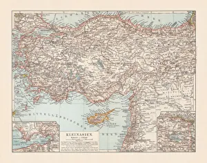
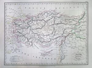
Background imageTurkey Collection: Old topographic map of Asia Minor (Turkey), lithograph, published 1897

Old topographic map of Asia Minor (Turkey), lithograph, published 1897
Old topographic map of Asia Minor (Turkey). Lithograph, published 1897

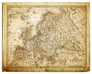
Background imageTurkey Collection: old map of central europe

old map of central europe
an old map form 1870, showing central europe countries

Background imageTurkey Collection: 1850 Mitchell Mitchell Map Of Turkey In Asia

1850 Mitchell Mitchell Map Of Turkey In Asia
1850, Mitchell, Mitchell Map of Turkey in Asia

Background imageTurkey Collection: 1837 Malte-Brun Map Of Turkey Or Asia Minor In Ancient Times

1837 Malte-Brun Map Of Turkey Or Asia Minor In Ancient Times
1837, Malte-Brun Map of Turkey or Asia Minor in Ancient Times

Background imageTurkey Collection: 1835 Malte-Brun Map Of Turkey Or The Ottoman Empire In Europe

1835 Malte-Brun Map Of Turkey Or The Ottoman Empire In Europe
1835, Malte-Brun Map of Turkey or the Ottoman Empire in Europe

Background imageTurkey Collection: 1835 Bradford Map Of Turkey In Asia And The Caucases

1835 Bradford Map Of Turkey In Asia And The Caucases
1835, Bradford Map of Turkey in Asia and the Caucases

Background imageTurkey Collection: 1799 Clement Cruttwell Map Of Turkey In Europe

1799 Clement Cruttwell Map Of Turkey In Europe
1799, Clement Cruttwell Map of Turkey in Europe

Background imageTurkey Collection: 1780 Raynal And Bonne Map Of Turkey In Europe And Asia

1780 Raynal And Bonne Map Of Turkey In Europe And Asia
1780, Raynal and Bonne Map of Turkey in Europe and Asia, Rigobert Bonne 1727 - 1794, one of the most important cartographers of the late 18th century

Background imageTurkey Collection: 1873 Stieler Map Of Asia Minor Syria And Israel

1873 Stieler Map Of Asia Minor Syria And Israel
1873, Stieler Map of Asia Minor, Syria and Israel, Palestine, modern Turkey

Background imageTurkey Collection: 1870 Johnson Map Of Turkey Persia Arabia Iran

1870 Johnson Map Of Turkey Persia Arabia Iran
1870, Johnson Map of Turkey, Persia, Arabia, Iran, Iraq, Afghanistan

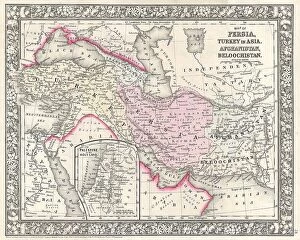
Background imageTurkey Collection: 1866 Mitchell Map Of Persia Turkey And Afghanistan

1866 Mitchell Map Of Persia Turkey And Afghanistan
1866, Mitchell Map of Persia, Turkey and Afghanistan, Iran, Iraq

Background imageTurkey Collection: 1866 Johnson Map Of Arabia Persia Turkey And Afghanistan

1866 Johnson Map Of Arabia Persia Turkey And Afghanistan
1866, Johnson Map of Arabia, Persia, Turkey and Afghanistan, Iraq

Background imageTurkey Collection: 1864 Mitchell Map Of Persia Turkey And Afghanistan

1864 Mitchell Map Of Persia Turkey And Afghanistan
1864, Mitchell Map of Persia, Turkey and Afghanistan, Iran, Iraq

Background imageTurkey Collection: 1865 Spruner Map Of Asia Minor Turkey In Antiquity

1865 Spruner Map Of Asia Minor Turkey In Antiquity
1865, Spruner Map of Asia Minor, Turkey in Antiquity

Background imageTurkey Collection: 1863 Johnson Map Of Austria Hungary Turkey Italy And Greece

1863 Johnson Map Of Austria Hungary Turkey Italy And Greece
1863, Johnson Map of Austria, Hungary, Turkey, Italy and Greece

Background imageTurkey Collection: 1862 Johnson Map Of Arabia Persia And Turkey In Asia

1862 Johnson Map Of Arabia Persia And Turkey In Asia
1862, Johnson Map of Arabia, Persia and Turkey in Asia

Background imageTurkey Collection: 1855 Colton Map Of Turkey Iraq And Syria Topography

1855 Colton Map Of Turkey Iraq And Syria Topography
1855, Colton Map of Turkey, Iraq, and Syria

Background imageTurkey Collection: 1855 Colton Map Of Turkey In Europe Macedonia

1855 Colton Map Of Turkey In Europe Macedonia
1855, Colton Map of Turkey in Europe, Macedonia, and the Balkans

Background imageTurkey Collection: 1853 Mitchell Map Of Turkey In Europe And Greece

1853 Mitchell Map Of Turkey In Europe And Greece
1853, Mitchell Map of Turkey in Europe and Greece, Greece, Balkans, Macedonia

Background imageTurkey Collection: 1853 Mitchell Map Of Turkey In Asia Palestine

1853 Mitchell Map Of Turkey In Asia Palestine
1853, Mitchell Map of Turkey in Asia, Palestine, Syria, Iraq, Turkey

Background imageTurkey Collection: 1849 Mitchell Map Of Turkey Iraq Syria Palestine

1849 Mitchell Map Of Turkey Iraq Syria Palestine
1849, Mitchell Map of Turkey, Iraq, Syria, Palestine

Background imageTurkey Collection: 1843 Malte Brun Map Of The Biblical Lands Of The Hebrews

1843 Malte Brun Map Of The Biblical Lands Of The Hebrews
1843, Malte Brun Map of the Biblical Lands of the Hebrews, Egypt, Arabia, Israel, Turkey

Background imageTurkey Collection: 1840 S.D.U.K. Map Of Constantinople Istanbul

1840 S.D.U.K. Map Of Constantinople Istanbul
1840, S.D.U.K. Map of Constantinople, Istanbul, Turkey


All Professionally Made to Order for Quick Shipping


-

Turkey Collection

Turkey is a transcontinental country located in Southeast Europe and Southwest Asia and has a population of over 82 million people, making it the world's 18th most populous country. The capital city is Ankara, while Istanbul is the largest city and economic center. A diverse economy with industries such as textiles, automotive, electronics, and tourism contributing significantly to its GDP. The country also boasts of rich cultural heritage evident in its architecture, cuisine, music, and festivals. Turkey shares borders with eight countries including Greece, Bulgaria, Georgia, Armenia among others and has access to two seas; the Black Sea and Mediterranean Sea.
+

Our beautiful pictures are available as Framed Prints, Photos, Wall Art and Photo Gifts

The Turkey collection from Media Storehouse is a stunning selection of wall art and framed prints that showcase the beauty and history of Turkey. Our collection features a range of maps, charts, and illustrations that depict the country's geography, landmarks, cities, and historical events. The artwork in our collection is sourced from various archives around the world, including museums, libraries, and private collections. Each piece in our collection has been carefully curated to offer a unique perspective on Turkey's rich cultural heritage. From antique maps depicting Ottoman-era borders to modern-day satellite images showcasing Istanbul's bustling cityscape - there is something for everyone in this diverse collection. Whether you're looking to add some Turkish flair to your home or office decor or simply want to learn more about this fascinating country - the Turkey collection from Media Storehouse offers an unparalleled glimpse into its past and present.
+

What are Turkey (Maps and Charts) art prints?

Turkey art prints are high-quality reproductions of historical maps and charts depicting the country of Turkey. These prints showcase the intricate details, unique features, and geographical landmarks of Turkey that have been captured by skilled cartographers over time. These art prints offer a glimpse into the past, allowing viewers to explore how Turkey has evolved through history. They also serve as educational tools for students, historians, and geography enthusiasts who want to learn more about this fascinating country. Turkey art prints are available in various sizes and formats such as framed or unframed prints, canvas wraps or posters. They make great additions to any home or office decor with their vintage charm adding character to any space. Whether you're looking for a piece of artwork that celebrates your love for travel or simply want to add some cultural flair to your living space - these beautiful art pieces from Media Storehouse are sure to impress.
+

What Turkey (Maps and Charts) art prints can I buy from Media Storehouse?

We offer a wide range of Turkey art prints, including maps and charts. These prints showcase the beauty and diversity of Turkey's landscapes, cities, and historical sites. You can choose from vintage maps that highlight the country's geography or contemporary charts that depict its political boundaries. In addition to maps and charts, Media Storehouse also offers photographic prints featuring iconic landmarks such as Hagia Sophia in Istanbul or Cappadocia's unique rock formations. You can also find stunning images of Turkey's coastline, mountains, and countryside. Whether you're looking for a piece to decorate your home or office or a gift for someone who loves Turkey, we have something for everyone. With high-quality printing on premium paper stock, these art prints are sure to impress anyone who sees them.
+

How do I buy Turkey (Maps and Charts) art prints?

To buy Turkey art prints from Media Storehouse, you can browse our extensive collection of high-quality images online. Simply search for "Turkey Maps and Charts" in the search bar on our website to find a range of options available. Once you have found an image that you like, select the size and format that suits your needs. You can choose from a variety of print sizes, including small, medium, large or extra-large prints. After selecting your preferred size and format, add the item to your cart and proceed to checkout. You will be prompted to enter your shipping information as well as payment details. We offer secure payment methods such as credit card payments or PayPal transactions. Once your order is confirmed, they will process it promptly so that you receive your Turkey art print in no time.
+

How much do Turkey (Maps and Charts) art prints cost?

We offer a wide range of Turkey art prints at varying prices. Our collection includes high-quality prints that are perfect for adding a touch of elegance to any room in your home or office. The cost of our Turkey art prints depends on the size, framing options, and other customizations you choose. We have something for everyone's budget with affordable options as well as premium quality products. We take pride in offering exceptional value for money while maintaining the highest standards of quality. Our Turkey art prints come in various sizes ranging from small to large formats so that you can find the perfect fit for your space. Whether you're looking to decorate your living room, bedroom or office, our selection has got you covered.
+

How will my Turkey (Maps and Charts) art prints be delivered to me?

We take great care in delivering your Turkey art prints to you. Once you have placed your order with us, our team of professionals will carefully package your print to ensure it arrives safely at its destination. We use high-quality materials that are designed to protect the artwork during transit. Depending on the size of the print, we may roll it up and place it in a sturdy tube for shipping or pack it flat between two pieces of cardboard. Our delivery partners are trusted couriers who specialize in handling fragile items such as artwork. When your Turkey art print arrives, please inspect it carefully to ensure that there is no damage during transit. If you do find any issues with your order, please contact us immediately so that we can resolve them for you as quickly as possible. We hope that you enjoy your new artwork from Media Storehouse.