Fraud Blocker Skip to main content

Home > Maps and Charts > Related Images

Related Images Collection (page 37)

50,000 items

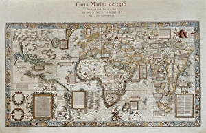
Background imageRelated Images Collection: Carta marina (map of the sea). 1516. Facsimile

Carta marina (map of the sea). 1516. Facsimile
" Carta marina (map of the sea). 1516. Facsimile. Sea map described by Carlos Sainz in his work " The name of America". Engraving. SPAIN. Madrid. Americas Museum."

Background imageRelated Images Collection: The Caverio Map or Caveri Map, circa 1505. This

The Caverio Map or Caveri Map, circa 1505. This map was one of the primary sources used to make the Waldseem� map. Miniature Painting. FRANCE. Paris. National Library

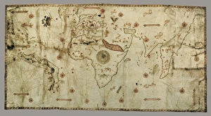
Background imageRelated Images Collection: Nautical chart entitled King Hamy. 1502. Parchment

Nautical chart entitled King Hamy. 1502. Parchment
" Nautical chart entitled " King Hamy". 1502. Parchment. Miniature Painting. SPAIN. Barcelona. Barcelona Maritime Museum."

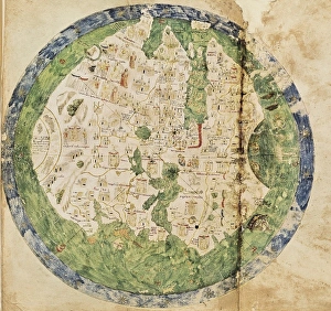
Background imageRelated Images Collection: Andrea Biancos Atlas, 1436. Page 10, World Map

Andrea Biancos Atlas, 1436. Page 10, World Map
" Andrea Biancos Atlas, 1436. Page 10, World Map, the East is on the upper side. First time Florida coast is depicted as a big peninsula linked to an island called Antillia (legendary island)

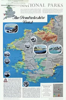
Background imageRelated Images Collection: Map of the Pembrokeshire Coast

Map of the Pembrokeshire Coast
National Parks poster map of the Pembrokeshire Coast Date: circa 1950

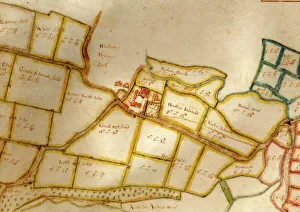
Background imageRelated Images Collection: Coombes Tithe Map, 1840

Coombes Tithe Map, 1840
Surveyor unknown. 16 in. to 1m. Original map size 32in. × 37in. Tithe Award Map Collection West Sussex Record Office Ref No: TD/W38

Background imageRelated Images Collection: Climping Tithe Map, 1843

Climping Tithe Map, 1843
Compiled by J. F. Tidey, Littlehampton. 13.3 in. to 1m. Original map size 28in. × 50in. Tithe Award Map Collection West Sussex Record Office Ref No: TD/W33

Background imageRelated Images Collection: Billingshurst Tithe Map, 1841

Billingshurst Tithe Map, 1841
By Messrs. Crawter, Surveyors, Cobham, Surrey and Southampton Buildings, Chancery Lane, London. 13.3 in. to 1m. Original map size 78in. × 63in

Background imageRelated Images Collection: Balcombe Tithe Map, 1842

Balcombe Tithe Map, 1842
By H. Walter. 20 in. to 1 m. Original Map size 79in. × 77in. Tithe Award Map Collection West Sussex Record Office Ref No: TD/E24

Background imageRelated Images Collection: Map of Westbourne village, 1640

Map of Westbourne village, 1640
Additional Manuscript Collection West Sussex Record Office Ref No: Add Ms 2856

Background imageRelated Images Collection: Map of the manor of Woolbeding, 1652

Map of the manor of Woolbeding, 1652
Additional Manuscript Collection West Sussex Record Office Ref No: Add Ms 1052

Background imageRelated Images Collection: CIVIL WAR: ANACONDA PLAN. Scotts Great Snake or the Anaconda Plan

CIVIL WAR: ANACONDA PLAN. Scotts Great Snake or the Anaconda Plan: General Winfield Scotts plan to blockade the Confederacy and conduct a major offensive down the Mississippi River

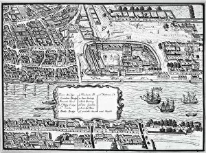
Background imageRelated Images Collection: TOWER OF LONDON, 1560. Detail from the Agas map of 1560 showing the Tower of London on the Thames

TOWER OF LONDON, 1560. Detail from the Agas map of 1560 showing the Tower of London on the Thames River

Background imageRelated Images Collection: MAP: CHICAGO, 1874. Map of Chicago, Illinois, and its suburbs

MAP: CHICAGO, 1874. Map of Chicago, Illinois, and its suburbs. Line engraving, 1874, by Rufus Blanchard

Background imageRelated Images Collection: LONDON: MAP, 1575. Engraved map of London, England, 1575

LONDON: MAP, 1575. Engraved map of London, England, 1575

Background imageRelated Images Collection: MAP: WESTERN RESERVE. Map of the Connecticut Western Reserve on Lake Erie

MAP: WESTERN RESERVE. Map of the Connecticut Western Reserve on Lake Erie, later to become the northeastern part of the state of Ohio

Background imageRelated Images Collection: MAGELLAN: MAP, 1519-1522. Map of the Pacific Ocean showing Ferdinand Magellans route, 1519-1522

MAGELLAN: MAP, 1519-1522. Map of the Pacific Ocean showing Ferdinand Magellans route, 1519-1522. Wood engraving, 19th century

Background imageRelated Images Collection: COPERNICAN UNIVERSE, 1660. Copernican map of the Universe, with the sun at the center

COPERNICAN UNIVERSE, 1660. Copernican map of the Universe, with the sun at the center: copperplate engraving from Andreas Cellarius " Atlas Coelestis seu Harmonia Macrocosmica

Background imageRelated Images Collection: Map of Rome

Map of Rome

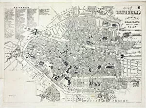
Background imageRelated Images Collection: Map of Brussels

Map of Brussels
Map of the city of Brussels, Belgium Date: 19th century

Background imageRelated Images Collection: Map of Paris

Map of Paris
Bradshaws Plan of Paris, France and map of the environs Date: 19th century

Background imageRelated Images Collection: Railway Map of England

Railway Map of England
London & North Western Railway Co rail map of England, 1899 Date: 1899

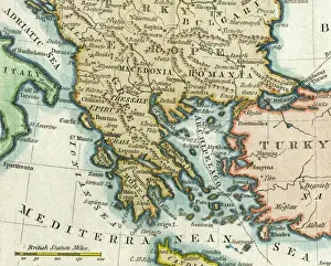
Background imageRelated Images Collection: Map of Greece, 1792

Map of Greece, 1792
Map of Greece and Greek islands plus Romania (which appears on this map to be incorrectly labelled or positioned south of Bulgaria), Macedonia, Albania and parts of Turkey and Italy

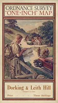
Background imageRelated Images Collection: Ordnance Survey map cover - Dorking and Leith Hill

Ordnance Survey map cover - Dorking and Leith Hill
Front cover of an Ordnance Survey map covering the Dorking and Leith Hill area of Surrey. The cover features a hiker or rambler leaning against a wall and smoking a pipe as he consults his map

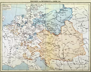
Background imageRelated Images Collection: AUSTRIAN EMPIRE MAP, 1795. Map of Prussia and the Austrian Empire as they appeared in the year 1795

AUSTRIAN EMPIRE MAP, 1795. Map of Prussia and the Austrian Empire as they appeared in the year 1795

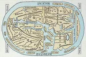
Background imageRelated Images Collection: WORLD MAP 2ND CENTURY. World map according to Roman geographers of the 2nd century A. D

WORLD MAP 2ND CENTURY. World map according to Roman geographers of the 2nd century A. D
WORLD MAP 2ND CENTURY. World map according to Roman geographers of the 2nd century A.D

Background imageRelated Images Collection: APIAN: WORLD MAP, 1530. Heart-shaped map of the world, with small portraits of Amerigo Vespucci

APIAN: WORLD MAP, 1530. Heart-shaped map of the world, with small portraits of Amerigo Vespucci (upper left) and Ptolemy (upper right) by Peter Apian, 1530

Background imageRelated Images Collection: ASIA MAP, 19th CENTURY. Persia, Afghanistan, Turkestan, India, Tibet, Burma, and Siam

ASIA MAP, 19th CENTURY. Persia, Afghanistan, Turkestan, India, Tibet, Burma, and Siam. Detail from a late 19th century map of Asia

Background imageRelated Images Collection: WORLD MAP, 1635. By Willem Janszoon Blaeu, with two polar insets in the body of the map

WORLD MAP, 1635. By Willem Janszoon Blaeu, with two polar insets in the body of the map and border panels depicting the four elements, the seven known planets, the four seasons

Background imageRelated Images Collection: NEW ORLEANS MAP, 1837. Map of New Orleans, Louisiana

NEW ORLEANS MAP, 1837. Map of New Orleans, Louisiana

Background imageRelated Images Collection: ANTI-RUSSIAN MAP, 1904. A Humorous Diplomatic Atlas of Europe and Asia

ANTI-RUSSIAN MAP, 1904. A Humorous Diplomatic Atlas of Europe and Asia. Japanese propaganda handbill of 1904 portraying Russia as a grasping octopus

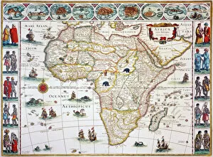
Background imageRelated Images Collection: MAP OF AFRICA, 1630. Willem Blaeus ornamental map of Africa Newly Described

MAP OF AFRICA, 1630. Willem Blaeus ornamental map of Africa Newly Described

Background imageRelated Images Collection: MAP: UNITED STATES, 1820. Engraved map of the United States, 1820

MAP: UNITED STATES, 1820. Engraved map of the United States, 1820, drawing on the geographical discoveries of the Lewis & Clark expedition

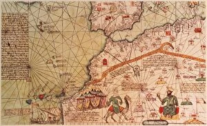
Background imageRelated Images Collection: MANSA MUSA (1312-1337). King of Mali. Mansa Musa seated on his throne

MANSA MUSA (1312-1337). King of Mali. Mansa Musa seated on his throne. Facing him is a Tuareg on his camel. Detail from the Catalan Atlas of 1375

Background imageRelated Images Collection: UNITED FRUIT COMPANY, 1922. Advertisement from an American magazine of 1922, for

UNITED FRUIT COMPANY, 1922. Advertisement from an American magazine of 1922, for United Fruit Companys Carribean cruises

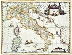
Background imageRelated Images Collection: MAP OF ITALY, 1631. Map of Italy, 1631, by Johannes Blaeu based on a map by Giovanni Antonio Magini

MAP OF ITALY, 1631. Map of Italy, 1631, by Johannes Blaeu based on a map by Giovanni Antonio Magini (d. 1617)

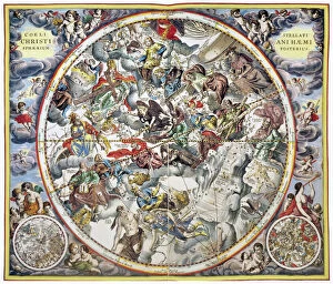
Background imageRelated Images Collection: CELESTIAL PLANISPHERE, 1660. Schillers Christianized Heaven, southern hemisphere

CELESTIAL PLANISPHERE, 1660. Schillers Christianized Heaven, southern hemisphere, from Andreas Cellarius " Atlas Coelestis seu Harmonia Macrocosmica" published, 1660, in Amsterdam

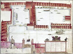
Background imageRelated Images Collection: VENICE: ARSENALE. The Arsenale of Venice, Italy. Drawing by Antonio di Natale, 18th century

VENICE: ARSENALE. The Arsenale of Venice, Italy. Drawing by Antonio di Natale, 18th century

Background imageRelated Images Collection: ANCIENT JERUSALEM. The ancient city of Jerusalem, with Solomons Temple in the center

ANCIENT JERUSALEM. The ancient city of Jerusalem, with Solomons Temple in the center. Lithograph, c1851

Background imageRelated Images Collection: James Van Allen, US astrophysicist

James Van Allen, US astrophysicist
James Van Allen (1914-2006), US astrophysicist, holding a model of the rocket launcher Juno 1 with the satellite Explorer 1 on the nose cone

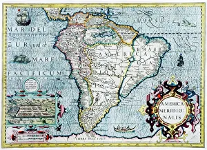
Background imageRelated Images Collection: 17th century map of South America

17th century map of South America
South America, 17th century Dutch map. This shows the new continent that was being discovered by European explorers. The shape is distorted because it had not yet been accurately mapped

Background imageRelated Images Collection: Atlas compass, 16th century

Atlas compass, 16th century
Atlas compass in a 1544 copy of the Agnese Atlas. Several copies of this atlas were produced between 1536 and 1564, in Venice, by the Italian mapmaker Battista Agnese

Background imageRelated Images Collection: 1862 Megalosaurus reconstruction

1862 Megalosaurus reconstruction
1862 Megalosaurus wallchart after Waterhouse Hawkins with Pterosaurs in background. One of six wall charts entitled " Waterhouse Hawkinss Diagrams of the Extinct Animals" for the Department

Background imageRelated Images Collection: Southern hemisphere star chart, 1537

Southern hemisphere star chart, 1537
Southern hemisphere star chart, 16th century. Star chart (planisphere) of the southern hemisphere, based on Albrecht Durers star charts of 1515. The illustrations show the constellations

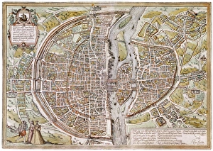
Background imageRelated Images Collection: PARIS MAP, 1581. Map of Paris, France, by Georg Braun from Civitates Orbis Terarum, 1581

PARIS MAP, 1581. Map of Paris, France, by Georg Braun from Civitates Orbis Terarum, 1581

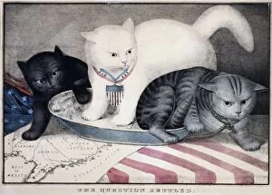
Background imageRelated Images Collection: CIVIL WAR: CARTOON, c1865. The Question Settled. White cat labeled Old Abe kicking out a grey cat

CIVIL WAR: CARTOON, c1865. The Question Settled. White cat labeled Old Abe kicking out a grey cat labeled Jeff Davis. Behind Old Abe is a black cat labeled Contraband. Color lithograph, c1865

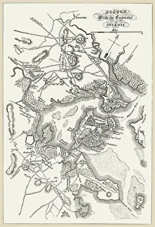
Background imageRelated Images Collection: BOSTON: MAP, 1775-1776. Map of Boston, Massachusetts, and the surrounding area, 1775-1776

BOSTON: MAP, 1775-1776. Map of Boston, Massachusetts, and the surrounding area, 1775-1776. Line engraving, 19th century

Background imageRelated Images Collection: Serbia map

Serbia map
Map of Servia in the 1870s. Printed color lithograph reproduction of a 19th-century illustration


All Professionally Made to Order for Quick Shipping


-

Why Choose Us?

We are a leading provider of Art Prints and Photo Gifts since 2003, working in partnership with a range of Sporting Clubs, Charities, Museums and Picture Libraries. A large share of profits from any of their images will go directly towards supporting that charity or club. Our archive of images is carefully curated to bring you a wide range of subjects, including landscapes, wildlife, architecture, and more. We ship from our partner labs in the UK, USA, EU (Netherlands) and Australia.
+

How do I place an order?

Ordering is quick & easy - Just follow 5 Simple Steps:
  1. Find your image: Use our search box or browse our online photo Collections to find the image you want.

  2. Choose your print format: Select your desired product and add it to your cart.

  3. Enter your details: If you're a returning customer, simply enter your email address and password, and we'll fill in your billing and shipping address details. All personal details are held securely and are fully GDPR compliant. As standard, we remove all Personally Identifiable Information after 12 months.

  4. Pay for your purchase: We use state-of-the-art security for online shopping and do not have access to your card details.

  5. Sit back and relax: We'll email you confirmation of your order and when it's dispatched. Registered customers can also track orders in the 'My Account' area.

+

How do I pay for an order?

You can pay for your order with most of the major credit and debit cards, or PayPal. For added security, major financial institutions process payment details separately and securely on our behalf. We do not have access to your online payment card details. Online payments are preferred however we do take phone orders. For UK customers only we accept cheques issued against a UK bank.
+

Is my data safe?

We take data security very seriously. We do not have access to your full card details and all payments are requested over a fully secure connection. Additionally, we fully comply with current European and GDPR legislation, and automatically remove all personal data after at most 12 months (unless you have an account with us and have signed in recently). We also have a strict opt-in policy and would never sell your personal details. Your data is only used to fulfill your order promptly and efficiently.
+

Is wall art ready to hang?

For quick and easy installation all wall art, including framed prints, canvas prints and metal prints are supplied with a ready to hang solution on the back. Generally, saw tooth hangers are applied as they allow wall art to hang flush against the wall. The serrated edge of the hanger prevents the frame from shifting or tilting when hung.
+

Are the photo prints fade resistant?

Yes, we use archival quality photo paper photographic paper for vivid reproduction Prints are an accurate representations of the original artwork, which is preserved for artistic character and authenticity. We guarantee they match previews shown on our web site