Jigsaw Puzzle > Africa > Sudan > Maps
Jigsaw Puzzle : Map of Egypt and Sudan 1896


![]()
Jigsaw Puzzles from Fine Art Storehouse
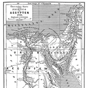
Map of Egypt and Sudan 1896
Andres Allgemeiner Handatlas - Bielefeld und Leipzig 1896
Unleash your creativity and transform your space into a visual masterpiece!
THEPALMER
Media ID 18356811
Jigsaw Puzzle (400 Pieces)
Discover the historical wonders of Egypt and Sudan with our intricately designed jigsaw puzzle from Media Storehouse. This captivating puzzle features an authentic map of Egypt and Sudan, as originally published in Andres Allgemeiner Handatlas of 1896 by THEPALMER from Fine Art Storehouse. Immerse yourself in the rich history and culture of this ancient region as you piece together the borderlands of Egypt and Sudan. Perfect for history enthusiasts, puzzle lovers, or anyone seeking a challenging and rewarding pastime.
400 piece puzzles are custom made in the UK and hand-finished on 100% recycled 1.5 mm millboard. There is a level of repetition in jigsaw shapes with each matching piece away from its pair. The completed puzzle measures 31x47cm and is delivered packaged in an attractive presentation box specially designed to fit most letter box slots
Jigsaw Puzzles are an ideal gift for any occasion
Estimated Product Size is 31.5cm x 47.2cm (12.4" x 18.6")
These are individually made so all sizes are approximate
Artwork printed orientated as per the preview above, with landscape (horizontal) or portrait (vertical) orientation to match the source image.
FEATURES IN THESE COLLECTIONS
> Fine Art Storehouse
> Map
> Historical Maps
> Africa
> Egypt
> Related Images
> Africa
> Sudan
> Related Images
> Maps and Charts
> Related Images
EDITORS COMMENTS
In this print titled "Map of Egypt and Sudan 1896" we are transported back in time to the late 19th century, where cartography was an art form in itself. The intricate details and craftsmanship of this map, sourced from Andres Allgemeiner Handatlas - Bielefeld und Leipzig 1896, truly capture the essence of a bygone era. As we gaze upon this historical artifact, our eyes are immediately drawn to the rich colors that adorn its surface. Shades of deep blues represent water bodies like the Nile River and Lake Victoria, while earthy tones depict vast deserts and fertile lands. Every contour line meticulously etched onto the paper reveals mountains, valleys, and plateaus with remarkable precision. The Map of Egypt and Sudan transports us to a time when these regions were still under colonial rule. It serves as a reminder of their complex history intertwined with European powers seeking control over strategic territories. This print offers not only geographical information but also provides insights into political boundaries during that period. "The Palmer" has skillfully captured this piece from Fine Art Storehouse, allowing us to appreciate its beauty up close. Whether you're an avid historian or simply fascinated by vintage maps, this print is sure to ignite your imagination as you explore the intricacies of Egypt and Sudan's past through cartographic mastery.
MADE IN THE UK
Safe Shipping with 30 Day Money Back Guarantee
FREE PERSONALISATION*
We are proud to offer a range of customisation features including Personalised Captions, Color Filters and Picture Zoom Tools
SECURE PAYMENTS
We happily accept a wide range of payment options so you can pay for the things you need in the way that is most convenient for you
* Options may vary by product and licensing agreement. Zoomed Pictures can be adjusted in the Basket.