Fraud Blocker Skip to main content

Jigsaw Puzzle > Africa > Algeria > Maps

Maps Jigsaw Puzzle Collection

Discover the beauty and complexity of Algeria with our Maps of Algeria, Africa collection of jigsaw puzzles from Media Storehouse. Each puzzle features intricately detailed maps of various regions in Algeria, providing an engaging and educational experience for puzzle enthusiasts of all ages. Made with high-quality materials and pieces that fit securely, these puzzles are perfect for solo puzzling or group activities. Immerse yourself in the rich cultural heritage and geography of Algeria as you piece together these captivating maps. Complete one puzzle and discover your next adventure in this fascinating African country.
Algeria is a country located in North Africa, bordered by the Mediterranean Sea to the north and east, Tunisia to the northeast, Libya to the east

Choose a picture from our Maps Jigsaw Puzzle Collection for your Wall Art and Photo Gifts

124 Jigsaw Puzzles

Background imageMaps Jigsaw Puzzle Collection: Africa Political Map

Africa Political Map
Antique illustration of a Africa Political Map from 1893

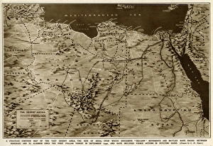
Background imageMaps Jigsaw Puzzle Collection: Map of the war in North Africa by G. H. Davis

Map of the war in North Africa by G. H. Davis
The war in North Africa: a strategic contour map of the desert arena during the Second World War. Conflict began there in September 1940. Date: 1942

Background imageMaps Jigsaw Puzzle Collection: Colonialism: mapping of the Algiers region (chromolithograph)

Colonialism: mapping of the Algiers region (chromolithograph)
FGL5471170 Colonialism: mapping of the Algiers region (chromolithograph); (add.info.: French vignette from the collection, Edition de la Chocolaterie d'Aiguebelle ", chromolithography)

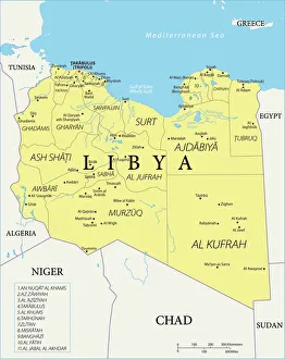
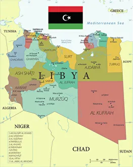
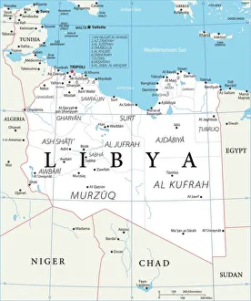
Background imageMaps Jigsaw Puzzle Collection: Reference Map of Libya

Reference Map of Libya
Libya is an African nation situated in North Africa, along the Mediterranean Sea. Libya shares borders with Egypt, Sudan, Chad, Niger, Algeria, and Tunisia

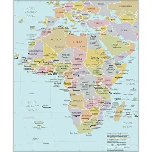
Background imageMaps Jigsaw Puzzle Collection: Political Map of Africa

Political Map of Africa
Vector Illustration of the policital map of Africa Reference map as created by the US Central Intelligence Agency

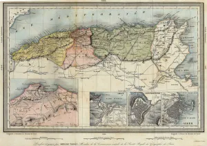
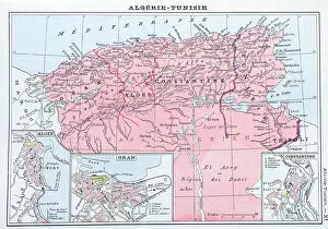
Background imageMaps Jigsaw Puzzle Collection: Geographic map of Algeria and details of the provinces of Algiers, Oran and Constantine

Geographic map of Algeria and details of the provinces of Algiers, Oran and Constantine
XEE4405752 Geographic map of Algeria and details of the provinces of Algiers, Oran and Constantine, realized by Amboise Tardieu, 19th century

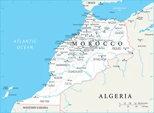
Background imageMaps Jigsaw Puzzle Collection: Reference Map of Morocco

Reference Map of Morocco
Morocco is a country in the western Maghreb region of North Africa. Morocco is bordered by the Atlantic Ocean in west, by the Mediterranean Sea in north

Background imageMaps Jigsaw Puzzle Collection: Map of Morocco

Map of Morocco
Morocco is a country in the western Maghreb region of North Africa. Morocco is bordered by the Atlantic Ocean in west, by the Mediterranean Sea in north

Background imageMaps Jigsaw Puzzle Collection: Geographic atlas: detail of the portulan of Francois Ollive representing Barbarie (Algeria, Tunisia)

Geographic atlas: detail of the portulan of Francois Ollive representing Barbarie (Algeria, Tunisia)
JEB4874959 Geographic atlas: detail of the portulan of Francois Ollive representing Barbarie (Algeria, Tunisia, Tripolitan) and Morocco

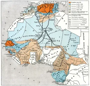
Background imageMaps Jigsaw Puzzle Collection: Map of French colonial Africa, 1930 (print)

Map of French colonial Africa, 1930 (print)
8672352 Map of French colonial Africa, 1930 (print); Private Collection; (add.info.: Map of French colonial Africa (French colonial empire) in 1930

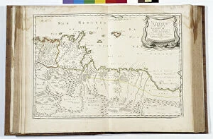
Background imageMaps Jigsaw Puzzle Collection: Geographic atlas: view of the Mediterranean Sea and the coasts of Barbaria (Algeria, Tunisia)

Geographic atlas: view of the Mediterranean Sea and the coasts of Barbaria (Algeria, Tunisia, Tripolitan)
JEB4874639 Geographic atlas: view of the Mediterranean Sea and the coasts of Barbaria (Algeria, Tunisia, Tripolitan). Atlas de Nicolas et Guillaume Sanson, 1670

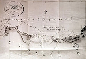
Background imageMaps Jigsaw Puzzle Collection: Map of african coasts from Ras El Hadid (Algeria) to Cap Negre (Tunisia), 1821, engraving

Map of african coasts from Ras El Hadid (Algeria) to Cap Negre (Tunisia), 1821, engraving
1754351 Map of african coasts from Ras El Hadid (Algeria) to Cap Negre (Tunisia), 1821, engraving; (add.info.: Map of african coasts from Ras El Hadid (Algeria) to Cap Negre (Tunisia), 1821

Background imageMaps Jigsaw Puzzle Collection: Chart of Algiers Bay, 1620 (ink on vellum)

Chart of Algiers Bay, 1620 (ink on vellum)
7340488 Chart of Algiers Bay, 1620 (ink on vellum) by Norton, Robert (17th century); 58x49 cm; National Maritime Museum, London

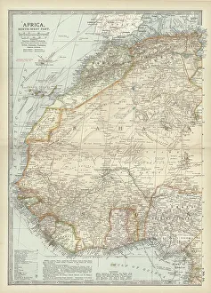
Background imageMaps Jigsaw Puzzle Collection: Map of northwestern Africa, c.1900 (engraving)

Map of northwestern Africa, c.1900 (engraving)
533056 Map of northwestern Africa, c.1900 (engraving); (add.info.: Map of northwest Africa with Morocco, Algeria, Tunis, Sahara, Senegal, Portuguese Guinea, circa 1902)

Background imageMaps Jigsaw Puzzle Collection: Marine chart: portulan of Augustin Roussin. View of the Atlantic Ocean

Marine chart: portulan of Augustin Roussin. View of the Atlantic Ocean and the coasts of Western Europe
JEB4878348 Marine chart: portulan of Augustin Roussin. View of the Atlantic Ocean and the coasts of Western Europe and North Africa. These include: Morocco, Barbaria, Spain and France

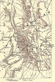
Background imageMaps Jigsaw Puzzle Collection: 'Le Haut Sahara, Massif de l Ahaggar; Afrique du nord, 1914. Creator: Unknown

'Le Haut Sahara, Massif de l Ahaggar; Afrique du nord, 1914. Creator: Unknown
'Le Haut Sahara, Massif de l Ahaggar; Afrique du nord, 1914. From "Grande Geographie Bong Illustree", 1914

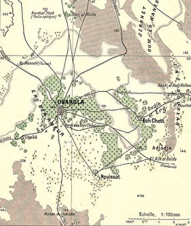
Background imageMaps Jigsaw Puzzle Collection: 'Le bas Sahara-Les Oasis, Ouargla; Afrique du nord, 1914. Creator: Unknown

'Le bas Sahara-Les Oasis, Ouargla; Afrique du nord, 1914. Creator: Unknown
'Le bas Sahara-Les Oasis, Ouargla; Afrique du nord, 1914. From "Grande Geographie Bong Illustree", 1914

Background imageMaps Jigsaw Puzzle Collection: 'Le bas Sahara-Les Oasis, Oued Rhir; Afrique du nord, 1914. Creator: Unknown

'Le bas Sahara-Les Oasis, Oued Rhir; Afrique du nord, 1914. Creator: Unknown
'Le bas Sahara-Les Oasis, Oued Rhir; Afrique du nord, 1914. From "Grande Geographie Bong Illustree", 1914

Background imageMaps Jigsaw Puzzle Collection: 'Le bas Sahara-Les Oasis, Mzab; Afrique du nord, 1914. Creator: Unknown

'Le bas Sahara-Les Oasis, Mzab; Afrique du nord, 1914. Creator: Unknown
'Le bas Sahara-Les Oasis, Mzab; Afrique du nord, 1914. From "Grande Geographie Bong Illustree", 1914

Background imageMaps Jigsaw Puzzle Collection: 'Carte administrative de l'Algerie; Afrique du nord, 1914. Creator: Unknown

'Carte administrative de l'Algerie; Afrique du nord, 1914. Creator: Unknown
'Carte administrative de l'Algerie; Afrique du nord, 1914. From "Grande Geographie Bong Illustree", 1914

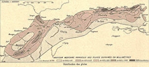
Background imageMaps Jigsaw Puzzle Collection: 'Le Climat, distribution des pluies; Afrique du nord, 1914. Creator: Unknown

'Le Climat, distribution des pluies; Afrique du nord, 1914. Creator: Unknown
'Le Climat, distribution des pluies; Afrique du nord, 1914. From "Grande Geographie Bong Illustree", 1914

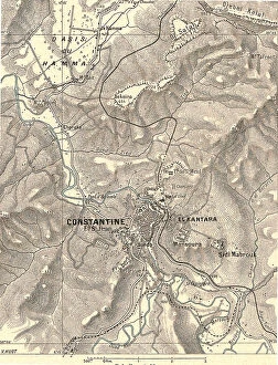
Background imageMaps Jigsaw Puzzle Collection: 'Constantine et ses environs; Afrique du nord, 1914. Creator: Unknown

'Constantine et ses environs; Afrique du nord, 1914. Creator: Unknown
'Constantine et ses environs; Afrique du nord, 1914. From "Grande Geographie Bong Illustree", 1914

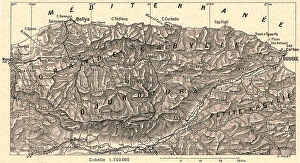
Background imageMaps Jigsaw Puzzle Collection: 'Grande Kabylie et Djurdjura; Afrique du nord, 1914. Creator: Unknown

'Grande Kabylie et Djurdjura; Afrique du nord, 1914. Creator: Unknown
'Grande Kabylie et Djurdjura; Afrique du nord, 1914. From "Grande Geographie Bong Illustree", 1914

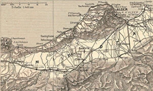
Background imageMaps Jigsaw Puzzle Collection: 'Le Sahel d'Alger et la Mitidja; Afrique du nord, 1914. Creator: Unknown

'Le Sahel d'Alger et la Mitidja; Afrique du nord, 1914. Creator: Unknown
'Le Sahel d'Alger et la Mitidja; Afrique du nord, 1914. From "Grande Geographie Bong Illustree", 1914

Background imageMaps Jigsaw Puzzle Collection: 'La Sahel d'Oran et la Grande Sebkha; Afrique du nord, 1914. Creator: Unknown

'La Sahel d'Oran et la Grande Sebkha; Afrique du nord, 1914. Creator: Unknown
'La Sahel d'Oran et la Grande Sebkha; Afrique du nord, 1914. From "Grande Geographie Bong Illustree", 1914

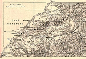
Background imageMaps Jigsaw Puzzle Collection: 'La plaine d'Oudjda; Afrique du nord, 1914. Creator: Unknown

'La plaine d'Oudjda; Afrique du nord, 1914. Creator: Unknown
'La plaine d'Oudjda; Afrique du nord, 1914. From "Grande Geographie Bong Illustree", 1914

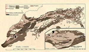
Background imageMaps Jigsaw Puzzle Collection: 'Carte geologique; Afrique du nord, 1914. Creator: Unknown

'Carte geologique; Afrique du nord, 1914. Creator: Unknown
'Carte geologique; Afrique du nord, 1914. From "Grande Geographie Bong Illustree", 1914

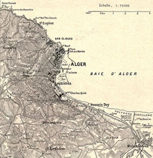
Background imageMaps Jigsaw Puzzle Collection: 'Alger et ses environs; Afrique du nord, 1914. Creator: Unknown

'Alger et ses environs; Afrique du nord, 1914. Creator: Unknown
'Alger et ses environs; Afrique du nord, 1914. From "Grande Geographie Bong Illustree", 1914

Background imageMaps Jigsaw Puzzle Collection: 'Massif de l Aures; Afrique du nord, 1914. Creator: Unknown

'Massif de l Aures; Afrique du nord, 1914. Creator: Unknown
'Massif de l Aures; Afrique du nord, 1914. From "Grande Geographie Bong Illustree", 1914

Background imageMaps Jigsaw Puzzle Collection: 'Relief Map of Sahara Algerien, 1914. Creator: Unknown

'Relief Map of Sahara Algerien, 1914. Creator: Unknown
'Relief Map of Sahara Algerien, 1914. From "Grande Geographie Bong Illustree", 1914

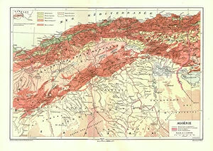
Background imageMaps Jigsaw Puzzle Collection: 'Relief Map of Algerie, 1914. Creator: Unknown

'Relief Map of Algerie, 1914. Creator: Unknown
'Relief Map of Algerie, 1914. From "Grande Geographie Bong Illustree", 1914

Background imageMaps Jigsaw Puzzle Collection: 'Relief Map of Berberie, 1914. Creator: Unknown

'Relief Map of Berberie, 1914. Creator: Unknown
'Relief Map of Berberie, 1914. From "Grande Geographie Bong Illustree", 1914

Background imageMaps Jigsaw Puzzle Collection: Reference Map of Libya with Keys

Reference Map of Libya with Keys
Libya is an African nation situated in North Africa, along the Mediterranean Sea. Libya shares borders with Egypt, Sudan, Chad, Niger, Algeria, and Tunisia

Background imageMaps Jigsaw Puzzle Collection: Map of Libya

Map of Libya
Reference Map of Libya

Background imageMaps Jigsaw Puzzle Collection: 1857 Dufour Map Of Algeria Topography Cartography

1857 Dufour Map Of Algeria Topography Cartography
1857, Dufour Map of Algeria

Background imageMaps Jigsaw Puzzle Collection: 1852 Levasseur Map Of Algeria Topography Cartography

1852 Levasseur Map Of Algeria Topography Cartography
1852, Levasseur Map of Algeria

Background imageMaps Jigsaw Puzzle Collection: 1857 Dufour Map Of Constantine Algeria Topography

1857 Dufour Map Of Constantine Algeria Topography
1857, Dufour Map of Constantine, Algeria

Background imageMaps Jigsaw Puzzle Collection: Antique map of Algeria and Tunisia

Antique map of Algeria and Tunisia

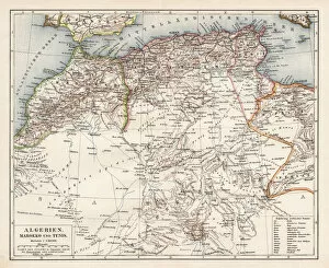
Background imageMaps Jigsaw Puzzle Collection: Map of Algeria, Morocco, Tunisia, 1900

Map of Algeria, Morocco, Tunisia, 1900
Meyers hand-Atlas Leipzig und Wien Verlag des Bibliographischen Instituts 1900

Background imageMaps Jigsaw Puzzle Collection: Old Antique map of North Africa, Morocco, Algeria, Tunisia, Libya, detail of Tunis, 1890s

Old Antique map of North Africa, Morocco, Algeria, Tunisia, Libya, detail of Tunis, 1890s, Victorian 19th Century history

Background imageMaps Jigsaw Puzzle Collection: Battle in Sahara, 1900

Battle in Sahara, 1900
7143097 Battle in Sahara, 1900 by Belon, Jose (d.1927); Private Collection; (add.info.: History. Algeria. Battle between french troops and tuaregs near In Salah, Sahara)

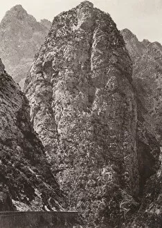
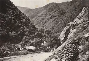
Background imageMaps Jigsaw Puzzle Collection: Chabet el Akhra Gorges, Algeria (b / w photo)

Chabet el Akhra Gorges, Algeria (b / w photo)
7202074 Chabet el Akhra Gorges, Algeria (b/w photo) by Geiser, Jean (1848-1923); Private Collection; (add.info.: Chabet el Akhra Gorges, Algeria)

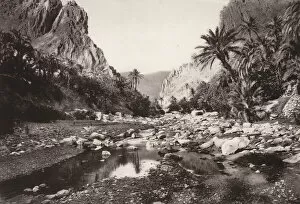
Background imageMaps Jigsaw Puzzle Collection: Gorge of El Kantara, Algeria (b / w photo)

Gorge of El Kantara, Algeria (b / w photo)
7202078 Gorge of El Kantara, Algeria (b/w photo) by Geiser, Jean (1848-1923); Private Collection; (add.info.: Gorge of El Kantara, Algeria)

Background imageMaps Jigsaw Puzzle Collection: Atlas Mountains, Algeria (b / w photo)

Atlas Mountains, Algeria (b / w photo)
7202070 Atlas Mountains, Algeria (b/w photo) by Geiser, Jean (1848-1923); Private Collection; (add.info.: Atlas Mountains, Algeria)

Background imageMaps Jigsaw Puzzle Collection: Geographic map of the Mediterranean Sea and the Black Sea showing the coasts of Europe (France)

Geographic map of the Mediterranean Sea and the Black Sea showing the coasts of Europe (France, Spain)
JLJ4592326 Geographic map of the Mediterranean Sea and the Black Sea showing the coasts of Europe (France, Spain, Italy and Africa (Tunisia, Algeria, Egypt)

Background imageMaps Jigsaw Puzzle Collection: Department of Constantine, French Algeria. - France and its Colonies. Atlas illustrates one hundred

Department of Constantine, French Algeria. - France and its Colonies. Atlas illustrates one hundred
XEE4144396 Department of Constantine, French Algeria. - France and its Colonies. Atlas illustrates one hundred and five maps from the maps of the depot of war, bridges and footwear and the Navy by M

Background imageMaps Jigsaw Puzzle Collection: Gorge of the River Rhumel, near Constantine, Algeria (b / w photo)

Gorge of the River Rhumel, near Constantine, Algeria (b / w photo)
7202079 Gorge of the River Rhumel, near Constantine, Algeria (b/w photo) by Geiser, Jean (1848-1923); Private Collection; (add.info.: Gorge of the River Rhumel, near Constantine, Algeria)

Background imageMaps Jigsaw Puzzle Collection: Bamboo avenue in the Jardin d Essay, Algiers, Algeria (b / w photo)

Bamboo avenue in the Jardin d Essay, Algiers, Algeria (b / w photo)
7202072 Bamboo avenue in the Jardin d Essay, Algiers, Algeria (b/w photo) by Geiser, Jean (1848-1923); Private Collection; (add.info.: Bamboo avenue in the Jardin d essai du Hamma, Algiers, Algeria)


All Professionally Made to Order for Quick Shipping


-

Maps Jigsaw Puzzle Collection

Algeria is a country located in North Africa, bordered by the Mediterranean Sea to the north and east, Tunisia to the northeast, Libya to the east, Niger to the southeast, Mali and Mauritania to the southwest and Morocco to the west. Maps of Algeria are available in various formats including physical maps showing terrain features such as mountains, rivers and lakes; political maps showing administrative divisions; road maps; satellite images; topographical maps; tourist attractions maps and more. The capital city of Algiers is located on Algeria's Mediterranean coast. In addition to its rich cultural heritage with ancient cities like Timbuktu and Ghardaïa, Algeria also has some of Africa's most spectacular natural landscapes such as Tassili n'Ajjer National Park in southern Algeria which is home to some of Africa's oldest rock art.
+

Our beautiful pictures are available as Framed Prints, Photos, Wall Art and Photo Gifts

Media Storehouse offers a collection of Maps of Algeria Africa, which includes wall art and framed prints. Our collection features various maps that showcase the geography and topography of Algeria, including its cities, towns, rivers, mountains, and deserts. These maps are not only informative but also aesthetically pleasing with their intricate details and vibrant colors. The Maps of Algeria Africa collection is perfect for those who have an interest in Algerian history or geography or want to add a unique touch to their home decor. The prints are available in different sizes and formats to suit individual preferences. Our Maps of Algeria Africa collection provides a comprehensive range of high-quality prints that capture the essence of this North African country's landscape. Whether you're looking for educational resources or decorative pieces for your home or office space, these maps offer something for everyone interested in exploring the beauty and diversity of Algeria.
+

What are Maps of Algeria Africa art prints?

Maps of Algeria Africa art prints are beautiful and intricate depictions of the country of Algeria in North Africa. These prints showcase the diverse terrain, cities, and landmarks that make up this fascinating nation. From the Sahara Desert to the Mediterranean coastline, these maps provide a detailed view of Algeria's geography. These art prints are perfect for anyone interested in Algerian culture or history. They can be used as decorative pieces in homes or offices, or as educational tools for students studying geography or world cultures. The maps come in a variety of sizes and styles to suit any taste. We offer a wide selection of Maps of Algeria Africa art prints that are high-quality reproductions made from original cartographic sources. Each print is carefully crafted using advanced printing techniques to ensure accurate color reproduction and sharp detail. Whether you're looking for a vintage-style map or a modern interpretation, we have something for everyone who loves Algerian culture and history.
+

What Maps of Algeria Africa art prints can I buy from Media Storehouse?

We offer a wide range of Maps of Algeria Africa art prints that are perfect for anyone looking to add a touch of culture and history to their home or office. These maps showcase the beauty and diversity of Algeria, highlighting its rich cultural heritage, stunning landscapes, and unique landmarks. Some popular options include vintage maps that capture the country's colonial past, as well as more modern designs that feature detailed topographical information. You can also choose from different sizes and styles to suit your preferences, whether you want a large canvas print or a smaller framed piece. These Maps of Algeria Africa art prints make great gifts for anyone who loves travel or has an interest in geography. They are also ideal for decorating classrooms or offices with an educational theme. With so many beautiful designs available at Media Storehouse, you're sure to find the perfect map print to suit your needs.
+

How do I buy Maps of Algeria Africa art prints?

To buy Maps of Algeria Africa art prints from Media Storehouse, you can browse our collection online and select the print that catches your eye. Once you have found the print you want to purchase, simply add it to your cart and proceed to checkout. You will be prompted to enter your shipping information and payment details before finalizing your order. We offer a wide range of high-quality art prints featuring maps of Algeria in various styles and sizes. Whether you are looking for a vintage map or a modern interpretation, there is something for everyone. Their selection includes both framed and unframed options, so you can choose the best option based on your personal preference. With fast and reliable shipping options available, buying Maps of Algeria Africa art prints from Media Storehouse is easy and hassle-free.
+

How much do Maps of Algeria Africa art prints cost?

As a provider of Maps of Algeria Africa art prints, we offer a range of options at varying prices to suit different budgets and preferences. Our selection includes high-quality prints in various sizes and formats, including framed and unframed options. The cost of these prints will depend on factors such as the size, format, and quality selected by the customer. We strive to provide competitive pricing for all our products while maintaining the highest standards of quality. Our Maps of Algeria Africa art prints are perfect for anyone looking to add some cultural or historical flair to their home or office decor. They make great gifts for friends or family members who have an interest in geography or African culture. Whether you're looking for something small and simple or large and intricate, we have something that will meet your needs without breaking the bank.
+

How will my Maps of Algeria Africa art prints be delivered to me?

Your Maps of Algeria Africa art prints will be delivered to you in a safe and secure manner. We take great care in packaging your artwork, ensuring that it arrives at your doorstep undamaged. Our team uses high-quality materials to protect the print during transit. We offer various delivery options depending on your location and preferences. You can choose standard shipping or express delivery for faster arrival times. Additionally, we provide tracking information so you can keep an eye on the progress of your order. Our goal is to make sure that you receive your Maps of Algeria Africa art prints in perfect condition as quickly as possible. If there are any issues with the delivery or if you have any questions about our process, please do not hesitate to contact us and we will be happy to assist you.