Greetings Card > Aerial Photography > Related Images
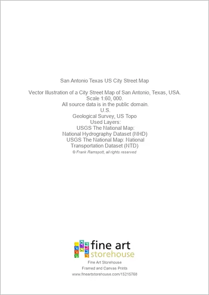
Greetings Card : San Antonio Texas US City Street Map


![]()
Cards from Fine Art Storehouse
San Antonio Texas US City Street Map
Vector Illustration of a City Street Map of San Antonio, Texas, USA. Scale 1:60, 000.
All source data is in the public domain.
U.S. Geological Survey, US Topo
Used Layers:
USGS The National Map: National Hydrography Dataset (NHD)
USGS The National Map: National Transportation Dataset (NTD)
Unleash your creativity and transform your space into a visual masterpiece!
Frank Ramspott
Media ID 15215768
© Frank Ramspott, all rights reserved
Aerial View City Map Computer Graphic Directly Above Downtown District Gray Road Map San Antonio Texas Text Digitally Generated Image Green Color White Color
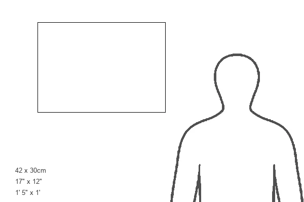
Greetings Card Large (A4)
Discover the charm of San Antonio, Texas with our exquisite greeting cards from Media Storehouse. Featuring a stunning vector illustration of the city street map by Frank Ramspott from Fine Art Storehouse, these cards offer a unique blend of art and functionality. Each card showcases the intricate details of San Antonio's urban landscape, making it an ideal gift for travel enthusiasts, history buffs, or anyone who appreciates the beauty of cityscapes. With all source data in the public domain and a scale of 1:60,000, these cards are not only beautiful but also an accurate representation of the city. Add a personal touch to your message with our San Antonio greeting cards and make your recipient's day extra special.
Create your own large greetings card. Size when folded is A4 (21x30cm or 8.3x11.7 inches)
Greetings Cards suitable for Birthdays, Weddings, Anniversaries, Graduations, Thank You and much more
Estimated Image Size (if not cropped) is 21cm x 29.7cm (8.3" x 11.7")
Estimated Product Size is 42cm x 29.7cm (16.5" x 11.7")
These are individually made so all sizes are approximate
Artwork printed orientated as per the preview above, with portrait (vertical) orientation to match the source image.
FEATURES IN THESE COLLECTIONS
> Fine Art Storehouse
> Map
> Street Maps
> Fine Art Storehouse
> Map
> USA Maps
> Aerial Photography
> Related Images
> Animals
> Insects
> Hemiptera
> Green Scale
> Arts
> Contemporary art
> Digital artwork
> Street art
> Arts
> Landscape paintings
> Waterfall and river artworks
> River artworks
> Arts
> Portraits
> Pop art gallery
> Street art portraits
> Arts
> Street art graffiti
> Digital art
> Digital paintings
> Arts
> Street art graffiti
> Digital art
> Vector illustrations
> Maps and Charts
> Geological Map
> Maps and Charts
> Related Images
> North America
> United States of America
> Lakes
> Related Images
EDITORS COMMENTS
This print showcases a meticulously detailed city street map of San Antonio, Texas, USA. The vector illustration beautifully captures the essence of this vibrant city, with its downtown district, serene lake, and meandering river. The scale of 1:60,000 ensures that every intricate detail is brought to life in this visually stunning artwork. The source data used for creating this masterpiece is all in the public domain and comes from reputable sources such as the U. S. Geological Survey (USGS) and their National Map datasets including the National Hydrography Dataset (NHD) and National Transportation Dataset (NTD). This guarantees accuracy and reliability in representing the city's hydrography and transportation networks. The design itself is a testament to exceptional cartography skills, showcasing a digitally generated image that highlights various elements using an array of colors - gray, blue, white color scheme dominates while touches of green add vibrancy to the landscape. The aerial view perspective offers a unique vantage point directly above the city streets. With no people present in this image, it focuses solely on capturing San Antonio's physical geography through computer graphics. Frank Ramspott has masterfully created an artistic representation that seamlessly combines functionality with aesthetic appeal. Whether you are a resident or visitor to San Antonio or simply appreciate fine art depicting cities' intricacies - this print will undoubtedly captivate your imagination.
MADE IN THE UK
Safe Shipping with 30 Day Money Back Guarantee
FREE PERSONALISATION*
We are proud to offer a range of customisation features including Personalised Captions, Color Filters and Picture Zoom Tools
SECURE PAYMENTS
We happily accept a wide range of payment options so you can pay for the things you need in the way that is most convenient for you
* Options may vary by product and licensing agreement. Zoomed Pictures can be adjusted in the Basket.