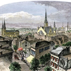
Greetings Card > North America > United States of America > Ohio > Cincinnati
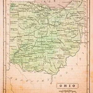
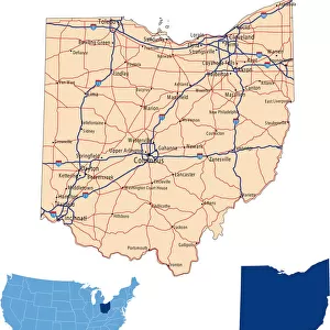
Greetings Card : 1883 Ohio State Map


![]()
Cards from Fine Art Storehouse
1883 Ohio State Map
Unleash your creativity and transform your space into a visual masterpiece!
benoitb
Media ID 15245281
© benoitb
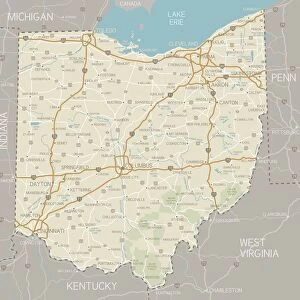
Cincinnati Kentucky Lake Erie Michigan Ohio Retro Revival Road Map State Us State Border West Virginia Ohio State
Greetings Card (A5)
"Add a touch of history to your greetings with Media Storehouse's exquisite range of greeting cards. This design features an intricately detailed 1883 Ohio State Map by the talented artist benoitb from our Fine Art Storehouse collection. Each card is printed on high-quality paper with vibrant colors, ensuring your message stands out. Perfect for birthdays, anniversaries, or just to say hello, our greeting cards are a thoughtful and unique way to express your feelings. Order yours today and make every correspondence a work of art."
Create your own greetings card. Size when folded is A5 (14.5x21cm or 5.7x8.3 inches)
Greetings Cards suitable for Birthdays, Weddings, Anniversaries, Graduations, Thank You and much more
Estimated Image Size (if not cropped) is 14.5cm x 21cm (5.7" x 8.3")
Estimated Product Size is 29cm x 21cm (11.4" x 8.3")
These are individually made so all sizes are approximate
Artwork printed orientated as per the preview above, with portrait (vertical) orientation to match the source image.
FEATURES IN THESE COLLECTIONS
> Fine Art Storehouse
> Map
> Map Illustrations
> Maps and Charts
> Related Images
> North America
> United States of America
> Ohio
> Cincinnati
EDITORS COMMENTS
This print showcases the intricate details of an 1883 Ohio State Map, taking us back in time to a bygone era. The artistry and craftsmanship evident in this cartographic masterpiece are truly remarkable. Every contour, river, and city is meticulously depicted, offering a glimpse into the state's rich history. The retro revival aesthetic adds an extra layer of charm to this piece. It evokes nostalgia for a simpler time when maps were carefully crafted by hand rather than generated digitally. This vintage appeal makes it a perfect addition to any home or office space seeking to capture the essence of yesteryears. One cannot help but be drawn towards Lake Erie on this map, its vastness stretching across the northern border of Ohio. From Cincinnati in the southwest corner to West Virginia in the southeast, every region is intricately illustrated with precision and accuracy. The neighboring states of Michigan and Kentucky also find their place within these borders. Benoitb's expertise shines through as he captures not only geographical accuracy but also manages to convey a sense of wonderment that comes from exploring one's own state through such detailed cartography. Whether you're an avid historian or simply appreciate fine art, this 1883 Ohio State Map print will transport you back in time while adding character and sophistication to your surroundings.
MADE IN THE UK
Safe Shipping with 30 Day Money Back Guarantee
FREE PERSONALISATION*
We are proud to offer a range of customisation features including Personalised Captions, Color Filters and Picture Zoom Tools
SECURE PAYMENTS
We happily accept a wide range of payment options so you can pay for the things you need in the way that is most convenient for you
* Options may vary by product and licensing agreement. Zoomed Pictures can be adjusted in the Basket.