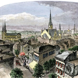
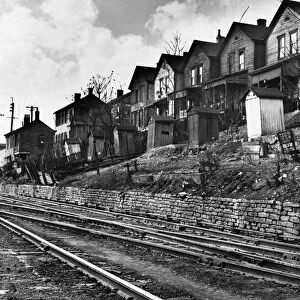
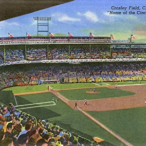
Antique Framed Print > North America > United States of America > Ohio > Cincinnati
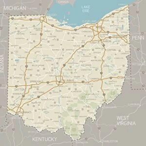
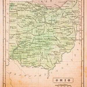
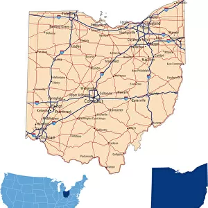
Antique Framed Print : 1883 Ohio State Map


![]()
Framed Photos from Fine Art Storehouse
1883 Ohio State Map
Unleash your creativity and transform your space into a visual masterpiece!
benoitb
Media ID 15245281
© benoitb
Cincinnati Kentucky Lake Erie Michigan Ohio Retro Revival Road Map State Us State Border West Virginia Ohio State
14"x12" (36x31cm) Antique Frame
Bevelled wood effect frame, card mounted, 10x8 archival quality photo print. Overall outside dimensions 14x12 inches (36x31cm). Environmentally and ozone friendly, the Polycore® moulding has the look of real wood, is durable and light and easy to hang. Biodegradable and made with non-chlorinated gases (no toxic fumes) it is efficient; producing 100 tons of polystyrene can save 300 tons of trees! Prints are glazed with lightweight, shatterproof, optical clarity acrylic (providing the same general protection from the environment as glass). The back is stapled hardboard with a sawtooth hanger attached. Note: To minimise original artwork cropping, for optimum layout, and to ensure print is secure, the visible print may be marginally smaller
Bevelled Wood Effect Framed and Mounted Prints - Professionally Made and Ready to Hang
Estimated Image Size (if not cropped) is 19cm x 24.4cm (7.5" x 9.6")
Estimated Product Size is 31.2cm x 36.3cm (12.3" x 14.3")
These are individually made so all sizes are approximate
Artwork printed orientated as per the preview above, with portrait (vertical) orientation to match the source image.
FEATURES IN THESE COLLECTIONS
> Maps and Charts
> Related Images
> North America
> United States of America
> Ohio
> Cincinnati
> Fine Art Storehouse
> Map
> Map Illustrations
EDITORS COMMENTS
This print showcases the intricate details of an 1883 Ohio State Map, taking us back in time to a bygone era. The artistry and craftsmanship evident in this cartographic masterpiece are truly remarkable. Every contour, river, and city is meticulously depicted, offering a glimpse into the state's rich history. The retro revival aesthetic adds an extra layer of charm to this piece. It evokes nostalgia for a simpler time when maps were carefully crafted by hand rather than generated digitally. This vintage appeal makes it a perfect addition to any home or office space seeking to capture the essence of yesteryears. One cannot help but be drawn towards Lake Erie on this map, its vastness stretching across the northern border of Ohio. From Cincinnati in the southwest corner to West Virginia in the southeast, every region is intricately illustrated with precision and accuracy. The neighboring states of Michigan and Kentucky also find their place within these borders. Benoitb's expertise shines through as he captures not only geographical accuracy but also manages to convey a sense of wonderment that comes from exploring one's own state through such detailed cartography. Whether you're an avid historian or simply appreciate fine art, this 1883 Ohio State Map print will transport you back in time while adding character and sophistication to your surroundings.
MADE IN THE UK
Safe Shipping with 30 Day Money Back Guarantee
FREE PERSONALISATION*
We are proud to offer a range of customisation features including Personalised Captions, Color Filters and Picture Zoom Tools
SECURE PAYMENTS
We happily accept a wide range of payment options so you can pay for the things you need in the way that is most convenient for you
* Options may vary by product and licensing agreement. Zoomed Pictures can be adjusted in the Basket.