Greetings Card > Europe > France > Canton > Landes
Greetings Card : Mexico, ancient map, lithograph, published in 1877


![]()
Cards from Fine Art Storehouse
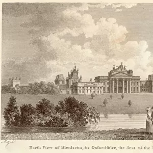
Mexico, ancient map, lithograph, published in 1877
Ancient map of Mexico. Lithograph, published in 1877
Unleash your creativity and transform your space into a visual masterpiece!
Media ID 13666763
© ZU_09
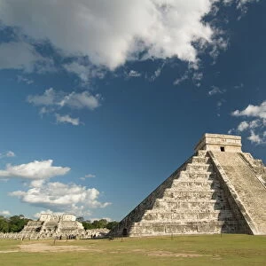
American Culture Central Mexico Chichen Itza Contour Drawing Country Geographic Area Gulf Of Mexico Land Latin America Merida Mexico Mexican Culture Mexico Nation National North America Northern Mexico Southern Mexico The Americas Topographic Map Topography Yucatan Guadalupe Island
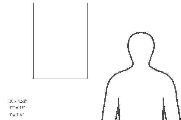
Greetings Card Large (A4)
"Transport yourself back in time with our exquisite selection of Greetings Cards from Media Storehouse's Fine Art Storehouse. This enchanting series showcases an ancient map of Mexico, beautifully rendered as a lithograph and published in 1877. Each card is a window into the past, perfect for sending a message that's as timeless as the art itself. Express your thoughts with a touch of history and culture. Order now and add a unique touch to your correspondence."
Create your own large greetings card. Size when folded is A4 (21x30cm or 8.3x11.7 inches)
Greetings Cards suitable for Birthdays, Weddings, Anniversaries, Graduations, Thank You and much more
Estimated Image Size (if not cropped) is 29.7cm x 21cm (11.7" x 8.3")
Estimated Product Size is 29.7cm x 42cm (11.7" x 16.5")
These are individually made so all sizes are approximate
Artwork printed orientated as per the preview above, with landscape (horizontal) orientation to match the source image.
FEATURES IN THESE COLLECTIONS
> Fine Art Storehouse
> Map
> Historical Maps
> Europe
> France
> Canton
> Landes
> Historic
> Monuments and landmarks
> Maps and Charts
> Early Maps
> Maps and Charts
> Related Images
> North America
> Mexico
> Maps
> North America
> Mexico
> Mexico Heritage Sites
> Pre-Hispanic City of Chichen-Itza
> North America
> Mexico
> Related Images
> North America
> Related Images
> Popular Themes
> North Island
EDITORS COMMENTS
This lithograph, published in 1877, showcases an ancient map of Mexico that takes us on a journey through time. With its intricate details and historical significance, this print offers a glimpse into the rich cultural heritage of this vibrant nation. The topography of Mexico is beautifully depicted, featuring landmarks such as Guadalupe Island off the southern coast and the majestic Chichen Itza in central Mexico. The engraving skillfully captures the contours of the land, showcasing the diverse landscapes that make up this vast country. As we explore further, we are reminded of the deep-rooted Mexican culture intertwined with American influences. Valladolid and Merida stand out as prominent cities representing both traditional Mexican customs and modern progress. Progresso on the Gulf of Mexico serves as a gateway to international trade and connection. This horizontal composition not only highlights Mexico's geographical location within North America but also emphasizes its importance within Latin America. The map encompasses not just national boundaries but also extends to encompassing regions across The Americas. With no people present in this photograph taken in 2015, it allows us to focus solely on appreciating this remarkable piece of artistry. A true national treasure capturing centuries-old history and geography for all who admire it today.
MADE IN THE UK
Safe Shipping with 30 Day Money Back Guarantee
FREE PERSONALISATION*
We are proud to offer a range of customisation features including Personalised Captions, Color Filters and Picture Zoom Tools
SECURE PAYMENTS
We happily accept a wide range of payment options so you can pay for the things you need in the way that is most convenient for you
* Options may vary by product and licensing agreement. Zoomed Pictures can be adjusted in the Basket.