Greetings Card > North America > United States of America > New York > New York > Maps
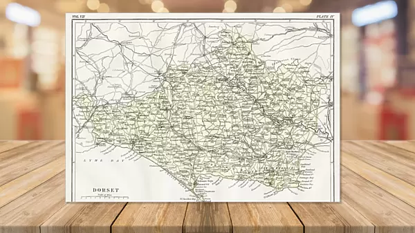
Greetings Card : Map of Dorset 1883


![]()
Cards from Fine Art Storehouse
Map of Dorset 1883
Encyclopedia Britannica 9th Edition New York Samuel L. Hall 1883 Vol VII
Unleash your creativity and transform your space into a visual masterpiece!
THEPALMER
Media ID 14549465
© This content is subject to copyright
Greetings Card (A5)
Introducing the exquisite range of greeting cards from Media Storehouse, featuring the captivating "Map of Dorset 1883" by THEPALMER from the Fine Art Storehouse. This vintage map, originally published in the Encyclopedia Britannica 9th Edition in New York in 1883, adds a touch of history and charm to your correspondence. Each card is printed on high-quality paper with vibrant colors, bringing the intricate details of this antique map to life. Perfect for birthdays, anniversaries, or just to brighten someone's day, these greeting cards are a thoughtful and unique way to express your feelings. Add a touch of history and nostalgia to your mailbox with Media Storehouse's Map of Dorset 1883 greeting cards.
Create your own greetings card. Size when folded is A5 (14.5x21cm or 5.7x8.3 inches)
Greetings Cards suitable for Birthdays, Weddings, Anniversaries, Graduations, Thank You and much more
Estimated Image Size (if not cropped) is 21cm x 14.5cm (8.3" x 5.7")
Estimated Product Size is 21cm x 29cm (8.3" x 11.4")
These are individually made so all sizes are approximate
Artwork printed orientated as per the preview above, with landscape (horizontal) orientation to match the source image.
FEATURES IN THESE COLLECTIONS
> Fine Art Storehouse
> Map
> Historical Maps
> Europe
> United Kingdom
> England
> Dorset
> Related Images
> Europe
> United Kingdom
> Maps
> Maps and Charts
> Related Images
> North America
> United States of America
> New York
> New York
> Maps
> North America
> United States of America
> New York
> Related Images
EDITORS COMMENTS
This print showcases a remarkable piece of history, the "Map of Dorset 1883" sourced from the Encyclopedia Britannica 9th Edition. A true treasure for enthusiasts and collectors alike, this vintage map takes us back to a bygone era when cartography was an art form in itself. The intricate details and exquisite craftsmanship captured in this print transport us to Great Britain's picturesque county of Dorset during the late 19th century. Every line, contour, and symbol on this map tells a story about the land it represents - its towns, villages, rivers, hills, and coastlines come alive before our eyes. As we gaze upon this stunning work by THEPALMER from Fine Art Storehouse, we are reminded of how maps have always been essential tools for exploration and understanding. They offer glimpses into the past while guiding us towards new horizons. Whether you are a history buff or simply appreciate fine art prints that evoke nostalgia and curiosity simultaneously, this Map of Dorset will undoubtedly captivate your imagination. It serves as both an educational resource for those seeking knowledge about British geography at that time and as a beautiful decorative piece that adds character to any space. Let yourself be transported through time with this extraordinary print – immerse yourself in the rich heritage of Dorset County as seen through the lens of Samuel L. Hall's expertise in cartography.
MADE IN THE UK
Safe Shipping with 30 Day Money Back Guarantee
FREE PERSONALISATION*
We are proud to offer a range of customisation features including Personalised Captions, Color Filters and Picture Zoom Tools
SECURE PAYMENTS
We happily accept a wide range of payment options so you can pay for the things you need in the way that is most convenient for you
* Options may vary by product and licensing agreement. Zoomed Pictures can be adjusted in the Basket.