Glass Place Mat > North America > United States of America > New York > Related Images
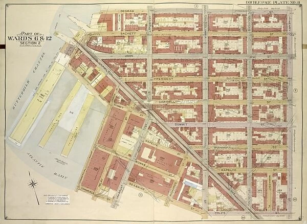
Glass Place Mat : Brooklyn, Vol. 1, Double Page Plate No. 8;Part of Wards 6 & 12, Section 2;Map bounded
![]()

Home Decor from Liszt Collection
Brooklyn, Vol. 1, Double Page Plate No. 8;Part of Wards 6 & 12, Section 2;Map bounded
Brooklyn, Vol. 1, Double Page Plate No. 8; Part of Wards 6 & 12, Section 2; Map bounded by Degraw St. Henry St. Coles St. Seabring St. Van Brunt St. Commerce St.; Including Commercial Wharf Conover St. India Wharf, Hamilton Ave. Un
Liszt Collection of nineteenth-century engravings and images to browse and enjoy
Media ID 12673389
© Quint Lox Limited
Brooklyn Cartographic Degraw St Double Page Hamilton Ave Historic Map Map Bounded By Plate No 8 Vintage Map Vol 1 Henry St Section 2
Glass Place Mat (Set of 4)
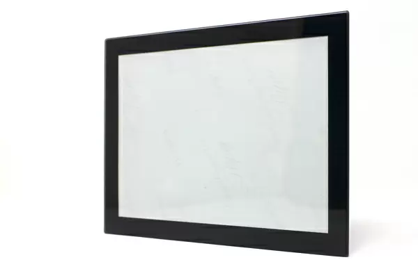
Set of 4 Glass Place Mats. Stylish and elegant polished safety glass, toughened and heat resistant (275x225mm, 7mm thick). Matching Coasters also available.
Set of 4 Glass Place Mats. Elegant polished safety glass and heat resistant. Matching Coasters may also be available
Estimated Image Size (if not cropped) is 25.4cm x 18.5cm (10" x 7.3")
Estimated Product Size is 27.5cm x 22.5cm (10.8" x 8.9")
These are individually made so all sizes are approximate
EDITORS COMMENTS
This vintage map print titled "Brooklyn, Vol. 1, Double Page Plate No. 8; Part of Wards 6 & 12, Section 2" takes us back in time to the bustling streets of Brooklyn in its early days. With intricate cartographic details and historic charm, this piece captures a specific section bounded by Degraw St. , Henry St. , Coles St. , Seabring St. , Van Brunt St. , Commerce St. The map encompasses various landmarks that were significant during that era, including Commercial Wharf Conover St. , India Wharf, Hamilton Ave. It offers a glimpse into the commercial activities and maritime trade that shaped this part of Brooklyn's history. As we study this artwork from the Liszt Collection, we are transported to an America long gone but not forgotten. The attention to detail and precision in mapping out every street and building is awe-inspiring. This print serves as a testament to the artistry of cartography and its ability to preserve historical moments for generations to come. Whether you're a lover of geography or simply fascinated by old maps, this piece is sure to spark curiosity about Brooklyn's past. Hang it on your wall as a conversation starter or use it as an educational tool for studying urban development over time. This vintage map print beautifully combines art and history into one captivating composition that will surely stand the test of time.
MADE IN THE UK
Safe Shipping with 30 Day Money Back Guarantee
FREE PERSONALISATION*
We are proud to offer a range of customisation features including Personalised Captions, Color Filters and Picture Zoom Tools
SECURE PAYMENTS
We happily accept a wide range of payment options so you can pay for the things you need in the way that is most convenient for you
* Options may vary by product and licensing agreement. Zoomed Pictures can be adjusted in the Basket.


