Glass Frame > Animals > Mammals > Cats (Wild) > Tiger
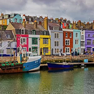
Glass Frame : MA Norfolk Weymouth Town Vector Road Map


![]()
Mounted Prints from Fine Art Storehouse
MA Norfolk Weymouth Town Vector Road Map
MA Norfolk Weymouth Town Vector Road Map. All source data is in the public domain. U.S. Census Bureau Census Tiger. Used Layers: areawater, linearwater, roads, rails, cousub, pointlm, uac10
Unleash your creativity and transform your space into a visual masterpiece!
Frank Ramspott
Media ID 20668555
© Frank Ramspott, all rights reserved
City Map Computer Graphic County Digital Composite District Geographical Border Harbor Holbrook Massachusetts Norfolk Road Map Text Vector Braintree Digitally Generated Image Fort Hill Hull Bay Pine Hill
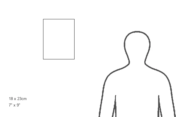
8"x6" Glass Mount
Wall mounted or free-standing, these black edged glass frames feature a smooth chamfered edge and a stylish black border (on back face of the glass). Manufactured from 4mm thick glass, Glass Mounts are a durable, professional way of displaying and protecting your prints. Your 8x6 print is slotted into the back of the frame so can easily be changed if needed.
Tempered Glass Mounts are ideal for wall display, plus the smaller sizes can also be used free-standing via an integral stand
Estimated Image Size (if not cropped) is 15.2cm x 20.3cm (6" x 8")
Estimated Product Size is 17.7cm x 22.8cm (7" x 9")
These are individually made so all sizes are approximate
Artwork printed orientated as per the preview above, with portrait (vertical) orientation to match the source image.
FEATURES IN THESE COLLECTIONS
> Fine Art Storehouse
> Travel Imagery
> Travel Destinations
> UK Travel Destinations
> Dorset, England
> Animals
> Mammals
> Cats (Wild)
> Tiger
> Animals
> Mammals
> Muridae
> Water Mouse
> Arts
> Contemporary art
> Digital artwork
> Street art
> Arts
> Landscape paintings
> Waterfall and river artworks
> River artworks
> Arts
> Portraits
> Pop art gallery
> Street art portraits
> Arts
> Street art graffiti
> Digital art
> Digital paintings
> Europe
> Spain
> Related Images
EDITORS COMMENTS
This vibrant and detailed print captures the essence of MA Norfolk Weymouth Town like never before. A masterpiece in cartography, this vector road map showcases the intricate network of roads, rails, and waterways that define this picturesque region. Created using publicly available data from the U. S. Census Bureau Census Tiger, every element has been meticulously crafted to provide an accurate representation of the area. From its charming city streets to its serene rivers and lakes, every feature is brought to life in vivid color through digital generation. The absence of people allows for a pure focus on the physical geography that makes this place so unique. Geographical borders are clearly defined while text labels ensure easy navigation across neighborhoods such as Idlewell, Pine Hill, and Bay. The coastal charm is evident as well with Hingham Bay, Hull Bay, and Braintree's coastline beautifully depicted alongside Fort Hill and Old Spain landmarks. This digitally generated image seamlessly combines various layers including areawater, linearwater, roads, rails, cousub (county subdivisions), pointlm (landmarks), uac10 (urban areas) - resulting in a comprehensive visual representation. Designed by Frank Ramspott with utmost precision and attention to detail; this stunning artwork serves both aesthetic appreciation and functional utility purposes. Whether you're a resident or visitor exploring MA Norfolk Weymouth Town or simply an admirer of fine cartography artistry – this print is sure to be a conversation starter in any space it graces!
MADE IN THE UK
Safe Shipping with 30 Day Money Back Guarantee
FREE PERSONALISATION*
We are proud to offer a range of customisation features including Personalised Captions, Color Filters and Picture Zoom Tools
SECURE PAYMENTS
We happily accept a wide range of payment options so you can pay for the things you need in the way that is most convenient for you
* Options may vary by product and licensing agreement. Zoomed Pictures can be adjusted in the Basket.