Glass Frame > Europe > Italy > Maps
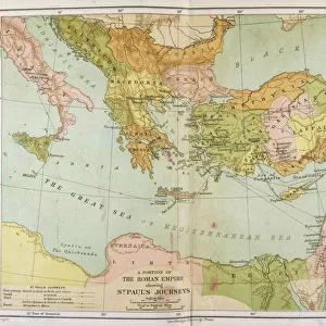
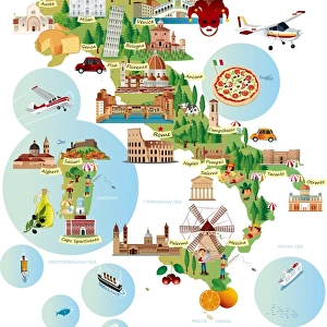
Glass Frame : Map of Italy in the times of Augustus 1889


![]()
Mounted Prints from Fine Art Storehouse
Map of Italy in the times of Augustus 1889
Comprehensive Geography by James Monteith - American Book Company 1882, 1889
Unleash your creativity and transform your space into a visual masterpiece!
THEPALMER
Media ID 18357309
8"x6" Glass Mount
Wall mounted or free-standing, these black edged glass frames feature a smooth chamfered edge and a stylish black border (on back face of the glass). Manufactured from 4mm thick glass, Glass Mounts are a durable, professional way of displaying and protecting your prints. Your 8x6 print is slotted into the back of the frame so can easily be changed if needed.
Tempered Glass Mounts are ideal for wall display, plus the smaller sizes can also be used free-standing via an integral stand
Estimated Image Size (if not cropped) is 15.2cm x 20.3cm (6" x 8")
Estimated Product Size is 17.7cm x 22.8cm (7" x 9")
These are individually made so all sizes are approximate
Artwork printed orientated as per the preview above, with portrait (vertical) orientation to match the source image.
FEATURES IN THESE COLLECTIONS
> Fine Art Storehouse
> Map
> Historical Maps
> Fine Art Storehouse
> Map
> Italian Maps
> Europe
> Italy
> Related Images
> Maps and Charts
> Italy
> Maps and Charts
> Related Images
EDITORS COMMENTS
In this print titled "Map of Italy in the times of Augustus 1889" we are transported back to a bygone era, where history and geography intertwine. The image showcases an exquisite map meticulously crafted by James Monteith for his renowned book "Comprehensive Geography". Published in 1882 and updated in 1889, this particular edition captures the essence of Italy during the reign of Emperor Augustus. The map itself is a testament to Monteith's expertise as it vividly depicts the intricate details of ancient Italian cities, provinces, and territories. Each stroke on paper brings forth a sense of grandeur that once defined this remarkable civilization. From Rome's majestic Colosseum to Pompeii's haunting ruins, every landmark seems to come alive under our gaze. As we delve into this visual masterpiece captured by THEPALMER from Fine Art Storehouse, we can't help but marvel at how much has changed since those ancient times. Yet amidst all the transformations over centuries, there remains an undeniable connection between past and present within these borders. This print serves as a window through time—a reminder that beneath modernity lies layers upon layers of stories waiting to be discovered. It invites us to explore not only Italy's physical landscape but also its rich cultural heritage that continues to shape our world today. Whether you're an avid historian or simply captivated by artistry, this stunning piece will undoubtedly transport you on a journey through time—an exploration that transcends mere cartography and del
MADE IN THE UK
Safe Shipping with 30 Day Money Back Guarantee
FREE PERSONALISATION*
We are proud to offer a range of customisation features including Personalised Captions, Color Filters and Picture Zoom Tools
SECURE PAYMENTS
We happily accept a wide range of payment options so you can pay for the things you need in the way that is most convenient for you
* Options may vary by product and licensing agreement. Zoomed Pictures can be adjusted in the Basket.