Fraud Blocker Skip to main content

World Collection (page 5)

"Exploring the Vastness: A Journey through the World" Embarking on a historical voyage, we delve into the depths of time with Al-Idrisi's world map from 1154

Background imageWorld Collection: Yamaha YZF R1 - James Toseland with Rea

Yamaha YZF R1 - James Toseland with Rea

Background imageWorld Collection: Yamaha YZF R1 - James Toseland

Yamaha YZF R1 - James Toseland

Background imageWorld Collection: World Superbikes 2010 Silverstone No. 52 James Toseland Yamaha YZF R1 Sterilgarda Team

World Superbikes 2010 Silverstone No. 52 James Toseland Yamaha YZF R1 Sterilgarda Team

Background imageWorld Collection: Honda CBR1000RR - Josh Brookes

Honda CBR1000RR - Josh Brookes

Background imageWorld Collection: Ducati 1098R F08

Ducati 1098R F08

Background imageWorld Collection: Africa, night-day satellite image

Africa, night-day satellite image. This composite image of the Earth is set against a background of stars, and is centred on the continent of Africa. North is at top

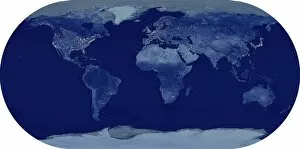
Background imageWorld Collection: Whole Earth at night, satellite image

Whole Earth at night, satellite image. This map is centred on the Greenwich meridian, at zero degrees latitude. City lights (yellow) show areas of dense population

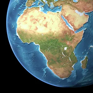
Background imageWorld Collection: Africa, topographic map

Africa, topographic map. Highlands and lowlands of the continents are shown as ridges and flat areas. Southern Europe and the Middle East are also seen at top and upper right respectively
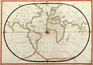
Background imageWorld Collection: Map of the world, 1590

Map of the world, 1590
16th century map of the world. Published around 1590, this map shows the known world, including the new lands being discovered by Europeans exploring across the Atlantic
Background imageWorld Collection: Lawrence Dallaglio of England Oct 1999 punching Jonah Lomu of New Zealand

Lawrence Dallaglio of England Oct 1999 punching Jonah Lomu of New Zealand

Background imageWorld Collection: Dark clouds and misty weather in Doubtful Sound, Southland in New Zealand

Dark clouds and misty weather in Doubtful Sound, Southland in New Zealand

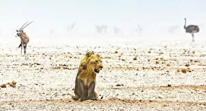
Background imageWorld Collection: A male lion, a gemsbok and an ostrich during a duststorm in Namibia

A male lion, a gemsbok and an ostrich during a duststorm in Namibia. This was taken near a waterhole in Etosha National Park

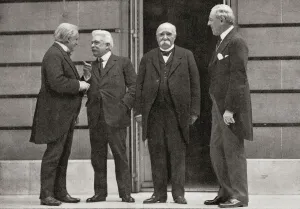
Background imageWorld Collection: The Big Four At Versailles, France During The Peace Treaty Of 1919 At The End Of World War One

The Big Four At Versailles, France During The Peace Treaty Of 1919 At The End Of World War One. From Left, David Lloyd George, Vittorio Emanuele Orlando

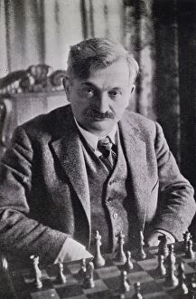
Background imageWorld Collection: Emanuel Lasker 1868 - 1941 German Chess Grandmaster Mathematician And Philosopher Second World

Emanuel Lasker 1868 - 1941 German Chess Grandmaster Mathematician And Philosopher Second World Chess Champion Illustration From Chess Pie No3 The Official Souvenir International Tournament Published

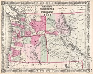
Background imageWorld Collection: 1864, Johnson Map of Washington, Oregon, and Idaho, topography, cartography, geography

1864, Johnson Map of Washington, Oregon, and Idaho, topography, cartography, geography
1864, Johnson Map of Washington, Oregon, and Idaho

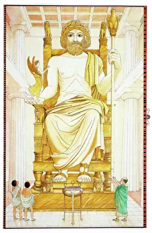
Background imageWorld Collection: Greece, Third Wonder, seated statue of Greek God Zeus, located in ancient town of Olympia

Greece, Third Wonder, seated statue of Greek God Zeus, located in ancient town of Olympia

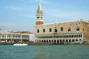
Background imageWorld Collection: Palazzo Ducale San Marco Torre dellOrologio Clock Tower Venice Italy

Palazzo Ducale San Marco Torre dellOrologio Clock Tower Venice Italy

Background imageWorld Collection: A lone astronaut looks up at the sun while exploring Mars

A lone astronaut looks up at the sun while exploring Mars. A rover trails behind

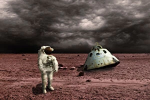
Background imageWorld Collection: An astronaut surveys his situation after being marooned on a barren planet

An astronaut surveys his situation after being marooned on a barren planet. Ominous clouds form in the distance while his scorched capsule is nearby

Background imageWorld Collection: A horse looking out of its stable

A horse looking out of its stable

Background imageWorld Collection: Little pied cormorants (Phalacrocorax melanoleucos), Kangaroo Island, Australia

Little pied cormorants (Phalacrocorax melanoleucos), Kangaroo Island, Australia

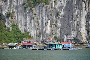
Background imageWorld Collection: Floating village, Halong Bay, Vietnam, Southeast Asia

Floating village, Halong Bay, Vietnam, Southeast Asia

Background imageWorld Collection: White cat, portrait

White cat, portrait

Background imageWorld Collection: Martin Gillespie of Skerryvore playing at Oban Live in Scotland

Martin Gillespie of Skerryvore playing at Oban Live in Scotland
Martin Gillespie of Skerryvore playing at Oban Live 2016. This was held at Oban, in Argyll & Bute in Scotland

Background imageWorld Collection: Koelner Dom, Cologne Cathedral at dusk, Cologne, North Rhine-Westphalia, Germany, Europe

Koelner Dom, Cologne Cathedral at dusk, Cologne, North Rhine-Westphalia, Germany, Europe

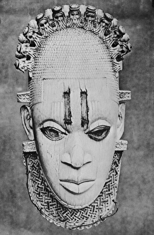
Background imageWorld Collection: Ivory Mask

Ivory Mask
An elaborate 16th century ivory mask from Benin City, Nigeria, circa 1930. (Photo by Hulton Archive/Getty Images)

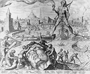
Background imageWorld Collection: Colossus Solis

Colossus Solis
The Colossus Of Rhodes, one of the Seven Wonders of the Ancient World, straddles the harbour on the Greek island of Rhodes, circa 250 BC

Background imageWorld Collection: A statue of the Roman emperor Hadrian at Vaison la Romain in France

A statue of the Roman emperor Hadrian at Vaison la Romain in France. This is in the Vaucluse area of Provence-Alpes-cote d`Azur

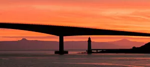
Background imageWorld Collection: Sunset at the Skye Bridge in Scotland

Sunset at the Skye Bridge in Scotland
Sunset at the Skye Bridge from the village of Kyleakin. This is in the Highland Region of Scotland

Background imageWorld Collection: A sea kayaker at the Falls of Lora at Connel in Scotland

A sea kayaker at the Falls of Lora at Connel in Scotland
A sea kayaker at the tidal Falls of Lora at Connel in Scotland. The village is in Argyll & Bute in Scotland

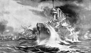
Background imageWorld Collection: World War I 1914-1918. Battle of the Falkland Islands, South Atlantic. Decisive British

World War I 1914-1918. Battle of the Falkland Islands, South Atlantic. Decisive British naval victory over German Navy, 8 December 1914

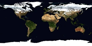
Background imageWorld Collection: World Flat projection map from composite of satellite images. Credit NASA: Science

World Flat projection map from composite of satellite images. Credit NASA: Science Earth Geology Oceanography

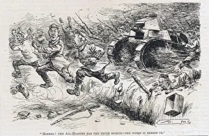
Background imageWorld Collection: Himmel The All-Highest has the truth spoken - the worst is behind us. German

Himmel The All-Highest has the truth spoken - the worst is behind us. German infantry retreating in panic before Allied infantry supported by tanks

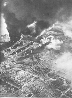
Background imageWorld Collection: Battle of Stalingrad - Aerial view of fuel stores on fire. The Battle of Stalingrad between Germany

Battle of Stalingrad - Aerial view of fuel stores on fire. The Battle of Stalingrad between Germany and the Soviet Union lasted from 17 July 1942 until 2 February 1943

Background imageWorld Collection: Scene in Minington Road, Leyton, WW2

Scene in Minington Road, Leyton, WW2
A panoramic daytime scene in Minington(?) Road, Leyton, East London, during the Second World War, showing the aftermath of an air raid, 22 October 1944

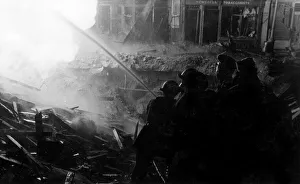
Background imageWorld Collection: Blitz in London -- Old Compton Street, WW2

Blitz in London -- Old Compton Street, WW2
Blitz in London -- firefighters in action in Old Compton Street, W1, where a gas main was ignited by a high explosive bomb and buildings were damaged by the blast, 24 February 1944

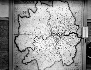
Background imageWorld Collection: WW2 - Map showing Flying Bomb hits during Blitz on London

WW2 - Map showing Flying Bomb hits during Blitz on London in the LCC-London Fire Brigade Control Room at Lambeth HQ, SE1

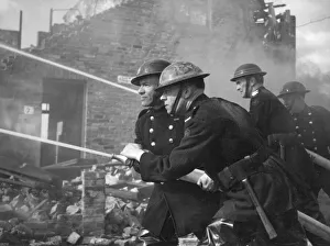
Background imageWorld Collection: Blitz in London -- AFS firefighters at work, WW2

Blitz in London -- AFS firefighters at work, WW2
Blitz in London -- AFS firefighters at work with hosepipes

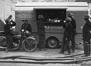
Background imageWorld Collection: Firefighters outside mobile kitchen, WW2

Firefighters outside mobile kitchen, WW2
Firefighters enjoying a mug of tea outside a mobile kitchen presented to the National Fire Service by the Order of the Eastern Star, Manitoba, Canada, during the Second World War

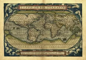
Background imageWorld Collection: Orteliuss world map, 1570

Orteliuss world map, 1570
Orteliuss world map. This world map is from the 1570 first edition of Theatrum orbis terrarum ( Theatre of the World ). Drawn by the Flemish mapmaker Abraham Ortelius (1527-1598)

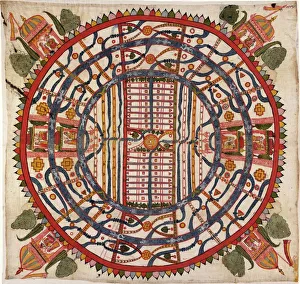
Background imageWorld Collection: Jain cosmological map, 19th century

Jain cosmological map, 19th century. Titled Manusyaloka ( map of the world of man ), this artwork shows the world according to the cosmological traditions of Jainism, an ancient religion of India

Background imageWorld Collection: World Superbikes 2006 Group shot

World Superbikes 2006 Group shot

Background imageWorld Collection: Team Pedercini Kawasaki Team ZX-10R ridden by

Team Pedercini Kawasaki Team ZX-10R ridden by

Background imageWorld Collection: Gallivanting

Gallivanting
Rosana Laiz Blursbyai

Background imageWorld Collection: The World In Love

The World In Love
Hanna Lee Tidd

Background imageWorld Collection: The Explanation of the Cosmorama, 29 St. Jamess Street Gallery, pub

The Explanation of the Cosmorama, 29 St. Jamess Street Gallery, pub
GHL56515 The Explanation of the Cosmorama, 29 St.Jamess Street Gallery, pub. December 1st 1821 (aquatint) by English School, (19th century); 14x22 cm; London Metropolitan Archives

Background imageWorld Collection: Mother of the World, 1924 (tempera on canvas laid on cardboard)

Mother of the World, 1924 (tempera on canvas laid on cardboard)
5642780 Mother of the World, 1924 (tempera on canvas laid on cardboard) by Roerich, Nicholas (1874-1947); 98A--65.4 cm; Nicholas Roerich Museum, New York; eNicholas Roerich Museum; Russian


All Professionally Made to Order for Quick Shipping

"Exploring the Vastness: A Journey through the World" Embarking on a historical voyage, we delve into the depths of time with Al-Idrisi's world map from 1154. This ancient cartographic masterpiece unveils the intricate knowledge and curiosity that shaped our understanding of the world. As dusk descends upon Uluru, Ayers Rock in Australia, nature paints a breathtaking canvas with hues of orange and pink. The sunset at this sacred site reminds us of Earth's awe-inspiring beauty and its ability to captivate our senses. Traveling back to 1886, we uncover Walter Crane's map showcasing the vast expanse of the British Empire. It serves as a reminder of an era when nations sought to expand their influence across continents, leaving lasting imprints on history. In Namibia's Walvis Bay, white pelicans gracefully glide over shimmering waters. Their presence symbolizes harmony within nature and highlights how diverse ecosystems coexist harmoniously in different corners of our planet. The scars left by war are etched into Brampton Road in Bexleyheath from World War II bombings. These remnants serve as poignant reminders that peace is fragile and must be cherished above all else. A satirical cartoon by James Gillray takes us back to 1805 when Napoleon Bonaparte attempted peace negotiations with British Prime Minister William Pitt. Depicting them carving up the world like plumb pudding, it humorously portrays political power struggles amidst global affairs. Revving engines echo as BMW S1000RR motorcycles race against time, embodying human innovation and pushing boundaries beyond what was once thought possible – reminding us that progress knows no bounds. Al-Idrisi's Tabula Rogeriana transports us further back to medieval times when maps were meticulously hand-drawn for Sicilian King Roger II. This remarkable piece showcases early geographical knowledge while highlighting cultural exchange between civilizations.