Fraud Blocker Skip to main content

World Collection (page 3)

"Exploring the Vastness: A Journey through the World" Embarking on a historical voyage, we delve into the depths of time with Al-Idrisi's world map from 1154

Background imageWorld Collection: Australia, satellite image

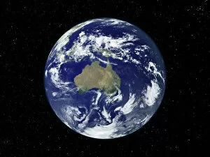
Australia, satellite image
Australia. Satellite image of the Earth, set against a background of stars, centred on the island continent of Australia. North is at top. Clouds (white) are seen in the atmosphere

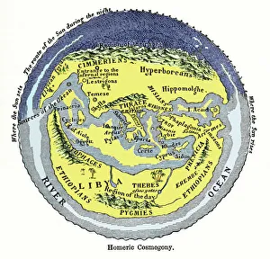
Background imageWorld Collection: Homeric cosmogony

Homeric cosmogony. Map of the Earth based on the myths and knowledge of the Ancient Greeks at the time of Homer (1st or 2nd millennium BC)

Background imageWorld Collection: 16th century world map

16th century world map made by Pierre Desceliers in 1546 on a commission by King Francis I for Henri II of France. Most noticeable is that the Northern hemisphere is upside-down

Background imageWorld Collection: Yamaha YZF R1 - Cal Crutchlow

Yamaha YZF R1 - Cal Crutchlow

Background imageWorld Collection: Yamaha YZF R1 - James Toseland

Yamaha YZF R1 - James Toseland

Background imageWorld Collection: Millau Bridge France

Millau Bridge France

Background imageWorld Collection: Yamaha Italia Team

Yamaha Italia Team

Background imageWorld Collection: Aprilia RSV4 Factory

Aprilia RSV4 Factory

Background imageWorld Collection: Yamaha YZF R1 Japan

Yamaha YZF R1 Japan

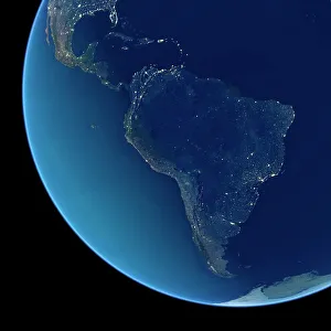
Background imageWorld Collection: South America at night, satellite image

South America at night, satellite image
South America at night. Satellite image of the Earth at night, set against a background of stars, centred on the continent of South America. North is at top

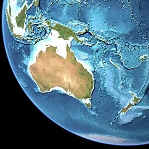
Background imageWorld Collection: Australia, topographic map

Australia, topographic map. Highlands and lowlands of the continents are shown as ridges and flat areas. Southeast Asia (top left), New Zealand (lower right) and Antarctica (bottom right)
Background imageWorld Collection: South America at night, satellite image

South America at night, satellite image. City lights (yellow) show areas of dense population, particularly in North America (top left) and South Americas coasts
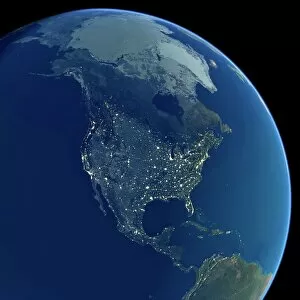
Background imageWorld Collection: North America at night, satellite image

North America at night, satellite image. City lights (yellow) show areas of dense population, particularly in North America (upper centre)

Background imageWorld Collection: Dunes in the Namib Naukluft Park in Namibia

Dunes in the Namib Naukluft Park in Namibia
Desert scenery with massive dunes and a lone tree in the Namib Naukluft Park in Namibia

Background imageWorld Collection: Dunes in the Namib Naukluft Park in Namibia

Dunes in the Namib Naukluft Park in Namibia
Desert scenery with massive dunes and a few trees in the Namib Naukluft Park in Namibia

Background imageWorld Collection: Cyclops Works, forging files, 1918

Cyclops Works, forging files, 1918
Cammell Laird and Co. Ltd. (1903) evolved from: Johnson, Cammell and Co. (1837), later Charles Cammell and Co Ltd (1864) ammalgamating with Laird Brothers of Birkenhead

Background imageWorld Collection: Female workers at Rip Bits factory, Sheffield during Second World War, 1941

Female workers at Rip Bits factory, Sheffield during Second World War, 1941
Rip Bits were based at Hill Street and made drill bits.Includes Ethel May (Rose) Fletcher

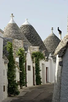
Background imageWorld Collection: Trulli houses, UNESCO World Heritage Site, Alberobello, Apulia, Italy

Trulli houses, UNESCO World Heritage Site, Alberobello, Apulia, Italy

Background imageWorld Collection: Death to the World Imperialist Monster, 1919. Soviet propaganda poster by Dmitry Moor (Orlov)

Death to the World Imperialist Monster, 1919. Soviet propaganda poster by Dmitry Moor (Orlov)

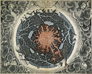
Background imageWorld Collection: MUNDUS SUBETERRANEUS. The earth depicted in a cross-section as containing a central core of fire

MUNDUS SUBETERRANEUS. The earth depicted in a cross-section as containing a central core of fire surrounded by subterranean lakes and rivers

Background imageWorld Collection: Millau viaduct spanning the Tarn Gorge, southern France. At 336 metres the cable-stayed Viaduc de

Millau viaduct spanning the Tarn Gorge, southern France. At 336 metres the cable-stayed Viaduc de Millau is the highest
MAB-72 Millau viaduct spanning the Tarn Gorge, southern France At 336 metres the cable-stayed Viaduc de Millau is the highest bridge in the world and 2.5 kms long

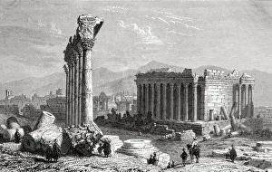
Background imageWorld Collection: Ruins Of Baalbek, Lebanon, As Seen In The 19Th Century. From El Mundo En La Mano Published 1875

Ruins Of Baalbek, Lebanon, As Seen In The 19Th Century. From El Mundo En La Mano Published 1875

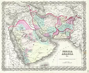
Background imageWorld Collection: 1855, Colton Map of Persia, Afghanistan, and Arabia, topography, cartography, geography

1855, Colton Map of Persia, Afghanistan, and Arabia, topography, cartography, geography
1855, Colton Map of Persia, Afghanistan, and Arabia

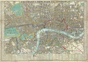
Background imageWorld Collection: 1848, Crutchley Pocket Map or Plan of London, England, topography, cartography, geography

1848, Crutchley Pocket Map or Plan of London, England, topography, cartography, geography
1848, Crutchley Pocket Map or Plan of London, England

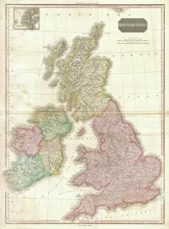
Background imageWorld Collection: 1818, Pinkerton Map of the British Isles, England, Scotland, Ireland, John Pinkerton

1818, Pinkerton Map of the British Isles, England, Scotland, Ireland, John Pinkerton, 1758 - 1826, Scottish antiquarian, cartographer, UK

Background imageWorld Collection: Iguazu Waterfalls, Brazil / Argentina

Iguazu Waterfalls, Brazil / Argentina
Iguazu Waterfalls, Brazil/Argentina

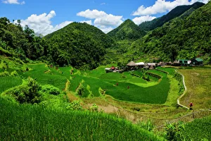
Background imageWorld Collection: Bangaan in the rice terraces of Banaue, Northern Luzon, Philippines

Bangaan in the rice terraces of Banaue, Northern Luzon, Philippines

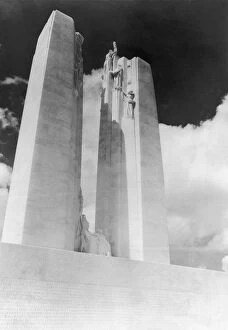
Background imageWorld Collection: Vimy Ridge Memorial

Vimy Ridge Memorial
The Canadian National Vimy Memorial in France, located on the site of the Battle of Vimy Ridge, 1936. The monument is inscribed with the names of the 11

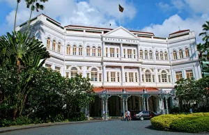
Background imageWorld Collection: World exclusive Raffles Hotel built in 1887, Singapore

World exclusive Raffles Hotel built in 1887, Singapore

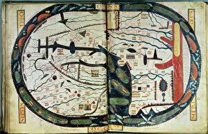
Background imageWorld Collection: MAP OF THE WORLD, c1060. Map of the world, centering on Jerusalem

MAP OF THE WORLD, c1060. Map of the world, centering on Jerusalem. Spanish manuscript illumination, c1060, from the work of Beatus of Liebana (c730-c800)

Background imageWorld Collection: Space walk

Space walk. Composite computer artwork of an astronaut working on the outside of a spacecraft. He is performing a space walk or EVA (extravehicular activity). Part of the Earth can be seen behind him

Background imageWorld Collection: Kawasaki ZX10R Japan

Kawasaki ZX10R Japan

Background imageWorld Collection: Earth, topographic and bathymetric map

Earth, topographic and bathymetric map. This map is centred on the Pacific Ocean, at longitude 140 degrees west. Highlands and lowlands of the continents are shown as ridges and flat areas

Background imageWorld Collection: Yamaha YZF R1

Yamaha YZF R1

Background imageWorld Collection: Caribbean, Cuba

Caribbean, Cuba
Havana, Cuba, UNESCO World Heritage City. Old sugar cane processor

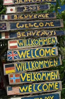
Background imageWorld Collection: Welcome signs

Welcome signs, Laem Tong beach, Phi Phi Don Island, Thailand, Southeast Asia, Asia

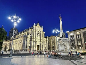
Background imageWorld Collection: Italy, Sicily, Catania, Cathedral of Catania

Italy, Sicily, Catania, Cathedral of Catania

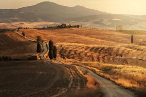
Background imageWorld Collection: Podere Terrapille (The Gladiators House) during a summer sunset, Val d Orcia

Podere Terrapille (The Gladiators House) during a summer sunset, Val d Orcia, Tuscany, Italy

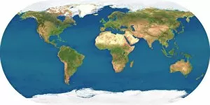
Background imageWorld Collection: Whole Earth, satellite image

Whole Earth, satellite image. This map is centred on the Greenwich meridian, at zero degrees latitude. Arctic and Antarctic ice is white, oceans are blue and land is green and brown

Background imageWorld Collection: Gallivanting

Gallivanting
Rosana Laiz Blursbyai

Background imageWorld Collection: A French Truffle-Hunting Pig (colour litho)

A French Truffle-Hunting Pig (colour litho)
6020668 A French Truffle-Hunting Pig (colour litho) by Noble, Edwin (1876-1941); Private Collection; (add.info.: A French Truffle-Hunting Pig)

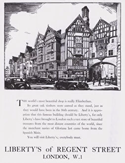
Background imageWorld Collection: Advertisement for Libertys Of Regent Street, London, c. 1944 (woodcut)

Advertisement for Libertys Of Regent Street, London, c. 1944 (woodcut)
5999172 Advertisement for Libertys Of Regent Street, London, c.1944 (woodcut) by English School, (20th century); Private Collection; (add.info.: Advertisement for Libertys Of Regent Street, London)

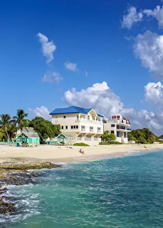
Background imageWorld Collection: Seven Mile Beach, West Bay, Grand Cayman, Cayman Islands

Seven Mile Beach, West Bay, Grand Cayman, Cayman Islands

Background imageWorld Collection: Covered alley in Yazd old town, Iran

Covered alley in Yazd old town, Iran
Yazd is an ancient desert city in central Iran and the capital of the Yazd province. Since 2017 its listed by UNESCO as a world heritage

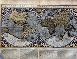
Background imageWorld Collection: Atlas of Gerardus Mercator, 1595. World Map

Atlas of Gerardus Mercator, 1595. World Map


All Professionally Made to Order for Quick Shipping

"Exploring the Vastness: A Journey through the World" Embarking on a historical voyage, we delve into the depths of time with Al-Idrisi's world map from 1154. This ancient cartographic masterpiece unveils the intricate knowledge and curiosity that shaped our understanding of the world. As dusk descends upon Uluru, Ayers Rock in Australia, nature paints a breathtaking canvas with hues of orange and pink. The sunset at this sacred site reminds us of Earth's awe-inspiring beauty and its ability to captivate our senses. Traveling back to 1886, we uncover Walter Crane's map showcasing the vast expanse of the British Empire. It serves as a reminder of an era when nations sought to expand their influence across continents, leaving lasting imprints on history. In Namibia's Walvis Bay, white pelicans gracefully glide over shimmering waters. Their presence symbolizes harmony within nature and highlights how diverse ecosystems coexist harmoniously in different corners of our planet. The scars left by war are etched into Brampton Road in Bexleyheath from World War II bombings. These remnants serve as poignant reminders that peace is fragile and must be cherished above all else. A satirical cartoon by James Gillray takes us back to 1805 when Napoleon Bonaparte attempted peace negotiations with British Prime Minister William Pitt. Depicting them carving up the world like plumb pudding, it humorously portrays political power struggles amidst global affairs. Revving engines echo as BMW S1000RR motorcycles race against time, embodying human innovation and pushing boundaries beyond what was once thought possible – reminding us that progress knows no bounds. Al-Idrisi's Tabula Rogeriana transports us further back to medieval times when maps were meticulously hand-drawn for Sicilian King Roger II. This remarkable piece showcases early geographical knowledge while highlighting cultural exchange between civilizations.