Fraud Blocker Skip to main content

Planet Earth Collection (page 3)

"Exploring the Vastness of Planet Earth

Background imagePlanet Earth Collection: Globe Showing Europe And Northern Africa, True Colour Satellite Image Of The Earth

Globe Showing Europe And Northern Africa, True Colour Satellite Image Of The Earth
Globe Showing Europe And Northern Africa, True Colour Satellite Image. True colour satellite image of the Earth showing Europe and Northern Africa, with cloud coverage

Background imagePlanet Earth Collection: Globe Centred On The South Pole, True Colour Satellite Image Of The Earth

Globe Centred On The South Pole, True Colour Satellite Image Of The Earth
Globe Centred On The South Pole, True Colour Satellite Image. True colour satellite image of the Earth centred on the South Pole with cloud coverage, during summer solstice at 12 a.m GMT

Background imagePlanet Earth Collection: North America At Night, True Colour Satellite Image. True colour satellite image of North America

North America At Night, True Colour Satellite Image. True colour satellite image of North America at night. This image in Lambert Conformal Conic projection was compiled from data acquired by LANDSAT

Background imagePlanet Earth Collection: Whole Earth At Night With Cloud Coverage, True Colour Satellite Image

Whole Earth At Night With Cloud Coverage, True Colour Satellite Image. True colour satellite image of the whole Earth at night with cloud coverage

Background imagePlanet Earth Collection: Planets In Outer Space

Planets In Outer Space

Background imagePlanet Earth Collection: Apollo 11, Close-Up, Cloud, Color Image, Environment, Exploration, Globe, Gulf Of Mexico

Apollo 11, Close-Up, Cloud, Color Image, Environment, Exploration, Globe, Gulf Of Mexico, Horizon, Infinity, Land, Majestic, Mexico, No People, North America, Pacific Ocean, Part Of, Photography

Background imagePlanet Earth Collection: 2001, Antarctica, Astronomy, City, Color Image, Digital Composite, Environment

2001, Antarctica, Astronomy, City, Color Image, Digital Composite, Environment, Exploration, Globe, Hemisphere, Horizontal, Infinity, Light, Majestic, Maps And Globes, Night, No People, Photography

Background imagePlanet Earth Collection: 360 Aerial View of Penang Island, Malaysia

360 Aerial View of Penang Island, Malaysia
Feast your eyes on the gorgeous 360-degree view of Penang Island, Malaysia from above

Background imagePlanet Earth Collection: Hindu concept of the universe

Hindu concept of the universe, showing it encircled by a serpent, the symbol of eternity. Mount Meru represents paradise, earth

Background imagePlanet Earth Collection: Oceania Australia map 1881

Oceania Australia map 1881
Coltons Common School Geography 1881 New York Sheldon and Co

Background imagePlanet Earth Collection: North Central states map 1886

North Central states map 1886
North Central states map Maps Monteith Physical Geography 1886

Background imagePlanet Earth Collection: North Dakota and MInnesota map 1881

North Dakota and MInnesota map 1881
Coltons Common School Geography 1881 New York Sheldon and Co

Background imagePlanet Earth Collection: Texas map 1881

Texas map 1881
Coltons Common School Geography 1881 New York Sheldon and Co

Background imagePlanet Earth Collection: Utah Arizona New Mexico Colorado map 1881

Utah Arizona New Mexico Colorado map 1881
Coltons Common School Geography 1881 New York Sheldon and Co

Background imagePlanet Earth Collection: Montana Washington Oregon Idaho map 1881

Montana Washington Oregon Idaho map 1881
Coltons Common School Geography 1881 New York Sheldon and Co

Background imagePlanet Earth Collection: indiana Ohio Kentucky map 1881

indiana Ohio Kentucky map 1881
Coltons Common School Geography 1881 New York Sheldon and Co

Background imagePlanet Earth Collection: Iowa Missouri Illinois map 1881

Iowa Missouri Illinois map 1881
Coltons Common School Geography 1881 New York Sheldon and Co

Background imagePlanet Earth Collection: Globe of Earth showing African continent, Europe, Middle East, and parts of Asia

Globe of Earth showing African continent, Europe, Middle East, and parts of Asia

Background imagePlanet Earth Collection: Illustration of set of scales with globe on one side and weights on the other

Illustration of set of scales with globe on one side and weights on the other

Background imagePlanet Earth Collection: A satellite orbiting above earth

A satellite orbiting above earth

Background imagePlanet Earth Collection: A satellite in orbit above earth

A satellite in orbit above earth

Background imagePlanet Earth Collection: Space shuttle orbiting earth, satellite view

Space shuttle orbiting earth, satellite view

Background imagePlanet Earth Collection: Earth from Apollo 8

Earth from Apollo 8

Background imagePlanet Earth Collection: Internal structure of the Earthwith English labels, 3D illustration

Internal structure of the Earthwith English labels, 3D illustration

Background imagePlanet Earth Collection: Globe South America Prominent

Globe South America Prominent
Globe with South America prominent starry sky in the background

Background imagePlanet Earth Collection: Crescent Earth

Crescent Earth. View of the Earth taken from the Apollo 4 spacecraft, in orbit 17, 960 kilometres above the surface. The large amount of cloud cover makes it difficult to identify any surface

Background imagePlanet Earth Collection: George Town, Penang in 360 View

George Town, Penang in 360 View
Travel to Penang, Malaysia through the eye of drone

Background imagePlanet Earth Collection: 360 View above Beautiful Langkawi, Malaysia

360 View above Beautiful Langkawi, Malaysia
Langkawi - an archipelago of 104 islands in the Andaman Sea is one of the most famous touristy destinations in Malaysia

Background imagePlanet Earth Collection: Our home planet earth

Our home planet earth

Background imagePlanet Earth Collection: Planet Earth

Planet Earth
Rui Almeida Photography, 159480663

Background imagePlanet Earth Collection: Surreal planet earth

Surreal planet earth
Rui Almeida Photography, 494375181

Background imagePlanet Earth Collection: Woman High Up in a Hot Air Ballon Looking at the Earth

Woman High Up in a Hot Air Ballon Looking at the Earth
Mandy Pritty, Hot Air Balloons, dv1233012

Background imagePlanet Earth Collection: Mexico Central america scene illustration 1886

Mexico Central america scene illustration 1886
Mexico Central america scene illustration Maps Monteith Physical Geography 1886

Background imagePlanet Earth Collection: World in zones hemispheres 1881

World in zones hemispheres 1881
Coltons Common School Geography 1881 New York Sheldon and Co

Background imagePlanet Earth Collection: Biritsh Isles map 1881

Biritsh Isles map 1881
Coltons Common School Geography 1881 New York Sheldon and Co

Background imagePlanet Earth Collection: Mexico and Central America map 1881

Mexico and Central America map 1881
Coltons Common School Geography 1881 New York Sheldon and Co

Background imagePlanet Earth Collection: Central Europe map 1881

Central Europe map 1881
Coltons Common School Geography 1881 New York Sheldon and Co

Background imagePlanet Earth Collection: Europe map 1881

Europe map 1881
Coltons Common School Geography 1881 New York Sheldon and Co

Background imagePlanet Earth Collection: Map drawing technique 1881

Map drawing technique 1881
Coltons Common School Geography 1881 New York Sheldon and Co

Background imagePlanet Earth Collection: Geography earth engraving 1881

Geography earth engraving 1881
Coltons Common School Geography 1881 New York Sheldon and Co

Background imagePlanet Earth Collection: South America map 1881

South America map 1881
Coltons Common School Geography 1881 New York Sheldon and Co

Background imagePlanet Earth Collection: Dominion of Canada map 1881

Dominion of Canada map 1881
Coltons Common School Geography 1881 New York Sheldon and Co

Background imagePlanet Earth Collection: North Eastern States USA map 1881

North Eastern States USA map 1881
Coltons Common School Geography 1881 New York Sheldon and Co

Background imagePlanet Earth Collection: United States map 1881

United States map 1881
Coltons Common School Geography 1881 New York Sheldon and Co

Background imagePlanet Earth Collection: New England States USA map 1881

New England States USA map 1881
Coltons Common School Geography 1881 New York Sheldon and Co

Background imagePlanet Earth Collection: Souther States USA map 1881

Souther States USA map 1881
Coltons Common School Geography 1881 New York Sheldon and Co

Background imagePlanet Earth Collection: Kansas and Nebraska map 1881

Kansas and Nebraska map 1881
Coltons Common School Geography 1881 New York Sheldon and Co

Background imagePlanet Earth Collection: Virginia North Carolina map 1881

Virginia North Carolina map 1881
Coltons Common School Geography 1881 New York Sheldon and Co


All Professionally Made to Order for Quick Shipping

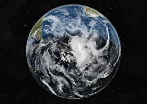
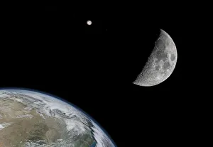
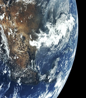
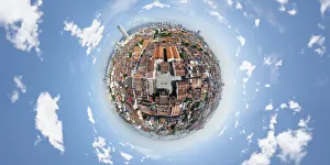
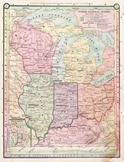
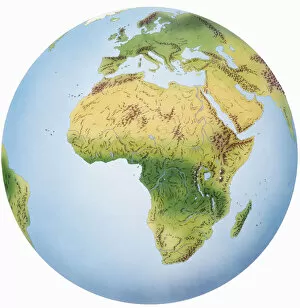
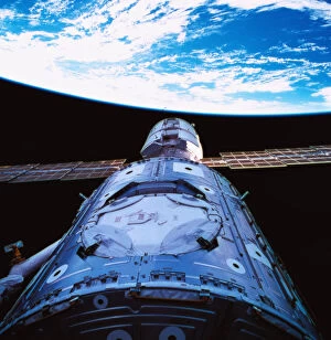
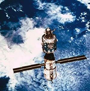
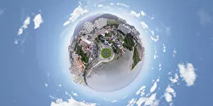
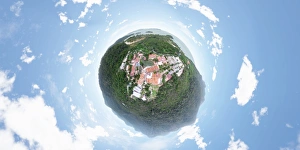
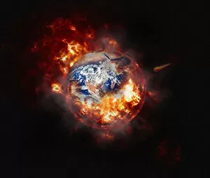
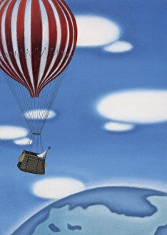
"Exploring the Vastness of Planet Earth: From Ancient Beliefs to Modern Discoveries" Step back in time and journey through the evolution of our understanding of planet Earth. Starting with Ptolemy's Solar System, which placed Earth at its center, we see how Copernicus challenged this geocentric model by proposing a revolutionary heliocentric view. As we delve deeper into history, Charon the ferryman engraving reminds us of mythical tales associated with celestial bodies. Shifting our focus to earthly wonders, Halong Bay in Vietnam captivates us with its breathtaking beauty. Meanwhile, a vintage map takes us on a visual expedition across continents and oceans, showcasing how perceptions of our world have evolved over time. The Hubble Space Telescope provides an awe-inspiring perspective from above as it orbits around Earth. Astronomy enthusiasts rejoice as they explore the cosmos against a black background filled with endless possibilities. Traveling back in time once again, maps from 1881 reveal intricate details about specific regions like Alabama Florida Georgia or New York Maryland Pennsylvania. These historical artifacts offer glimpses into past landscapes and boundaries that have shaped human history. Venturing further northwards, Wisconsin Michigan beckons explorers to uncover hidden treasures within their borders. The allure of these lands is mirrored by an enchanting Western Hemisphere map from 1856 that showcases diverse cultures and natural wonders spanning vast distances. From earthly realms to space exploration, an illustration depicting Apollo 11's monumental journey captures humanity's spirit for discovery beyond our home planet. Another illustration highlights the fascinating biomes found across different climatic variations worldwide – reminding us of nature's incredible diversity. In this captivating collage celebrating Planet Earth’s wonders and mysteries alike, there are no people present; instead, we find ourselves immersed in landscapes both familiar and unknown – inviting each viewer to embark on their own personal voyage through time and space.