
General Map Collection
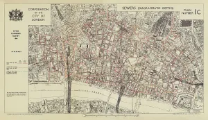
"Exploring the Depths: Sewer depths in the City of London, 1944 (colour litho)" Unveiling History: London in 1888 - The City Road


All Professionally Made to Order for Quick Shipping
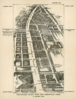
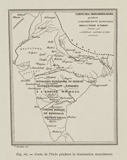
"Exploring the Depths: Sewer depths in the City of London, 1944 (colour litho)" Unveiling History: London in 1888 - The City Road, Finsbury Circus to the "Angel" Islington (engraving) A Glimpse into the Past: London in 1888 - Euston Road and Marylebone Road, Kings Cross to Paddington (engraving) Tracing Old Pathways: London in 1888 - Tottenham Court Road and Hampstead Road, to Camden Town (engraving) The Magnificence of Akbar's Empire: Map of India during the reign of Mughal Emperor Akbar, 16th Century (engraving) Shades of Slavery: Map of Slavery in the United States, 1863 - Black parts indicate American states where slavery was not abolished by President Abraham Lincoln's Emancipation Proclamation on January 1, 1863 Turbulence over Sudetenland: Map of Czechoslovakia during the crisis over Sudetenland, 1938 (colour litho) Connecting Nations through Commerce: Commercial Intercourse of Nations (colour litho) Unfolding Diplomacy: Map showcasing countries involved in the Czechoslovakian crisis that ended with signing Munich Agreement (colour litho) Witnessing Battle Strategies Unfolded: The Eye of Battle (Colour Litho) Marvel at Central Berlin's Splendor. Central Berlin, 1937 (colour litho) Navigating a World Fair Extravaganza.