Fraud Blocker Skip to main content

From Space Collection (page 14)

"Exploring the vastness of space, we catch a glimpse of our humble abode - the Pale Blue Dot

Background imageFrom Space Collection: Dust storm over the Arabian Sea

Dust storm over the Arabian Sea and Persian Gulf, Terra and Aqua composite satellite image. Sand and dust from surrounding countries has been picked up by winds, forming a sandstorm

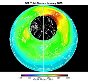
Background imageFrom Space Collection: Arctic ozone distribution

Arctic ozone distribution. Coloured satellite image of average total column ozone levels (amount of ozone in a column of air between the Earths surface and space) over the Arctic during January 2005

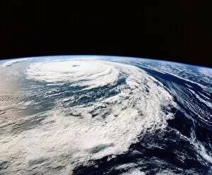
Background imageFrom Space Collection: Hurricane Florence from space shuttle

Hurricane Florence from space shuttle
Hurricane Florence. Photograph of the clouds associated with Hurricane Florence, taken from Space Shuttle Atlantis during Mission STS-66 of 3- 14 November 1994

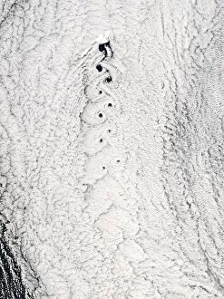
Background imageFrom Space Collection: Von Karman vortices in clouds

Von Karman vortices in clouds
Von Karmen vortices. Aqua satellite image of clouds showing a Von Karmen vortex street (braid- like area, centre) over Jan Mayen Island (at top of street). The wind is blowing from the top

Background imageFrom Space Collection: Mediterranean Basin, satellite image

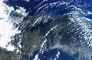
Mediterranean Basin, satellite image. North is at top. The mediterranean separates the continents of Europe and Africa. The northern Mediterranean borders Spain, France, Italy, Slovenia

Background imageFrom Space Collection: Flood risk in London, satellite image

Flood risk in London, satellite image
Flood risk in London. Satellite image of central London illustrating the areas at risk of flooding due to a rise in sea-level. North is at top

Background imageFrom Space Collection: Atlantic storms, QuikSCAT radar image

Atlantic storms, QuikSCAT radar image
Atlantic storms, radar image. This map, centred on the Atlantic, shows wind speeds measured by radar from the QuikSCAT satellite

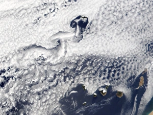
Background imageFrom Space Collection: Clouds disrupted by islands

Clouds disrupted by islands, true-colour satellite image. North is at top. The islands (brown) of the Canary Islands (lower right) and Madeira (upper centre) are disrupting clouds (white)

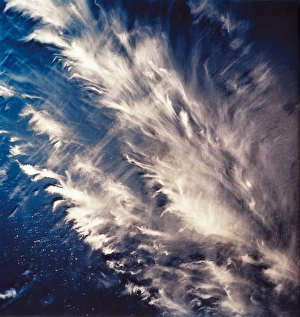
Background imageFrom Space Collection: View of long cirrus clouds over Atlantic

View of long cirrus clouds over Atlantic
View of long cirrus clouds & transverse bands over the Atlantic, 160 km northwest of Dakar on the westernmost tip of Africa

Background imageFrom Space Collection: Hurricane Emily, 17 July 2005

Hurricane Emily, 17 July 2005
Hurricane Emily. Satellite image of Hurricane Emily (centre) approaching Yucatan (left), Mexico, on 17 July 2005 at 1625 GMT
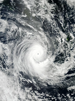
Background imageFrom Space Collection: Cyclone Rita over S. E. Asia showing the eye
Cyclone Rita over S. E. Asia showing the eye
Cyclone from space. Optical image of a tropical cyclone, a violent storm, from space. The cyclone is the swirl of clouds surrounding the dark hole (the " eye", at upper centre)

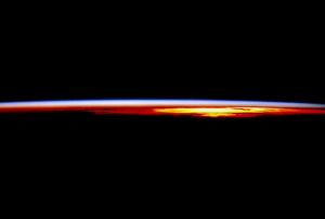
Background imageFrom Space Collection: The Earths atmosphere at sunrise seen from orbit

The Earths atmosphere at sunrise seen from orbit
Earths atmosphere. Sunrise over the Pacific Ocean, seen from a space shuttle in orbit (mission STS-69). The black area in the lower frame is the Earth in darkness

Background imageFrom Space Collection: Hurricane Dean, 21 August 2007

Hurricane Dean, 21 August 2007
Hurricane Dean, satellite image. North is at top. Image obtained at 15:05 local time on 21 August 2007 as the hurricane passed over Mexicos Yucatan peninsula

Background imageFrom Space Collection: Global ocean circulation

Global ocean circulation. Satellite image of the Earth from space with a map of ocean circulation. Ocean currents flow around the world due to differences in temperature and salinity

Background imageFrom Space Collection: Arctic ice minimum extent, 2005

Arctic ice minimum extent, 2005
Arctic sea ice minimum extent, 2005. The extent of the sea ice varies over the course of a year, being largest in winter and smallest in summer

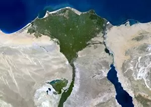
Background imageFrom Space Collection: Nile Delta, satellite image

Nile Delta, satellite image
Nile Delta, Egypt, satellite image. North is at top. The River Nile flows from bottom, out of the deserts (light brown) of Egypt, and into the Mediterranean Sea (top, blue)

Background imageFrom Space Collection: Rhine-Meuse delta, satellite image

Rhine-Meuse delta, satellite image. North is at top. Vegetation is red, barren areas are light blue, and water is dark blue

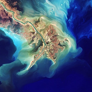
Background imageFrom Space Collection: Mouth of the mississippi, Landsat image

Mouth of the mississippi, Landsat image
Mouth of the Mississippi river, Landsat 7 satellite image. Draining much of North America, the Mississippi carries large quantities of sediment into the Gulf of Mexico

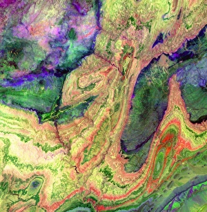
Background imageFrom Space Collection: Anti-Atlas mountains

Anti-Atlas mountains, Morocco, infrared satellite image. North is at top. This is at the western end of the Anti-Atlas Mountain Range in Morocco

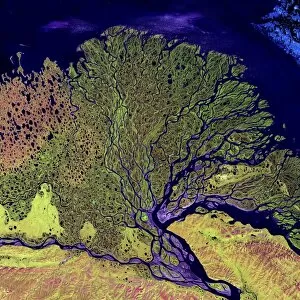
Background imageFrom Space Collection: Lena River Delta, Russia

Lena River Delta, Russia

Background imageFrom Space Collection: Gulf of Papua deltas, satellite image

Gulf of Papua deltas, satellite image
River deltas, Papua New Guinea, satellite image. North is at top. The rivers, flowing from inland through dense jungle and vast swamp plains (green)

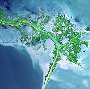
Background imageFrom Space Collection: Mississippi Delta

Mississippi Delta. Coloured satellite image of the delta of the Mississippi River, USA. North is at top, the Gulf of Mexico is at lower left

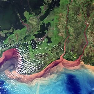
Background imageFrom Space Collection: River deltas in Borneo

River deltas in Borneo, satellite image. North is at top. Three rivers flow into the sea, carrying red silt deposits of sediment, mineral ores and organic matter

Background imageFrom Space Collection: River Congo in forest

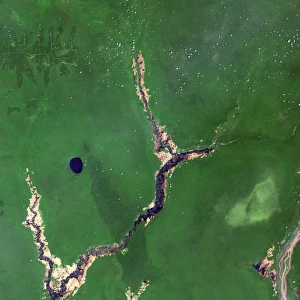
River Congo in forest
River Congo, Democratic Republic of Congo, satellite image. Formerly known as the Zaire, the Congo is seen flowing through forest (dark green) and swamp land (light green)

Background imageFrom Space Collection: Turpan Depression, satellite image

Turpan Depression, satellite image. North is at top. The Turpan (or Turfan) depression (lower frame) is located at the foot of Chinas Bogda Mountains (green, upper frame)

Background imageFrom Space Collection: Ganges Delta

Ganges Delta

Background imageFrom Space Collection: Himalaya mountain range, satellite image

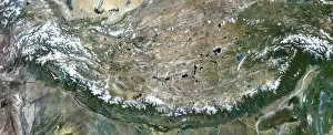
Himalaya mountain range, satellite image. North is towards upper left. The Himalaya mountain range stretches from Afghanistan (far left) to Bhutan (far right)

Background imageFrom Space Collection: River Nile

River Nile, true-colour satellite image. North is at top. Water is blue, deserts are brown, clouds are white. The lower reaches of the River Nile flow through Egypts deserts before reaching

Background imageFrom Space Collection: Amazon delta, Brazil

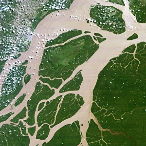
Amazon delta, Brazil
Amazon River delta, Brazil, satellite image. The Amazon River drains much of northern South America, meeting the Atlantic Ocean towards the north of Brazil

Background imageFrom Space Collection: Panama Canal

Panama Canal, from space. North is at upper right. Clouds (white) are seen over the narrow Isthmus of Panama (green), separating the Pacific Ocean (at bottom centre)

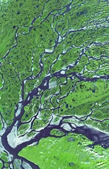
Background imageFrom Space Collection: Lena River Delta, satellite image

Lena River Delta, satellite image
Lena River Delta. Satellite image of part of the delta of the Lena River. North is at top. Water is blue and wetland areas are green

Background imageFrom Space Collection: Coloured radar image of mountains in Tibet

Coloured radar image of mountains in Tibet

Background imageFrom Space Collection: Himalaya mountain range, shuttle image

Himalaya mountain range, shuttle image
Himalaya mountain range. Space shuttle image of the Great Himalayas taken when the Shuttle was over Kolkata (formally Calcutta), India, looking northwest over Nepal

Background imageFrom Space Collection: Mount Everest, satellite image

Mount Everest, satellite image. North is at top. Mount Everest is the worlds highest peak (8848 metres). The summit peak forms a pyramidal shape just above and right of centre

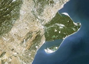
Background imageFrom Space Collection: True-colour satellite image of the Ebro Delta

True-colour satellite image of the Ebro Delta
Ebro Delta. True-colour satellite image of the Ebro (Ebre) Delta (green, centre right) in eastern Spain. North is at top. Dense vegetation is green

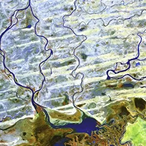
Background imageFrom Space Collection: Saharan desert rivers, satellite image

Saharan desert rivers, satellite image. North is at top. Water is blue, desert areas are white, and fresh sediments and vegetation is orange/green

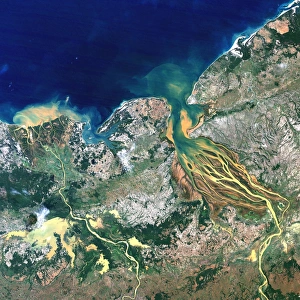
Background imageFrom Space Collection: Betsiboka estuary, Madagascar

Betsiboka estuary, Madagascar, satellite image. 20th century deforestation has resulted in massive soil erosion, causing the waters of the estuary (centre)

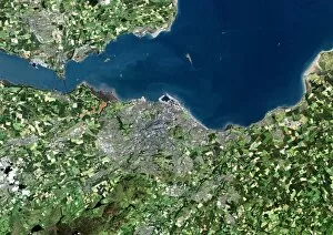
Background imageFrom Space Collection: Edinburgh, Scotland, UK, satellite image

Edinburgh, Scotland, UK, satellite image. North is at top, water is blue, urban areas are grey, vegetation is green and agricultural areas are brown

Background imageFrom Space Collection: Tropical storm Zeta, 2nd January 2006

Tropical storm Zeta, 2nd January 2006
Tropical storm Zeta over the Atlantic Ocean on 2nd January 2006. Zeta was the 27th named storm of the 2005 Atlantic hurricane season, extending the already record-breaking season yet further

Background imageFrom Space Collection: Greater London, satellite image

Greater London, satellite image. North is at top. Vegetation is green, water is blue and urbanised areas are grey and pink. London is the most populous city in the European Union

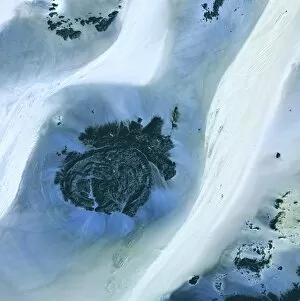
Background imageFrom Space Collection: Libyan Desert outcrop, satellite image

Libyan Desert outcrop, satellite image. North is at top. Sand dunes are white, less sandy areas are blue, and rock is dark grey

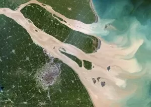
Background imageFrom Space Collection: Shanghai and the Yangtze, 1989

Shanghai and the Yangtze, 1989. Image to of two. Shanghai, visible as a grey conurbation towards the bottom left, is one of the largest cities in the world

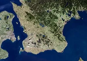
Background imageFrom Space Collection: Malmo, satellite image

Malmo, satellite image. Water is blue, forest is dark green, agricultural areas are green and brown and urbanised areas are pink

Background imageFrom Space Collection: Auckland, New Zealand, satellite image

Auckland, New Zealand, satellite image. North is at top, water is blue, shallow coastal areas are light blue, urban areas are grey and vegetation areas are green

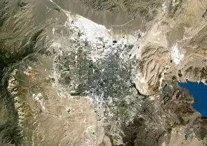
Background imageFrom Space Collection: Las Vegas, satellite image

Las Vegas, satellite image. North is at top. Vegetation is green, desert is brown, bare soil is white and water is blue. The lake at far right is Lake Mead, the largest man-made lake in the world

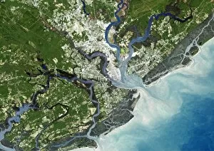
Background imageFrom Space Collection: Charleston, South Carolina, USA

Charleston, South Carolina, USA, satellite image. North is at top, water is blue, shallow coastal areas are light blue, urban areas are grey and vegetation is green

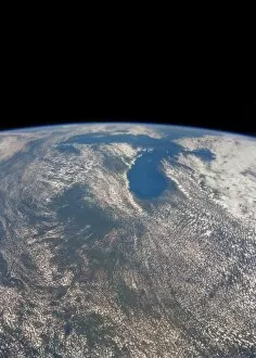
Background imageFrom Space Collection: Great Lakes from space

Great Lakes from space
Great Lakes on the USA/Canada border, seen from space. The Great Lakes cover an area of almost 250, 000 square kilometres, making them the largest expanse of fresh water in the world

Background imageFrom Space Collection: Tropical Cyclone Erica

Tropical Cyclone Erica (22P), satellite image, on 13 March 2003. North is at top. Erica peaked as a powerful Category 5 cyclone on 12 March 2003


All Professionally Made to Order for Quick Shipping

"Exploring the vastness of space, we catch a glimpse of our humble abode - the Pale Blue Dot. Voyager 1's iconic image reminds us of Earth's insignificance in the grand scheme of things. " "The breathtaking Earthrise over Moon captured by Apollo 8 serves as a reminder that even from space, our home planet remains an awe-inspiring sight to behold. " "A mesmerizing view of the Whole Earth, also known as Blue Marble 2000, showcases the stunning beauty and fragility of our precious planet. " "From high above, a satellite image reveals the intricate details and natural splendor of the British Isles, offering a unique perspective on this enchanting region. " "As night falls upon the UK, its illuminated cities create a dazzling spectacle when viewed from space. The vibrant lights paint a picture of human activity against the dark canvas of night. " "Gazing down at Europe at night through satellite imagery unveils an interconnected web of bustling metropolises and tranquil landscapes intertwined under twinkling stars. " "Inspired by darkness, Europe at night captivates with its ethereal glow emanating from countless cities scattered across its diverse lands. A testament to humanity's constant motion even after sunset. " "Astonishingly beautiful yet hauntingly mysterious, witnessing Whole Earth at night through satellite imagery evokes contemplation about our place in this vast universe and how we illuminate it with life. " "Jupiter and Io dance gracefully in their celestial ballet as captured by New Horizons' lens. This captivating image transports us beyond our own world into realms where giants roam amidst swirling storms. " "Awe-inspiring from any angle; an exquisite satellite image captures Earth's majestic presence against infinite blackness. A reminder that every corner holds hidden wonders waiting to be discovered. "With remarkable clarity seen from above Scotland within UK is unveiled like never before through detailed satellite imaging—a land steeped in history and adorned with rugged beauty.