Fraud Blocker Skip to main content

Earth Observation Collection (page 12)

"Earth Observation: Glimpses of Our Pale Blue Dot and Beyond" In the vast expanse of space

Background imageEarth Observation Collection: Global tectonics, South American Plate C016 / 3712

Global tectonics, South American Plate C016 / 3712
Global tectonics. Satellite-based artwork of an Earth globe centred on the South American Plate. This is one of the seven primary tectonic plates that make up the Earths crust

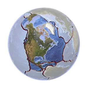
Background imageEarth Observation Collection: Global tectonics, North American Plate C016 / 3710

Global tectonics, North American Plate C016 / 3710
Global tectonics. Satellite-based artwork of an Earth globe centred on the North American Plate, one of the seven primary tectonic plates that make up the Earths crust

Background imageEarth Observation Collection: Global tectonics, Pacific Plate C016 / 3711

Global tectonics, Pacific Plate C016 / 3711
Global tectonics. Satellite-based artwork of an Earth globe centred on the Pacific Plate. This is one of the seven primary tectonic plates that make up the Earths crust

Background imageEarth Observation Collection: Global tectonics, Eurasian Plate C016 / 3709

Global tectonics, Eurasian Plate C016 / 3709
Global tectonics. Satellite-based artwork of an Earth globe centred on the Eurasian Plate and Indian Plate. The Eurasian Plate is one of the seven primary tectonic plates that make up the Earths

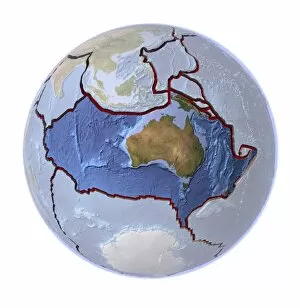
Background imageEarth Observation Collection: Global tectonics, Australian Plate C016 / 3708

Global tectonics, Australian Plate C016 / 3708
Global tectonics. Satellite-based artwork of an Earth globe centred on the Australian Plate. This is one of the seven primary tectonic plates that make up the Earths crust

Background imageEarth Observation Collection: Global tectonics, Antarctic Plate C016 / 3707

Global tectonics, Antarctic Plate C016 / 3707
Global tectonics. Satellite-based artwork of an Earth globe centred on the Antarctic Plate. This is one of the seven primary tectonic plates that make up the Earths crust

Background imageEarth Observation Collection: Global tectonics, African Plate C016 / 3706

Global tectonics, African Plate C016 / 3706
Global tectonics. Satellite-based artwork of an Earth globe centred on the African Plate and Arabian Plate. The African Plate is one of the seven primary tectonic plates that make up the Earths

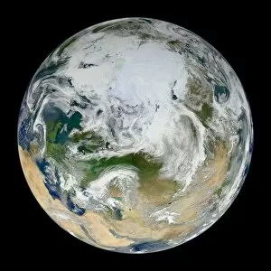
Background imageEarth Observation Collection: Earth, satellite image C016 / 3076

Earth, satellite image C016 / 3076
Earth. Blue Marble satellite image of the Earth, showing the North Pole (white, upper centre), Europe (centre left) and Asia (centre right)

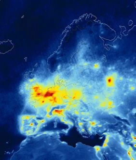
Background imageEarth Observation Collection: European nitrogen dioxide emissions, 2008 C016 / 3063

European nitrogen dioxide emissions, 2008 C016 / 3063
European nitrogen dioxide emissions, 2008. Map of Europe showing average annual tropospheric nitrogen dioxide (NO2) measurements as recorded by the Ozone Monitoring Instrument (OMI)

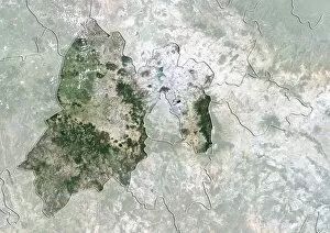
Background imageEarth Observation Collection: Mexico State, Mexico, satellite image

Mexico State, Mexico, satellite image
Mexico City, satellite image. North is at top. Natural colour satellite image showing the state of Mexico City, Mexico, with the surrounding Mexican states shaded out

Background imageEarth Observation Collection: Mexico State, Mexico, satellite image C014 / 0071

Mexico State, Mexico, satellite image C014 / 0071
Mexico City, satellite image. North is at top. Natural colour satellite image showing the state of Mexico City, Mexico, with the surrounding Mexican states shaded out

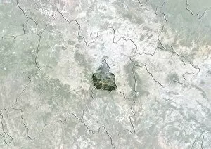
Background imageEarth Observation Collection: Chihuahua, Mexico, satellite image

Chihuahua, Mexico, satellite image
Chihuahua, satellite image. North is at top. Natural colour satellite image showing the state of Chihuahua, Mexico, with the surrounding Mexican states shaded out

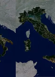
Background imageEarth Observation Collection: Italy, satellite image C014 / 0065

Italy, satellite image C014 / 0065
Italy, satellite image. North is at top. Natural colour satellite image showing Italy divided into its 20 regions. Italy is located in south-central Europe and is bordered by France (upper left)

Background imageEarth Observation Collection: Lower Saxony, Germany, satellite image

Lower Saxony, Germany, satellite image
Lower Saxony, satellite image. North is at top. Natural colour satellite image showing the state of Lower Saxony, Germany, with the surrounding German states shaded out

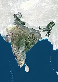
Background imageEarth Observation Collection: Madhya Pradesh, India, satellite image

Madhya Pradesh, India, satellite image
Madhya Pradesh, satellite image. North is at top. Natural colour satellite image showing the state of Madhya Pradesh, India, with the surrounding Indian states shaded out

Background imageEarth Observation Collection: Tibet, China, satellite image

Tibet, China, satellite image
Tibet, satellite image. North is at top. Natural colour satellite image showing the Tibet Autonomous Region (Tibet), with the surrounding Chinese provinces and regions shaded out

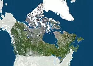
Background imageEarth Observation Collection: Quebec, Canada, satellite image

Quebec, Canada, satellite image
Quebec, satellite image. North is at top. Natural colour satellite image showing the predominantly French-speaking Canadian province of Quebec

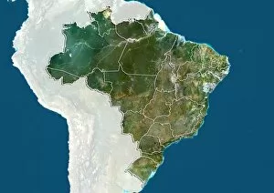
Background imageEarth Observation Collection: Amazonas, Brazil, satellite image

Amazonas, Brazil, satellite image
Amazonas, satellite image. North is at top. Natural colour satellite image showing the state of Amazonas in Brazil, with the surrounding states shaded out

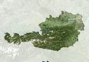
Background imageEarth Observation Collection: Upper Austria, Austria, satellite image

Upper Austria, Austria, satellite image
Upper Austria, satellite image. Natural colour satellite image showing the state (Bundeslander) of Upper Austria in Austria, with the surrounding states: Lower Austria, Styria, and Salzburg

Background imageEarth Observation Collection: Buenos Aires, Argentina, satellite image

Buenos Aires, Argentina, satellite image
Buenos Aires, satellite image. North is at top. Natural colour satellite image showing Buenos Aires in Argentina, with the countrys other provinces shaded out

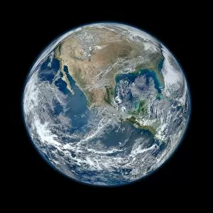
Background imageEarth Observation Collection: Earth, satellite image C013 / 9951

Earth, satellite image C013 / 9951
Earth. Composite satellite image of Earths Western hemisphere, showing the Americas from a perspective of 12, 740 kilometres away

Background imageEarth Observation Collection: Morocco 1985-2011 C013 / 7147

Morocco 1985-2011 C013 / 7147
Morocco 1985-2011. Landsat satellite photographs of cities near the Atlantic coast of Morocco. The right hand image, taken in 2011

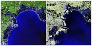
Background imageEarth Observation Collection: Binhai, China, 1992-2012 C013 / 7146

Binhai, China, 1992-2012 C013 / 7146
Binhai, China, 1992-2012. Landsat satellite photograph of Binhai, China. This city is located on the coast of the Bohai Sea Region southeast of Beijing in China

Background imageEarth Observation Collection: Caspian Sea 1972-2010 C013 / 7145

Caspian Sea 1972-2010 C013 / 7145
Caspian Sea 1972-2010. Landsat satellite photograph of the Caspian Sea in 1972 (left), 1987 (middle) and 2010 (right). The Caspian is the largest body of inland water in the world

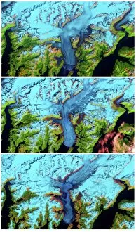
Background imageEarth Observation Collection: Columbia Glacier, Alaska, 1986-2011 C013 / 7144

Columbia Glacier, Alaska, 1986-2011 C013 / 7144
Columbia Glacier, Alaska, 1986-2011. Landsat satellite photograph of Columbia Glacier in 1986 (top), 2000 (middle) and 2011 (bottom)

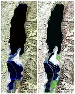
Background imageEarth Observation Collection: Dead Sea 1984-2011 C013 / 7143

Dead Sea 1984-2011 C013 / 7143
Dead Sea 1984-2011. Landsat satellite photo of the Dead Sea in 1984 (left) and 2011 (right). The Dead Sea is located in the Jordan Rift Valley and borders Jordan, Israel, and the West Bank

Background imageEarth Observation Collection: Shrimp farming, Fonseca, 1985-2011 C013 / 7115

Shrimp farming, Fonseca, 1985-2011 C013 / 7115
Shrimp farming, Fonseca, 1985-2011. Landsat satellite photographs of shrimp farming in the Gulf of Fonseca in 1985 (left), 1999 (centre) and 2011 (right)

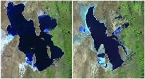
Background imageEarth Observation Collection: Great Salt Lake, USA, 1985-2010 C013 / 7111

Great Salt Lake, USA, 1985-2010 C013 / 7111
Great Salt Lake, USA, 1985-2010. Landsat satellite photographs showing the loss of water from the Great Salt Lake in Utah, USA. The image on the left was taken in 1985 and on the right 2010

Background imageEarth Observation Collection: Lake Meredith, USA, 1990-2011

Lake Meredith, USA, 1990-2011. Landsat satellite photograph showing Lake Meredith in 1990 and 2011. This is an artificial lake formed by the Sanford Dam in Texas

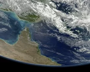
Background imageEarth Observation Collection: Great Barrier Reef, satellite image

Great Barrier Reef, satellite image. North is at top. Clouds are white. At centre left is the Cape York Peninsula in Queensland, north-eastern Australia

Background imageEarth Observation Collection: Gulf of Mexico coast, satellite image C013 / 5167

Gulf of Mexico coast, satellite image C013 / 5167
Gulf of Mexico coast, satellite image. North is towards upper left. Clouds are white. The Mississippi River, flowing south, enters the Gulf of Mexico at New Orleans, Louisiana, USA, at upper centre

Background imageEarth Observation Collection: North-eastern Australia, satellite image C013 / 5161

North-eastern Australia, satellite image C013 / 5161
North-eastern Australia, satellite image. North is at top. Clouds are white. Most of the land area is the state of Queensland in north-eastern Australia

Background imageEarth Observation Collection: Western Europe, satellite image C013 / 5165

Western Europe, satellite image C013 / 5165
Western Europe, satellite image. North is towards upper right. Clouds are white, seen mostly over the North Atlantic, North Sea and Mediterranean

Background imageEarth Observation Collection: Saharan Mediterranean, satellite image C013 / 5166

Saharan Mediterranean, satellite image C013 / 5166
Saharan Mediterranean, satellite image. North is towards upper right. Clouds are white. The land is dominated by the Sahara Desert (brown), stretching for thousands of kilometres across North Africa

Background imageEarth Observation Collection: Bering Sea, satellite image C013 / 5164

Bering Sea, satellite image C013 / 5164
Bering Sea, satellite image. North is towards upper left. Clouds, snow and ice are white. The Bering Sea, over a thousand kilometres across, is bounded by Alaska (upper centre)

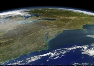
Background imageEarth Observation Collection: East coast of the USA, satellite image C013 / 5162

East coast of the USA, satellite image C013 / 5162
East coast of the USA, satellite image. North is towards top. Clouds are white. The land area consists of eastern Canada across top and the north-eastern USA across centre and lower left

Background imageEarth Observation Collection: Gulf of Mexico coast, satellite image C013 / 5163

Gulf of Mexico coast, satellite image C013 / 5163
Gulf of Mexico coast, satellite image. North is at left. Clouds are white. The Mississippi River, flowing south from left, enters the Gulf of Mexico at New Orleans, Louisiana, USA, at upper centre

Background imageEarth Observation Collection: North-western Africa, satellite image C013 / 5160

North-western Africa, satellite image C013 / 5160
North-western Africa, satellite image. North is at top. This north-western portion of Africa, over a thousand kilometres across, includes Morocco (left) and northern parts of Algeria

Background imageEarth Observation Collection: Tropical Storm Ernesto, satellite image C013 / 5157

Tropical Storm Ernesto, satellite image C013 / 5157
Tropical Storm Ernesto, satellite image. This view looks south over Florida, USA, as this storm (white clouds) made landfall on 29 and 30 August 2006. At upper left are Cuba, Jamaica, and Haiti

Background imageEarth Observation Collection: New Zealand, satellite image C013 / 5154

New Zealand, satellite image C013 / 5154
New Zealand, satellite image. Low-angle view looking west towards the islands of New Zealand (on horizon), with cloud cover at left and a phytoplankton bloom (blue-green) near centre

Background imageEarth Observation Collection: Menwith Hill spy base, aerial image

Menwith Hill spy base, aerial image
Menwith Hill monitoring station, UK, aerial photograph. This base, near Harrogate in North Yorkshire, is operated by the US National Security Agency

Background imageEarth Observation Collection: Identification and surveillance technology

Identification and surveillance technology, computer artwork. The technology seen here includes satellite imaging, iris scanning and fingerprinting

Background imageEarth Observation Collection: Early weather satellite images

Early weather satellite images of Europe. These images are from the TIROS (Television and Infrared Observation Satellite) programme (1960-1966), and the Nimbus satellites (1964-1978)

Background imageEarth Observation Collection: Epsom horse racing track, aerial image

Epsom horse racing track, aerial image
Epsom race track, UK. This track is the home of the Derby horse race. The Derby is run over 2.4 kilometres (1.5 miles) and is contested by three- year-old horses

Background imageEarth Observation Collection: Aintree horse racing track, aerial image

Aintree horse racing track, aerial image
Aintree race track, UK. This track is the home of the Grand National steeplechase horse race. The Grand National comprises two laps of the track, a distance of 7.2 kilometres (four and a half miles)

Background imageEarth Observation Collection: Alton Towers amusement park, aerial image

Alton Towers amusement park, aerial image
Alton Towers amusement park, aerial photograph. This park is situated in Staffordshire, UK

Background imageEarth Observation Collection: Crystal Palace Sports Centre, aerial view

Crystal Palace Sports Centre, aerial view
Crystal Palace National Sports Centre, London, UK, aerial image. The complex contains an athletics track, multi-purpose pitches (upper centre) and a swimming pool

Background imageEarth Observation Collection: Sandown Park racecourse, Surrey, UK

Sandown Park racecourse, Surrey, UK
Sandown Park racecourse. Aerial photograph of Sandown Park (centre left), racecourse and leisure venue, Surrey, UK. As well as holding races most weekends, this course hosts the Eclipse Stakes


All Professionally Made to Order for Quick Shipping

"Earth Observation: Glimpses of Our Pale Blue Dot and Beyond" In the vast expanse of space, Voyager 1 captured an awe-inspiring image that forever changed our perspective. The iconic "Pale Blue Dot" photograph revealed Earth as a tiny speck in the cosmic ocean, reminding us of our interconnectedness on this magnificent planet. Zooming in closer, we witness the intricate details of human achievements. The Wimbledon tennis complex stands out amidst the bustling cityscape of London, UK. From high above, a satellite image showcases the British Isles with its lush green landscapes and rugged coastlines – a testament to nature's beauty. As night falls, lights illuminate cities across Europe like constellations on Earth's canvas. A mesmerizing satellite image captures the brilliance of UK at night from space – a tapestry woven by millions living their lives under starry skies. Expanding further into darkness reveals Europe at night; clusters of light representing vibrant metropolises and quiet towns alike. And then there it is - an astonishing view showcasing our entire planet bathed in nocturnal glow - Whole Earth at night seen from space. Venturing beyond terrestrial boundaries, Tenerife emerges through a satellite lens – its volcanic terrain contrasting against azure waters surrounding this Spanish island paradise. The International Space Station floats gracefully in orbit around Earth during 2008 – humanity's outpost where astronauts conduct research while gazing back upon their home planet with wonderment. From afar, another satellite image depicts Earth from space - swirling clouds dance over continents and oceans; an ever-changing masterpiece painted by atmospheric currents and weather patterns. Closer to home once more, Scotland's stunning landscape unfolds beneath us through yet another captivating satellite image. Majestic mountains blend seamlessly with lochs and glens creating breathtaking scenery that captivates all who behold it.