Fraud Blocker Skip to main content

Earth Observation Collection (page 6)

"Earth Observation: Glimpses of Our Pale Blue Dot and Beyond" In the vast expanse of space

Background imageEarth Observation Collection: Aircraft graveyard, USA C017 / 7654

Aircraft graveyard, USA C017 / 7654
Aircraft graveyard, Davis-Monthan Air force Base, Tucson, Arizona, USA. The largest of its kind in the world, hundreds of old military

Background imageEarth Observation Collection: Gravelly Hill Interchange, aerial view C017 / 0657

Gravelly Hill Interchange, aerial view C017 / 0657
Gravelly Hill Interchange, UK, aerial photograph. This interchange lies off junction 6 on the M6 motorway where it meets the A38(M)

Background imageEarth Observation Collection: Solar array panel, ISS image

Solar array panel, ISS image. Photograph of the sun through the solar array panels of the International Space Station (ISS). In the background can be seen the thin blue line of the Earths atmosphere

Background imageEarth Observation Collection: Arctic ice minimum extent, 2012

Arctic ice minimum extent, 2012
Arctic ice minimum extent. Satellite image showing the Arctic polar ice cap at its annual minimum extent on 16th September 2012

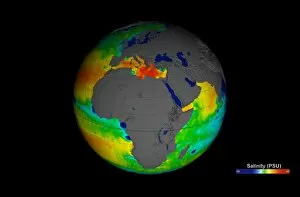
Background imageEarth Observation Collection: Sea surface salinity, Aquarius image C017 / 6820

Sea surface salinity, Aquarius image C017 / 6820
Sea surface salinity, Aquarius image. Computer model showing the salinity (dissolved salt-content) of the oceans around Africa

Background imageEarth Observation Collection: Dartford, aerial photograph C016 / 9930

Dartford, aerial photograph C016 / 9930
Dartford, UK, aerial photograph. At lower left is Queen Elizabeth II bridge which spans the River Thames. Directly beneath the bridge is the Dartford Crossing and the Dartford tunnel

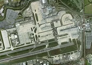
Background imageEarth Observation Collection: Gatwick airport, aerial photograph C016 / 9932

Gatwick airport, aerial photograph C016 / 9932
Gatwick airport, aerial photograph. Photographed in 2012

Background imageEarth Observation Collection: Columbia Glacier, Alaska, 1989

Columbia Glacier, Alaska, 1989
Columbia Glacier, Alaska. False-colour satellite image of the Columbia Glacier, Alaska, USA, taken in 1989. Columbia Glacier descends from an ice field (top) 3, 050 metres above sea level

Background imageEarth Observation Collection: St Pauls Cathedral, aerial photograph

St Pauls Cathedral, aerial photograph
St Pauls Cathedral, London, aerial photograph. Photographed in 2011

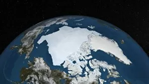
Background imageEarth Observation Collection: Arctic ice minimum extent, 2013 C017 / 3623

Arctic ice minimum extent, 2013 C017 / 3623
Arctic ice minimum extent. Satellite image showing the Arctic polar ice cap at its annual minimum extent on 12th September 2013

Background imageEarth Observation Collection: Gravity map of Earth C018 / 9377

Gravity map of Earth C018 / 9377
Gravity map of Earth. Computer model showing the variation of the Earths gravity field. Colours represent gravity anomaly

Background imageEarth Observation Collection: Gravity map of Earth C018 / 9376

Gravity map of Earth C018 / 9376
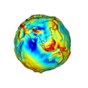
Gravity map of Earth. Computer model showing the variation of the Earths gravity field centred on the Asia. Colours represent gravity anomaly

Background imageEarth Observation Collection: Gravity map of Earth C018 / 9374

Gravity map of Earth C018 / 9374
Gravity map of Earth. Computer model showing the variation of the Earths gravity field centred on the Americas. Colours represent gravity anomaly

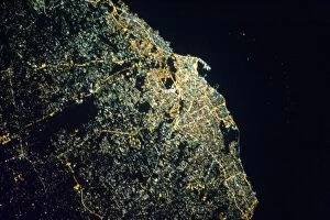
Background imageEarth Observation Collection: Tripoli at night, ISS image C018 / 9222

Tripoli at night, ISS image C018 / 9222
Tripoli at night. Photographed by astronauts aboard the International Space Station 18th April 2013. The picture was taken using a camera aid called NightPod

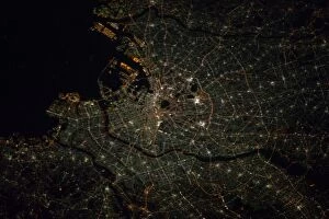
Background imageEarth Observation Collection: Tokyo at night, ISS image C018 / 9224

Tokyo at night, ISS image C018 / 9224
Tokyo at night. Photographed by astronauts aboard the International Space Station 9th January 2011. The picture was taken using a camera aid called NightPod

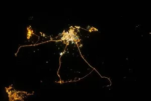
Background imageEarth Observation Collection: Qatar at night, ISS image C018 / 9225

Qatar at night, ISS image C018 / 9225
Qatar at night. Photographed by astronauts aboard the International Space Station 13th October 2012. The picture was taken using a camera aid called NightPod

Background imageEarth Observation Collection: Paris C018 / 9219

Paris C018 / 9219
Paris at night. Photographed by astronauts aboard the International Space Station 7th April 2013. The picture was taken using a camera aid called NightPod

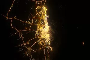
Background imageEarth Observation Collection: Dubai at night, ISS image C018 / 9216

Dubai at night, ISS image C018 / 9216
Dubai at night. Photographed by astronauts aboard the International Space Station 16th June 2012. The picture was taken using a camera aid called NightPod

Background imageEarth Observation Collection: Plosky Tolbachik volcano erupting, 2013 C016 / 9732

Plosky Tolbachik volcano erupting, 2013 C016 / 9732
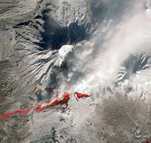
Plosky Tolbachik volcano erupting, satellite image. North is at top. This volcano (3682 metres) is located in Russias far eastern Kamchatka Peninsula

Background imageEarth Observation Collection: Jebel Uweinat mountains, satellite image C016 / 9731

Jebel Uweinat mountains, satellite image C016 / 9731
Jebel Uweinat mountains, satellite image. North is at top. This mountain range (peak elevation: 1934 metres) is located on the Egyptian-Sudanese-Libyan border

Background imageEarth Observation Collection: Coriolis effect, artwork C016 / 7691

Coriolis effect, artwork C016 / 7691
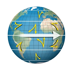
Coriolis effect. Computer artwork of an Earth globe, showing how the rotation of the Earth (white arrow) affects the motion (yellow arrows) of the winds at different locations on the Earth

Background imageEarth Observation Collection: Cloud vortex street, satellite image

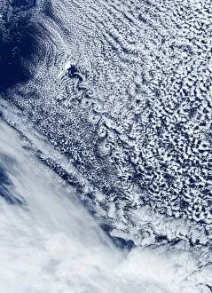
Cloud vortex street, satellite image. North is at top. The island of Jan Mayen (white, upper left) is located in the Arctic Ocean

Background imageEarth Observation Collection: Walker Lake, Nevada, ISS image

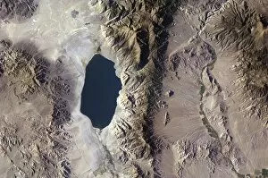
Walker Lake, Nevada, ISS image. Photograph of Walker Lake, western Nevada, taken by astronauts aboard the International Space Station (ISS). Photographed 29th July 2012

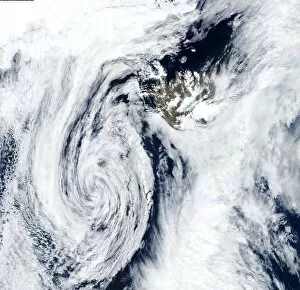
Background imageEarth Observation Collection: Low pressure, Iceland, satellite image

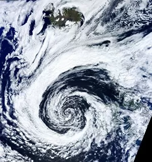
Low pressure, Iceland, satellite image. North is at top. The swirl of clouds (lower left) marks an area of low pressure that is centred south-west of Iceland (upper right)

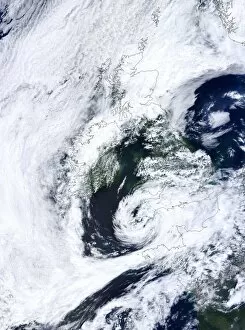
Background imageEarth Observation Collection: Low pressure, UK, satellite image

Low pressure, UK, satellite image. North is at top, with land areas outlined in black. The swirl of clouds at lower centre is a lower pressure system centred over South-West England

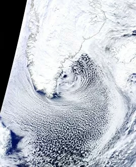
Background imageEarth Observation Collection: Cloud streets, Greenland, satellite image

Cloud streets, Greenland, satellite image. North is at top, with Greenland and Iceland outlined in black. Cloud streets are parallel lines of clouds aligned with the wind

Background imageEarth Observation Collection: Bassas da India, ISS image C015 / 1897

Bassas da India, ISS image C015 / 1897
Bassas da India photographed by astronauts on the International Space Station (ISS) on 2nd April 2011. Bassas da India is an uninhabited atoll in the Indian Ocean

Background imageEarth Observation Collection: Wildfire, Idaho, USA, ISS image

Wildfire, Idaho, USA, ISS image. Forest wildfires photographed by astronauts aboard the International Space Station in September 2012

Background imageEarth Observation Collection: Cloud streets, Black Sea, satellite image

Cloud streets, Black Sea, satellite image. North is at top, with the Black Sea outlined in black. Cloud streets are parallel lines of clouds aligned with the wind

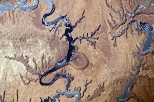
Background imageEarth Observation Collection: Lake Powell, Utah, ISS image

Lake Powell, Utah, ISS image. Photograph of Lake Powell (left and right of image) and the Rincon (centre middle), a circular dried river bed impression

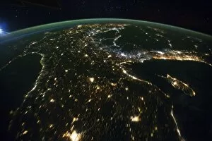
Background imageEarth Observation Collection: Europe and middle east at night, ISS

Europe and middle east at night, ISS
Europe and middle east at night photographed by astronauts on the International Space Station (ISS) on 21st October 2011. This image is one frame from a time-lapse series of stills taken as the ISS

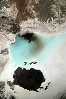
Background imageEarth Observation Collection: Salar de Coipasa, Bolivia, ISS image

Salar de Coipasa, Bolivia, ISS image. Photograph of Salar de Coipasa, Bolivia, taken by astronauts aboard the International Space Station (ISS)

Background imageEarth Observation Collection: Polar mesospheric clouds, ISS image

Polar mesospheric clouds, ISS image. Photograph of polar mesospheric clouds from the northern hemisphere taken by astronauts aboard the International Space Station (ISS)

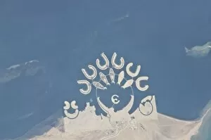
Background imageEarth Observation Collection: Durrat Al Bahrain, ISS image

Durrat Al Bahrain, ISS image
Durrat Al Bahrain as photographed by astronauts on the International Space Station (ISS) on the 23rd January 2011. Durrat Al Bahrain is a series of artificial islands that were built to house hotels

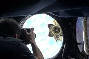
Background imageEarth Observation Collection: Astronaut Aki Hoshide, ISS

Astronaut Aki Hoshide, ISS. Photograph of Japanese born astronaut Aki Hoshide taking still pictures of the Canadarm2 robotic arm outside the International Space Station. Photographed 16th October 2012

Background imageEarth Observation Collection: Atlantic low pressure, satellite image

Atlantic low pressure, satellite image. North is at top, and land areas are outlined in black. The swirl of cloud at lower centre is a low pressure system centred west of Ireland and the UK

Background imageEarth Observation Collection: Satellites and ISS solar panel in space

Satellites and ISS solar panel in space. Photograph of three small satellites released into space from the International Space Station (ISS). This photograph was taken by astronauts aboard the ISS

Background imageEarth Observation Collection: Solar eclipse, ISS image

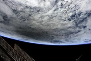
Solar eclipse, ISS image. Photograph showing the moons shadow over Earth caused by the solar eclipse on 20th May 2012. This image was taken by astronaut Don Pettit aboard the International Space

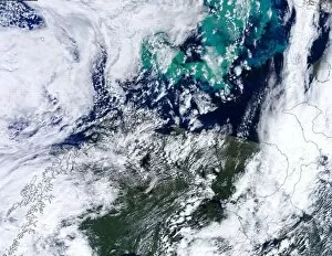
Background imageEarth Observation Collection: Barents Sea algal bloom, satellite image

Barents Sea algal bloom, satellite image. North is at top, with land areas outlined in black. Algal blooms (green, top) have formed in the Barents Sea off northern Scandinavia (lower left)

Background imageEarth Observation Collection: US-Mexico border, Sonoran Desert C016 / 6318

US-Mexico border, Sonoran Desert C016 / 6318
US-Mexico border, north-western Sonoran Desert. North is towards upper right. Farm fields (green) lie between the Salton Sea in California (top) and the Colorado River Delta in Mexico (bottom)

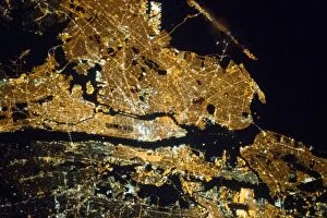
Background imageEarth Observation Collection: New York at night, ISS image C016 / 6382

New York at night, ISS image C016 / 6382
New York at night. Photographed by astronauts aboard the International Space Station 23rd March 2013. The picture was taken using a camera aid called NightPod

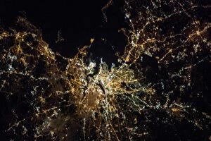
Background imageEarth Observation Collection: Boston at night, ISS image C016 / 6376

Boston at night, ISS image C016 / 6376
Boston at night. Photographed by astronaut Chris Hadfield aboard the International Space Station 6th April 2012. The picture was taken using a camera aid called NightPod

Background imageEarth Observation Collection: New Mexico, USA C016 / 6357

New Mexico, USA C016 / 6357
New Mexico, USA, from Earth orbit. North is towards upper right. At lower right is White Sands National Monument (white), with the Carrizozo Malpais lava flow (dark)
Background imageEarth Observation Collection: Waterloo Station, London, aerial view C017 / 0661

Waterloo Station, London, aerial view C017 / 0661
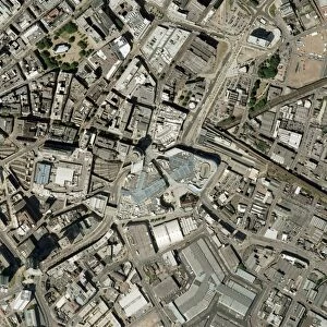
Waterloo Station, London, aerial photograph. Waterloo Station terminal and lines can be seen centre middle towards bottom middle of the image
Background imageEarth Observation Collection: Birmingham city centre, aerial photograph C016 / 9924

Birmingham city centre, aerial photograph C016 / 9924
Birmingham city centre, aerial photograph. At centre, middle is the Bullring Shopping Centre. Photographed in 2004

Background imageEarth Observation Collection: Isle of Dogs, aerial photograph C016 / 9934

Isle of Dogs, aerial photograph C016 / 9934
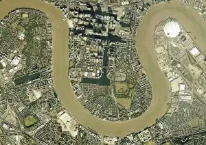
Isle of Dogs, London, UK, aerial photograph. The Isle of Dogs in east London includes extensive office buildings around the Canary Wharf Tower (top)

Background imageEarth Observation Collection: Sea surface salinity, Aquarius image C017 / 6817

Sea surface salinity, Aquarius image C017 / 6817
Sea surface salinity, Aquarius image. Computer model showing the salinity (dissolved salt-content) of the Atlantic and Pacific oceans

Background imageEarth Observation Collection: Sea surface salinity, Aquarius image C017 / 6819

Sea surface salinity, Aquarius image C017 / 6819
Sea surface salinity, Aquarius image. Computer model showing the salinity (dissolved salt-content) of the Western Pacific Ocean


All Professionally Made to Order for Quick Shipping

"Earth Observation: Glimpses of Our Pale Blue Dot and Beyond" In the vast expanse of space, Voyager 1 captured an awe-inspiring image that forever changed our perspective. The iconic "Pale Blue Dot" photograph revealed Earth as a tiny speck in the cosmic ocean, reminding us of our interconnectedness on this magnificent planet. Zooming in closer, we witness the intricate details of human achievements. The Wimbledon tennis complex stands out amidst the bustling cityscape of London, UK. From high above, a satellite image showcases the British Isles with its lush green landscapes and rugged coastlines – a testament to nature's beauty. As night falls, lights illuminate cities across Europe like constellations on Earth's canvas. A mesmerizing satellite image captures the brilliance of UK at night from space – a tapestry woven by millions living their lives under starry skies. Expanding further into darkness reveals Europe at night; clusters of light representing vibrant metropolises and quiet towns alike. And then there it is - an astonishing view showcasing our entire planet bathed in nocturnal glow - Whole Earth at night seen from space. Venturing beyond terrestrial boundaries, Tenerife emerges through a satellite lens – its volcanic terrain contrasting against azure waters surrounding this Spanish island paradise. The International Space Station floats gracefully in orbit around Earth during 2008 – humanity's outpost where astronauts conduct research while gazing back upon their home planet with wonderment. From afar, another satellite image depicts Earth from space - swirling clouds dance over continents and oceans; an ever-changing masterpiece painted by atmospheric currents and weather patterns. Closer to home once more, Scotland's stunning landscape unfolds beneath us through yet another captivating satellite image. Majestic mountains blend seamlessly with lochs and glens creating breathtaking scenery that captivates all who behold it.