Fraud Blocker Skip to main content

Earth Observation Collection (page 5)

"Earth Observation: Glimpses of Our Pale Blue Dot and Beyond" In the vast expanse of space

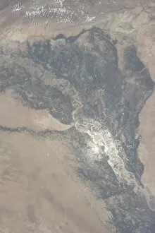
Background imageEarth Observation Collection: View from space of the Indus Valley in Pakistan

View from space of the Indus Valley in Pakistan
August 14, 2013 - View from space of the Indus Valley in Pakistan with its huge August floods brilliantly visible in sunglint

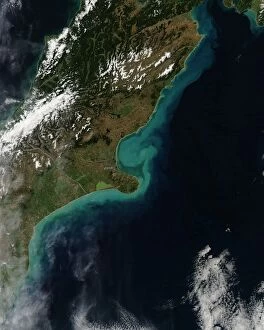
Background imageEarth Observation Collection: Satellite view showing sediment near Christchurch, New Zealand

Satellite view showing sediment near Christchurch, New Zealand
March 6, 2014 - Satellite view showing sediment near Christchurch, New Zealand

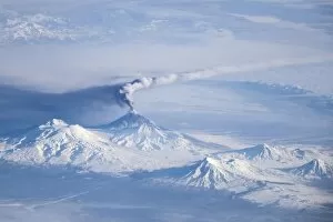
Background imageEarth Observation Collection: An eruption plume emanating from Kliuchevskoi volcano

An eruption plume emanating from Kliuchevskoi volcano
An eruption plume emanating from Kliuchevskoi, one of the many active volcanoes on the Kamchatka Peninsula. The plume, likely a combination of steam, volcanic gases, and ash

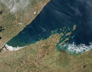
Background imageEarth Observation Collection: Satellite view showing chunks of ice afloat on Lake Superior

Satellite view showing chunks of ice afloat on Lake Superior
May 23, 2014 - Satellite view showing chunks of ice afloat on Lake Superior near Chequamegon Bay, Wisconsin

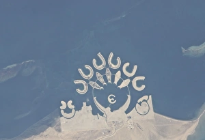
Background imageEarth Observation Collection: Durrat Al Bahrain, Bahrain

Durrat Al Bahrain, Bahrain
January 23, 2011 - Durrat Al Bahrain, Bahrain. Set at the southern end of Bahrain Island, at the furthest point from the cities of the kingdom, is a new complex of 14 artificial islands

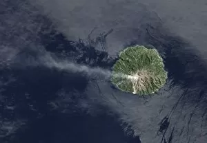
Background imageEarth Observation Collection: Sporadic eruptions from Paluweh Volcano

Sporadic eruptions from Paluweh Volcano
April 19, 2013 - Sporadic eruptions from Paluweh Volcano emitting ash and volcanic gases into the air

Background imageEarth Observation Collection: The Great Salt Desert in Iran

The Great Salt Desert in Iran
October 24, 2000 - Dasht-e Kavir, or Great Salt Desert, is the largest desert in Iran. It is primarily uninhabited wasteland

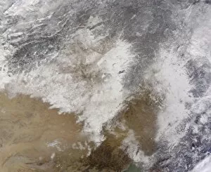
Background imageEarth Observation Collection: Satellite view of snow in northeastern China

Satellite view of snow in northeastern China
January 8, 2014 - Satellite view of snow in northeastern China

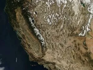
Background imageEarth Observation Collection: Autumn snow in the western United States

Autumn snow in the western United States
October 31, 2013 - Autumn snow in the western United States

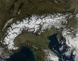
Background imageEarth Observation Collection: Satellite view of the Alps

Satellite view of the Alps
February 24, 2014 - Satellite view of the Alps

Background imageEarth Observation Collection: Satellite view of a winter snowstorm across the Mid-Atlantic United States

Satellite view of a winter snowstorm across the Mid-Atlantic United States in March 2014

Background imageEarth Observation Collection: Sea ice and icebergs floating along the Mawson Coast of East Antarctica

Sea ice and icebergs floating along the Mawson Coast of East Antarctica
March 15, 2013 - Sea ice and icebergs floating along the Mawson Coast of East Antarctica

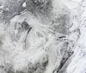
Background imageEarth Observation Collection: Satellite view of fog forming over the Great Lakes

Satellite view of fog forming over the Great Lakes
January 6, 2014 - Satellite view of fog forming over the Great Lakes and streaming southeast with the wind. A swirling mass of Arctic air moved south into the continental United States in early

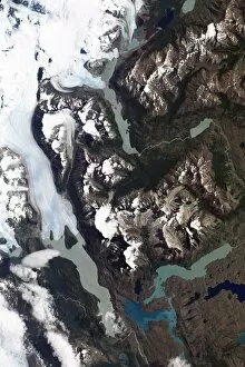
Background imageEarth Observation Collection: View of grinding glaciers and granite peaks in Chiles Torres del Paine National Park

View of grinding glaciers and granite peaks in Chiles Torres del Paine National Park
January 21, 2013 - Satellite view of grinding glaciers and granite peaks in Chiles Torres del Paine National Park. The rivers of glacial ice in Torres del Paine National Park grind over bedrock

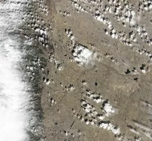
Background imageEarth Observation Collection: Satellite view of Fort Collins, Colorado

Satellite view of Fort Collins, Colorado
March 18, 2013 - Satellite view of Fort Collins, Colorado. The city is a gray grid surrounded by the curving roads and brown yards of residential neighborhoods

Background imageEarth Observation Collection: Satellite view of Tasmania, an island state of Australia

Satellite view of Tasmania, an island state of Australia
January 7, 2013 - Satellite view of Tasmania, an island state of Australia

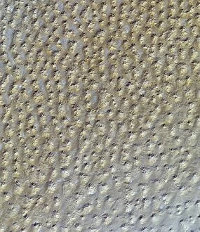
Background imageEarth Observation Collection: Satellite view of the Grand Erg Oriental sand dunes in the Saharan Desert

Satellite view of the Grand Erg Oriental sand dunes in the Saharan Desert
October 27, 2012 - Satellite view of the Grand Erg Oriental, a sprawling sea of sand dunes in the Saharan Desert

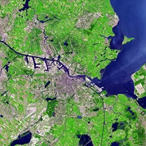
Background imageEarth Observation Collection: Satellite view of Amsterdam, Netherlands

Satellite view of Amsterdam, Netherlands
July 24, 2012 - Satellite view of Amsterdam, Netherlands. Urbanized areas appear in shades of gray; vegetation is red; and water is blue

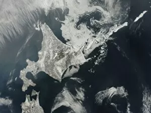
Background imageEarth Observation Collection: Satellite view of Hokkaido Island, Japan

Satellite view of Hokkaido Island, Japan
February 27, 2014 - Satellite view of Hokkaido Island, Japan

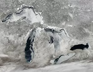
Background imageEarth Observation Collection: Satellite view of ice on the Great Lakes, United States

Satellite view of ice on the Great Lakes, United States
March 16, 2014 - Satellite view of ice on the Great Lakes, United States

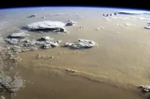
Background imageEarth Observation Collection: View of a dust storm that stretches across the sand seas of the Sahara Desert

View of a dust storm that stretches across the sand seas of the Sahara Desert
September 8, 2014 - View of a dust storm that stretched hundreds of miles across the sand seas of the Sahara Desert. Billowing cumulus and cumulonimbus clouds suggest that a cold
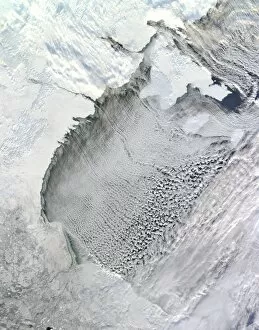
Background imageEarth Observation Collection: Satellite view of cloud streets over Hudson Bay, Canada

Satellite view of cloud streets over Hudson Bay, Canada
November 13, 2012 - Satellite view of cloud streets amidst northwesterly winds over Hudson Bay, Canada. Cloud streets, long parallel bands of cumulus clouds

Background imageEarth Observation Collection: Satellite view of a cold front in the United States

Satellite view of a cold front in the United States
May 29, 2014 - Satellite view of clouds associated with a backdoor cold front that stretches from southern Illinois to North Carolina

Background imageEarth Observation Collection: Several tiny satellites backdropped by a blue and white part of Earth

Several tiny satellites backdropped by a blue and white part of Earth
October 4, 2012 - Several tiny satellites backdropped by a blue and white part of Earth

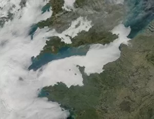
Background imageEarth Observation Collection: Satellite view showing low clouds over the English Channel

Satellite view showing low clouds over the English Channel
March 13, 2014 - Satellite view showing low clouds over the English Channel

Background imageEarth Observation Collection: Satellite view of Russias Kamchatka Peninsula

Satellite view of Russias Kamchatka Peninsula
January 11, 2013 - Satellite view of Russias Kamchatka Peninsula. The active volcanos Shiveluch, Bezymianny, Tolbachik, and Kizimen were all erupting simultaneously in this image

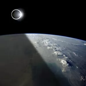
Background imageEarth Observation Collection: A solar eclipses partially shades the Earth below

A solar eclipses partially shades the Earth below while the emerging sun lights the remainder of the planet

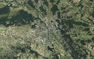
Background imageEarth Observation Collection: Satellite view of Warsaw, Poland

Satellite view of Warsaw, Poland
September 8, 2013 - Satellite view of Warsaw, Poland

Background imageEarth Observation Collection: Satellite view of a powerful weather system in the United States

Satellite view of a powerful weather system in the United States
Satellite view of a powerful weather system moving from the central U.S. to the east coast from March 11 to March 13, 2014

Background imageEarth Observation Collection: Visualization of global winds

Visualization of global winds
This atmospheric modeling visualization shows global winds from a GEOS-5 simulation using 10-kilometer resolution. Surface winds (0 to 40 meters/second)

Background imageEarth Observation Collection: Earth vegetation globes, artworks C018 / 3559

Earth vegetation globes, artworks C018 / 3559
Earth vegetation globes. Artwork of Earth globes with vegetation cover pictured as a scale, or index of greenness. Greenness is based on several factors: the number and type of plants

Background imageEarth Observation Collection: Milton Keynes, aerial photograph C017 / 0653

Milton Keynes, aerial photograph C017 / 0653
Milton Keynes, aerial photograph. The main rectangular portion of the image shows the shopping district in central Milton Keynes. It is surrounded by residential housing

Background imageEarth Observation Collection: Southampton, aerial photograph C017 / 0655

Southampton, aerial photograph C017 / 0655
Southampton, aerial photograph. The sports stadium at bottom centre is St. Marys football stadium which lies next to the River Itchen

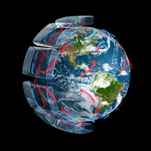
Background imageEarth Observation Collection: Global winds, artwork C017 / 7235

Global winds, artwork C017 / 7235
Global winds. Computer artwork showing the path of the prevailing and dominant winds around the globe, caused by the rotation of the Earth and the Coriolis effect

Background imageEarth Observation Collection: Coriolis effect, artwork C017 / 7211

Coriolis effect, artwork C017 / 7211
Coriolis effect. Computer artwork of a globe, showing how the Coriolis effect affects the motion (red arrows) of free-moving objects in the northern and southern hemispheres of the Earth

Background imageEarth Observation Collection: Brighton, aerial photograph C016 / 9926

Brighton, aerial photograph C016 / 9926
Brighton, aerial photograph. Brighton Marine and Palace Pier is visible at centre, bottom along the beach front. To the far left are the remains of the West Pier which was closed in 1975

Background imageEarth Observation Collection: Global winds, artwork C017 / 7234

Global winds, artwork C017 / 7234
Global winds. Computer artwork showing the path of the prevailing and dominant winds around the globe, caused by the rotation of the Earth and the Coriolis effect

Background imageEarth Observation Collection: Cardiff city centre, aerial photograph C016 / 9928

Cardiff city centre, aerial photograph C016 / 9928
Cardiff city centre, aerial photograph. The large sports ground at lower centre left is the Cardiff Millennium Stadium. To the north of the stadium is the circular structure of Cardiff Castle

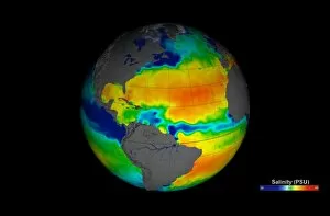
Background imageEarth Observation Collection: Sea surface salinity, Aquarius image C017 / 6816

Sea surface salinity, Aquarius image C017 / 6816
Sea surface salinity, Aquarius image. Computer model showing the salinity (dissolved salt-content) of the Atlantic Ocean, based on information recorded by the Aquarius spacecraft from December 2011

Background imageEarth Observation Collection: Aircraft graveyard, USA C017 / 7654

Aircraft graveyard, USA C017 / 7654
Aircraft graveyard, Davis-Monthan Air force Base, Tucson, Arizona, USA. The largest of its kind in the world, hundreds of old military

Background imageEarth Observation Collection: Gravelly Hill Interchange, aerial view C017 / 0657

Gravelly Hill Interchange, aerial view C017 / 0657
Gravelly Hill Interchange, UK, aerial photograph. This interchange lies off junction 6 on the M6 motorway where it meets the A38(M)

Background imageEarth Observation Collection: Solar array panel, ISS image

Solar array panel, ISS image. Photograph of the sun through the solar array panels of the International Space Station (ISS). In the background can be seen the thin blue line of the Earths atmosphere

Background imageEarth Observation Collection: Arctic ice minimum extent, 2012

Arctic ice minimum extent, 2012
Arctic ice minimum extent. Satellite image showing the Arctic polar ice cap at its annual minimum extent on 16th September 2012

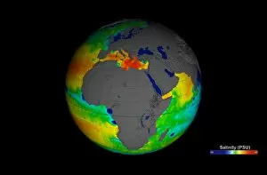
Background imageEarth Observation Collection: Sea surface salinity, Aquarius image C017 / 6820

Sea surface salinity, Aquarius image C017 / 6820
Sea surface salinity, Aquarius image. Computer model showing the salinity (dissolved salt-content) of the oceans around Africa

Background imageEarth Observation Collection: Dartford, aerial photograph C016 / 9930

Dartford, aerial photograph C016 / 9930
Dartford, UK, aerial photograph. At lower left is Queen Elizabeth II bridge which spans the River Thames. Directly beneath the bridge is the Dartford Crossing and the Dartford tunnel

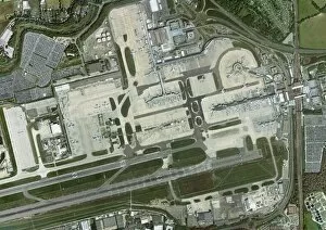
Background imageEarth Observation Collection: Gatwick airport, aerial photograph C016 / 9932

Gatwick airport, aerial photograph C016 / 9932
Gatwick airport, aerial photograph. Photographed in 2012

Background imageEarth Observation Collection: Columbia Glacier, Alaska, 1989

Columbia Glacier, Alaska, 1989
Columbia Glacier, Alaska. False-colour satellite image of the Columbia Glacier, Alaska, USA, taken in 1989. Columbia Glacier descends from an ice field (top) 3, 050 metres above sea level

Background imageEarth Observation Collection: St Pauls Cathedral, aerial photograph

St Pauls Cathedral, aerial photograph
St Pauls Cathedral, London, aerial photograph. Photographed in 2011


All Professionally Made to Order for Quick Shipping

"Earth Observation: Glimpses of Our Pale Blue Dot and Beyond" In the vast expanse of space, Voyager 1 captured an awe-inspiring image that forever changed our perspective. The iconic "Pale Blue Dot" photograph revealed Earth as a tiny speck in the cosmic ocean, reminding us of our interconnectedness on this magnificent planet. Zooming in closer, we witness the intricate details of human achievements. The Wimbledon tennis complex stands out amidst the bustling cityscape of London, UK. From high above, a satellite image showcases the British Isles with its lush green landscapes and rugged coastlines – a testament to nature's beauty. As night falls, lights illuminate cities across Europe like constellations on Earth's canvas. A mesmerizing satellite image captures the brilliance of UK at night from space – a tapestry woven by millions living their lives under starry skies. Expanding further into darkness reveals Europe at night; clusters of light representing vibrant metropolises and quiet towns alike. And then there it is - an astonishing view showcasing our entire planet bathed in nocturnal glow - Whole Earth at night seen from space. Venturing beyond terrestrial boundaries, Tenerife emerges through a satellite lens – its volcanic terrain contrasting against azure waters surrounding this Spanish island paradise. The International Space Station floats gracefully in orbit around Earth during 2008 – humanity's outpost where astronauts conduct research while gazing back upon their home planet with wonderment. From afar, another satellite image depicts Earth from space - swirling clouds dance over continents and oceans; an ever-changing masterpiece painted by atmospheric currents and weather patterns. Closer to home once more, Scotland's stunning landscape unfolds beneath us through yet another captivating satellite image. Majestic mountains blend seamlessly with lochs and glens creating breathtaking scenery that captivates all who behold it.