Fraud Blocker Skip to main content

Chart Collection (page 2)

"Unlocking the Secrets: Exploring the Fascinating World of Charts" Dive into the realm of reflexology with a detailed foot map chart

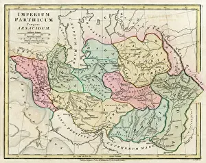
Background imageChart Collection: Map of Persia (Iran)

Map of Persia (Iran) - all place names in their Latin form. The ancient realms of Assyria, Babylonia Date: 1807

Background imageChart Collection: Portolan chart, 1591. Map of the Pacific Ocean

Portolan chart, 1591. Map of the Pacific Ocean. It depicts the western coast of Central and South America, from Mexico to the Strait of Magellan. Renaissance art. Miniature Painting

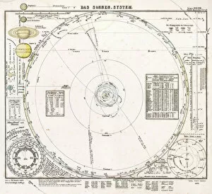
Background imageChart Collection: Solar system map from 1853

Solar system map from 1853
Historical map of the solar system, published in Germany in 1853. The main diagram shows the orbits of the first seven planets out to Uranus

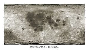
Background imageChart Collection: Spacecraft on the Moon, lunar map

Spacecraft on the Moon, lunar map
Spacecraft on the Moon. Map showing coloured markers for 34 spacecraft that impacted or landed on the Moon from the 1960s onwards

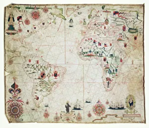
Background imageChart Collection: 17th Century nautical map of the Atlantic

17th Century nautical map of the Atlantic Ocean. Historical portolan chart showing the Atlantic Ocean and adjacent continents

Background imageChart Collection: Geological map, South-East England, 1830s

Geological map, South-East England, 1830s. This map, dating from between 1830 and 1833, shows the denudation of The Weald

Background imageChart Collection: NATI2A-00094

NATI2A-00094
Cherokee alphabet developed by Sequoyah. Woodcut reproduction with a watercolor wash

Background imageChart Collection: A Map of the Island of Chios

A Map of the Island of Chios
A Turkish Map of the Greek Island of Chios, at this point under Ottoman Turkish control. The island is in the Aegean Sea only 5 miles off the coast of Asia Minor

Background imageChart Collection: British Forest Trees

British Forest Trees
A chart of British forest trees

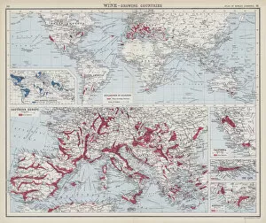
Background imageChart Collection: Wine, growing countries (colour litho)

Wine, growing countries (colour litho)
3648621 Wine, growing countries (colour litho) by English School, (20th century); Private Collection; (add.info.: Wine, growing countries)

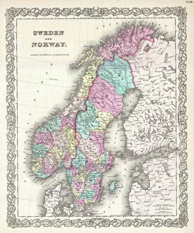
Background imageChart Collection: 1855, Colton Map of Scandinavia, Norway, Sweden, Finland, topography, cartography

1855, Colton Map of Scandinavia, Norway, Sweden, Finland, topography, cartography
1855, Colton Map of Scandinavia, Norway, Sweden, Finland

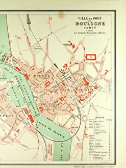
Background imageChart Collection: Map of Boulogne Sur Mer

Map of Boulogne Sur Mer

Background imageChart Collection: D Napier and Son - Deltic

D Napier and Son - Deltic
General arrangement of Deltic 18-11B MTB Driving End

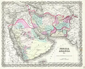
Background imageChart Collection: 1855, Colton Map of Persia, Afghanistan, and Arabia, topography, cartography, geography

1855, Colton Map of Persia, Afghanistan, and Arabia, topography, cartography, geography
1855, Colton Map of Persia, Afghanistan, and Arabia

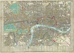
Background imageChart Collection: 1848, Crutchley Pocket Map or Plan of London, England, topography, cartography, geography

1848, Crutchley Pocket Map or Plan of London, England, topography, cartography, geography
1848, Crutchley Pocket Map or Plan of London, England

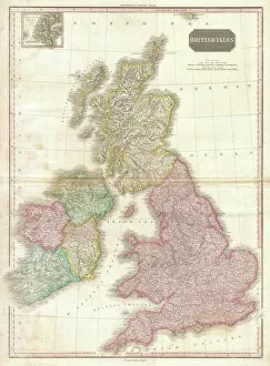
Background imageChart Collection: 1818, Pinkerton Map of the British Isles, England, Scotland, Ireland, John Pinkerton

1818, Pinkerton Map of the British Isles, England, Scotland, Ireland, John Pinkerton, 1758 - 1826, Scottish antiquarian, cartographer, UK

Background imageChart Collection: Map of Litchfield in Staffordshire, England Victorian Engraving, 1840

Map of Litchfield in Staffordshire, England Victorian Engraving, 1840
Very Rare, Beautifully Illustrated Antique Engraving of Map of Litchfield in Worcestershire, England Victorian Engraving, 1840. Source: Original edition from my own archives

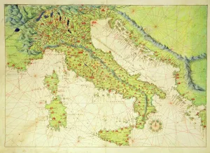
Background imageChart Collection: Italy, from an Atlas of the World in 33 Maps, Venice, 1st September 1553 (ink on vellum)

Italy, from an Atlas of the World in 33 Maps, Venice, 1st September 1553 (ink on vellum)
XOT330948 Italy, from an Atlas of the World in 33 Maps, Venice, 1st September 1553 (ink on vellum) by Agnese, Battista (1514-64); Museo Correr, Venice, Italy; Italian, out of copyright

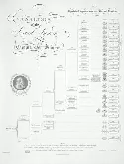
Background imageChart Collection: Plant sex system by Linnaeus, 1807

Plant sex system by Linnaeus, 1807
Plant sex system by Linnaeus. This diagram, laying out the sexual classification of plants devised by the Swedish botanist Carl Linnaeus (1707-1778)

Background imageChart Collection: SKY CHART

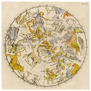
SKY CHART
Sky chart showing the signs of the Zodiac and other celestial features

Background imageChart Collection: Masonic chart

Masonic chart. Date c1846 May 28

Background imageChart Collection: Johnsons new chart of national emblems

Johnsons new chart of national emblems

Background imageChart Collection: Early map of the Moon, 1635

Early map of the Moon, 1635
Map of the Moon, by Johann Doppelmayr (1671- 1750). This early engraving of the Moon by the German mathematician and astronomer Doppelmayer is thought to date from 1730

Background imageChart Collection: Manhattan map, 1780s

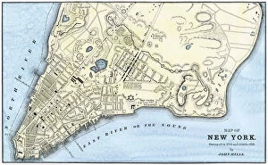
Manhattan map, 1780s
John Hills map of New York City, surveyed in 1782, drawn in 1785. Hand-colored woodcut reproduction of an 18th-century illustration

Background imageChart Collection: New York City map, 1767

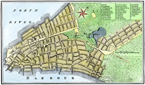
New York City map, 1767
Map of New York City in 1767. Hand-colored woodcut of an 18th-century illustration

Background imageChart Collection: WW1 - Trench map from a soldiers war diary showing the Somme Battlefield with

WW1 - Trench map from a soldiers war diary showing the Somme Battlefield with information gleaned from captured German Prisoners

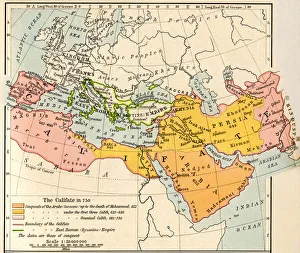
Background imageChart Collection: Map of the Muslim expansion and the Byzantine Empire at the end of the Umayyad Caliphate, in 750

Map of the Muslim expansion and the Byzantine Empire at the end of the Umayyad Caliphate, in 750. From Historical Atlas, published 1923

Background imageChart Collection: Seamless Astronomical Constellation Night Sky Pattern

Seamless Astronomical Constellation Night Sky Pattern
Simple, modern seamless astronomy patterned background with major star captions against a night sky and galaxy

Background imageChart Collection: Anatomy of Organs Engraving

Anatomy of Organs Engraving
Engraved illustrations of Anatomy of the Fasciae, Integuents, and Organs of Mastication and Respiration from Iconographic Encyclopedia of Science, Literature and Art, Published in 1851

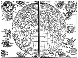
Background imageChart Collection: Johannes Stabius map of the world, 1515, (1936). Artist: Albrecht Durer

Johannes Stabius map of the world, 1515, (1936). Artist: Albrecht Durer
Johannes Stabius map of the world, 1515, (1936). A print from Durer, Und Seine Zeit, by Wilhelm Waetzoldt, Grosse Phaidon Ausgabe, 1936

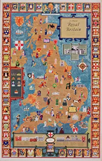
Background imageChart Collection: Poster, Map of Royal Britain

Poster, Map of Royal Britain. 1957

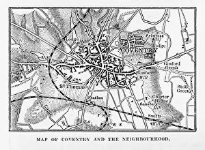
Background imageChart Collection: Map of Coventry in Warwickshire, England Victorian Engraving, 1840

Map of Coventry in Warwickshire, England Victorian Engraving, 1840
Very Rare, Beautifully Illustrated Antique Engraving of Map of Coventry in Warwickshire, England Victorian Engraving, 1840. Source: Original edition from my own archives

Background imageChart Collection: Vintage Map of the World

Vintage Map of the World
Vintage map of the world from 1837

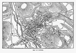
Background imageChart Collection: Map of Exeter in Devon, England Victorian Engraving, 1840

Map of Exeter in Devon, England Victorian Engraving, 1840
Very Rare, Beautifully Illustrated Antique Engraving of Map of Exeter in Devon, England Victorian Engraving, 1840. Source: Original edition from my own archives

Background imageChart Collection: A plan of Cowden Furnace with pond and land in the parish of Cowden in Kent belonging

A plan of Cowden Furnace with pond and land in the parish of Cowden in Kent belonging to Mr William Bowen surveyed by John Bowra in 1748

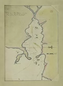
Background imageChart Collection: An eye-sketch of Port Stephens, to the north of Broken Bay

An eye-sketch of Port Stephens, to the north of Broken Bay
Drawing LS 4 from the Watling Collection titled High water at Port Stephens at 10 o clock by a Port Jackson Painter, 1791-1792

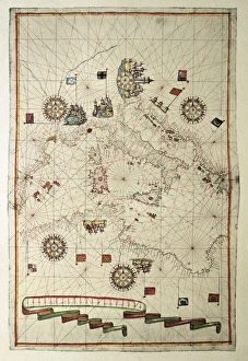
Background imageChart Collection: Portolan chart, 1582. Map of the central part

Portolan chart, 1582. Map of the central part of the Mediterranean sea. Printed in Messina. Renaissance art. Miniature Painting

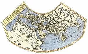
Background imageChart Collection: EXPL2A-00014

EXPL2A-00014
Ptolemys map of the world, illustrating a concept of the flat earth. Hand-colored 19th-century woodcut reproduction

Background imageChart Collection: Battle of Gettysburg Map, July 3, 1863 Civil War Engraving

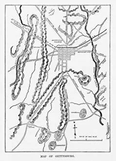
Battle of Gettysburg Map, July 3, 1863 Civil War Engraving
Engraving of the Map of the Battle of Gettysburgs, Pennsylvania, July 3, 1863 Civil War Engraving from Famous Leaders and Battle Scenes of the Civil War, Published in 1864

Background imageChart Collection: Map of Pamlico and Albemarle Sounds

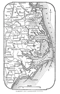
Map of Pamlico and Albemarle Sounds
Vintage engraving from 1863 of a map of Map of Pamlico and Albemarle Sounds at the time of the American Civil War

Background imageChart Collection: Antquie Map of Italy

Antquie Map of Italy
Vintage map of Italy from 1815

Background imageChart Collection: Map of Soviet Central Asia

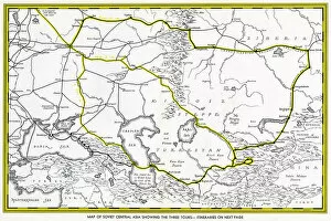
Map of Soviet Central Asia - showing marked tour routes. Date: 1933
Background imageChart Collection: The new world revealed to Islam in 1513. The map of the Atlantic, work of Admiral

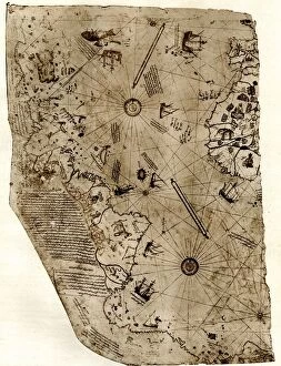
The new world revealed to Islam in 1513. The map of the Atlantic, work of Admiral Piri Reis, the celebrated Turkish cartographer

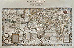
Background imageChart Collection: Carta marina (map of the sea). 1516. Facsimile

Carta marina (map of the sea). 1516. Facsimile
" Carta marina (map of the sea). 1516. Facsimile. Sea map described by Carlos Sainz in his work " The name of America". Engraving. SPAIN. Madrid. Americas Museum."

Background imageChart Collection: Nautical chart entitled King Hamy. 1502. Parchment

Nautical chart entitled King Hamy. 1502. Parchment
" Nautical chart entitled " King Hamy". 1502. Parchment. Miniature Painting. SPAIN. Barcelona. Barcelona Maritime Museum."

Background imageChart Collection: Manhattan map, 1789

Manhattan map, 1789
Map of the City of New York, 1789. Hand-colored woodcut reproduction of an 18th century illustration

Background imageChart Collection: EXPL2A-00377

EXPL2A-00377
Chart of the West Indies sea depths and land elevations. Printed color lithograph of a 19th-century illustration
Background imageChart Collection: PEXP2A-00015

PEXP2A-00015
Captain James Cook regarding a map. Hand-colored woodcut of a painting


All Professionally Made to Order for Quick Shipping

"Unlocking the Secrets: Exploring the Fascinating World of Charts" Dive into the realm of reflexology with a detailed foot map chart, revealing hidden connections between pressure points and overall well-being. Immerse yourself in breathtaking artwork as "Kiss of the Oceans" captures the meeting point between Atlantic and Pacific through a mesmerizing chart inspired by the Panama Canal. Travel back in time with a captivating map showcasing the vast Ancient Persian Empire, unraveling its grandeur and historical significance. Follow in the footsteps of greatness as you trace King Alexander the Great's conquests on an intricate chart mapping his empire's expansion across continents. Join forces with The Salvation Army Campaign through their emblematic chart, highlighting their noble mission to bring hope and aid to those in need. Unveil Masonic mysteries through an enchanting chart that delves into both symbolic imagery and rich history surrounding Free and Accepted Masons. Embark on a journey through time with a remarkable Masonic chart, shedding light on ancient rituals, traditions, and brotherhood within this enigmatic society. Explore distant lands from centuries past as an Anglo-Saxon 10th-century world map unfolds before your eyes, offering insights into early cartography techniques. Discover rugged beauty amidst towering peaks with an old map of the Alps; let it guide you through nature's wonders while tracing historic routes taken by explorers long ago. Gain strategic insight during WWII using a military-focused map of Beirut, Lebanon; uncover hidden locations crucial for wartime operations throughout this historically significant cityscape. Step back in time to 1768 Edinburgh as James Craig's Map reveals New Town's first plan—a testament to meticulous topography shaping Scotland's capital cityscape over centuries. Test your vision acuity against an eye-catching eyesight test chart; decipher letters or symbols while appreciating the importance of visual health in our daily lives.