Fraud Blocker Skip to main content

Chart Collection (page 4)

"Unlocking the Secrets: Exploring the Fascinating World of Charts" Dive into the realm of reflexology with a detailed foot map chart

Background imageChart Collection: Map of European Railway Lines

Map of European Railway Lines

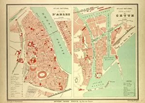
Background imageChart Collection: Map of Arles and Cette, France

Map of Arles and Cette, France

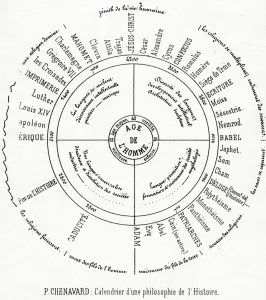
Background imageChart Collection: A Calender of a philosophy of History (printed paper)

A Calender of a philosophy of History (printed paper)
XJF439981 A Calender of a philosophy of History (printed paper) by Chenavard, Paul Marc Joseph (1807-1895); Private Collection; (add.info.: A diagram of Chenavards philosophy of history)

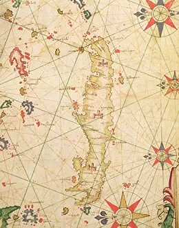
Background imageChart Collection: The Island of Crete, from a nautical atlas, 1651 (ink on vellum) (detail from 330925)

The Island of Crete, from a nautical atlas, 1651 (ink on vellum) (detail from 330925)
XOT330926 The Island of Crete, from a nautical atlas, 1651 (ink on vellum) (detail from 330925) by Pietro Giovanni Prunes (fl. 17th Century); Museo Correr, Venice, Italy; Italian, out of copyright

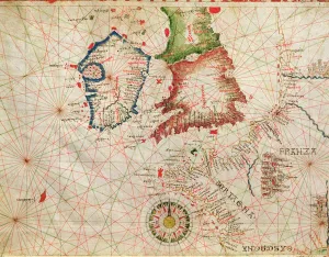
Background imageChart Collection: The French Coast, England, Scotland and Ireland, from a nautical atlas, 1520 (ink on vellum)

The French Coast, England, Scotland and Ireland, from a nautical atlas, 1520 (ink on vellum)
XOT330911 The French Coast, England, Scotland and Ireland, from a nautical atlas, 1520 (ink on vellum) (detail from 330910) by Giovanni Xenodocus da Corfu (fl)

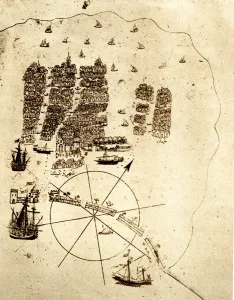
Background imageChart Collection: Venice, as a retired Turkish Admiral saw it in the early sixteenth ceuntry: a miniature

Venice, as a retired Turkish Admiral saw it in the early sixteenth ceuntry: a miniature from Piri Reiss geographical work on the Mediterranean; showing an arsenal with galleys building; the lagoon;

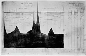
Background imageChart Collection: Chart of oceanic section, Madeira, Portugal to St. Vincent

Chart of oceanic section, Madeira, Portugal to St. Vincent
A photograph taken during the voyage of H.M.S. Challenger (1872-1876) funded by the British Government for scientific purposes

Background imageChart Collection: Illustrated political chart, a cartoon of American politics

Illustrated political chart, a cartoon of American politics and the Tapeworm Party. Print shows James G. Blaine as the head of a tapeworm made up of various government scandals over a map of

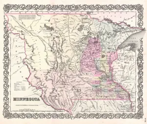
Background imageChart Collection: 1855, Colton Map of Minnesota, topography, cartography, geography, land, illustration

1855, Colton Map of Minnesota, topography, cartography, geography, land, illustration
1855, Colton Map of Minnesota

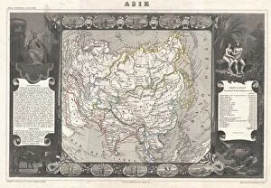
Background imageChart Collection: 1852, Levasseur Map of Asia, topography, cartography, geography, land, illustration

1852, Levasseur Map of Asia, topography, cartography, geography, land, illustration
1852, Levasseur Map of Asia

Background imageChart Collection: 1863, Cassells Dispatch Atlas Map of Taiwan, Formosa and the Hainan Coast of China

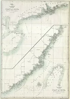
1863, Cassells Dispatch Atlas Map of Taiwan, Formosa and the Hainan Coast of China

Background imageChart Collection: 1835, S. D. U. K. City Map or Plan of Amsterdam, The Netherlands, topography, cartography

1835, S. D. U. K. City Map or Plan of Amsterdam, The Netherlands, topography, cartography
1835, S.D.U.K. City Map or Plan of Amsterdam, The Netherlands

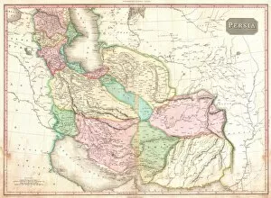
Background imageChart Collection: 1818, Pinkerton Map of Persia, Iran, Afghanistan, John Pinkerton, 1758 - 1826, Scottish

1818, Pinkerton Map of Persia, Iran, Afghanistan, John Pinkerton, 1758 - 1826, Scottish antiquarian, cartographer, UK

Background imageChart Collection: Map of French Railway Lines

Map of French Railway Lines

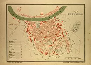
Background imageChart Collection: Map of Grenoble, France

Map of Grenoble, France

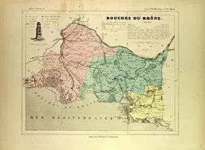
Background imageChart Collection: Map of Bouches Du Rhone, France

Map of Bouches Du Rhone, France

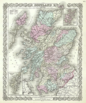
Background imageChart Collection: 1855, Colton Map of Scotland, topography, cartography, geography, land, illustration

1855, Colton Map of Scotland, topography, cartography, geography, land, illustration
1855, Colton Map of Scotland

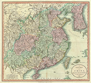
Background imageChart Collection: 1801, Cary Map of China and Korea, John Cary, 1754 - 1835, English cartographer, topography

1801, Cary Map of China and Korea, John Cary, 1754 - 1835, English cartographer, topography
1801, Cary Map of China and Korea, John Cary, 1754 - 1835, English cartographer

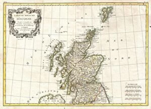
Background imageChart Collection: 1772, Bonne Map of Scotland, Rigobert Bonne 1727 - 1794, one of the most important

1772, Bonne Map of Scotland, Rigobert Bonne 1727 - 1794, one of the most important cartographers of the late 18th century

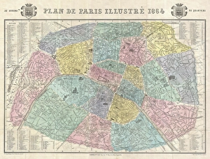
Background imageChart Collection: 1864, Garnier Map of Pairs, France w-Monuments, topography, cartography, geography

1864, Garnier Map of Pairs, France w-Monuments, topography, cartography, geography
1864, Garnier Map of Pairs, France w-Monuments

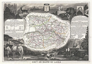
Background imageChart Collection: 1852, Levasseur Map of the Department De Maine et Loire, France, topography, cartography

1852, Levasseur Map of the Department De Maine et Loire, France, topography, cartography
1852, Levasseur Map of the Department De Maine et Loire, France

Background imageChart Collection: 1801, Cary Map of Scotland, 4 Sheets, John Cary, 1754 - 1835, English cartographer

1801, Cary Map of Scotland, 4 Sheets, John Cary, 1754 - 1835, English cartographer

Background imageChart Collection: Map of Savoie, 1896, France

Map of Savoie, 1896, France

Background imageChart Collection: Map of Steiermark, Austria, 1899

Map of Steiermark, Austria, 1899

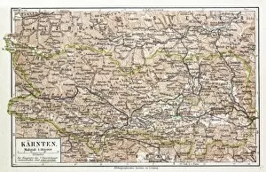
Background imageChart Collection: Map of Karnten, Austria, 1899

Map of Karnten, Austria, 1899

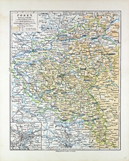
Background imageChart Collection: Map of Posen (Poznan), Poland, 1899

Map of Posen (Poznan), Poland, 1899

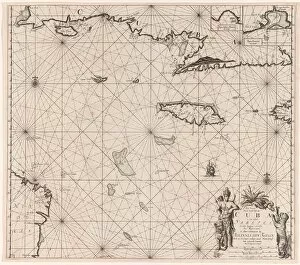
Background imageChart Collection: Sea chart of the south coast of Cuba and Jamaica, Jan Luyken, Claes Jansz Voogt

Sea chart of the south coast of Cuba and Jamaica, Jan Luyken, Claes Jansz Voogt, Johannes van Keulen (I), 1684 - 1799

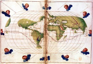
Background imageChart Collection: Map of Magellans round the world voyage, 1519-1521

Map of Magellans round the world voyage, 1519-1521. A Portuguese-born navigator sponsored by Spain, Ferdinand Magellan (c1480-1521)

Map showing the distribution of the Aryan speaking peoples between about 1,000 - 500 BC. (print)
7420094 Map showing the distribution of the Aryan speaking peoples between about 1,000 - 500 BC. (print); (add.info.: Map showing the distribution of the Aryan speaking peoples between about 1,000)

Map of Europe, 1848 - 1871. (print)
7420064 Map of Europe, 1848 - 1871. (print); (add.info.: Map of Europe, 1848 - 1871. From the book Outline of History by H.G. Wells, published 1920.); Photo © Ken Welsh. All rights reserved 2024

Background imageChart Collection: Sketch map showing Boston and neighbourhood, 1775. (print)

Sketch map showing Boston and neighbourhood, 1775. (print)
7420060 Sketch map showing Boston and neighbourhood, 1775. (print); (add.info.: Sketch map showing Boston and neighbourhood, 1775. From the book Outline of History by H.G)

Map of the World showing the chief voyages of exploration, to 1522. (print)
7420054 Map of the World showing the chief voyages of exploration, to 1522. (print); (add.info.: Map of the World showing the chief voyages of exploration, to 1522)

Background imageChart Collection: Map showing the Timurid Empire (print)

Map showing the Timurid Empire (print)
7420052 Map showing the Timurid Empire (print); Photo © Ken Welsh. All rights reserved 2024.

Background imageChart Collection: Map of the Ottoman Empire before 1453. (print)

Map of the Ottoman Empire before 1453. (print)
7420051 Map of the Ottoman Empire before 1453. (print); (add.info.: Map of the Ottoman Empire before 1453. From the book Outline of History by H.G. Wells, published 1920.); Photo © Ken Welsh

Background imageChart Collection: Map of the Mongol States c. 1280 AD and Marco Polo's travels. (print)

Map of the Mongol States c. 1280 AD and Marco Polo's travels. (print)
7420050 Map of the Mongol States c. 1280 AD and Marco Polo's travels. (print); (add.info.: Map of the Mongol States c. 1280 AD and Marco Polo's travels)

Map showing the beginnings of the Moslem Power, 7th century. (print)
7420043 Map showing the beginnings of the Moslem Power, 7th century. (print); (add.info.: Map showing the beginnings of the Moslem Power, 7th century. From the book Outline of History by H.G)

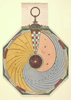
Background imageChart Collection: Volvelle to show how to find the time, in hours and minutes, in which the Moon reaches one of its

Volvelle to show how to find the time, in hours and minutes, in which the Moon reaches one of its aspects
7340909 Volvelle to show how to find the time, in hours and minutes, in which the Moon reaches one of its aspects. The disc is fixed and is read by a wire in the centre

Marine diagram of flowers, c.1810 (engraving & etching)
7340669 Marine diagram of flowers, c.1810 (engraving & etching) by Benard, Robert (fl.1734); 24.7x17.7 cm; National Maritime Museum, London

Background imageChart Collection: Rules of the North Star, 16th century (manuscript)

Rules of the North Star, 16th century (manuscript)
7339147 Rules of the North Star, 16th century (manuscript) by Portuguese School, (16th century); 49x70.5 cm; National Maritime Museum, London, UK; (add.info.: North Star rules)

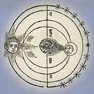
Background imageChart Collection: ASTRONOMY Geocentric system, 13th century (engraving)

ASTRONOMY Geocentric system, 13th century (engraving)
7272463 ASTRONOMY Geocentric system, 13th century (engraving); (add.info.: ASTRONOMY Geocentric system 'The Earth is immovable at the center of the Universe between the Sun)

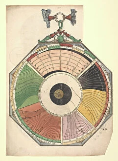
Background imageChart Collection: Volvelle illustrating the magnitude, start time and duration of eclipses

Volvelle illustrating the magnitude, start time and duration of eclipses, 1540 (hand-coloured engraving)
7340904 Volvelle illustrating the magnitude, start time and duration of eclipses, 1540 (hand-coloured engraving) by Apianus, Petrus (1495-1552); National Maritime Museum, London

Background imageChart Collection: Transparent diagram of the phases of the moon, 1846-60 (paper, engraving)

Transparent diagram of the phases of the moon, 1846-60 (paper, engraving)
7340572 Transparent diagram of the phases of the moon, 1846-60 (paper, engraving) by Reynolds, James (fl.c.1846-60) & Emslie, John (1813-75); 29.2x23.5 cm; National Maritime Museum, London

Map of the chief foreign settlements in India at the end of the 17th century (print)
7420058 Map of the chief foreign settlements in India at the end of the 17th century (print); (add.info.: Map of the chief foreign settlements in India at the end of the 17th century)

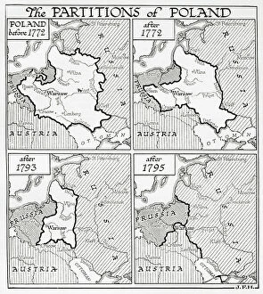
Map showing the partitions of Poland, 18th century. (print)
7420057 Map showing the partitions of Poland, 18th century. (print); (add.info.: Map showing the partitions of Poland, from top left, Poland before 1772, after 1772, after 1793 and after 1795)

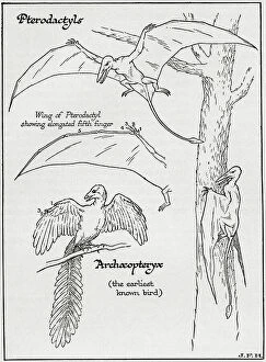
Background imageChart Collection: Pterodactyl and Archaeopteryx (print)

Pterodactyl and Archaeopteryx (print)
7420074 Pterodactyl and Archaeopteryx (print); (add.info.: Diagram of a Pterodactyl, its wing showing the elongated 5th finger and an Archaeopteryx. From the book Outline of History by H.G)

Map showing the trail of Napoleon, 1785-1815. (print)
7420061 Map showing the trail of Napoleon, 1785-1815. (print); (add.info.: Map showing the trail of Napoleon, 1785-1815. From the book Outline of History by H.G)

Background imageChart Collection: Map of Europe at the time of the Fall of Constantinople, 15th century. (print)

Map of Europe at the time of the Fall of Constantinople, 15th century. (print)
7420053 Map of Europe at the time of the Fall of Constantinople, 15th century. (print); (add.info.: Map of Europe at the time of the Fall of Constantinople, 15th century)

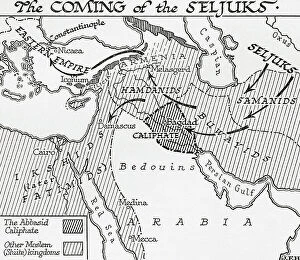
Background imageChart Collection: Map showing the coming of the Seljuks, 11th century. (print)

Map showing the coming of the Seljuks, 11th century. (print)
7420047 Map showing the coming of the Seljuks, 11th century. (print); (add.info.: Map showing the coming of the Seljuks, 11th century. From the book Outline of History by H.G)


All Professionally Made to Order for Quick Shipping

"Unlocking the Secrets: Exploring the Fascinating World of Charts" Dive into the realm of reflexology with a detailed foot map chart, revealing hidden connections between pressure points and overall well-being. Immerse yourself in breathtaking artwork as "Kiss of the Oceans" captures the meeting point between Atlantic and Pacific through a mesmerizing chart inspired by the Panama Canal. Travel back in time with a captivating map showcasing the vast Ancient Persian Empire, unraveling its grandeur and historical significance. Follow in the footsteps of greatness as you trace King Alexander the Great's conquests on an intricate chart mapping his empire's expansion across continents. Join forces with The Salvation Army Campaign through their emblematic chart, highlighting their noble mission to bring hope and aid to those in need. Unveil Masonic mysteries through an enchanting chart that delves into both symbolic imagery and rich history surrounding Free and Accepted Masons. Embark on a journey through time with a remarkable Masonic chart, shedding light on ancient rituals, traditions, and brotherhood within this enigmatic society. Explore distant lands from centuries past as an Anglo-Saxon 10th-century world map unfolds before your eyes, offering insights into early cartography techniques. Discover rugged beauty amidst towering peaks with an old map of the Alps; let it guide you through nature's wonders while tracing historic routes taken by explorers long ago. Gain strategic insight during WWII using a military-focused map of Beirut, Lebanon; uncover hidden locations crucial for wartime operations throughout this historically significant cityscape. Step back in time to 1768 Edinburgh as James Craig's Map reveals New Town's first plan—a testament to meticulous topography shaping Scotland's capital cityscape over centuries. Test your vision acuity against an eye-catching eyesight test chart; decipher letters or symbols while appreciating the importance of visual health in our daily lives.