Fraud Blocker Skip to main content

Chart Collection (page 12)

"Unlocking the Secrets: Exploring the Fascinating World of Charts" Dive into the realm of reflexology with a detailed foot map chart

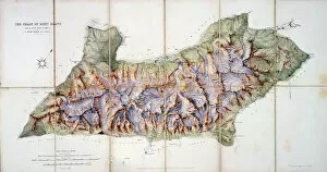
Background imageChart Collection: The Chain of Mont Blanc, from an actual survey in 1863 by A

The Chain of Mont Blanc, from an actual survey in 1863 by A
STC184871 The Chain of Mont Blanc, from an actual survey in 1863 by A. Adams Reilly, published in A Record of Mountain Adventure and Scientific Observation for the Alpine Club

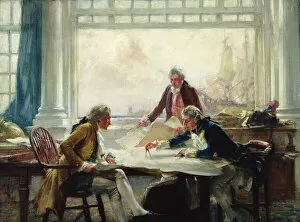
Background imageChart Collection: A Plan of Campaign (oil on canvas)

A Plan of Campaign (oil on canvas)
BOU217116 A Plan of Campaign (oil on canvas) by McCormick, Arthur David (1860-1943); 56x76.2 cm; Private Collection; Bourne Gallery, Reigate, Surrey; English, out of copyright

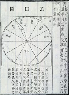
Background imageChart Collection: Algebra, illustration from The Nine Chapters on the Mathematical Art

Algebra, illustration from The Nine Chapters on the Mathematical Art
XEE3091080 Algebra, illustration from The Nine Chapters on the Mathematical Art, by JiC" zhung SuAnshu (ink on paper) by Chinese School; Private Collection; Stefano Bianchetti; Chinese

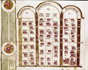
Background imageChart Collection: All localities founded by the Hebrew people during three years of exodus

All localities founded by the Hebrew people during three years of exodus
LRI702675 All localities founded by the Hebrew people during three years of exodus, Genealogy of the Bible (vellum) by Italian School, (14th century); Biblioteca Statale di Cremona

Background imageChart Collection: Ancient Alphabets, from the L Encyclopedie by Diderot and d

Ancient Alphabets, from the L Encyclopedie by Diderot and d
LSE702652 Ancient Alphabets, from the L Encyclopedie by Diderot and d Alembert (litho) by French School, (18th century); Musee des Arts Decoratifs, Paris

Background imageChart Collection: Ancient Oriental Alphabets, from the L Encyclopedie by Diderot and d

Ancient Oriental Alphabets, from the L Encyclopedie by Diderot and d
LSE702651 Ancient Oriental Alphabets, from the L Encyclopedie by Diderot and d Alembert (litho) by French School, (18th century); Musee des Arts Decoratifs, Paris

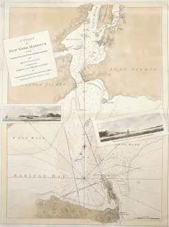
Background imageChart Collection: A chart of New York harbour, 1774-1779 (hand coloured etching tinted in sepia

A chart of New York harbour, 1774-1779 (hand coloured etching tinted in sepia
985888 A chart of New York harbour, 1774-1779 (hand coloured etching tinted in sepia, orange and red watercolou) by English School

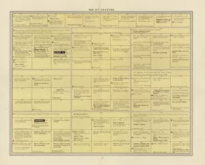
Background imageChart Collection: English History: The nineteenth century (colour litho)

English History: The nineteenth century (colour litho)
6029617 English History: The nineteenth century (colour litho) by English School, (19th century); Private Collection; (add.info.: The nineteenth century)

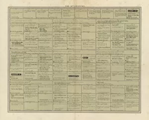
Background imageChart Collection: English History: The sixteenth century (colour litho)

English History: The sixteenth century (colour litho)
6029602 English History: The sixteenth century (colour litho) by English School, (19th century); Private Collection; (add.info.: The sixteenth century)

Background imageChart Collection: English History: The thirteenth century (colour litho)

English History: The thirteenth century (colour litho)
6029600 English History: The thirteenth century (colour litho) by English School, (19th century); Private Collection; (add.info.: The thirteenth century)

Background imageChart Collection: English History: The eleventh century (colour litho)

English History: The eleventh century (colour litho)
6029598 English History: The eleventh century (colour litho) by English School, (19th century); Private Collection; (add.info.: The eleventh century)

Background imageChart Collection: Chart showing the ranks and heraldic symbols of the British aristocracy (colour litho)

Chart showing the ranks and heraldic symbols of the British aristocracy (colour litho)
6030576 Chart showing the ranks and heraldic symbols of the British aristocracy (colour litho) by English School, (19th century); Private Collection; (add.info)

Background imageChart Collection: Fictional map charting the route through Betrothal Bay (colour litho)

Fictional map charting the route through Betrothal Bay (colour litho)
6031765 Fictional map charting the route through Betrothal Bay (colour litho) by English School, (20th century); Private Collection; (add.info)

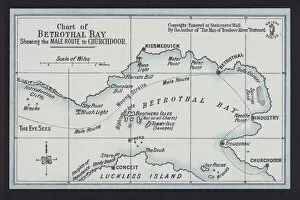
Background imageChart Collection: Chart of Betrothal Bay, shewing the Male Route to Churchdoor (colour litho)

Chart of Betrothal Bay, shewing the Male Route to Churchdoor (colour litho)
6032849 Chart of Betrothal Bay, shewing the Male Route to Churchdoor (colour litho) by English School, (19th century); Private Collection; (add.info.: Chart of Betrothal Bay)

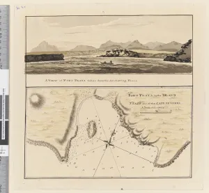
Background imageChart Collection: Page 3a Chart of Port Praya in the Island of St Jago, Cape Verde Islands

Page 3a Chart of Port Praya in the Island of St Jago, Cape Verde Islands
5670253 Page 3a Chart of Port Praya in the Island of St Jago, Cape Verde Islands. Titled Port Praya in the Island St Jago one of the Cape de Verds sic A scale of 2 to 1/2 a mile / A View of Port

Background imageChart Collection: iii. Sketches of the islands Lagoon, Thrum-Cap, Bow-Island, the Two Groups

iii. Sketches of the islands Lagoon, Thrum-Cap, Bow-Island, the Two Groups
5670248 iii. Sketches of the islands Lagoon, Thrum-Cap, Bow-Island, the Two Groups, Bird Island and Chain Island, lying in the South, Sea

Background imageChart Collection: Plate 27 from Atlas Coelestis, by John Flamsteed (1646-1719), pub

Plate 27 from Atlas Coelestis, by John Flamsteed (1646-1719), pub
STC128640 Plate 27 from Atlas Coelestis, by John Flamsteed (1646-1719), pub. in 1729 (hand coloured engraving) by Thornhill

Background imageChart Collection: Diagram explaining the art of heraldry, from The Gentlemans Recreation

Diagram explaining the art of heraldry, from The Gentlemans Recreation
483375 Diagram explaining the art of heraldry, from The Gentlemans Recreation published by Richard Blome, 1686 (engraving) by English School

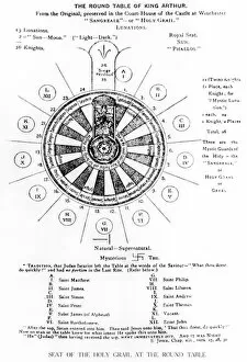
Background imageChart Collection: The Round Table of King Arthur (litho)

The Round Table of King Arthur (litho)
XJF365309 The Round Table of King Arthur (litho) by English School, (19th century); Private Collection; (add.info.: shows the table as the seat of the Holy Grail; places at the table are assigned to)

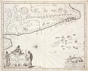
Background imageChart Collection: Map of the Coast of Malabar, East Indies, 1672 (engraving)

Map of the Coast of Malabar, East Indies, 1672 (engraving)
STC434932 Map of the Coast of Malabar, East Indies, 1672 (engraving) by Dutch School, (17th century); Private Collection; (add.info)

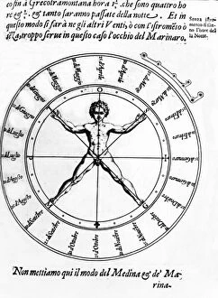
Background imageChart Collection: Illustration from Della Nautica Mediterranea by Bartolomeo Crescenzio

Illustration from Della Nautica Mediterranea by Bartolomeo Crescenzio
498319 Illustration from Della Nautica Mediterranea by Bartolomeo Crescenzio, published 1607 (engraving) by Italian School

Background imageChart Collection: Ms 1288 f. 25 Map of Brazil, from Dutch Marine Maps, 1637 (engraving)

Ms 1288 f. 25 Map of Brazil, from Dutch Marine Maps, 1637 (engraving)
BIF159065 Ms 1288 f.25 Map of Brazil, from Dutch Marine Maps, 1637 (engraving) by Vingboons, Philip (1607/8-78); Bibliotheque de l Institut de France, Paris, France; Dutch, out of copyright

Background imageChart Collection: Gestures for miming from John Bulwers Chrilogia Naturall Language of Hand

Gestures for miming from John Bulwers Chrilogia Naturall Language of Hand
XJF197469 Gestures for miming from John Bulwers Chrilogia Naturall Language of Hand, 1644 (engraving) (b/w photo) by English School, (17th century); Private Collection; English, out of copyright

Background imageChart Collection: Double representation accorded to the Third Estate by the Estates General

Double representation accorded to the Third Estate by the Estates General
XIR180021 Double representation accorded to the Third Estate by the Estates General, 17th December 1788 (coloured engraving) by French School, (18th century); Bibliotheque Nationale, Paris

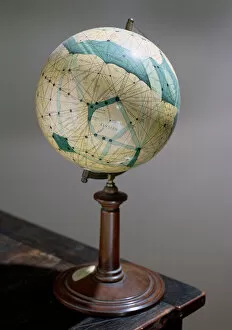
Background imageChart Collection: Globe of the planet Mars, made 1903-09

Globe of the planet Mars, made 1903-09
CHT176313 Globe of the planet Mars, made 1903-09 by Lowell, Percival (1855-1916) (after); Observatoire Camille Flammarion, Juvisy

Background imageChart Collection: Map of West African coastline, 1596 (hand coloured engraving)

Map of West African coastline, 1596 (hand coloured engraving)
STC239179 Map of West African coastline, 1596 (hand coloured engraving) by Langren, Arnold Florent van (1571-1644); 39x56 cm; Private Collection; (add.info)

Background imageChart Collection: Map of the excavations of Pompeii, 1874-1881

Map of the excavations of Pompeii, 1874-1881
Map of the excavations of Pompeii, showing the Insulae excavated between 1874-1881 in red. Chromolithograph by J.G. Bach after an illustration by Emile Presuhn from his Les Plus Belles Peintures de

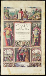
Background imageChart Collection: Frontispiece of the Fifth Volume of Janssons Atlas Novus

Frontispiece of the Fifth Volume of Janssons Atlas Novus
XCF277096 Frontispiece of the Fifth Volume of Janssons Atlas Novus, published in Amsterdam in 1650 (coloured engraving) by Jansson

Background imageChart Collection: Federal Money, page from The Scholars Arithmetic 6th Edition

Federal Money, page from The Scholars Arithmetic 6th Edition
AQS254888 Federal Money, page from The Scholars Arithmetic 6th Edition, by Daniel Adams, published by N.H.Keene, 1810 (print) by American School, (19th century); American Antiquarian Society

Background imageChart Collection: Christopher Columbus (mosaic)

Christopher Columbus (mosaic)
PNP344520 Christopher Columbus (mosaic) by Salviati, Antonio (1816-90); Palazzo Tursi, Genoa, Italy; (add.info.: Columbus (1451-1506) was a Genoese navigator

Background imageChart Collection: Application of the Cercle Chromatique of Charles Henry, 1889 (colour litho)

Application of the Cercle Chromatique of Charles Henry, 1889 (colour litho)
CHT316933 Application of the Cercle Chromatique of Charles Henry, 1889 (colour litho) by Signac, Paul (1863-1935); Bibliotheque des Arts Decoratifs, Paris

Background imageChart Collection: Map of Oceania and the southern Pacific by

Map of Oceania and the southern Pacific by Bartolomeo Borghi, Florence, 1836. Handcoloured copperplate engraving from Giulio Ferrarios Ancient and Modern Costumes of all the Peoples of the World

Background imageChart Collection: Map of the world circa 1810

Map of the world circa 1810. Handcoloured copperplate engraving by Andrea Bernieri from Giulio Ferrarios Ancient and Modern Costumes of all the Peoples of the World, Florence, Italy, 1843

Background imageChart Collection: Map of South America, 1842

Map of South America, 1842. Handcoloured copperplate engraving after a chart by Ab. B. Berghi from Giulio Ferrrarios Costumes Antique and Modern of All Peoples

Background imageChart Collection: Map of Africa, circa 1820

Map of Africa, circa 1820. Handcoloured copperplate engraving from Giulio Ferrrarios Costumes Antique and Modern of All Peoples (Il Costume Antico e Moderno di Tutti i Popoli), Florence, 1842

Background imageChart Collection: Patriotism (w / c on paper)

Patriotism (w / c on paper)
810313 Patriotism (w/c on paper) by Dadd, Richard (1817-86); Victoria & Albert Museum, London, UK; The Stapleton Collection; English, out of copyright

Background imageChart Collection: Venlo, 1649 (hand-coloured engraving)

Venlo, 1649 (hand-coloured engraving)
478386 Venlo, 1649 (hand-coloured engraving) by Blaeu, Joan (1596-1673); Private Collection; (add.info.: Venlo, a town in the Netherlands on the River Ms near the German border)

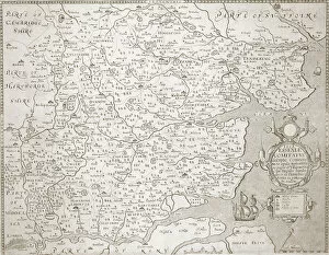
Background imageChart Collection: Map of Essex, 1602 / 03 (engraving)

Map of Essex, 1602 / 03 (engraving)
478401 Map of Essex, 1602/03 (engraving) by Smith, William (c.1550-1618); Private Collection; The Stapleton Collection; English, out of copyright

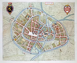
Background imageChart Collection: Lier, 1649 (hand-coloured engraving)

Lier, 1649 (hand-coloured engraving)
478394 Lier, 1649 (hand-coloured engraving) by Blaeu, Joan (1596-1673); Private Collection; (add.info.: Lier, now in Belgium)

Background imageChart Collection: Bergen, Netherlands, 1649 (hand-coloured engraving)

Bergen, Netherlands, 1649 (hand-coloured engraving)
478388 Bergen, Netherlands, 1649 (hand-coloured engraving) by Blaeu, Joan (1596-1673); Private Collection; (add.info.: From Tooneel der Steden vans Konings Nederlanden, met hare beschrijvingen)

Background imageChart Collection: Doctor treating a patient with ultra-violet rays, 1936 (colour litho)

Doctor treating a patient with ultra-violet rays, 1936 (colour litho)
473461 Doctor treating a patient with ultra-violet rays, 1936 (colour litho) by Bull, Rene(1872-1942); Private Collection; (add.info.: from the series of humorous cigarette cards, Howlers)

Background imageChart Collection: Imperial Horoscope of Louis XIV (1638-1715) by Michel Nostradamus (1503-66

Imperial Horoscope of Louis XIV (1638-1715) by Michel Nostradamus (1503-66
CHT163914 Imperial Horoscope of Louis XIV (1638-1715) by Michel Nostradamus (1503-66) published by Francois Huart in Paris 1652 (engraving) (b/w photo) by French School

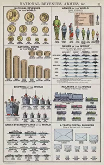
Background imageChart Collection: National revenues, armies etc (colour litho)

National revenues, armies etc (colour litho)
3648983 National revenues, armies etc (colour litho) by English School, (20th century); Private Collection; (add.info.: National revenues, armies etc)

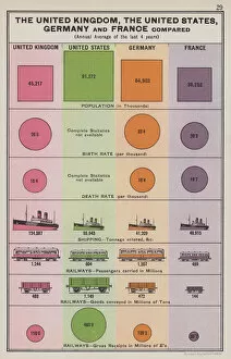
Background imageChart Collection: The United Kingdom, the United States, Germany and France compared (colour litho)

The United Kingdom, the United States, Germany and France compared (colour litho)
3648957 The United Kingdom, the United States, Germany and France compared (colour litho) by English School, (20th century); Private Collection; (add.info.: The United Kingdom, the United States)

Background imageChart Collection: The worlds markets, Australasia (colour litho)

The worlds markets, Australasia (colour litho)
3648951 The worlds markets, Australasia (colour litho) by English School, (20th century); Private Collection; (add.info.: The worlds markets, Australasia)

Background imageChart Collection: The worlds sources of supply, iron and lead, copper and tin (colour litho)

The worlds sources of supply, iron and lead, copper and tin (colour litho)
3648949 The worlds sources of supply, iron and lead, copper and tin (colour litho) by English School, (20th century); Private Collection; (add.info.: The worlds sources of supply, iron and lead)

Background imageChart Collection: The worlds source of supply, timber, coal and petroleum (colour litho)

The worlds source of supply, timber, coal and petroleum (colour litho)
3648948 The worlds source of supply, timber, coal and petroleum (colour litho) by English School, (20th century); Private Collection; (add.info.: The worlds source of supply, timber)

Background imageChart Collection: The worlds sources of supply, tea and coffee, cocoa and wine (colour litho)

The worlds sources of supply, tea and coffee, cocoa and wine (colour litho)
3648945 The worlds sources of supply, tea and coffee, cocoa and wine (colour litho) by English School, (20th century); Private Collection; (add.info.: The worlds sources of supply, tea and coffee)


All Professionally Made to Order for Quick Shipping

"Unlocking the Secrets: Exploring the Fascinating World of Charts" Dive into the realm of reflexology with a detailed foot map chart, revealing hidden connections between pressure points and overall well-being. Immerse yourself in breathtaking artwork as "Kiss of the Oceans" captures the meeting point between Atlantic and Pacific through a mesmerizing chart inspired by the Panama Canal. Travel back in time with a captivating map showcasing the vast Ancient Persian Empire, unraveling its grandeur and historical significance. Follow in the footsteps of greatness as you trace King Alexander the Great's conquests on an intricate chart mapping his empire's expansion across continents. Join forces with The Salvation Army Campaign through their emblematic chart, highlighting their noble mission to bring hope and aid to those in need. Unveil Masonic mysteries through an enchanting chart that delves into both symbolic imagery and rich history surrounding Free and Accepted Masons. Embark on a journey through time with a remarkable Masonic chart, shedding light on ancient rituals, traditions, and brotherhood within this enigmatic society. Explore distant lands from centuries past as an Anglo-Saxon 10th-century world map unfolds before your eyes, offering insights into early cartography techniques. Discover rugged beauty amidst towering peaks with an old map of the Alps; let it guide you through nature's wonders while tracing historic routes taken by explorers long ago. Gain strategic insight during WWII using a military-focused map of Beirut, Lebanon; uncover hidden locations crucial for wartime operations throughout this historically significant cityscape. Step back in time to 1768 Edinburgh as James Craig's Map reveals New Town's first plan—a testament to meticulous topography shaping Scotland's capital cityscape over centuries. Test your vision acuity against an eye-catching eyesight test chart; decipher letters or symbols while appreciating the importance of visual health in our daily lives.