Fraud Blocker Skip to main content

Chart Collection (page 10)

"Unlocking the Secrets: Exploring the Fascinating World of Charts" Dive into the realm of reflexology with a detailed foot map chart

Background imageChart Collection: Old Testament Map

Old Testament Map
Vintage biblical map from 1879 showing the gentile countries and nations of the Old Testament

Background imageChart Collection: Persberg Mines, Sweden

Persberg Mines, Sweden
Engraved illustrations of Mining from Iconographic Encyclopedia of Science, Literature and Art, Published in 1851. Copyright has expired on this artwork. Digitally restored

Background imageChart Collection: Svalbard Islands maritime map. Date: 05-06-2018

Svalbard Islands maritime map. Date: 05-06-2018

Background imageChart Collection: Locomotive lubrication chart in the laboratory of the C & NW R s, Chicago, Ill, 1942

Locomotive lubrication chart in the laboratory of the C & NW R s, Chicago, Ill, 1942. Creator: Jack Delano
Locomotive lubrication chart in the laboratory of the Chicago and Northwestern [i.e. North Western] Railroad. The laboratory assistant in foreground is working at a precision balance. Chicago, Ill

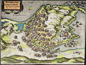
Background imageChart Collection: Site of the Battle of the Castle of Cape Leucate during the war over Roussillon

Site of the Battle of the Castle of Cape Leucate during the war over Roussillon, 1635-39 (coloured engraving)
354839 Site of the Battle of the Castle of Cape Leucate during the war over Roussillon, 1635-39 (coloured engraving) by German School, (17th century) (after); Private Collection; Index Fototeca

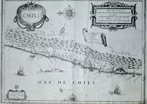
Background imageChart Collection: Map of Chile, 17th century (litho)

Map of Chile, 17th century (litho)
354835 Map of Chile, 17th century (litho) by Blaeu, Willem (1571-1638) (after); Index Fototeca

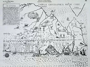
Background imageChart Collection: Map of Chile made for Alonso de Ovalle, 1646 (engraving)

Map of Chile made for Alonso de Ovalle, 1646 (engraving)
364997 Map of Chile made for Alonso de Ovalle, 1646 (engraving) by Spanish School, (17th century); (add.info.: Alonso de Ovalle (1603-51), Chilean Jesuit priest and historian.); Index Fototeca

Background imageChart Collection: Plan of the Citadel of Turin during the siege of 1640 (colour litho)

Plan of the Citadel of Turin during the siege of 1640 (colour litho)
354818 Plan of the Citadel of Turin during the siege of 1640 (colour litho) by Blaeu, Joan (1596-1673) (after); Historical Archive, Turin, Italy; Index Fototeca

Background imageChart Collection: Plan of the Citadel of Turin in 1664 (colour litho)

Plan of the Citadel of Turin in 1664 (colour litho)
354817 Plan of the Citadel of Turin in 1664 (colour litho) by Italian School, (17th century) (after); Historical Archive, Turin, Italy; Index Fototeca

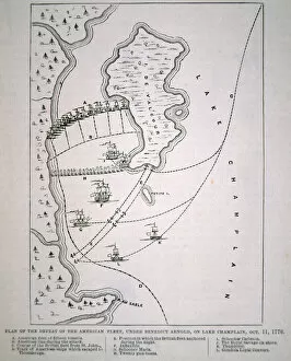
Background imageChart Collection: Plan of the defeat of the American Fleet on Lake Champlain (litho)

Plan of the defeat of the American Fleet on Lake Champlain (litho)
PNP325952 Plan of the defeat of the American Fleet on Lake Champlain (litho) by English School; Private Collection; (add.info.: Battle of Valcour Island)

Background imageChart Collection: Poster with Graph of Rising Profits and Dollar Signs, c. 1936-39 (colour litho)

Poster with Graph of Rising Profits and Dollar Signs, c. 1936-39 (colour litho)
1126469 Poster with Graph of Rising Profits and Dollar Signs, c.1936-39 (colour litho) by Buczak, John (fl.1936-39); Private Collection; (add.info.: Strictly Business vintage poster by John Buczak)

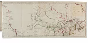
Background imageChart Collection: Voyages from Asia to America, for Completing the Discoveries of the North West Coast of America

Voyages from Asia to America, for Completing the Discoveries of the North West Coast of America
3666907 Voyages from Asia to America, for Completing the Discoveries of the North West Coast of America, London: Thomas Jefferys, 1761 (hand-coloured engraving) by Muller

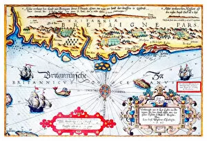
Background imageChart Collection: Navigation chart of Brittany coast, 1583

Navigation chart of Brittany coast, 1583
3854275 Navigation chart of Brittany coast, 1583 by Janszoon Waghenaer, Lucas (c.1533-c.1606); Photo © Derek Bayes. All rights reserved 2022

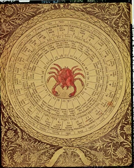
Background imageChart Collection: Astrological table of Cancer, from the Book of Good and Bad Fortune (engraving)

Astrological table of Cancer, from the Book of Good and Bad Fortune (engraving)
XIR172298 Astrological table of Cancer, from the Book of Good and Bad Fortune (engraving) by Italian School, (15th century); Biblioteca Nazionale Marciana, Venice

Background imageChart Collection: Ms R 171 f. 285 Plan of Canterbury Cathedral and the plumbing system, from the Eadwine Psalter, c

Ms R 171 f. 285 Plan of Canterbury Cathedral and the plumbing system, from the Eadwine Psalter, c. 1150 (vellum)
NUL42005 Ms R 171 f.285 Plan of Canterbury Cathedral and the plumbing system, from the Eadwine Psalter, c.1150 (vellum) by English School, (12th century); Trinity College, Cambridge

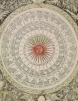
Background imageChart Collection: Astrological table of the Sun, from the Book of Good and Bad Fortune (vellum)

Astrological table of the Sun, from the Book of Good and Bad Fortune (vellum)
XIR155538 Astrological table of the Sun, from the Book of Good and Bad Fortune (vellum) by Italian School, (15th century); Biblioteca Nazionale Marciana, Venice

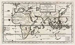
Background imageChart Collection: Map showing the route taken by William Dampier on his expedition which reached the shores of New

Map showing the route taken by William Dampier on his expedition which reached the shores of New Holland, now Western Australia, in 1699. From a contemporary map

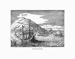
Background imageChart Collection: The Cocos Islands Dutch Navigation, Victorian Illustration

The Cocos Islands Dutch Navigation, Victorian Illustration
Very Rare, Beautifully Illustrated Antique Engraved Victorian Illustration of The Cocos Islands. Copyright has expired on this artwork. Digitally restored
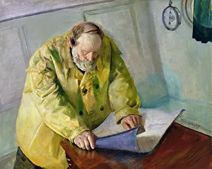
Background imageChart Collection: Muddy water, 1890 (oil on canvas)

Muddy water, 1890 (oil on canvas)
OVR390550 Muddy water, 1890 (oil on canvas) by Krohg, Christian (1852-1925); 98x125 cm; Private Collection; Photo © O. Vaering

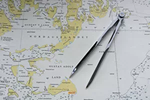
Background imageChart Collection: Svalbard Islands maritime map

Svalbard Islands maritime map

Background imageChart Collection: Abstract Presentation

Abstract Presentation
http://csaimages.com/images/istockprofile/csa_vector_dsp.jpg

Background imageChart Collection: Buttons, c. 1937. Creator: Gertrude Lemberg

Buttons, c. 1937. Creator: Gertrude Lemberg
Buttons, c. 1937

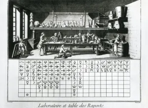
Background imageChart Collection: Plate showing chemical laboratory and table of affinities

Plate showing chemical laboratory and table of affinities
AIS5355328 Plate showing chemical laboratory and table of affinities, Jean Baptiste Le Rond d Alembert, L Encyclopedie, 1751-1757 (engraving) by Diderot, Denis (1713-84); eIberfoto; French

Background imageChart Collection: Portolan chart of the Mediterranean Coast, depicting the different stages of the Voyage

Portolan chart of the Mediterranean Coast, depicting the different stages of the Voyage
JEB940232 Portolan chart of the Mediterranean Coast, depicting the different stages of the Voyage of Ulysses, as told in Homers Odyssey, 1593 (parchment) by French School

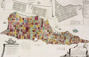
Background imageChart Collection: Tilforladelig Kort over Eglandet St. Croix udi America, Copenhagen, 1754

Tilforladelig Kort over Eglandet St. Croix udi America, Copenhagen, 1754
828371 Tilforladelig Kort over Eglandet St. Croix udi America, Copenhagen, 1754, 1754 (hand coloured engraving) by Unknown artist

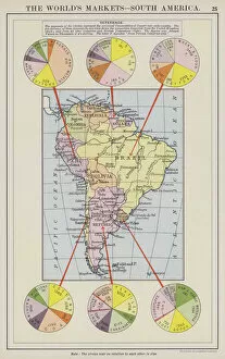
Background imageChart Collection: The worlds markets, South America (colour litho)

The worlds markets, South America (colour litho)
3648972 The worlds markets, South America (colour litho) by English School, (20th century); Private Collection; (add.info.: The worlds markets, South America)

Background imageChart Collection: The worlds sources of supply, tobacco, rubber and silk (colour litho)

The worlds sources of supply, tobacco, rubber and silk (colour litho)
3648962 The worlds sources of supply, tobacco, rubber and silk (colour litho) by English School, (20th century); Private Collection; (add.info.: The worlds sources of supply, tobacco)

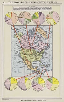
Background imageChart Collection: The worlds markets, North America (colour litho)

The worlds markets, North America (colour litho)
3648954 The worlds markets, North America (colour litho) by English School, (20th century); Private Collection; (add.info.: The worlds markets, North America)

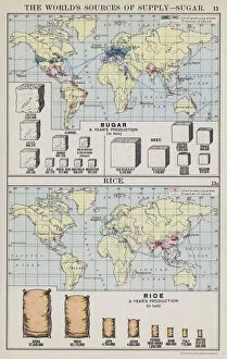
Background imageChart Collection: The worlds sources of supply, sugar, rice (colour litho)

The worlds sources of supply, sugar, rice (colour litho)
3648941 The worlds sources of supply, sugar, rice (colour litho) by English School, (20th century); Private Collection; (add.info.: The worlds sources of supply, sugar, rice)

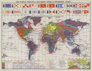
Background imageChart Collection: The world, principal steamship lines and isochronic chart (colour litho)

The world, principal steamship lines and isochronic chart (colour litho)
3648936 The world, principal steamship lines and isochronic chart (colour litho) by English School, (20th century); Private Collection; (add.info.: The world)

Background imageChart Collection: The world, regions commercially developed (colour litho)

The world, regions commercially developed (colour litho)
3648932 The world, regions commercially developed (colour litho) by English School, (20th century); Private Collection; (add.info.: The world, regions commercially developed)

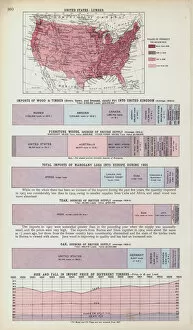
Background imageChart Collection: Timber (colour litho)

Timber (colour litho)
3648678 Timber (colour litho) by English School, (20th century); Private Collection; (add.info.: Timber. Illustration for Atlas of the Worlds Commerce compiled from the latest official returns at)

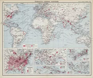
Background imageChart Collection: Tobacco, growing countries (colour litho)

Tobacco, growing countries (colour litho)
3648673 Tobacco, growing countries (colour litho) by English School, (20th century); Private Collection; (add.info.: Tobacco, growing countries)

Background imageChart Collection: India-rubber (colour litho)

India-rubber (colour litho)
3648664 India-rubber (colour litho) by English School, (20th century); Private Collection; (add.info.: India-rubber. Illustration for Atlas of the Worlds Commerce compiled from the latest official)

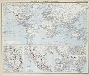
Background imageChart Collection: Silver and lead, mining countries (colour litho)

Silver and lead, mining countries (colour litho)
3648662 Silver and lead, mining countries (colour litho) by English School, (20th century); Private Collection; (add.info.: Silver and lead, mining countries)

Background imageChart Collection: Tin, platinum, aluminium etc (colour litho)

Tin, platinum, aluminium etc (colour litho)
3648657 Tin, platinum, aluminium etc (colour litho) by English School, (20th century); Private Collection; (add.info.: Tin, platinum, aluminium etc)

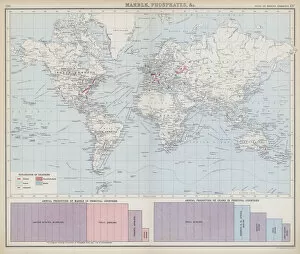
Background imageChart Collection: Marble, phosphates etc (colour litho)

Marble, phosphates etc (colour litho)
3648655 Marble, phosphates etc (colour litho) by English School, (20th century); Private Collection; (add.info.: Marble, phosphates etc)

Background imageChart Collection: Steel (colour litho)

Steel (colour litho)
3648654 Steel (colour litho) by English School, (20th century); Private Collection; (add.info.: Steel. Illustration for Atlas of the Worlds Commerce compiled from the latest official returns at)

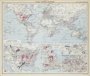
Background imageChart Collection: Coal, mining countries (colour litho)

Coal, mining countries (colour litho)
3648652 Coal, mining countries (colour litho) by English School, (20th century); Private Collection; (add.info.: Coal, mining countries)

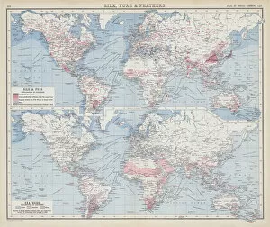
Background imageChart Collection: Silk, furs and feathers (colour litho)

Silk, furs and feathers (colour litho)
3648646 Silk, furs and feathers (colour litho) by English School, (20th century); Private Collection; (add.info.: Silk, furs and feathers)

Background imageChart Collection: Fish (colour litho)

Fish (colour litho)
3648644 Fish (colour litho) by English School, (20th century); Private Collection; (add.info.: Fish. Illustration for Atlas of the Worlds Commerce compiled from the latest official returns at)

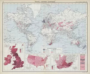
Background imageChart Collection: Wool, growing countries (colour litho)

Wool, growing countries (colour litho)
3648639 Wool, growing countries (colour litho) by English School, (20th century); Private Collection; (add.info.: Wool, growing countries)

Background imageChart Collection: Wool (colour litho)

Wool (colour litho)
3648632 Wool (colour litho) by English School, (20th century); Private Collection; (add.info.: Wool. Illustration for Atlas of the Worlds Commerce compiled from the latest official returns at)

Background imageChart Collection: Domestic animals in principal countries (colour litho)

Domestic animals in principal countries (colour litho)
3648628 Domestic animals in principal countries (colour litho) by English School, (20th century); Private Collection; (add.info.: Domestic animals in principal countries)

Background imageChart Collection: Dairy products (colour litho)

Dairy products (colour litho)
3648626 Dairy products (colour litho) by English School, (20th century); Private Collection; (add.info.: Dairy products. Illustration for Atlas of the Worlds Commerce compiled from the latest)

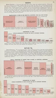
Background imageChart Collection: Beer and spirits (colour litho)

Beer and spirits (colour litho)
3648620 Beer and spirits (colour litho) by English School, (20th century); Private Collection; (add.info.: Beer and spirits)

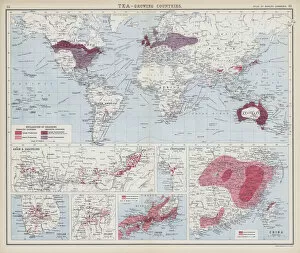
Background imageChart Collection: Tea, growing countries (colour litho)

Tea, growing countries (colour litho)
3648616 Tea, growing countries (colour litho) by English School, (20th century); Private Collection; (add.info.: Tea, growing countries)

Background imageChart Collection: Rice and rye (colour litho)

Rice and rye (colour litho)
3648604 Rice and rye (colour litho) by English School, (20th century); Private Collection; (add.info.: Rice and rye. Illustration for Atlas of the Worlds Commerce compiled from the latest official)


All Professionally Made to Order for Quick Shipping

"Unlocking the Secrets: Exploring the Fascinating World of Charts" Dive into the realm of reflexology with a detailed foot map chart, revealing hidden connections between pressure points and overall well-being. Immerse yourself in breathtaking artwork as "Kiss of the Oceans" captures the meeting point between Atlantic and Pacific through a mesmerizing chart inspired by the Panama Canal. Travel back in time with a captivating map showcasing the vast Ancient Persian Empire, unraveling its grandeur and historical significance. Follow in the footsteps of greatness as you trace King Alexander the Great's conquests on an intricate chart mapping his empire's expansion across continents. Join forces with The Salvation Army Campaign through their emblematic chart, highlighting their noble mission to bring hope and aid to those in need. Unveil Masonic mysteries through an enchanting chart that delves into both symbolic imagery and rich history surrounding Free and Accepted Masons. Embark on a journey through time with a remarkable Masonic chart, shedding light on ancient rituals, traditions, and brotherhood within this enigmatic society. Explore distant lands from centuries past as an Anglo-Saxon 10th-century world map unfolds before your eyes, offering insights into early cartography techniques. Discover rugged beauty amidst towering peaks with an old map of the Alps; let it guide you through nature's wonders while tracing historic routes taken by explorers long ago. Gain strategic insight during WWII using a military-focused map of Beirut, Lebanon; uncover hidden locations crucial for wartime operations throughout this historically significant cityscape. Step back in time to 1768 Edinburgh as James Craig's Map reveals New Town's first plan—a testament to meticulous topography shaping Scotland's capital cityscape over centuries. Test your vision acuity against an eye-catching eyesight test chart; decipher letters or symbols while appreciating the importance of visual health in our daily lives.