Fraud Blocker Skip to main content

1902 Collection (page 8)

In the year 1902, a myriad of events unfolded that shaped history and left an indelible mark on society

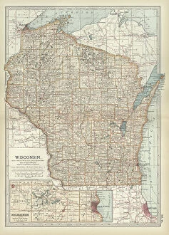
Background image1902 Collection: Map of Wisconsin, c.1900 (engraving)

Map of Wisconsin, c.1900 (engraving)
533185 Map of Wisconsin, c.1900 (engraving); (add.info.: Map of Wisconsin, United States, with an inset map of Milwaukee and the Waukesha Lake Region, circa 1902)

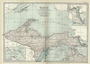
Background image1902 Collection: Map of the northern part of Michigan, c.1900 (engraving)

Map of the northern part of Michigan, c.1900 (engraving)
533181 Map of the northern part of Michigan, c.1900 (engraving); (add.info.: Map of the northern part of Michigan, United States, with inset maps of St)

Background image1902 Collection: Map of England, c.1900 (engraving)

Map of England, c.1900 (engraving)
532930 Map of England, c.1900 (engraving); (add.info.: Map of England, with Cornwall, Devonshire, Dorset, and an inset of the Channel Islands, circa 1902)

Background image1902 Collection: Map of southern Ohio, c.1900 (engraving)

Map of southern Ohio, c.1900 (engraving)
533168 Map of southern Ohio, c.1900 (engraving); (add.info.: Map of the southern part of Ohio, United States, with inset maps of Cincinnati and Cleveland, circa 1902)

Background image1902 Collection: Map of England, c.1900 (engraving)

Map of England, c.1900 (engraving)
532911 Map of England, c.1900 (engraving); (add.info.: Map of England with Yorkshire, Lancashire, and Westmorland, circa 1902)

Background image1902 Collection: Map of Mississippi, c.1900 (engraving)

Map of Mississippi, c.1900 (engraving)
533154 Map of Mississippi, c.1900 (engraving); (add.info.: Map of Mississippi, United States, circa 1902, from the 10th edition of Encyclopaedia Britannica.); Encyclopaedia Britannica/UIG.

Background image1902 Collection: Map of Georgia, c.1900 (engraving)

Map of Georgia, c.1900 (engraving)
533139 Map of Georgia, c.1900 (engraving); (add.info.: Map of Georgia, United States, with inset maps of Savannah and Chickamauga National Park, circa 1902)

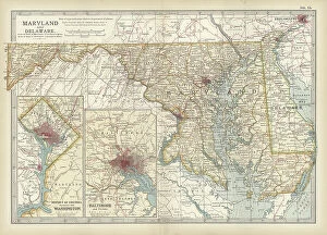
Background image1902 Collection: Map of Maryland and Delaware, c.1900 (engraving)

Map of Maryland and Delaware, c.1900 (engraving)
533120 Map of Maryland and Delaware, c.1900 (engraving); (add.info.: Map of Maryland and Delaware, inset maps of District of Columbia and Baltimore, circa 1902)

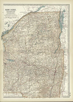
Background image1902 Collection: Map of New York State, c.1900 (engraving)

Map of New York State, c.1900 (engraving)
533105 Map of New York State, c.1900 (engraving); (add.info.: Map of north and eastern New York State, United States, circa 1902)

Background image1902 Collection: Map of Connecticut and Rhode Island, c.1900 (engraving)

Map of Connecticut and Rhode Island, c.1900 (engraving)
533101 Map of Connecticut and Rhode Island, c.1900 (engraving); (add.info.: Map of Connecticut and Rhode Island, United States, with an inset of Newport, circa 1902)

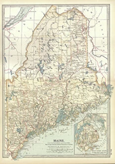
Background image1902 Collection: Map of Maine, c.1900 (engraving)

Map of Maine, c.1900 (engraving)
533088 Map of Maine, c.1900 (engraving); (add.info.: Map of Maine, United States, with inset map of Mount Desert Island, circa 1902)

Background image1902 Collection: Prince William of Prussia, V. Luise, Liersch

Prince William of Prussia, V. Luise, Liersch
945834 Prince William of Prussia, V. Luise, Liersch by German Photographer (20th Century); Private Collection; © Arkivi UG All Rights Reserved.

Background image1902 Collection: Map of Corsica, c.1900 (engraving)

Map of Corsica, c.1900 (engraving)
533290 Map of Corsica, c.1900 (engraving); (add.info.: Map of Corsica, France, circa 1902, from the 10th edition of Encyclopaedia Britannica.); Encyclopaedia Britannica/UIG.

Background image1902 Collection: Map of Persia with Afghanistan and Baluchistan, c.1900 (engraving)

Map of Persia with Afghanistan and Baluchistan, c.1900 (engraving)
533013 Map of Persia with Afghanistan and Baluchistan, c.1900 (engraving); (add.info.: Map showing the historical boundaries of Persia (now Iran), Afghanistan, and Baluchistan, circa 1902

Background image1902 Collection: Map of Turkey, c.1900 (engraving)

Map of Turkey, c.1900 (engraving)
532998 Map of Turkey, c.1900 (engraving); (add.info.: Map showing historical boundaries of the European portion of Turkey, circa 1902)

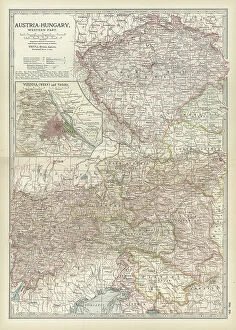
Background image1902 Collection: Map of Austria with Vienna, c.1900 (engraving)

Map of Austria with Vienna, c.1900 (engraving)
532980 Map of Austria with Vienna, c.1900 (engraving); (add.info.: Map showing Austria-Hungary, with an inset of Vienna, circa 1902)

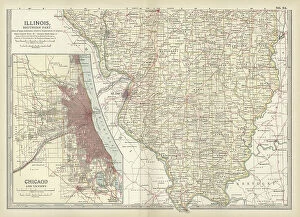
Background image1902 Collection: Map of southern Illinois, c.1900 (engraving)

Map of southern Illinois, c.1900 (engraving)
533175 Map of southern Illinois, c.1900 (engraving); (add.info.: Map of the southern part of Illinois, United States, with an inset map of Chicago and Vicinity, circa 1902)

Background image1902 Collection: Map of Indiana, c.1900 (engraving)

Map of Indiana, c.1900 (engraving)
533170 Map of Indiana, c.1900 (engraving); (add.info.: Map of Indiana, United States, circa 1902, from the 10th edition of Encyclopaedia Britannica.); Encyclopaedia Britannica/UIG.

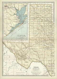
Background image1902 Collection: Map of western Texas with Galveston, c.1900 (engraving)

Map of western Texas with Galveston, c.1900 (engraving)
533163 Map of western Texas with Galveston, c.1900 (engraving); (add.info.: Map of the western part of Texas with inset map of Galveston Bay, Galveston, Houston and Vicinity, circa 1902)

Background image1902 Collection: Map of Arkansas, c.1900 (engraving)

Map of Arkansas, c.1900 (engraving)
533157 Map of Arkansas, c.1900 (engraving); (add.info.: Map of Arkansas, United States, circa 1902, from the 10th edition of Encyclopaedia Britannica.); Encyclopaedia Britannica/UIG.

Background image1902 Collection: Map of England and Wales, c.1900 (engraving)

Map of England and Wales, c.1900 (engraving)
532927 Map of England and Wales, c.1900 (engraving); (add.info.: Map of England and Wales, circa 1902, from the 10th edition of Encyclopaedia Britannica.); Encyclopaedia Britannica/UIG.

Background image1902 Collection: Map of southeast Australia, c.1900 (engraving)

Map of southeast Australia, c.1900 (engraving)
533045 Map of southeast Australia, c.1900 (engraving); (add.info.: Map of southeast Australia with Victoria, New South Wales, and parts of South Australia and Queensland, circa 1902)

Background image1902 Collection: Map of Chickamauga National Park, c.1900 (engraving)

Map of Chickamauga National Park, c.1900 (engraving)
533433 Map of Chickamauga National Park, c.1900 (engraving); (add.info.: Map of Chickamauga National Park, Tennessee, circa 1902)

Background image1902 Collection: Map of the western part of Ontario, Canada, c.1900 (engraving)

Map of the western part of Ontario, Canada, c.1900 (engraving)
533408 Map of the western part of Ontario, Canada, c.1900 (engraving); (add.info.: Map of the western part of Ontario, Canada, circa 1902)

Background image1902 Collection: Map of Madagascar and Comoro Islands, c.1900 (engraving)

Map of Madagascar and Comoro Islands, c.1900 (engraving)
533398 Map of Madagascar and Comoro Islands, c.1900 (engraving); (add.info.: Map of Madagascar and Comoro Islands, circa 1902)

Background image1902 Collection: Map of the Nile Delta and Suez Canal, c.1900 (engraving)

Map of the Nile Delta and Suez Canal, c.1900 (engraving)
533396 Map of the Nile Delta and Suez Canal, c.1900 (engraving); (add.info.: Map of Nile Delta and Suez Canal, Egypt, circa 1902)

Background image1902 Collection: Map of Tasmania, Australia, c.1902 (engraving)

Map of Tasmania, Australia, c.1902 (engraving)
533347 Map of Tasmania, Australia, c.1902 (engraving); (add.info.: Map of Tasmania, Australia, circa 1902, from the 10th edition of Encyclopaedia Britannica.); Encyclopaedia Britannica/UIG.

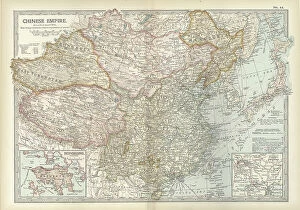
Background image1902 Collection: Map of the Chinese Empire, c.1900 (engraving)

Map of the Chinese Empire, c.1900 (engraving)
533025 Map of the Chinese Empire, c.1900 (engraving); (add.info.: Map showing the historical boundaries of the Chinese Empire, with insets of Hong Kong, Peking (now Beijing), and Tientsin

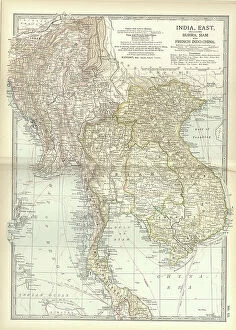
Background image1902 Collection: Map of Eastern India, c.1900 (engraving)

Map of Eastern India, c.1900 (engraving)
533022 Map of Eastern India, c.1900 (engraving); (add.info.: Map showing historical boundaries of eastern India, Burma, Siam and French Indo-China, circa 1902)

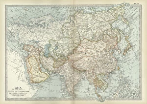
Background image1902 Collection: Map of Asia with Siberia and Central Asia, c.1900 (engraving)

Map of Asia with Siberia and Central Asia, c.1900 (engraving)
533003 Map of Asia with Siberia and Central Asia, c.1900 (engraving); (add.info.: Map of Asia, circa 1902, from the 10th edition of Encyclopaedia Britannica.); Encyclopaedia Britannica/UIG.

Background image1902 Collection: Map of the eastern part of South America, c.1900 (engraving)

Map of the eastern part of South America, c.1900 (engraving)
533262 Map of the eastern part of South America, c.1900 (engraving); (add.info.: Map showing the historical boundaries of eastern South America, with an inset map of Rio de Janeiro, circa 1902)

Background image1902 Collection: Map of the West Indies, c.1900 (engraving)

Map of the West Indies, c.1900 (engraving)
533240 Map of the West Indies, c.1900 (engraving); (add.info.: Map of the West Indies, circa 1902, from the 10th edition of Encyclopaedia Britannica.); Encyclopaedia Britannica/UIG.

Background image1902 Collection: Map of the southern part of California, c.1900 (engraving)

Map of the southern part of California, c.1900 (engraving)
533233 Map of the southern part of California, c.1900 (engraving); (add.info.: Map of the southern part of California, United States, with inset maps of Los Angeles, San Diego)

Background image1902 Collection: Map of the northern part of California, c.1900 (engraving)

Map of the northern part of California, c.1900 (engraving)
533231 Map of the northern part of California, c.1900 (engraving); (add.info.: Map of the northern part of California, United States, with inset maps of San Francisco and Yosemite Valley, circa 1902)

Background image1902 Collection: Map of Oregon, c.1900 (engraving)

Map of Oregon, c.1900 (engraving)
533223 Map of Oregon, c.1900 (engraving); (add.info.: Map of Oregon, United States, circa 1902, from the 10th edition of Encyclopaedia Britannica.); Encyclopaedia Britannica/UIG.

Background image1902 Collection: Map of Kansas, c.1900 (engraving)

Map of Kansas, c.1900 (engraving)
533205 Map of Kansas, c.1900 (engraving); (add.info.: Map of Kansas, United States, circa 1902, from the 10th edition of Encyclopaedia Britannica.); Encyclopaedia Britannica/UIG.

Background image1902 Collection: Map of the southern part of Missouri, c.1900 (engraving)

Map of the southern part of Missouri, c.1900 (engraving)
533203 Map of the southern part of Missouri, c.1900 (engraving); (add.info.: Map of the southern part of Missouri, United States, circa 1902)

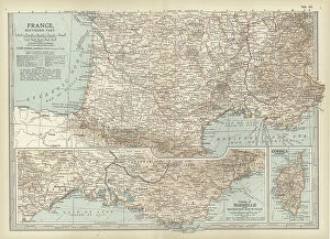
Background image1902 Collection: Map of France, c.1900 (engraving)

Map of France, c.1900 (engraving)
532946 Map of France, c.1900 (engraving); (add.info.: Map of France with inset map of Vicinity of Marseille and the Mediterranean Coast of France, and Corsica, circa 1902)

Background image1902 Collection: Map of Scotland, c.1900 (engraving)

Map of Scotland, c.1900 (engraving)
532933 Map of Scotland, c.1900 (engraving); (add.info.: Map of Scotland with inset of Shetland Islands, circa 1902, from the 10th edition of Encyclopaedia Britannica.); Encyclopaedia Britannica/UIG.

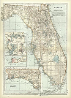
Background image1902 Collection: Map of Florida with insets of cities, c.1900 (engraving)

Map of Florida with insets of cities, c.1900 (engraving)
533142 Map of Florida with insets of cities, c.1900 (engraving); (add.info.: Map of Florida, United States, with inset maps of Jacksonville, Tampa, St)

Background image1902 Collection: Map of Pennsylvania, with inset map of Pittsburg, c.1900 (engraving)

Map of Pennsylvania, with inset map of Pittsburg, c.1900 (engraving)
533118 Map of Pennsylvania, with inset map of Pittsburg, c.1900 (engraving); (add.info.: Map of Pennsylvania, with inset map of Pittsburg, circa 1902)

Background image1902 Collection: New Brunswick, Nova Scotia & Prince Edward Island, c.1900 (engraving)

New Brunswick, Nova Scotia & Prince Edward Island, c.1900 (engraving)
533083 New Brunswick, Nova Scotia & Prince Edward Island, c.1900 (engraving); (add.info.: Map of New Brunswick, Nova Scotia, and Prince Edward Island, Canada, with an inset of Newfoundland)

Background image1902 Collection: Map of northeastern Africa, c.1900 (engraving)

Map of northeastern Africa, c.1900 (engraving)
533059 Map of northeastern Africa, c.1900 (engraving); (add.info.: Map of northeast Africa, with insets of the Nile Delta and Suez Canal, circa 1902)

Background image1902 Collection: Map of England, c.1900 (engraving)

Map of England, c.1900 (engraving)
532914 Map of England, c.1900 (engraving); (add.info.: Map of England, including Nottingham, Leicester, Rutland, Northampton, Huntingdon, Cambridge, Norfolk, circa 1902)

Background image1902 Collection: Map of England and Wales, c.1900 (engraving)

Map of England and Wales, c.1900 (engraving)
532905 Map of England and Wales, c.1900 (engraving); (add.info.: Map of southern England and Wales, including insets of London and Vicinity, and the Isles of Sicily, circa 1902)

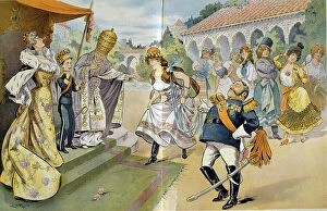
Background image1902 Collection: Alfonso XIII of Spain (1886-1941) who officially came of age at 16 in 1902 here

Alfonso XIII of Spain (1886-1941) who officially came of age at 16 in 1902 here, standing beside his mother
528558 Alfonso XIII of Spain (1886-1941) who officially came of age at 16 in 1902 here, standing beside his mother, is introduced by the Pope of prospective brides

Background image1902 Collection: Prage Litho Coronation, King Eduard VII, England, 1902 (print)

Prage Litho Coronation, King Eduard VII, England, 1902 (print)
948139 Prage Litho Coronation, King Eduard VII, England, 1902 (print); Private Collection; © Arkivi UG All Rights Reserved.

Background image1902 Collection: Camille Saint-Saens (1835-1921)

Camille Saint-Saens (1835-1921)
864929 Camille Saint-Saens (1835-1921); (add.info.: Camille Saint-Saens (1835-1921) French composer, organist and music critic. Halftone, 1902.); Universal History Archive/UIG.


All Professionally Made to Order for Quick Shipping

In the year 1902, a myriad of events unfolded that shaped history and left an indelible mark on society. It was a time when tales were spun, heroes emerged, and the world witnessed both triumphs and tragedies. One such tale was "The Cat that Walked by Himself, " penned by Rudyard Kipling in his iconic collection of stories called Just So Stories. This whimsical feline captivated readers with its independence and cunning nature. Meanwhile, across the vast Atlantic Ocean, another story was unfolding aboard the RMS Carpathia in 1903. This ship would later gain fame for its heroic role in rescuing survivors from the ill-fated Titanic disaster just nine years later. While maritime adventures took place at sea, on land, Newfoundland in Canada thrived as it proudly showcased its bountiful products - particularly cod. The fishing industry flourished as these prized fish became a staple food source for many around the world. In science and academia, brilliance shone through with Paul Dirac being awarded the Nobel Prize in Physics in 1933. His groundbreaking contributions to quantum mechanics paved the way for advancements that continue to shape our understanding of the universe today. Notable figures also made their mark during this era; Cecil Rhodes left an enduring legacy through his influential role as a British imperialist and businessman. Meanwhile, London Hospital on Mile End Road stood tall as a beacon of hope amidst illness and despair. As bustling streets teemed with life at Spitalfields in East End London, one could almost hear echoes of Kipling's words resonating: "I am only just beginning my travels. " And indeed, there was much more to explore within this vibrant cityscape. From hunting expeditions where foxes met their fate at "the meet" to brave soldiers fighting valiantly under adverse conditions like those depicted by Modderfontein's 17th Lancers - all that remained were memories etched in history.