Fraud Blocker Skip to main content

1902 Collection (page 7)

In the year 1902, a myriad of events unfolded that shaped history and left an indelible mark on society

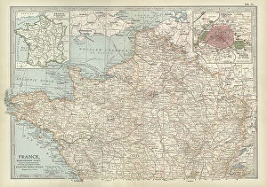
Background image1902 Collection: Map of France, c.1900 (engraving)

Map of France, c.1900 (engraving)
532942 Map of France, c.1900 (engraving); (add.info.: Map of northern France with insets showing the provinces of France and Paris and Vicinity, circa 1902)

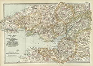
Background image1902 Collection: Map of England and Wales, c.1900 (engraving)

Map of England and Wales, c.1900 (engraving)
532924 Map of England and Wales, c.1900 (engraving); (add.info.: Map of England and Wales, with Hereford, Monmouth, Gloucester, Somerset, and parts of Worchester and Wiltshire, circa 1902)

Background image1902 Collection: Map of London, England, c.1900 (engraving)

Map of London, England, c.1900 (engraving)
532921 Map of London, England, c.1900 (engraving); (add.info.: Map of London, England, and vicinity, circa 1902, from the 10th edition of Encyclopaedia Britannica.); Encyclopaedia Britannica/UIG.

Background image1902 Collection: Map of England and Wales, c.1900 (engraving)

Map of England and Wales, c.1900 (engraving)
532903 Map of England and Wales, c.1900 (engraving); (add.info.: Map showing the historical boundaries of northern England and Wales, including insets of Liverpool, Manchester and Vicinity)

Background image1902 Collection: Map of Central Europe, c.1900 (engraving)

Map of Central Europe, c.1900 (engraving)
532900 Map of Central Europe, c.1900 (engraving); (add.info.: Map of Central Europe, circa 1902, From the 10th edition of Encyclopaedia Britannica.); Encyclopaedia Britannica/UIG.

Background image1902 Collection: Map of Iceland, c.1900 (engraving)

Map of Iceland, c.1900 (engraving)
533307 Map of Iceland, c.1900 (engraving); (add.info.: Map of Iceland showing glaciers (Jokull), fjords and other geographical features, circa 1902

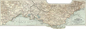
Background image1902 Collection: Map of Marseille, France, c.1900 (engraving)

Map of Marseille, France, c.1900 (engraving)
533294 Map of Marseille, France, c.1900 (engraving); (add.info.: Map of Marseille, France, circa 1902, from the 10th edition of Encyclopaedia Britannica.); Encyclopaedia Britannica/UIG.

Background image1902 Collection: Map of South America, c.1900 (engraving)

Map of South America, c.1900 (engraving)
533256 Map of South America, c.1900 (engraving); (add.info.: Map of South America with inset maps of Isthmus of Panama, Galapagos Islands and Trinidad, circa 1902)

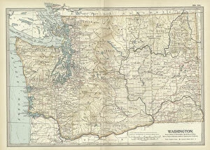
Background image1902 Collection: Map of Washington State, c.1900 (engraving)

Map of Washington State, c.1900 (engraving)
533220 Map of Washington State, c.1900 (engraving); (add.info.: Map of Washington State, United States, circa 1902, from the 10th edition of Encyclopaedia Britannica.); Encyclopaedia Britannica/UIG.

Background image1902 Collection: Ronald Ross (1857-1932) British physician, c.1902 (b/w photo)

Ronald Ross (1857-1932) British physician, c.1902 (b/w photo)
527308 Ronald Ross (1857-1932) British physician, c.1902 (b/w photo); (add.info.: Discovered the Malaria parasite and its life cycle)

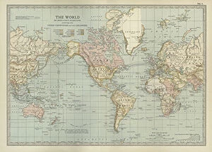
Background image1902 Collection: Map of the colonial powers, 1902, c.1900 (engraving)

Map of the colonial powers, 1902, c.1900 (engraving)
532894 Map of the colonial powers, 1902, c.1900 (engraving); (add.info.: Map of the world showing "the Chief Countries and their Colonies," circa 1902)

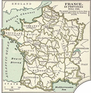
Background image1902 Collection: Map of France in Provinces, c.1900 (engraving)

Map of France in Provinces, c.1900 (engraving)
533288 Map of France in Provinces, c.1900 (engraving); (add.info.: Map of the provinces of France before the French Revolution in 1789, circa 1902)

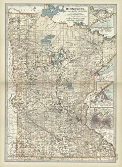
Background image1902 Collection: Map of Minnesota, c.1900 (engraving)

Map of Minnesota, c.1900 (engraving)
533188 Map of Minnesota, c.1900 (engraving); (add.info.: Map of Minnesota, United States, with inset maps of Duluth and Minneapolis, circa 1902)

Background image1902 Collection: Map of eastern Texas, c.1900 (engraving)

Map of eastern Texas, c.1900 (engraving)
533161 Map of eastern Texas, c.1900 (engraving); (add.info.: Map of the eastern part of Texas, circa 1902, from the 10th edition of Encyclopaedia Britannica.); Encyclopaedia Britannica/UIG.

Background image1902 Collection: Map of eastern Tennessee, c.1900 (engraving)

Map of eastern Tennessee, c.1900 (engraving)
533145 Map of eastern Tennessee, c.1900 (engraving); (add.info.: Map of the eastern part of Tennessee with inset map of Chattanooga, circa 1902)

Background image1902 Collection: Map of North Carolina, c.1900 (engraving)

Map of North Carolina, c.1900 (engraving)
533130 Map of North Carolina, c.1900 (engraving); (add.info.: Map of North Carolina, United States, circa 1902, from the 10th edition of Encyclopaedia Britannica.); Encyclopaedia Britannica/UIG.

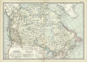
Background image1902 Collection: Map of Canada, c.1900 (engraving)

Map of Canada, c.1900 (engraving)
533072 Map of Canada, c.1900 (engraving); (add.info.: Map showing historical boundaries of Canada and Newfoundland, circa 1902)

Background image1902 Collection: Map of colonial Africa, c.1900 (engraving)

Map of colonial Africa, c.1900 (engraving)
533053 Map of colonial Africa, c.1900 (engraving); (add.info.: Map of colonial Africa, with insets of Ascension Island, St)

Background image1902 Collection: Map of Australia and Tasmania. c1902 (engraving)

Map of Australia and Tasmania. c1902 (engraving)
533041 Map of Australia and Tasmania. c1902 (engraving); (add.info.: Map showing Australia with insets of Melbourne and Port Phillip, Tasmania, and Sydney and Vicinity, circa 1902)

Background image1902 Collection: Map of Guadeloupe, c.1900 (engraving)

Map of Guadeloupe, c.1900 (engraving)
533480 Map of Guadeloupe, c.1900 (engraving); (add.info.: Map of Guadeloupe, circa 1902, from the 10th edition of Encyclopaedia Britannica.); Encyclopaedia Britannica/UIG.

Background image1902 Collection: Map of Dominica, c.1900 (engraving)

Map of Dominica, c.1900 (engraving)
533477 Map of Dominica, c.1900 (engraving); (add.info.: Map of Dominica, circa 1902, from the 10th edition of Encyclopaedia Britannica.); Encyclopaedia Britannica/UIG.

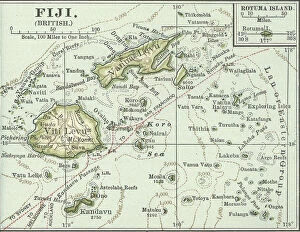
Background image1902 Collection: Map of Fiji Islands, c.1900 (engraving)

Map of Fiji Islands, c.1900 (engraving)
533354 Map of Fiji Islands, c.1900 (engraving); (add.info.: Map of Fiji Islands, South Pacific with inset map of Rotuma Island, circa 1902)

Background image1902 Collection: Map of New Guinea and Bismarck Archipelago, c.1900 (engraving)

Map of New Guinea and Bismarck Archipelago, c.1900 (engraving)
533344 Map of New Guinea and Bismarck Archipelago, c.1900 (engraving); (add.info.: Map of New Guinea and the Bismarck Archipelago, circa 1902)

Background image1902 Collection: Map of Bonin Islands and Sulphur Islands, c.1900 (engraving)

Map of Bonin Islands and Sulphur Islands, c.1900 (engraving)
533329 Map of Bonin Islands and Sulphur Islands, c.1900 (engraving); (add.info.: Inset map of Bonin Islands and Sulphur Islands, circa 1902)

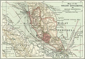
Background image1902 Collection: Map of the Malay Peninsula, c.1900 (engraving)

Map of the Malay Peninsula, c.1900 (engraving)
533325 Map of the Malay Peninsula, c.1900 (engraving); (add.info.: Map showing historical boundaries of the Malay Peninsula, Sumatra, and Singapore, circa 1902)

Background image1902 Collection: Map of Crete, c.1900 (engraving)

Map of Crete, c.1900 (engraving)
533320 Map of Crete, c.1900 (engraving); (add.info.: Map of Crete, Greece, circa 1902, From the 10th edition of Encyclopaedia Britannica.); Encyclopaedia Britannica/UIG.

Background image1902 Collection: Map of London and Vicinity, 1902, c.1900 (engraving)

Map of London and Vicinity, 1902, c.1900 (engraving)
533273 Map of London and Vicinity, 1902, c.1900 (engraving); (add.info.: Map of London, England, circa 1902, from the 10th edition of Encyclopaedia Britannica.); Encyclopaedia Britannica/UIG.

Background image1902 Collection: Map of Liverpool, Manchester, c.1900 (engraving)

Map of Liverpool, Manchester, c.1900 (engraving)
533270 Map of Liverpool, Manchester, c.1900 (engraving); (add.info.: Map of Liverpool and Manchester, England, circa 1902)

Background image1902 Collection: Map of Norway and Sweden, c.1900 (engraving)

Map of Norway and Sweden, c.1900 (engraving)
532971 Map of Norway and Sweden, c.1900 (engraving); (add.info.: Map of Norway, Sweden, with insets of Kristianiafjord and Stockholm, circa 1902)

Background image1902 Collection: Map of Scotland, c.1900 (engraving)

Map of Scotland, c.1900 (engraving)
532936 Map of Scotland, c.1900 (engraving); (add.info.: Map of the central part of Scotland, circa 1902, from the 10th edition of Encyclopaedia Britannica.); Encyclopaedia Britannica/UIG.

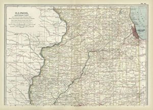
Background image1902 Collection: Map of northern Illinois, c.1900 (engraving)

Map of northern Illinois, c.1900 (engraving)
533173 Map of northern Illinois, c.1900 (engraving); (add.info.: Map of the northern part of Illinois, United States, circa 1902)

Background image1902 Collection: Boer War 25 December 1901 (print)

Boer War 25 December 1901 (print)
533165 Boer War 25 December 1901 (print); (add.info.: Boer War: Boer forces under General Dewet surprising encampment of British soldiers at Tweefontein, 25 December 1901)

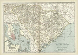
Background image1902 Collection: Map of South Carolina with inset of Charleston, c.1900 (engraving)

Map of South Carolina with inset of Charleston, c.1900 (engraving)
533136 Map of South Carolina with inset of Charleston, c.1900 (engraving); (add.info.: Map showing the historical boundaries of South Carolina, United States, with an inset map of Charleston)

Background image1902 Collection: Map of Vermont and New Hampshire, c.1900 (engraving)

Map of Vermont and New Hampshire, c.1900 (engraving)
533091 Map of Vermont and New Hampshire, c.1900 (engraving); (add.info.: Map showing the historical boundaries of Vermont and New Hampshire, United States, circa 1902)

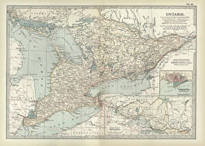
Background image1902 Collection: Map of Ontario, Canada, c.1900 (engraving)

Map of Ontario, Canada, c.1900 (engraving)
533076 Map of Ontario, Canada, c.1900 (engraving); (add.info.: Map of Ontario, Canada, with an inset of Toronto, circa 1902)

Background image1902 Collection: Map of Carson City with Virginia City and Reno, c.1900 (engraving)

Map of Carson City with Virginia City and Reno, c.1900 (engraving)
533459 Map of Carson City with Virginia City and Reno, c.1900 (engraving); (add.info.: Map of Reno, Carson City, and Virginia City, Nevada, circa 1902)

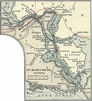
Background image1902 Collection: Map of St. Marys River and Sault Ste. Marie, MI, c.1900 (engraving)

Map of St. Marys River and Sault Ste. Marie, MI, c.1900 (engraving)
533450 Map of St. Marys River and Sault Ste. Marie, MI, c.1900 (engraving); (add.info.: Map of St. Marys River and Sault Ste)

Background image1902 Collection: Map of Jersey City, Paterson and Newark, c.1900 (engraving)

Map of Jersey City, Paterson and Newark, c.1900 (engraving)
533430 Map of Jersey City, Paterson and Newark, c.1900 (engraving); (add.info.: Map of Jersey City, Newark, and Paterson, New Jersey, circa 1902)

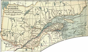
Background image1902 Collection: Map of Quebec, c.1900 (engraving)

Map of Quebec, c.1900 (engraving)
533412 Map of Quebec, c.1900 (engraving); (add.info.: Map of Quebec, Canada, circa 1902, from the 10th edition of Encyclopaedia Britannica.); Encyclopaedia Britannica/UIG.

Background image1902 Collection: Map of Cape Town, c.1900 (engraving)

Map of Cape Town, c.1900 (engraving)
533400 Map of Cape Town, c.1900 (engraving); (add.info.: Map of Cape Town, South Africa, circa 1902, from the 10th edition of Encyclopaedia Britannica.); Encyclopaedia Britannica/UIG.

Background image1902 Collection: Map of the Liu-Kiu Islands and Formosa, c.1900 (engraving)

Map of the Liu-Kiu Islands and Formosa, c.1900 (engraving)
533335 Map of the Liu-Kiu Islands and Formosa, c.1900 (engraving); (add.info.: Historical map of Southern part of Japan, Liu-Kiu Islands and Formosa with inset map of Bonin and Sulphur Islands)

Background image1902 Collection: Map of Naples, c.1900 (engraving)

Map of Naples, c.1900 (engraving)
533313 Map of Naples, c.1900 (engraving); (add.info.: Map of Naples, Italy, circa 1902, from the 10th edition of Encyclopaedia Britannica.); Encyclopaedia Britannica/UIG.

Background image1902 Collection: Map of Kristianiafjord, Kristiania, c.1900 (engraving)

Map of Kristianiafjord, Kristiania, c.1900 (engraving)
533309 Map of Kristianiafjord, Kristiania, c.1900 (engraving); (add.info.: Map of Kristiania (now Oslo), Norway, circa 1902

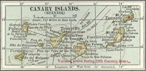
Background image1902 Collection: Map of the Canary Islands, c.1900 (engraving)

Map of the Canary Islands, c.1900 (engraving)
533299 Map of the Canary Islands, c.1900 (engraving); (add.info.: Map of Canary Islands (Spanish), circa 1902, from the 10th edition of Encyclopaedia Britannica.); Encyclopaedia Britannica/UIG.

Background image1902 Collection: Map of the Isle of Man, c.1900 (engraving)

Map of the Isle of Man, c.1900 (engraving)
533276 Map of the Isle of Man, c.1900 (engraving); (add.info.: Map of Isle of Man, United Kingdom, circa 1902, from the 10th edition of Encyclopaedia Britannica.); Encyclopaedia Britannica/UIG.

Background image1902 Collection: Map of Russia showing historical boundaries of Russia in Europe with Poland and Finland, circa 1902

Map of Russia showing historical boundaries of Russia in Europe with Poland and Finland, circa 1902
532992 Map of Russia showing historical boundaries of Russia in Europe with Poland and Finland, circa 1902; (add.info.: Map showing historical boundaries of Russia in Europe with Poland and Finland)

Background image1902 Collection: Map of Italy with Sicily and Naples, c.1900 (engraving)

Map of Italy with Sicily and Naples, c.1900 (engraving)
532989 Map of Italy with Sicily and Naples, c.1900 (engraving); (add.info.: Map of central and southern Italy with insets map of Sicily and Naples, circa 1902)

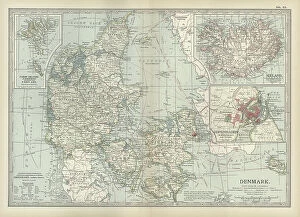
Background image1902 Collection: Map of Denmark, c.1900 (engraving)

Map of Denmark, c.1900 (engraving)
532967 Map of Denmark, c.1900 (engraving); (add.info.: Map of Denmark, with insets of Iceland, Copenhagen, and the Faeroe Islands, circa 1902)


All Professionally Made to Order for Quick Shipping

In the year 1902, a myriad of events unfolded that shaped history and left an indelible mark on society. It was a time when tales were spun, heroes emerged, and the world witnessed both triumphs and tragedies. One such tale was "The Cat that Walked by Himself, " penned by Rudyard Kipling in his iconic collection of stories called Just So Stories. This whimsical feline captivated readers with its independence and cunning nature. Meanwhile, across the vast Atlantic Ocean, another story was unfolding aboard the RMS Carpathia in 1903. This ship would later gain fame for its heroic role in rescuing survivors from the ill-fated Titanic disaster just nine years later. While maritime adventures took place at sea, on land, Newfoundland in Canada thrived as it proudly showcased its bountiful products - particularly cod. The fishing industry flourished as these prized fish became a staple food source for many around the world. In science and academia, brilliance shone through with Paul Dirac being awarded the Nobel Prize in Physics in 1933. His groundbreaking contributions to quantum mechanics paved the way for advancements that continue to shape our understanding of the universe today. Notable figures also made their mark during this era; Cecil Rhodes left an enduring legacy through his influential role as a British imperialist and businessman. Meanwhile, London Hospital on Mile End Road stood tall as a beacon of hope amidst illness and despair. As bustling streets teemed with life at Spitalfields in East End London, one could almost hear echoes of Kipling's words resonating: "I am only just beginning my travels. " And indeed, there was much more to explore within this vibrant cityscape. From hunting expeditions where foxes met their fate at "the meet" to brave soldiers fighting valiantly under adverse conditions like those depicted by Modderfontein's 17th Lancers - all that remained were memories etched in history.