



Framed Prints From Sheffield City Archives
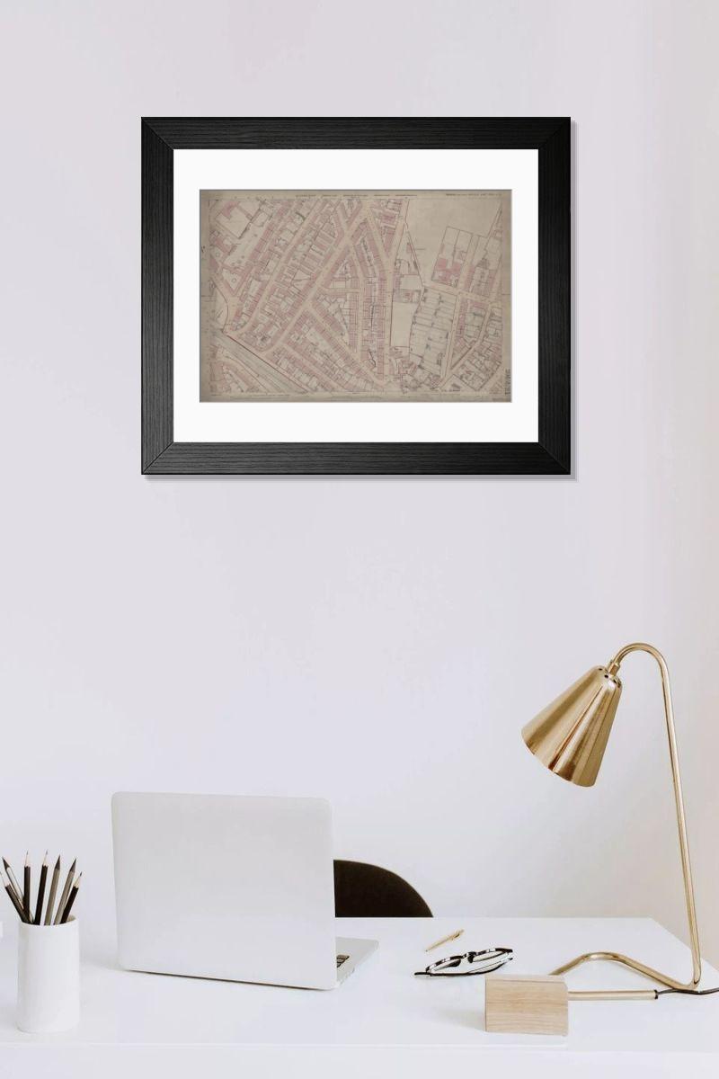
Framed Print of Ordnance Survey Map, Fowler Street, Pitsmoor area of Sheffield, 1889 (Yorkshire sheet no. 294. 4. 21)
This map features:
Top left: Rutland Road, [Woodside Board School] School (Girls and Infants), Playground, Botsford Street, Rutland Street, Woodside Lane Birley Street, Fowler Street, Grove Street, Sales Street, Kirkham Place, Fowler Place, Fowler Terrace, Westow Place, Langton Place, Corporation Yard, Stone Yard.
Top right: Grove Street, Sales Street, Fowler Street, United Free Methodist Chapel [Pye Bank Methodist Free Church], Fowler Street Hotel Public House, Haywood Road, Pitsmoor Road, Post Office, Fox and Duck Inn, Bank Top, Victoria Terrace, Chapel Terrace, Victoria Cottage, [Pye Bank Board School] School, Playground, Recreational Ground, Arundel Cottage, Fox Street, Andover Street, West Pye Bank, Gray Street.
Bottom left: Botsford Street, Rutland Street, Woodside Lane, Birley Street, Fowler Street, Macro Street, Wilson Street, Malton Place, Cooper Terrace, Harvest Lane, Platt Street, Bingley Street, Reginald Street, Marshall Street, Wheat Sheaf Inn, Manchester, Sheffield and Lincolnshire Railway.
Bottom right: Grove Street, Marshall Street, Fox Street, Fox Hill, Gray Street, Rock Street, Andover Street West, Victoria Cottage, Chapel Terrace, Bank Rise, Pye Bank, Tower Terrace, Richbell Place, Blenkarn Place, Blenkarn House, Harrington Place, Myrtle Villa, Beech Villa, Arundel Terrace, Tower Hill, Tower House, Grove cottage, Manor View, Hawthorne Cottage, Grove Lodge, Bank House.
Dimensions of original: 77 x 102 cm.
Scale 10.56 feet : 1 mile [1:500].
From an original at Sheffield Libraries: q00043 (sheet no.
294.4.21). Sheffield City Archives and Local Studies Library has an unrivalled collection of images of Sheffield, England. © Sheffield City Council - All Rights Reserved
Artwork supplied by Sheffield City Archives
Your chosen combination is quickly and professionally made to order, our shipping page has more details
If you are not entirely happy with your items, simply return them to us within 30 days for a replacement or full refund. Please read our full returns policy.
Media ID 24196955
Sheffield OS Maps , Old Sheffield Maps , Ordnance Survey Map Sheffield
Editors Comments
Discover the history of Sheffield's Pitsmoor area with this framed print from the Media Storehouse collection. Featuring an authentic Ordnance Survey Map from 1889 (Yorkshire sheet no. 294. 4. 21), this vintage map shows the intricate details of the Pitsmoor neighborhood, including Rutland Road, Woodside Board School, and the surrounding streets such as Botsford Street, Rutland Street, Woodside Lane, Birley Street, and Fowler Street. Bring a piece of Sheffield's rich history into your home or office with this beautifully framed and preserved map, a thoughtful addition to any space.
This artwork is also available as...
Photo Prints - Discover the history of Sheffield with our Photo Prints, featuring an 1889 Ordnance Survey Map from the Sheffield City Archives. This vintage map shows Fowler Street and surrounding areas, including Rutland Road, Woodside Board School and Birley Street. Perfect for genealogists and local historians, our Photo Prints are a way to explore the city's past.
Greetings Cards - Step back in time with our Ordnance Survey Map Greetings Cards. This charming design features a snapshot of Sheffield's Pitsmoor area from 1889, as depicted on Yorkshire sheet no. 294. 4. 21 from Sheffield City Archives. Discover the intricacies of Rutland Road, Woodside Board School, and the surrounding streets including Botsford Street, Rutland Street, Woodside Lane, Birley Street, and Fowler Street. Perfect for those with a love for history or a connection to Sheffield, these cards add a touch of nostalgia to any occasion. Send a piece of the past with our Ordnance Survey Map Greetings Cards.
Photo Mugs - Step back in time with our Photo Mug, featuring an intriguing snapshot of Sheffield's history. This vintage Ordnance Survey Map from 1889 shows the Pitsmoor area, including Fowler Street, with notable landmarks such as Woodside Board School and Rutland Road. Bring a piece of Sheffield's rich past into your daily routine with this beautifully designed mug. Perfect for tea or coffee, it makes for an excellent gift for history enthusiasts or locals. Relive the charm of the past, one sip at a time.
Poster Prints - Discover the charm of vintage Sheffield with our Poster Prints featuring an Ordnance Survey Map from 1889. This authentic map shows Fowler Street, Pitsmoor area, Yorkshire sheet no. 294.4.21, highlighting local landmarks like Woodside Board School and Rutland Road.
Metal Prints - Discover the history of Sheffield with our Metal Prints. This piece features an intriguing Ordnance Survey Map of the Pitsmoor area from 1889, taken from the Sheffield City Archives. The map highlights key landmarks such as Rutland Road, Woodside Board School, and Fowler Street in the and industrial heart of Yorkshire. Bring a piece of history into your home or office with this eye-catching and durable Metal Print, perfect for those with a love for local history or a connection to Sheffield.
Canvas Prints - Bring a piece of Sheffield's history to your home with our Canvas Prints. Featuring an authentic 1889 Ordnance Survey Map from the Sheffield City Archives, this print shows the Pitsmoor area, including Fowler Street and surrounding streets like Rutland Road and Woodside Lane. Perfect for locals and map enthusiasts alike.
Cushions - Step into the past with our cushions, featuring a piece of Sheffield's history. This vintage Ordnance Survey map from 1889 brings to life the charming streets of Pitsmoor, including Rutland Road and Fowler Street. Each cushion is a reminder of the city's rich heritage and a lovely addition to any room.
Mouse Mats - Step into the past with our range of Mouse Mats, featuring a piece of Sheffield's history. This image from 1889 shows the Ordnance Survey Map of Fowler Street in Pitsmoor, highlighting the area's charming streets and landmarks like Woodside Board School. Bring a touch of nostalgia to your workspace with this fascinating design.
Tote Bags - Step into the past with our Tote Bag featuring a 1889 Ordnance Survey Map of Sheffield's Pitsmoor area. This piece of history shows the charming streets and landmarks that once were, including Rutland Road, Woodside Board School, and Birley Street. Carry a piece of Sheffield's rich heritage wherever you go with this tote bag.
Modern Frame 14"x12" (36x31cm)
Ready to Hang Contemporary Framed Prints adds style, protection, and a polished touch to your space - effortlessly.
Your artwork will be printed as shown in the preview. To adjust please select Edit Printed Image under the Buy button
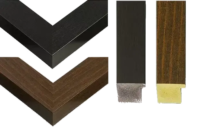
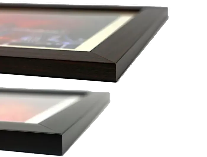
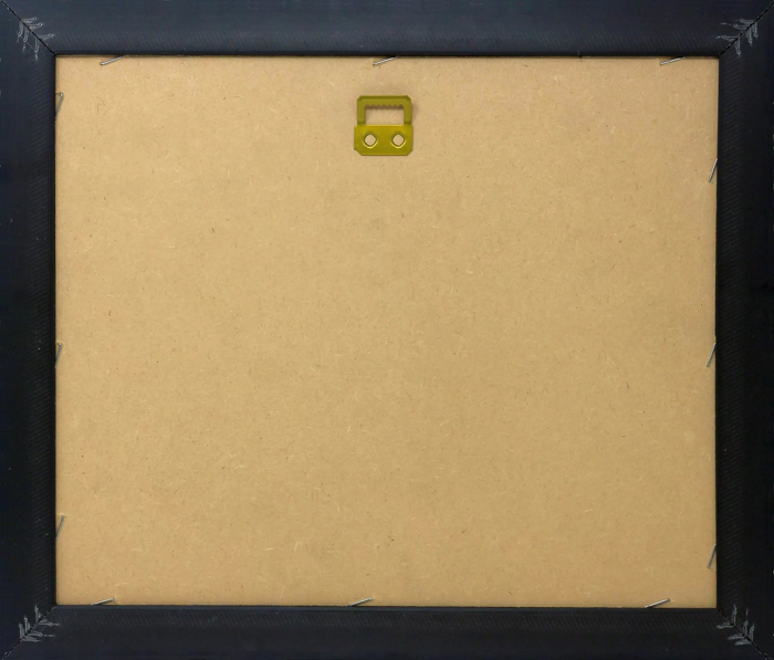
Wood effect frame, card mounted, 10x8 fade resistant photo print. Overall outside dimensions 14x12 inches (36x31cm). Environmentally and ozone friendly, 40mm wide x 15mm Polycore® moulding has the look of real wood, is durable and light and easy to hang. Biodegradable and made with non-chlorinated gases (no toxic fumes) it is efficient; producing 100 tons of polystyrene can save 300 tons of trees! Prints are glazed with lightweight, shatterproof, optical clarity acrylic (providing the same general protection from the environment as glass). The back is stapled hardboard with a sawtooth hanger attached. Note: measurements provided are estimated outer dimensions, which include both the image and the frame. While we aim to keep sizing consistent, exact dimensions may vary slightly due to differences in print size or production requirements, which may result in a variation in the overall size (up to approximately 2.5cm (1"))
These are individually made so all sizes are approximate
Estimated Image Size (if not cropped) is 24.4cm x 16.6cm (9.6" x 6.5")
Estimated Product Size is 36cm x 31cm (14.2" x 12.2")
Features In These Collections
> Europe > United Kingdom > England > Rutland > Related
> Europe > United Kingdom > England > Yorkshire > Sheffield
> Maps and Charts > Early Maps
> Sheffield City Archives > Maps and Plans > Sheffield OS Maps