Framed Print > Maps and Charts > Related Images
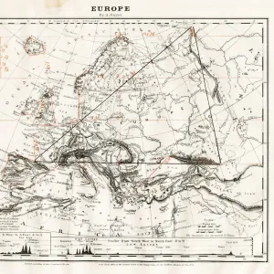
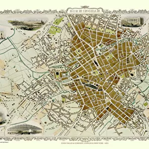
Framed Print : Map of Europe showing how it appeared at the time of the Accession of The Emperor Charles V in AD 1519


![]()
Framed Photos from MapSeeker
Map of Europe showing how it appeared at the time of the Accession of The Emperor Charles V in AD 1519
EHIST008
Welcome to the Mapseeker Image library and enter an historic gateway to one of the largest on-line collections of Historic Maps, Nostalgic Views, Vista's and Panorama's from a World gone by.
Media ID 20348250
Europe Europe Map Map Of Europe
14"x12" (38x32cm) Modern Frame
Discover history with our exquisite Framed Prints from Media Storehouse. This particular piece showcases a captivating Map of Europe as it appeared during the significant historical moment of Emperor Charles V's accession in AD 1519. Meticulously sourced from MapSeeker, this detailed and intricately designed map is a must-have for history enthusiasts and collectors. The high-quality print is beautifully framed, adding an elegant touch to any room in your home or office. Travel back in time and enhance your space with this fascinating piece of history.
Wood effect frame, card mounted, 10x8 archival quality photo print. Overall outside dimensions 14x12 inches (38x32cm). Environmentally and ozone friendly, 40mm wide x 15mm Polycore® moulding has the look of real wood, is durable and light and easy to hang. Biodegradable and made with non-chlorinated gases (no toxic fumes) it is efficient; producing 100 tons of polystyrene can save 300 tons of trees! Prints are glazed with lightweight, shatterproof, optical clarity acrylic (providing the same general protection from the environment as glass). The back is stapled hardboard with a sawtooth hanger attached. Note: To minimise original artwork cropping, for optimum layout, and to ensure print is secure, the visible print may be marginally smaller
Contemporary Framed and Mounted Prints - Professionally Made and Ready to Hang
Estimated Image Size (if not cropped) is 24.4cm x 20.3cm (9.6" x 8")
Estimated Product Size is 37.6cm x 32.5cm (14.8" x 12.8")
These are individually made so all sizes are approximate
Artwork printed orientated as per the preview above, with landscape (horizontal) orientation to match the source image.
FEATURES IN THESE COLLECTIONS
> Maps and Charts
> Related Images
> MapSeeker
> Maps of Europe
> Old Maps of Europe and Small Islands of
EDITORS COMMENTS
This print showcases a historical treasure, the "Map of Europe showing how it appeared at the time of the Accession of The Emperor Charles V in AD 1519". This meticulously crafted map offers us a glimpse into the political landscape and geographical boundaries that shaped Europe during this significant period. As we gaze upon this remarkable piece, our eyes are immediately drawn to the intricate details and vibrant colors that bring each nation to life. From Spain's vast empire stretching across continents to France's regal presence in Western Europe, every kingdom is depicted with precision and artistry. The map not only highlights major cities but also captures rivers, mountain ranges, and other natural features that influenced strategic decisions and trade routes. The accession of Emperor Charles V in 1519 marked a turning point in European history. His reign witnessed profound changes as he inherited an extensive empire comprising territories from Spain, Austria, Italy, Germany, and more. This map allows us to comprehend the sheer magnitude of his dominion while appreciating the diverse cultures and languages encompassed within its borders. Beyond its historical significance lies an aesthetic appeal that draws viewers closer. Its vintage charm evokes nostalgia for a bygone era when cartography was both science and art. Whether displayed in classrooms or personal collections, this print serves as a window into Europe's past—a tangible reminder of how empires rose and fell amidst ever-shifting alliances on this ancient continent
MADE IN THE UK
Safe Shipping with 30 Day Money Back Guarantee
FREE PERSONALISATION*
We are proud to offer a range of customisation features including Personalised Captions, Color Filters and Picture Zoom Tools
SECURE PAYMENTS
We happily accept a wide range of payment options so you can pay for the things you need in the way that is most convenient for you
* Options may vary by product and licensing agreement. Zoomed Pictures can be adjusted in the Basket.