Fraud Blocker Skip to main content

Home > Africa > Botswana > Maps

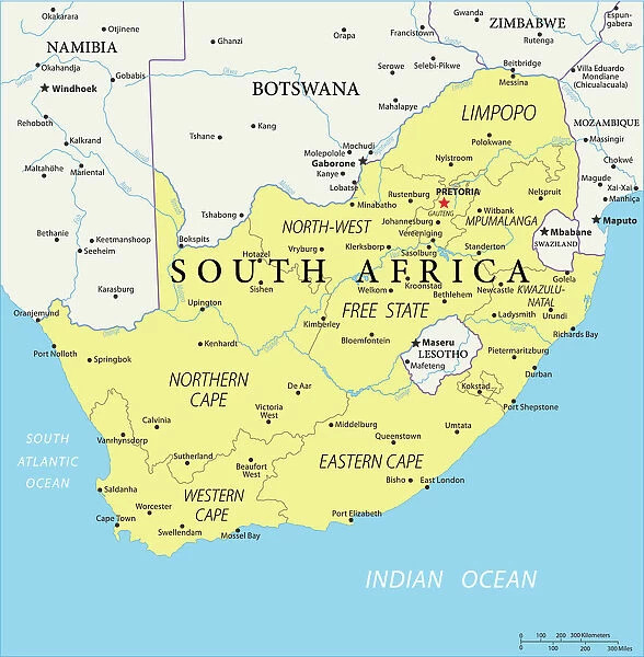
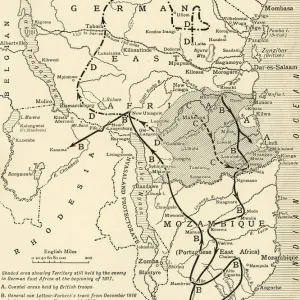
Reference Map of Map of South Africa

Reference Map of Map of South Africa
Sold 1
In Stock
We accept all major credit cards
Framed Photos
Buy from £59.99
Photo Prints
Buy from £6.99
Jigsaw Puzzles
Buy from £32.99
Poster Prints
Buy from £16.99
Canvas Prints
Buy from £34.99
Fine Art Prints
Buy from £49.99
Mounted Prints
Buy from £17.99
Metal Prints
Buy from £169.99
Cards
Buy from £8.97
Home Decor
Buy from £11.99

Fine Art Storehouse Photo Prints and Wall Art

Reference Map of Map of South Africa

South Africa is located in southern Africa. South Africa is bordered by the Atlantic Ocean and the Indian Ocean, Lesotho and eSwatini (formerly Swaziland) in the eastern portion of South Africa, and Namibia, Botswana, Zimbabwe, and Mozambique to the north. Unleash your creativity and transform your space into a visual masterpiece.

Media ID 20251055

FEATURES IN THESE COLLECTIONS

> Africa > Botswana > Maps

> Africa > Botswana > Related Images

> Africa > Lesotho > Maps

> Africa > Lesotho > Related Images

> Africa > Mozambique > Maps

> Africa > Mozambique > Related Images

> Africa > Namibia > Maps

> Africa > Namibia > Related Images

> Africa > South Africa > Maps

> Africa > South Africa > Related Images

> Fine Art Storehouse > Map

SECURE PAYMENTS
We happily accept a wide range of payment options so you can pay for the things you need in the way that is most convenient for you

MADE IN THE UK
Safe Shipping with 30 Day Money Back Guarantee

FREE PERSONALISATION
We are proud to offer a range of customisation including Cropping, Captions, and Filters. Zoom Cropping can be adjusted in the Basket.


EDITORS COMMENTS

This print showcases a meticulously detailed reference map of South Africa, offering a comprehensive glimpse into the diverse landscapes and geographical features that define this remarkable country. Located in southern Africa, South Africa is bordered by both the Atlantic Ocean and the Indian Ocean, creating an awe-inspiring coastline that stretches for miles on end. The map highlights not only the country's extensive shoreline but also its neighboring countries. To the east, Lesotho and eSwatini (formerly Swaziland) form a natural boundary with South Africa, while to the north lie Namibia, Botswana, Zimbabwe, and Mozambique. These nations contribute to South Africa's rich cultural tapestry through shared histories and influences. Every inch of this artful depiction has been thoughtfully crafted to showcase topographical details such as mountain ranges, rivers, lakes, and national parks. It invites viewers to embark on a visual journey across vast plains dotted with vibrant cities like Johannesburg or Cape Town; traverse breathtaking mountainous regions such as Drakensberg; or explore iconic landmarks like Kruger National Park. Whether you are an avid traveler seeking inspiration for your next adventure or simply intrigued by cartography's beauty and precision—this exquisite print from Fine Art Storehouse is sure to captivate your imagination. Its intricate details will transport you directly into South Africa's enchanting world without ever leaving your home.


Framed Prints

Discover the beauty and intricacy of South Africa with our exquisite Framed Prints from Media Storehouse's Fine Art Storehouse collection. This stunning piece showcases a detailed Reference Map of South Africa, highlighting its unique borders with the Atlantic and Indian Oceans, as well as its neighboring countries, Lesotho and eSwatini. Bring the rich history and diverse culture of South Africa into your home or office with this elegant and informative addition to your decor. Order now and enjoy free shipping on your purchase.


Photo Prints

Discover the beauty and rich diversity of South Africa with our exquisite Fine Art Storehouse Photographic Prints. This stunning piece showcases a detailed Reference Map of South Africa, perfectly capturing its unique location at the southernmost tip of the African continent. Bordered by the Atlantic and Indian Oceans, and sharing borders with Lesotho and eSwatini, South Africa's geography is as varied as its people and culture. Bring the essence of this captivating country into your home or office with our premium quality, museum-grade prints, meticulously crafted to bring out the vibrant colors and intricate details of the map. Each print is carefully inspected for quality and shipped with the utmost care, ensuring your satisfaction.


Poster Prints

"Discover the beauty and complexity of South Africa with our exquisite Reference Map of South Africa Poster Print from Media Storehouse's Fine Art collection. This stunning piece showcases the intricate details of the African continent's southernmost country, including its borders with the Atlantic and Indian Oceans, as well as its neighboring nations of Lesotho and eSwatini. Bring a touch of world exploration to your home or office with this captivating and educational poster print."


Jigsaw Puzzles

Discover the beauty and complexity of South Africa with our intricately designed Jigsaw Puzzle from Media Storehouse's Fine Art Storehouse collection. This captivating puzzle showcases a detailed Reference Map of South Africa, allowing you to explore the diverse landscapes, borders, and geographical features that make up this stunning continent. Immerse yourself in the puzzle-solving experience and bring the wonders of South Africa right into your home.

diamond
Made With High Grade Materials
thumb_up
Professional Quality Finish
package_2
Carefully Packed To Aid Safe Arrival

You May Also Like


South Africa country mapSouth Africa country map
Add to Basket
South Africa Vector MapSouth Africa Vector Map
Add to Basket
Reference Map of SpainReference Map of Spain
Add to Basket
political map of south america in vector formatpolitical map of south america in vector format
Add to Basket
Africa Political MapAfrica Political Map
Add to Basket
Zimbabwe country mapZimbabwe country map
Add to Basket
Botswana country mapBotswana country map
Add to Basket
Map of Middle East - illustrationMap of Middle East - illustration
Add to Basket
Political Map of AfricaPolitical Map of Africa
Add to Basket
Map of NigeriaMap of Nigeria
Add to Basket
Detailed map of EuropeDetailed map of Europe
Add to Basket
Mozambique country mapMozambique country map
Add to Basket

Gallery Wall Inspiration

Antique map of Scotland
Old City Of London
Map of earth population 1895
Antique map, Southampton, England, 19th Century
Antique map of the Roman Empire
Map of Middle East - illustration
Antique map of Britain under the Anglo Saxons
Map of Cyprus, published in 1880
Map of Anglo-Saxon Kingdoms and the Danelaw, 9th Century
Battle Of Waterloo
Reference Map of Spain
Antique map of Britain under the Ancient Romans
Map of Whitby
Map of Dorset 1883
Cornwall map 1884
Detailed map of Europe
Coloured Map of Nigeria with Flag
Sicily map 1895
Antique map, Scotland, Isle of Skye, South and North Uist
Map of Ireland 1897
Map of Portugal
Map of Malvern Hills in Worcestershire, England Victorian Engraving, 1840
Antique map of New Zealand in the 19th Century, 1873
Greece at the beginning of the Peloponnesian War (431-404 BC)
Antique map of Hadrians wall
Antique colored illustrations: Geological map of England and Wales
Map of Malvern Hills in Worcestershire, England Victorian Engraving, 1840

Discover Our Collections


MapMap
View Collection
Botswana Related ImagesBotswana Related Images
View Collection
Lesotho Related ImagesLesotho Related Images
View Collection
Mozambique Related ImagesMozambique Related Images
View Collection
Namibia Related ImagesNamibia Related Images
View Collection
South Africa Related ImagesSouth Africa Related Images
View Collection
MapsMaps
View Collection
MapsMaps
View Collection
MapsMaps
View Collection
MapsMaps
View Collection
MapsMaps
View Collection


© Copyright Media Storehouse, All Rights Reserved 2003 - 2024
Facebook     Pinterest     Card Payments     Reviews IO