
Maps Collection
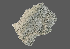
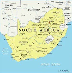
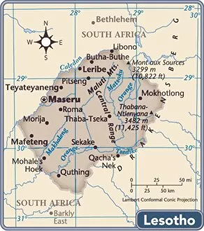
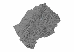
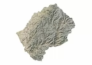
Lesotho is a small, landlocked country located in southern Africa and has completely surrounded by South Africa and has an area of 30,355 square kilometers
Choose a picture from our Maps Collection for your Wall Art and Photo Gifts
8 items
All Professionally Made to Order for Quick Shipping
-
Maps Collection
Lesotho is a small, landlocked country located in southern Africa and has completely surrounded by South Africa and has an area of 30,355 square kilometers. The terrain is mostly mountainous with the highest point being Thabana Ntlenyana at 3,482 meters. The climate is temperate with hot summers and cool winters. Lesotho has a population of approximately 2 million people who are mainly of Sotho origin and speak Sesotho as their native language. Agriculture is the main economic activity in Lesotho, with maize and wheat being the most important crops grown there. Other important industries include mining (diamonds), manufacturing (textiles) and tourism. Lesotho also produces wool, mohair and livestock products for export to other countries in Africa as well as Europe and North America.
+
Our beautiful pictures are available as Framed Prints, Photos, Wall Art and Photo Gifts
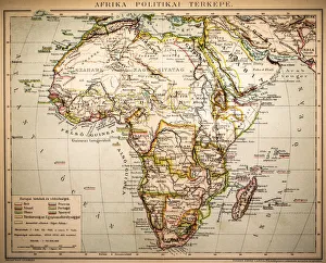
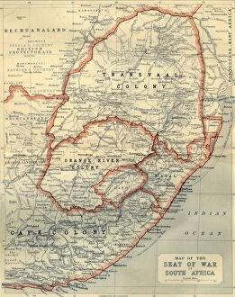
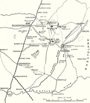
The Maps of Lesotho Africa collection, available on Media Storehouse, is a stunning compilation of vintage and contemporary maps that showcase the geography and topography of Lesotho. Our collection features a range of maps dating back to the 1800s, including hand-drawn sketches and lithographs that offer an insight into how this African country has evolved over time. These maps are not only visually appealing but also provide valuable information about the landforms, rivers, lakes, roads and settlements in Lesotho. Whether you're looking for wall art or framed prints to decorate your home or office space with unique pieces that reflect your love for travel and exploration or simply want to learn more about this fascinating country in southern Africa, the Maps of Lesotho Africa collection is sure to impress. With its rich history and diverse landscapes ranging from mountains to valleys, there's something for everyone in this captivating collection.
+
What are Maps of Lesotho Africa art prints?
Maps of Lesotho Africa art prints are high-quality reproductions of maps that depict the geography, topography and landmarks of the African country of Lesotho. These prints are created using advanced printing techniques to ensure that every detail is captured accurately and with exceptional clarity. These art prints are not only visually stunning but also serve as a valuable resource for anyone interested in learning about Lesotho's history, culture and geography. They can be used for educational purposes or simply as decorative pieces to add character and interest to any space. Whether you're an avid traveler, a history buff or simply someone who appreciates beautiful artwork, Maps of Lesotho Africa art prints offer something for everyone. With their intricate details and vibrant colors, they make excellent gifts for friends and family members who share your passion for exploration and discovery.
+
What Maps of Lesotho Africa art prints can I buy from Media Storehouse?
We offer a wide range of Lesotho Africa art prints that are perfect for anyone looking to add some African flair to their home or office. From detailed topographical maps to colorful political maps, there is something for everyone in our collection. Our Lesotho Africa map prints come in a variety of sizes and styles, so you can choose the one that best suits your needs. Whether you're looking for a large wall hanging or a smaller print to display on your desk, we have options available. In addition to traditional paper prints, we also offer canvas prints and framed art prints. These options allow you to customize your artwork even further and create a truly unique piece that reflects your personal style. No matter which type of Lesotho Africa map print you choose from Media Storehouse, you can be sure that it will be high-quality and expertly crafted. Our team takes great care in producing each print using only the finest materials available.
+
How do I buy Maps of Lesotho Africa art prints?
To buy Maps of Lesotho Africa art prints, you can visit Media Storehouse. We offer a wide range of high-quality art prints that are perfect for decorating your home or office space. To find the Maps of Lesotho Africa art print that you want to purchase, simply browse through our collection and select the one that catches your eye. Once you have found the artwork that you want to buy, add it to your cart and proceed to checkout. You will be prompted to enter your shipping information and payment details before completing your order. We offer a secure online shopping experience, so you can rest assured that your personal information is safe. They also provide excellent customer service if you have any questions or concerns about your purchase. Buying Maps of Lesotho Africa art prints from Media Storehouse is a simple and hassle-free process. With their extensive selection of artwork and easy-to-use website, finding the perfect piece for your home has never been easier.
+
How much do Maps of Lesotho Africa art prints cost?
We offer a wide range of Maps of Lesotho Africa art prints that are available at varying prices. Our collection includes high-quality prints that capture the beauty and uniqueness of Lesotho's landscapes, cities, and landmarks. Each print is carefully crafted to ensure it meets our customers' expectations in terms of quality and clarity. Our pricing varies depending on the size, framing options, and finish you choose for your print. We have different sizes ranging from small to large prints that can fit any wall or space in your home or office. Additionally, we offer various framing options such as black frames or white frames to suit your preference. Whether you're looking for a gift for someone special or want to add some African-inspired decor to your living space, our Maps of Lesotho Africa art prints are an excellent choice. They are affordable yet stylish pieces that will complement any room's aesthetic while showcasing the beauty of this African country.
+
How will my Maps of Lesotho Africa art prints be delivered to me?
We take great care in delivering your Maps of Lesotho Africa art prints to you. We use high-quality packaging materials to ensure that your artwork arrives in pristine condition. Depending on the size and quantity of your order, we may use a variety of delivery methods such as standard mail or courier services. All our deliveries are tracked so you can keep an eye on the progress of your order from dispatch to arrival. If for any reason there is a delay or issue with your delivery, our customer service team will be happy to assist you and provide updates. We understand how important it is for you to receive your artwork promptly and safely, which is why we work hard to ensure that all orders are processed quickly and efficiently. You can rest assured that when ordering from Media Storehouse, your Maps of Lesotho Africa art prints will be delivered with care and attention every step of the way.