Fine Art Print > North America > Canada > Maps
Fine Art Print : Hudsons Bay Map


![]()
Fine Art Prints from Mary Evans Picture Library
Hudsons Bay Map
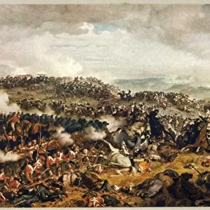
HUDSONs BAY, at the time of the Seven Years War, showing French and English forts including Fort York, the principal settlement of the Hudsons Bay Company
Mary Evans Picture Library makes available wonderful images created for people to enjoy over the centuries
Media ID 611103
© Mary Evans Picture Library 2015 - https://copyrighthub.org/s0/hub1/creation/maryevans/MaryEvansPictureID/10100649
1757 Fort Forts Hudsons Including Maps Principal Settlement Years
A2 (42x59cm) Fine Art Print
Step back in time with our exquisite Hudson's Bay Map Fine Art Print from the Media Storehouse collection. This captivating piece, sourced from Mary Evans Picture Library, transports you to the pivotal Seven Years War era. Witness the strategic layout of French and English forts, including Fort York, the principal settlement of the Hudson's Bay Company. Each detail is meticulously rendered, bringing history to life in your home or office. Experience the allure of the past with our museum-quality prints, expertly printed on premium archival paper for lasting brilliance.
Our Fine Art Prints are printed on 100% acid free, PH neutral paper with archival properties. This printing method is used by museums and art collections to exhibit photographs and art reproductions. Hahnemühle certified studio for digital fine art printing. Printed on 308gsm Photo Rag Paper.
Our fine art prints are high-quality prints made using a paper called Photo Rag. This 100% cotton rag fibre paper is known for its exceptional image sharpness, rich colors, and high level of detail, making it a popular choice for professional photographers and artists. Photo rag paper is our clear recommendation for a fine art paper print. If you can afford to spend more on a higher quality paper, then Photo Rag is our clear recommendation for a fine art paper print.
Estimated Product Size is 59.4cm x 42cm (23.4" x 16.5")
These are individually made so all sizes are approximate
Artwork printed orientated as per the preview above, with landscape (horizontal) orientation to match the source image.
FEATURES IN THESE COLLECTIONS
> Maps and Charts
> Early Maps
> Maps and Charts
> Related Images
> North America
> Canada
> Maps
> North America
> Canada
> Related Images
EDITORS COMMENTS
This intricately detailed map, dated circa 1757, offers a captivating glimpse into the geopolitical landscape of North America during the Seven Years War. The focus of the map is the expansive Hudson Bay, a body of water that was of great strategic importance to both the French and English during this period. At the heart of the map, the principal English settlement of Fort York is depicted, marking the center of the Hudsons Bay Company's influence. Fort York, established in 1682, served as a vital trading post and military outpost for the English. The fort's strategic position at the mouth of the Niagara River provided control over the access to the Great Lakes and the rich resources they offered. Surrounding Fort York, several other English forts are shown, including those at Moose Factory, Albany, and James Bay. These forts were crucial to the English defense against French encroachment in the region. On the opposite side of the map, the French forts of New France are depicted. Notable among these is Fort Frontenac, located at the confluence of the St. Lawrence and Cataraqui Rivers. This fort was a significant stronghold for the French, providing access to the Great Lakes and control over the fur trade in the region. The map also highlights several rivers and waterways, including the Niagara, St. Lawrence, and Ottawa Rivers. These waterways were essential for transportation and communication between the various forts and settlements. This map offers a fascinating look into the complex political and military landscape of North America during the Seven Years War. The depiction of the forts and settlements along the Hudson Bay provides insight into the strategic importance of this region and the efforts of both the French and English to establish and maintain their presence in the New World.
MADE IN THE UK
Safe Shipping with 30 Day Money Back Guarantee
FREE PERSONALISATION*
We are proud to offer a range of customisation features including Personalised Captions, Color Filters and Picture Zoom Tools
SECURE PAYMENTS
We happily accept a wide range of payment options so you can pay for the things you need in the way that is most convenient for you
* Options may vary by product and licensing agreement. Zoomed Pictures can be adjusted in the Basket.