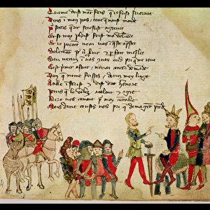
Fine Art Print > Granger Art on Demand > Maps
Fine Art Print : MAP OF NEW FRANCE, 1612. The easterly portion of Samuel de Champlains 1612 map


![]()
Fine Art Prints from Granger
MAP OF NEW FRANCE, 1612. The easterly portion of Samuel de Champlains 1612 map
MAP OF NEW FRANCE, 1612.
The easterly portion of Samuel de Champlains 1612 map of New France
Granger holds millions of images spanning more than 25,000 years of world history, from before the Stone Age to the dawn of the Space Age
Media ID 12321040
1612 Canada Canadian Champlain Colony Detail Eastern New France Portolan Chart Samuel Settlement
A2 (42x59cm) Fine Art Print
Discover the rich history of New France with our exquisite fine art print of Samuel de Champlains 1612 Map. This rare and intriguing piece, featuring the easterly portion of the map, offers a fascinating glimpse into the early exploration of North America. Meticulously reproduced from the original Granger Art on Demand archives, our fine art print brings the intricate details and vibrant colors of this historical cartography to life. Add this beautiful and educational addition to your home or office decor, and transport yourself back in time to the era of brave explorers and new discoveries.
Our Fine Art Prints are printed on 100% acid free, PH neutral paper with archival properties. This printing method is used by museums and art collections to exhibit photographs and art reproductions. Hahnemühle certified studio for digital fine art printing. Printed on 308gsm Photo Rag Paper.
Our fine art prints are high-quality prints made using a paper called Photo Rag. This 100% cotton rag fibre paper is known for its exceptional image sharpness, rich colors, and high level of detail, making it a popular choice for professional photographers and artists. Photo rag paper is our clear recommendation for a fine art paper print. If you can afford to spend more on a higher quality paper, then Photo Rag is our clear recommendation for a fine art paper print.
Estimated Image Size (if not cropped) is 51.3cm x 42cm (20.2" x 16.5")
Estimated Product Size is 59.4cm x 42cm (23.4" x 16.5")
These are individually made so all sizes are approximate
Artwork printed orientated as per the preview above, with landscape (horizontal) orientation to match the source image.
EDITORS COMMENTS
This print showcases the historical significance of the "MAP OF NEW FRANCE, 1612". Samuel de Champlain's meticulous cartographic skills come to life in this easterly portion of his map, which provides a fascinating glimpse into early French settlement and exploration in Canada. The intricate details on this map transport us back to the year 1612 when New France was still a burgeoning colony. As we study each line and symbol, we can almost feel the excitement and curiosity that must have fueled Champlain's expeditions along these uncharted rivers and coastlines. Champlain's dedication to accurately depicting the geography of New France is evident in every stroke of his pen. From the majestic river systems flowing through dense forests to carefully marked settlements dotting the landscape, this map serves as both an invaluable historical document and a work of art. As we admire this portolan chart, it becomes clear that it represents more than just geographical boundaries; it embodies centuries' worth of cultural exchange between indigenous peoples and European colonizers. It reminds us of the resilience and adaptability required for survival in such untamed lands. Granger Art on Demand has beautifully captured this piece from history, allowing us to appreciate its significance from our own homes. Whether you are a history enthusiast or simply intrigued by maps, this print offers an opportunity to delve into Canada's rich past while marveling at Champlain's mastery as a cartographer.
MADE IN THE UK
Safe Shipping with 30 Day Money Back Guarantee
FREE PERSONALISATION*
We are proud to offer a range of customisation features including Personalised Captions, Color Filters and Picture Zoom Tools
FREE COLORIZATION SERVICE
You can choose advanced AI Colorization for this picture at no extra charge!
SECURE PAYMENTS
We happily accept a wide range of payment options so you can pay for the things you need in the way that is most convenient for you
* Options may vary by product and licensing agreement. Zoomed Pictures can be adjusted in the Basket.