
Portolan Chart Collection
A portolan chart is a type of navigational map that was commonly used by sailors during the 13th to 16th centuries


All Professionally Made to Order for Quick Shipping
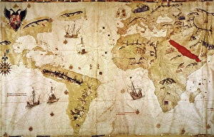
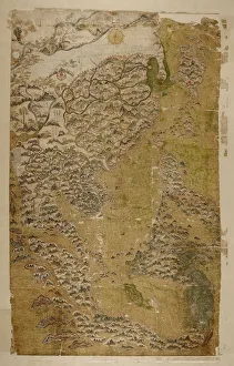
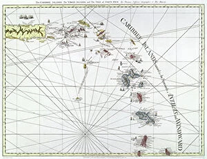
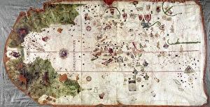
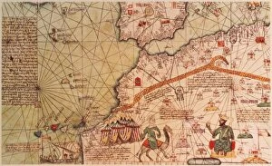
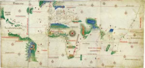
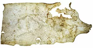
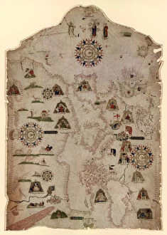
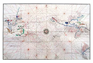
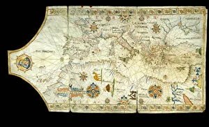
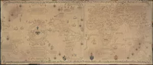
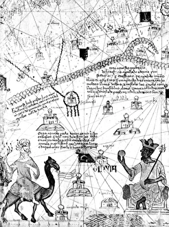
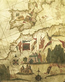
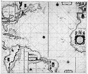
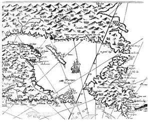
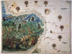
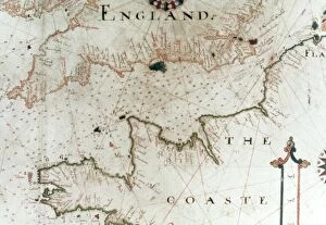
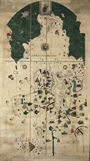
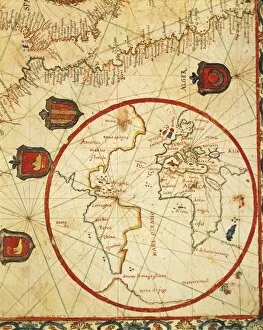
A portolan chart is a type of navigational map that was commonly used by sailors during the 13th to 16th centuries. These charts were highly detailed and accurate, providing crucial information about coastlines, harbors, and landmarks. One notable example is "The Selden Map of China, " created by an anonymous Chinese master. This map, dating back to the early 17th century, showcases the intricate knowledge of Chinese cartographers at the time. Another significant portolan chart is "Vespucci's World Map" from 1526. Created by Juan Vespucci, this map depicts various continents and provides valuable insights into geographical understanding during that era. The "Cantino World Map" from 1502 displays the western half of the world according to Portuguese explorers' knowledge at that time. It highlights their discoveries in Africa and South America. Thomas Jefferys' engraved map of The Caribee Islands in 1775 offers a glimpse into English exploration in the Caribbean region during colonial times. Juan de la Cosa's "Nina: World Map" from around 1500 showcases his experiences as a navigator on Christopher Columbus' second voyage aboard the Nina ship. "The Cantino Planisphere, " an anonymous masterpiece from 1502, reveals Portugal's extensive maritime knowledge during its Age of Discovery. A Portuguese map from 1519 focuses on Brazil between the Amazon River and Rio de la Plata. It demonstrates early European exploration efforts in South America. In another Portuguese map from 1565 depicting Brazil, native Indians are shown harvesting brazilwood trees—a valuable resource at that time—providing insight into indigenous cultures encountered by European explorers. Portolan charts also covered regions beyond Europe; for instance, one shows navigation routes through China, Ceylon (Sri Lanka), Philippines along with Tropics lines around mid-16th century These maps were essential tools for sailors, providing accurate information for safe navigation.