Fine Art Print > Europe > France > Canton > Landes
Fine Art Print : Antique Map of Switzerland


![]()
Fine Art Prints from Fine Art Storehouse
Antique Map of Switzerland
Antique Map of Switzerland from 1898
Unleash your creativity and transform your space into a visual masterpiece!
Nastasic
Media ID 13668347
© Nikola Nastasic
1830 1839 78279 95839 Aging Process Appenzellerland Canton Bern Canton Central Europe Chart Condition European Alps Geneva Geneva Canton Geneva Switzerland Geographical Locations Graubunden Canton Image Created 1830 1839 Land Land Feature Lucerne Canton Navigational Equipment Pennine Alps St Gallen Canton Styles Swiss Alps Switzerland Ticino Canton Valais Canton Vaud Canton Zurich Canton Arolla Basel Fribourg Canton Guarda Image Created 19th Century Jungfrau Region Lugano Neuchatel Obsolete Pontresina Thurgau Uri Canton Victorian Style
A2 (42x59cm) Fine Art Print
Discover the rich history and intricate detail of Switzerland with our exquisite Antique Map of Switzerland from Nastasic, available at Fine Art Storehouse. This fine art print transports you back in time to 1898, offering a captivating glimpse into the past. The intricately designed map showcases the borders, topography, and historical landmarks of Switzerland during this era. Each print is meticulously produced using premium quality materials, ensuring vibrant colors and sharp details that bring the map to life. Add a touch of history and sophistication to your home or office decor with this stunning antique map from Fine Art Storehouse.
Our Fine Art Prints are printed on 100% acid free, PH neutral paper with archival properties. This printing method is used by museums and art collections to exhibit photographs and art reproductions. Hahnemühle certified studio for digital fine art printing. Printed on 308gsm Photo Rag Paper.
Our fine art prints are high-quality prints made using a paper called Photo Rag. This 100% cotton rag fibre paper is known for its exceptional image sharpness, rich colors, and high level of detail, making it a popular choice for professional photographers and artists. Photo rag paper is our clear recommendation for a fine art paper print. If you can afford to spend more on a higher quality paper, then Photo Rag is our clear recommendation for a fine art paper print.
Estimated Image Size (if not cropped) is 53.2cm x 42cm (20.9" x 16.5")
Estimated Product Size is 59.4cm x 42cm (23.4" x 16.5")
These are individually made so all sizes are approximate
Artwork printed orientated as per the preview above, with landscape (horizontal) orientation to match the source image.
FEATURES IN THESE COLLECTIONS
> Europe
> France
> Canton
> Landes
> Europe
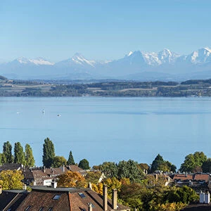
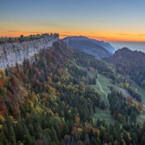
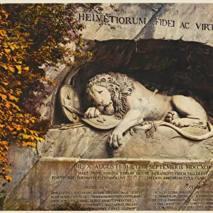
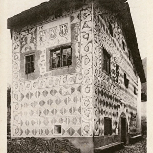
> Related Images
> Europe
> Switzerland
> Basel
> Europe
> Switzerland
> Bern
> Europe
> Switzerland
> Geneva
> Europe
> Switzerland
> Lucerne
> Europe
> Switzerland
> Lugano
> Europe
> Switzerland
> Maps
> Europe
> Switzerland
> Posters
> Europe
> Switzerland
> Related Images
> Fine Art Storehouse
> The Magical World of Illustration
> Nastasic Images & Illustrations
> Fine Art Storehouse
> Map
> Historical Maps
EDITORS COMMENTS
This print showcases an exquisite "Antique Map of Switzerland" from 1898, taking us on a visual journey through the rich history and geographical marvels of this enchanting country. With intricate details and a Victorian-style aesthetic, this piece transports us back to the 19th century, offering a glimpse into the past. The map encompasses various Swiss regions such as Neuchatel, Pontresina, Thurgau, Lugano, Jungfrau Region, Uri Canton, Jura Canton, St Gallen Canton, Aargau Canton and many more. It beautifully captures the diverse landscapes of Switzerland - from the majestic Pennine Alps to the serene valleys of Graubunden Cantons. As we admire this aging masterpiece with its faded hues and delicate condition that bear witness to time's passage since it was created between 1830-1839; we are reminded of how maps were once essential navigational tools in an era before GPS technology. With its historical significance and artistic charm, this antique map serves as both a decorative piece for any space and a testament to Switzerland's enduring allure. Whether you're an avid cartography enthusiast or simply appreciate European heritage and natural beauty; let your imagination wander as you explore every inch of this remarkable artwork by Nastasic.
MADE IN THE UK
Safe Shipping with 30 Day Money Back Guarantee
FREE PERSONALISATION*
We are proud to offer a range of customisation features including Personalised Captions, Color Filters and Picture Zoom Tools
SECURE PAYMENTS
We happily accept a wide range of payment options so you can pay for the things you need in the way that is most convenient for you
* Options may vary by product and licensing agreement. Zoomed Pictures can be adjusted in the Basket.