Fine Art Print > Europe > Russia > Maps
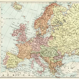
Fine Art Print : Map of European Russia shewing its Earliest Extent, its Encroachments upon Adjacent Countries, and the Present Boundary of the Empire (engraving)
![]()

Fine Art Prints from Fine Art Finder
Map of European Russia shewing its Earliest Extent, its Encroachments upon Adjacent Countries, and the Present Boundary of the Empire (engraving)
1608462 Map of European Russia shewing its Earliest Extent, its Encroachments upon Adjacent Countries, and the Present Boundary of the Empire (engraving) by Dower, John (fl.c.1845-55); Private Collection; (add.info.: Map of European Russia shewing its Earliest Extent, its Encroachments upon Adjacent Countries, and the Present Boundary of the Empire. Illustration for The Illustrated London News, 1855.
John Dower); Look and Learn / Illustrated Papers Collection
Media ID 22823518
© Look and Learn / Illustrated Papers Collection / Bridgeman Images
Boundary Shewing European Russia
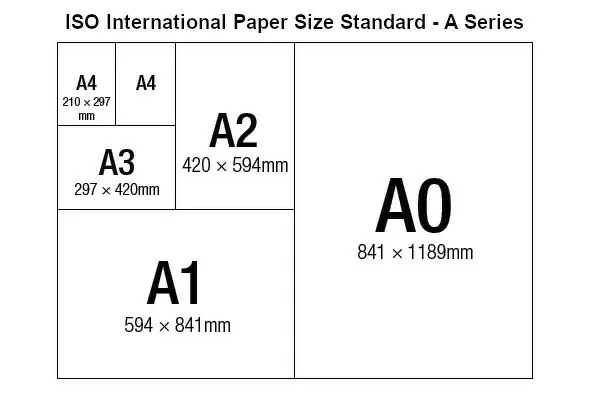
A2 (42x59cm) Fine Art Print
Discover the rich history of European Russia with this exquisite fine art print from Media Storehouse. Depicting an intricately detailed engraving by Dower, this map showcases the earliest extent of Russian territory, its encroachments upon adjacent lands, and the present boundary of the empire. A captivating addition to any home or office, this fine art print transports you back in time, offering a glimpse into the historical expansion of one of the world's most influential empires. Bring history to life with this stunning piece from Media Storehouse's extensive collection of fine art prints.
Our Fine Art Prints are printed on 100% acid free, PH neutral paper with archival properties. This printing method is used by museums and art collections to exhibit photographs and art reproductions. Hahnemühle certified studio for digital fine art printing. Printed on 308gsm Photo Rag Paper.
Our fine art prints are high-quality prints made using a paper called Photo Rag. This 100% cotton rag fibre paper is known for its exceptional image sharpness, rich colors, and high level of detail, making it a popular choice for professional photographers and artists. Photo rag paper is our clear recommendation for a fine art paper print. If you can afford to spend more on a higher quality paper, then Photo Rag is our clear recommendation for a fine art paper print.
Estimated Image Size (if not cropped) is 42cm x 52.5cm (16.5" x 20.7")
Estimated Product Size is 42cm x 59.4cm (16.5" x 23.4")
These are individually made so all sizes are approximate
Artwork printed orientated as per the preview above, with portrait (vertical) orientation to match the source image.
FEATURES IN THESE COLLECTIONS
> Europe
> Russia
> Related Images
> Maps and Charts
> Related Images
EDITORS COMMENTS
This engraving, titled "Map of European Russia shewing its Earliest Extent, its Encroachments upon Adjacent Countries, and the Present Boundary of the Empire" offers a fascinating glimpse into the historical expansion of the Russian Empire. Created by John Dower in the mid-19th century for The Illustrated London News, this intricate map showcases not only the earliest extent of European Russia but also highlights its encroachments upon neighboring countries. The detailed illustration takes us on a journey through time as we witness how the Russian Empire gradually expanded its borders over centuries. From its humble beginnings to becoming one of the largest empires in history, this map provides valuable insights into Russia's territorial growth and influence. As we explore this print further, it becomes evident that Europe and Asia are intimately connected within this vast empire. The boundaries depicted here reveal both political maneuvering and military conquests carried out by Russian rulers throughout history. This engraving serves as a visual testament to Russia's complex relationship with adjacent countries and sheds light on geopolitical dynamics that have shaped Eastern Europe and Central Asia. It invites us to contemplate how these historical events continue to impact contemporary politics in our ever-changing world. With meticulous attention to detail, John Dower has created an invaluable resource for historians and enthusiasts alike who seek to understand the rich tapestry of European Russia's past.
MADE IN THE UK
Safe Shipping with 30 Day Money Back Guarantee
FREE PERSONALISATION*
We are proud to offer a range of customisation features including Personalised Captions, Color Filters and Picture Zoom Tools
SECURE PAYMENTS
We happily accept a wide range of payment options so you can pay for the things you need in the way that is most convenient for you
* Options may vary by product and licensing agreement. Zoomed Pictures can be adjusted in the Basket.


