Fine Art Print > North America > Martinique > Maps
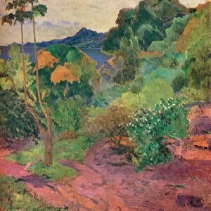
Fine Art Print : Map Of The Isle Of Martinique Circa. 1760. From "Atlas De Toutes Les Parties Connues Du Globe Terrestre "By Cartographer Rigobert Bonne. Published Geneva Circa. 1760


![]()
Fine Art Prints from Design Pics
Map Of The Isle Of Martinique Circa. 1760. From "Atlas De Toutes Les Parties Connues Du Globe Terrestre "By Cartographer Rigobert Bonne. Published Geneva Circa. 1760
Map Of The Isle Of Martinique Circa. 1760. From " Atlas De Toutes Les Parties Connues Du Globe Terrestre " By Cartographer Rigobert Bonne. Published Geneva Circa. 1760
Design Pics offers Distinctively Different Imagery representing over 1,500 contributors
Media ID 18186433
© Ken Welsh / Design Pics
Cartography Geography Isle Mapmaking Plate Martinique
A2 (42x59cm) Fine Art Print
Step back in time with our exquisite Fine Art Print of the Map of Martinique Island from the 1760 edition of "Atlas De Toutes Les Parties Connues Du Globe Terrestre" by renowned cartographer Rigobert Bonne. Published in Geneva, this captivating antique map showcases the intricate detail and historical accuracy that defined Bonne's work. Bring a touch of history and classic cartography into your home or office with this stunning, museum-quality print.
Our Fine Art Prints are printed on 100% acid free, PH neutral paper with archival properties. This printing method is used by museums and art collections to exhibit photographs and art reproductions. Hahnemühle certified studio for digital fine art printing. Printed on 308gsm Photo Rag Paper.
Our fine art prints are high-quality prints made using a paper called Photo Rag. This 100% cotton rag fibre paper is known for its exceptional image sharpness, rich colors, and high level of detail, making it a popular choice for professional photographers and artists. Photo rag paper is our clear recommendation for a fine art paper print. If you can afford to spend more on a higher quality paper, then Photo Rag is our clear recommendation for a fine art paper print.
Estimated Image Size (if not cropped) is 40.5cm x 59.4cm (15.9" x 23.4")
Estimated Product Size is 42cm x 59.4cm (16.5" x 23.4")
These are individually made so all sizes are approximate
Artwork printed orientated as per the preview above, with portrait (vertical) orientation to match the source image.
FEATURES IN THESE COLLECTIONS
> Maps and Charts
> Related Images
> North America
> Martinique
> Maps
> North America
> Martinique
> Related Images
EDITORS COMMENTS
This print showcases a beautifully detailed map of the Isle of Martinique, dating back to circa 1760. Created by renowned cartographer Rigobert Bonne and published in Geneva during the same period, this map is a true testament to the artistry and precision of early mapmaking. The vibrant colors and intricate engravings bring this historical piece to life, allowing us to explore the geography and topography of Martinique as it was over two centuries ago. From its lush forests and winding rivers to its stunning coastline dotted with towns and villages, every detail has been meticulously captured on this vertical plate. As we delve into this remarkable illustration, we are transported back in time, gaining insight into how our ancestors perceived the world around them. The Isle of Martinique holds a significant place in history due to its strategic location in the Caribbean Sea, making it an important hub for trade and colonization during that era. Ken Welsh's expertly crafted print allows us to appreciate not only the artistic beauty but also the historical significance of this map. Whether you are a lover of cartography or simply intrigued by exploring different corners of our planet's past, this image will undoubtedly enrich your understanding and appreciation for both artistry and history alike.
MADE IN THE UK
Safe Shipping with 30 Day Money Back Guarantee
FREE PERSONALISATION*
We are proud to offer a range of customisation features including Personalised Captions, Color Filters and Picture Zoom Tools
SECURE PAYMENTS
We happily accept a wide range of payment options so you can pay for the things you need in the way that is most convenient for you
* Options may vary by product and licensing agreement. Zoomed Pictures can be adjusted in the Basket.