Home > Asia > Indonesia > Maps
Map of the Moluccas, 1522 (manuscript on vellum)
")
![]()
Wall Art and Photo Gifts from Fine Art Finder
Map of the Moluccas, 1522 (manuscript on vellum)
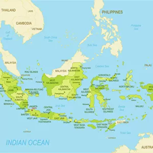
XCF701482 Map of the Moluccas, 1522 (manuscript on vellum) by Toreno, Nuno Garcia de (16th century); Biblioteca Reale, Turin, Italy; (add.info.: The earliest map to name the islands of the Indonesian Molucca (also Maluku) islands. Also shows the line of demarcation between the Spanish and Portuguese territories. ); Spanish, out of copyright
Media ID 12924490
© www.bridgemanart.com
Age Of Discovery Archipelago Cartographic Cartography Indonesia Indonesian Islands Maluku Moluccas Name Portuguese Spice Islands Territories Territory Molucca
FEATURES IN THESE COLLECTIONS
> Europe
> Italy
> Piedmont
> Turin
> Fine Art Finder
> Maps (celestial & Terrestrial)
> Maps and Charts
> Italy
EDITORS COMMENTS
This print showcases the "Map of the Moluccas, 1522" by Nuno Garcia de Toreno, a remarkable 16th-century manuscript on vellum. Housed in the Biblioteca Reale in Turin, Italy, this map is an invaluable piece of cartographic history. What sets this map apart is its distinction as the earliest known document to name and depict the Indonesian Molucca islands accurately. It also highlights the crucial line of demarcation between Spanish and Portuguese territories during that era. The intricate details and precision with which these boundaries are marked demonstrate the meticulousness of Renaissance cartography. The Map of the Moluccas not only serves as a geographical representation but also offers insights into one of history's most significant periods –the Age of Discovery. As explorers ventured into uncharted waters, searching for new trade routes and exotic spices, these islands played a pivotal role in shaping world events. Through this photograph print, we can appreciate both its artistic beauty and historical significance. It transports us back to an era when maps were hand-drawn masterpieces that provided valuable knowledge about distant lands. Whether you're fascinated by cartography or drawn to tales from the Age of Discovery, this image invites you to explore a world where exploration was at its peak – where lines on paper held immense power over vast territories and sparked curiosity about far-off places like Indonesia's Spice Islands.
MADE IN THE UK
Safe Shipping with 30 Day Money Back Guarantee
FREE PERSONALISATION*
We are proud to offer a range of customisation features including Personalised Captions, Color Filters and Picture Zoom Tools
SECURE PAYMENTS
We happily accept a wide range of payment options so you can pay for the things you need in the way that is most convenient for you
* Options may vary by product and licensing agreement. Zoomed Pictures can be adjusted in the Basket.