Home > Europe > France > Paris > Maps
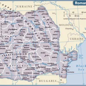
Map of Transylvania, from an atlas, Amsterdam, 1657 (coloured engraving)
")
![]()
Wall Art and Photo Gifts from Fine Art Finder
Map of Transylvania, from an atlas, Amsterdam, 1657 (coloured engraving)
CHT184785 Map of Transylvania, from an atlas, Amsterdam, 1657 (coloured engraving) by Dutch School, (17th century); Bibliotheque des Arts Decoratifs, Paris, France; eArchives Charmet; Dutch, out of copyright
Media ID 22917650
© Archives Charmet / Bridgeman Images
Eastern Europe Mountain Range Romania
FEATURES IN THESE COLLECTIONS
> Arts
> Artists
> Related Images
> Europe
> France
> Paris
> Maps
> Fine Art Finder
> Artists
> Dutch School
> Fine Art Finder
> Artists
> Egyptian 6th Dynasty
> Fine Art Finder
> Maps (celestial & Terrestrial)
EDITORS COMMENTS
This print showcases a beautifully detailed "Map of Transylvania" from an atlas dating back to 1657. Created by the Dutch School in Amsterdam, this coloured engraving offers a glimpse into the rich history and geography of Eastern Europe. The map features intricate illustrations of coat of arms, mountain ranges, and various landmarks that define the region. Transylvania, known for its mystique and folklore, is brought to life through this vintage artwork. The mountains depicted on the map evoke a sense of awe and grandeur, perfectly capturing the rugged beauty of Romania's landscape. Displayed at Bibliotheque des Arts Decoratifs in Paris, France, this historical gem now finds itself preserved within eArchives Charmet. Its inclusion in Bridgeman Images' collection allows art enthusiasts worldwide to appreciate its significance without any commercial restrictions. As we admire this remarkable piece, we are transported back in time to an era when cartography was both an art form and a scientific endeavor. This map serves as a testament to human curiosity and exploration during the 17th century. Whether you have an affinity for history or simply appreciate fine craftsmanship, this Map of Transylvania print is sure to captivate your imagination with its intricate details and timeless charm.
MADE IN THE UK
Safe Shipping with 30 Day Money Back Guarantee
FREE PERSONALISATION*
We are proud to offer a range of customisation features including Personalised Captions, Color Filters and Picture Zoom Tools
SECURE PAYMENTS
We happily accept a wide range of payment options so you can pay for the things you need in the way that is most convenient for you
* Options may vary by product and licensing agreement. Zoomed Pictures can be adjusted in the Basket.