Fraud Blocker Skip to main content

Home > Europe > Switzerland > Maps

Maps Collection (page 7)

Switzerland is a landlocked country located in Central Europe, bordered by France, Germany, Italy, Austria and Liechtenstein

443 items

Background imageMaps Collection: Coronation of the Virgin (chromolitho)

Coronation of the Virgin (chromolitho)
7173051 Coronation of the Virgin (chromolitho) by French School, (19th century); Private Collection; (add.info.: Coronation of the Virgin, tapestry banner given by Pope Leo X to the city of Zurich)

Background imageMaps Collection: Berner Oberland: Thun (coloured photo)

Berner Oberland: Thun (coloured photo)
7156704 Berner Oberland: Thun (coloured photo) by Swiss Photographer, (19th century); Private Collection; (add.info.: Thun)

Background imageMaps Collection: Berner Oberland: Kandersteg (coloured photo)

Berner Oberland: Kandersteg (coloured photo)
7156701 Berner Oberland: Kandersteg (coloured photo) by Swiss Photographer, (19th century); Private Collection; (add.info.: Kandersteg)

Background imageMaps Collection: Berner Oberland: Spiez (coloured photo)

Berner Oberland: Spiez (coloured photo)
7156699 Berner Oberland: Spiez (coloured photo) by Swiss Photographer, (19th century); Private Collection; (add.info.: Spiez)

Background imageMaps Collection: Berner Oberland: Murrenbahn (coloured photo)

Berner Oberland: Murrenbahn (coloured photo)
7156693 Berner Oberland: Murrenbahn (coloured photo) by Swiss Photographer, (19th century); Private Collection; (add.info.: Murrenbahn)

Background imageMaps Collection: Berner Oberland: Wengernalp (coloured photo)

Berner Oberland: Wengernalp (coloured photo)
7156690 Berner Oberland: Wengernalp (coloured photo) by Swiss Photographer, (19th century); Private Collection; (add.info.: Wengernalp)

Background imageMaps Collection: Berner Oberland: Kleine Scheidegg (coloured photo)

Berner Oberland: Kleine Scheidegg (coloured photo)
7156689 Berner Oberland: Kleine Scheidegg (coloured photo) by Swiss Photographer, (19th century); Private Collection; (add.info.: Kleine Scheidegg)

Background imageMaps Collection: Berner Oberland: Interlaken, Hohenweg (coloured photo)

Berner Oberland: Interlaken, Hohenweg (coloured photo)
7156679 Berner Oberland: Interlaken, Hohenweg (coloured photo) by Swiss Photographer, (19th century); Private Collection; (add.info.: Interlaken, Hohenweg)

Background imageMaps Collection: The Borders on the Lawn at Swiss Cottage, Osborne (colour litho)

The Borders on the Lawn at Swiss Cottage, Osborne (colour litho)
7159998 The Borders on the Lawn at Swiss Cottage, Osborne (colour litho) by Ward, Cyril (1863-1935); Private Collection; (add.info.: The Borders on the Lawn at Swiss Cottage, Osborne)

Background imageMaps Collection: The Genius of Death, 1890 (oil on canvas)

The Genius of Death, 1890 (oil on canvas)
6431756 The Genius of Death, 1890 (oil on canvas) by Anker, Albert (1831-1910); Private Collection

Background imageMaps Collection: Johann Rudolf Sinner, Swiss politician and Schultheiss of Bern (engraving)

Johann Rudolf Sinner, Swiss politician and Schultheiss of Bern (engraving)
7153707 Johann Rudolf Sinner, Swiss politician and Schultheiss of Bern (engraving) by Swiss School, (18th century); Private Collection; (add.info.: Johann Rudolf Sinner (1632-1708)

Background imageMaps Collection: Hans Franz Nageli, Swiss politician and Schultheiss of Bern (engraving)

Hans Franz Nageli, Swiss politician and Schultheiss of Bern (engraving)
7153705 Hans Franz Nageli, Swiss politician and Schultheiss of Bern (engraving) by Swiss School, (18th century); Private Collection; (add.info.: Hans Franz Nageli (1497-1579)

Background imageMaps Collection: Members of the League of Nations (colour litho)

Members of the League of Nations (colour litho)
7163177 Members of the League of Nations (colour litho) by English School, (20th century); Private Collection; (add.info.: Members of the League of Nations)

Background imageMaps Collection: Map of city Graz Switzerland 1898

Map of city Graz Switzerland 1898
Map of Graz Switzerland 1898 Original edition from my own archives Source : Brockhaus 1898

Background imageMaps Collection: Antique map of Geneva Switzerland 1896

Antique map of Geneva Switzerland 1896
Map of Geneva Switzerland Original edition from my own archives Source : Brockhaus 1896

Background imageMaps Collection: L Europe en 1871, 1871 (colour litho)

L Europe en 1871, 1871 (colour litho)
XCF290996 L Europe en 1871, 1871 (colour litho) by Hadol, Paul (1835-1875); Private Collection; French, out of copyright

Background imageMaps Collection: Plan of Paris in 1615. Engraving by Mathieu Merian, 17th century. Paris, Musee Carnavalet

Plan of Paris in 1615. Engraving by Mathieu Merian, 17th century. Paris, Musee Carnavalet
JLJ4688533 Plan of Paris in 1615. Engraving by Mathieu Merian, 17th century. Paris, Musee Carnavalet by Merian, Mattaus the Younger (1621-87); Musee de la Ville de Paris, Musee Carnavalet, Paris

Background imageMaps Collection: Central Europe showing the historic sites and battlefields of 1792-1813 - Central Europe

Central Europe showing the historic sites and battlefields of 1792-1813 - Central Europe
XEE4154372 Central Europe showing the historic sites and battlefields of 1792-1813 - Central Europe indicating historic sites

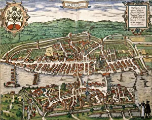
Background imageMaps Collection: Map of Zurich, 1575 (hand-coloured engraving)

Map of Zurich, 1575 (hand-coloured engraving)
1195383 Map of Zurich, 1575 (hand-coloured engraving) by German School, (16th century); Private Collection; Photo eChristies Images; German, out of copyright

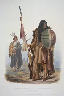
Background imageMaps Collection: Assiniboin Indians

Assiniboin Indians
3673678 Assiniboin Indians by Bodmer, Karl (1809-93); Newberry Library, Chicago, Illinois, USA; (add.info.: Travels in the interior of North America / by Maximilian)

Background imageMaps Collection: Forest Scene on the Lehigh

Forest Scene on the Lehigh
3673584 Forest Scene on the Lehigh by Bodmer, Karl (1809-93); Newberry Library, Chicago, Illinois, USA; (add.info.: Travels in the interior of North America / by Maximilian)

Background imageMaps Collection: Camp of the Gros Ventres of the Prairies on the Upper Missouri

Camp of the Gros Ventres of the Prairies on the Upper Missouri
3672572 Camp of the Gros Ventres of the Prairies on the Upper Missouri by Bodmer, Karl (1809-93); Newberry Library, Chicago, Illinois

Background imageMaps Collection: Snags (Sunken Trees) on the Missouri

Snags (Sunken Trees) on the Missouri
3673597 Snags (Sunken Trees) on the Missouri by Bodmer, Karl (1809-93); Newberry Library, Chicago, Illinois, USA; (add.info.: Travels in the interior of North America / by Maximilian)

Background imageMaps Collection: Encampment of the Peikann Indians

Encampment of the Peikann Indians
3672624 Encampment of the Peikann Indians by Bodmer, Karl (1809-93); Newberry Library, Chicago, Illinois, USA; (add.info.: Travels in the interior of North America / by Maximilian)

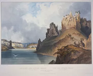
Background imageMaps Collection: View of the Stone Walls

View of the Stone Walls
3672601 View of the Stone Walls by Bodmer, Karl (1809-93); Newberry Library, Chicago, Illinois, USA; (add.info.: Travels in the interior of North America / by Maximilian)

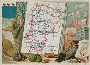
Background imageMaps Collection: Department of Aisne in northern France (chromolitho)

Department of Aisne in northern France (chromolitho)
724678 Department of Aisne in northern France (chromolitho) by French School, (19th century); Private Collection; (add.info.: Department of Aisne in northern France)

Background imageMaps Collection: Map of the Battle of Stockach, published by William Blackwood and Sons

Map of the Battle of Stockach, published by William Blackwood and Sons
746926 Map of the Battle of Stockach, published by William Blackwood and Sons, Edinburgh & London, 1848 (hand-coloured engraving) by Johnston

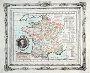
Background imageMaps Collection: Map of the regions and districts of France, known as the Carte de Necker

Map of the regions and districts of France, known as the Carte de Necker
ARH213911 Map of the regions and districts of France, known as the Carte de Necker, 1789 (coloured engraving) by French School, (18th century); Centre Historique des Archives Nationales, Paris

Background imageMaps Collection: Summit of Kulm, Mont Rigi, from Guide des Voyageurs sur le Mont Rigi, by Col

Summit of Kulm, Mont Rigi, from Guide des Voyageurs sur le Mont Rigi, by Col
STC184872 Summit of Kulm, Mont Rigi, from Guide des Voyageurs sur le Mont Rigi, by Col. Pfyffer de Wyer, published 1823 (hand coloured engraving) by French School

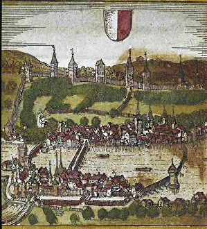
Background imageMaps Collection: View of Lucerne - Switzerland (engraving, 16th century)

View of Lucerne - Switzerland (engraving, 16th century)
LRI4647076 View of Lucerne - Switzerland (engraving, 16th century) by Hogenberg, Franz (1540-c.1590); Private Collection; (add.info)

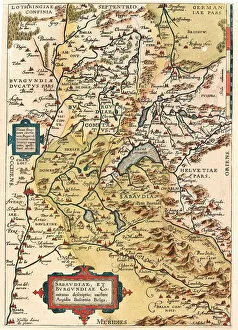
Background imageMaps Collection: Map of Burgundy and Savoy, 1570 (engraving)

Map of Burgundy and Savoy, 1570 (engraving)
LRI4704387 Map of Burgundy and Savoy, 1570 (engraving) by Ortelius, Abraham (1527-98); Museo Navale di Pegli, Genoa, Italy; (add.info)

Background imageMaps Collection: Map of the area around the Rhine (Germany, Switzerland, France) (Engraving, 1717)

Map of the area around the Rhine (Germany, Switzerland, France) (Engraving, 1717)
LRI4712348 Map of the area around the Rhine (Germany, Switzerland, France) (Engraving, 1717) by Nolin, Jean-Baptiste (c.1657-1708); Private Collection; (add.info)

Background imageMaps Collection: Map of the Swiss federation (etching, 1730)

Map of the Swiss federation (etching, 1730)
LRI4706606 Map of the Swiss federation (etching, 1730) by Delisle, Guillaume (1675-1726); Private Collection; (add.info.: Map of the Swiss federation - Strong water extracted from the " New)

Background imageMaps Collection: Views of the main cities of the Swiss Confederation: Schwytz (Svicia), Zug (Tugium)

Views of the main cities of the Swiss Confederation: Schwytz (Svicia), Zug (Tugium)
LRI4708146 Views of the main cities of the Swiss Confederation: Schwytz (Svicia), Zug (Tugium), Glaris (Glarona), Bale (Basilea), Zurich (Tugurum), Bern (Ursina), Lucerne (Lucerna), Uri (Ursella)

Background imageMaps Collection: Switzerland (engraving, 1596)

Switzerland (engraving, 1596)
LRI4717487 Switzerland (engraving, 1596) by Mercator, Gerardus (1512-94); Private Collection; (add.info.: Helvetia, 1612: Switzerland - in " Atlas Ssive Corsmograficae Meditationes" by)

Background imageMaps Collection: Northeast of Geneva, Swiss (engraving, 1596)

Northeast of Geneva, Swiss (engraving, 1596)
LRI4717460 Northeast of Geneva, Swiss (engraving, 1596) by Mercator, Gerardus (1512-94); Private Collection; (add.info.: Das Wiflispur Gergov, 1633: Northeast of Geneva)

Background imageMaps Collection: Map of Switzerland (etching, 1671)

Map of Switzerland (etching, 1671)
LRI4710341 Map of Switzerland (etching, 1671) by Wit, Frederick de (1630-1706); Private Collection; (add.info.: Map of Switzerland - Strong water extracted from " Theatrum Orbis", 1671)

Background imageMaps Collection: Europe (colour litho)

Europe (colour litho)
5996932 Europe (colour litho) by English School, (20th century); Private Collection; (add.info.: Europe. Illustration from The Modern World Encyclopedia)

Background imageMaps Collection: Louis-Philippe d Orleans as a geography teacher at the College of Reichenau

Louis-Philippe d Orleans as a geography teacher at the College of Reichenau
KDC384121 Louis-Philippe d Orleans as a geography teacher at the College of Reichenau, Switzerland 1793-4, c.1825 (litho) by Chretien (fl)

Background imageMaps Collection: Frontispiece to Robert Fludds Utriusque Cosmi Historia

Frontispiece to Robert Fludds Utriusque Cosmi Historia
XJF307396 Frontispiece to Robert Fludds Utriusque Cosmi Historia, Tractatus Secundus de Naturae Simia Sue Tecnica Macrocosmi, Frankfurt, 1624 (engraving) (b/w photo) by Merian, Matthaus

Background imageMaps Collection: Map of Basel (engraving) (b / w photo)

Map of Basel (engraving) (b / w photo)
CHT224856 Map of Basel (engraving) (b/w photo) by Swiss School, (16th century); Bibliotheque des Arts Decoratifs, Paris, France; eArchives Charmet; Swiss, out of copyright

Background imageMaps Collection: Fort Union on the Missouri

Fort Union on the Missouri
3673665 Fort Union on the Missouri by Bodmer, Karl (1809-93); Newberry Library, Chicago, Illinois, USA; (add.info.: Travels in the interior of North America / by Maximilian)

Background imageMaps Collection: Facsimile of an Indian Painting

Facsimile of an Indian Painting
3673645 Facsimile of an Indian Painting by Bodmer, Karl (1809-93); Newberry Library, Chicago, Illinois, USA; (add.info.: Travels in the interior of North America / by Maximilian)

Background imageMaps Collection: Mato-Tope, Adorned with the insignia of his warlike deeds

Mato-Tope, Adorned with the insignia of his warlike deeds
3673619 Mato-Tope, Adorned with the insignia of his warlike deeds. by Bodmer, Karl (1809-93); Newberry Library, Chicago, Illinois

Background imageMaps Collection: Niagara Falls

Niagara Falls
3672583 Niagara Falls by Bodmer, Karl (1809-93); Newberry Library, Chicago, Illinois, USA; (add.info.: Travels in the interior of North America / by Maximilian)

Background imageMaps Collection: Remarkable Hills on the Upper Missouri

Remarkable Hills on the Upper Missouri
3673688 Remarkable Hills on the Upper Missouri by Bodmer, Karl (1809-93); Newberry Library, Chicago, Illinois, USA; (add.info.: Travels in the interior of North America / by Maximilian)

Background imageMaps Collection: Junction of the Yellowstone River with the Missouri

Junction of the Yellowstone River with the Missouri
3673668 Junction of the Yellowstone River with the Missouri by Bodmer, Karl (1809-93); Newberry Library, Chicago, Illinois, USA; (add.info.: Travels in the interior of North America / by Maximilian)

Background imageMaps Collection: The White Castles on the Upper Missouri

The White Castles on the Upper Missouri
3673699 The White Castles on the Upper Missouri by Bodmer, Karl (1809-93); Newberry Library, Chicago, Illinois, USA; (add.info.: Travels in the interior of North America / by Maximilian)


All Professionally Made to Order for Quick Shipping


-

Maps Collection

Switzerland is a landlocked country located in Central Europe, bordered by France, Germany, Italy, Austria and Liechtenstein. Switzerland is known for its stunning alpine scenery and picturesque villages. Maps of Switzerland are essential for anyone travelling to the country as they provide an overview of the terrain and geographical features. It also show major cities such as Zurich and Geneva, transport links such as roads and railways, airports and scenic routes. They also indicate areas of natural beauty such as lakes or mountains that can be explored on foot or by car. In addition to physical maps of Switzerland there are also online maps available which provide detailed information about towns, villages and attractions throughout the country.
+

Our beautiful Wall Art and Photo Gifts include Framed Prints, Photo Prints, Poster Prints, Canvas Prints, Jigsaw Puzzles, Metal Prints and so much more

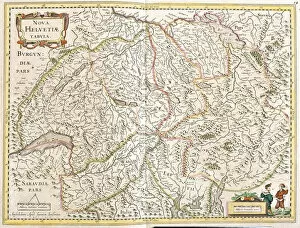
The Maps of Switzerland Europe collection from Media Storehouse offers a stunning array of wall art and framed prints that showcase the beauty and diversity of Switzerland's geography. Our collection features a range of maps, including topographical maps, vintage maps, and artistic renditions that capture the essence of this picturesque country. Each print is carefully crafted using high-quality materials to ensure longevity and durability. Whether you're looking for a statement piece for your living room or office space or want to add some character to your bedroom or study, the Maps of Switzerland Europe collection has something for everyone. From the snow-capped peaks of the Alps to the serene lakeside towns nestled in valleys below, these prints offer an immersive experience that transports you straight into the heartland of Switzerland. With its rich history and breathtaking landscapes, it's no wonder why so many people are drawn to this beautiful country – now you can bring a piece of it home with you thanks to our Maps of Switzerland Europe collection.
+

What are Maps of Switzerland Europe art prints?

Maps of Switzerland Europe art prints are high-quality reproductions of vintage and contemporary maps showcasing the geography, topography, and landmarks of Switzerland. These prints capture the beauty and intricacy of Swiss cartography in stunning detail, making them perfect for both decorative and educational purposes. These art prints showcase a range of styles including antique maps from the 16th century to modern-day satellite imagery. They come in various sizes, materials, and finishes such as paper or canvas with matte or glossy coatings. Maps of Switzerland Europe art prints are ideal for anyone who loves history, geography, travel or wants to add a touch of sophistication to their home or office decor. They make great gifts for students studying Swiss culture or people who have lived in Switzerland before. Overall Maps of Switzerland Europe art prints offer an excellent way to appreciate the beauty and complexity that is Swiss cartography while adding style to any space.
+

What Maps of Switzerland Europe art prints can I buy from Media Storehouse?

We offer a wide range of Maps of Switzerland Europe art prints that are perfect for anyone who loves geography or history. These maps come in various sizes and styles, including vintage, antique, and modern designs. You can choose from different types of maps such as topographical maps, political maps, physical maps, and more. Our collection includes highly detailed and accurate Swiss Alps map prints that showcase the stunning beauty of this mountainous region. We also offer city street maps that highlight the layout of major cities like Zurich, Geneva, Bern or Basel. Whether you're looking to decorate your home or office space with an eye-catching piece of wall art or want to gift someone who is passionate about cartography these Maps of Switzerland Europe art prints are sure to impress. With our vast selection available online at your fingertips it’s easy to find the perfect print for any occasion.
+

How do I buy Maps of Switzerland Europe art prints?

To buy Maps of Switzerland Europe art prints from Media Storehouse, you can browse our extensive collection of maps and select the one that suits your preferences. Once you have found the map you want to purchase, simply add it to your cart and proceed to checkout. You will be prompted to enter your shipping and billing information before completing the transaction. We offer a variety of payment options including credit cards, PayPal, and Apple Pay for added convenience. They also provide secure checkout processes to ensure that all transactions are safe and protected. In addition to purchasing individual maps, Media Storehouse also offers custom framing services so that you can display your new artwork in style. Whether you're looking for a vintage-style map or a modern interpretation of Switzerland's geography, we have something for everyone.
+

How much do Maps of Switzerland Europe art prints cost?

We offer a wide range of Maps of Switzerland Europe art prints that are perfect for anyone looking to add some geographical charm to their home or office. Our prices vary depending on the size and type of print you choose, but we strive to keep our prices competitive and affordable. Our Maps of Switzerland Europe art prints are available in a variety of sizes ranging from small to large, so you can find the perfect fit for your space. We use high-quality materials and printing techniques to ensure that each print is vibrant and long-lasting. Whether you're looking for a vintage map or a modern interpretation, we have something for everyone. Our Maps of Switzerland Europe art prints make great gifts for history buffs, travelers, or anyone who appreciates beautiful artwork. So if you're interested in purchasing one of our Maps of Switzerland Europe art prints, browse our selection today.
+

How will my Maps of Switzerland Europe art prints be delivered to me?

We take great care in ensuring that your Maps of Switzerland Europe art prints are delivered to you safely and securely. We use high-quality packaging materials to protect your print during transit and ensure it arrives in pristine condition. Your order will be dispatched from our printing facility and shipped directly to the address provided at checkout. We offer a range of delivery options depending on your location, including standard shipping or express delivery for those who require their prints quickly. Once your order has been dispatched, you will receive an email confirmation with tracking information so you can monitor the progress of your shipment. If there are any issues with the delivery of your package, please don't hesitate to contact us and we'll do everything we can to resolve the issue as quickly as possible. We're committed to providing our customers with exceptional service and quality products, so rest assured that when you order from Media Storehouse, you're in good hands.