Fraud Blocker Skip to main content

Home > Europe > Switzerland > Maps

Maps Collection (page 2)

Switzerland is a landlocked country located in Central Europe, bordered by France, Germany, Italy, Austria and Liechtenstein

443 items

Background imageMaps Collection: Map of the Zurich area, 1566. Creator: Murer, Jos (1530-1580)

Map of the Zurich area, 1566. Creator: Murer, Jos (1530-1580)
Map of the Zurich area, 1566. Private Collection

Background imageMaps Collection: Plan of the Fountain of Arethusa on Orhtygia Island, Syracuse, 1778. Creator: Louis Ducros

Plan of the Fountain of Arethusa on Orhtygia Island, Syracuse, 1778. Creator: Louis Ducros
Plan of the Fountain of Arethusa on Orhtygia Island, Syracuse, 1778. Drawing from the album Voyage to Italy, Sicily and Malta

Background imageMaps Collection: Tyrol, historical region in Austria and Italy, lithograph, published 1897

Tyrol, historical region in Austria and Italy, lithograph, published 1897
Tyrol - historical region in the Alps; in northern Italy and western Austria. Lithograph, published in 1897

Background imageMaps Collection: Old map of Switzerland, steel engraving, published in 1857

Old map of Switzerland, steel engraving, published in 1857
Old map of Switzerland. Steel engraving with hand coloured borderlines, published in 1857

Background imageMaps Collection: Black Maps Earth Tones 95

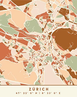
Black Maps Earth Tones 95
Emiliano Deificus

Background imageMaps Collection: 1 Maps 2 11

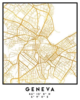
1 Maps 2 11
Emiliano Deificus

Background imageMaps Collection: 1 Maps 3 01

1 Maps 3 01
Emiliano Deificus

Background imageMaps Collection: 1 Maps 3 02

1 Maps 3 02
Emiliano Deificus

Background imageMaps Collection: 1 Maps 3 03

1 Maps 3 03
Emiliano Deificus

Background imageMaps Collection: City Love Maps 95

City Love Maps 95
Emiliano Deificus

Background imageMaps Collection: City Heart Maps 95

City Heart Maps 95
Emiliano Deificus

Background imageMaps Collection: Black Maps 95

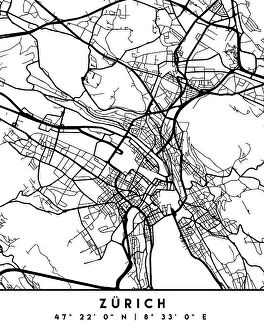
Black Maps 95
Emiliano Deificus

Background imageMaps Collection: City Heart Maps 95

City Heart Maps 95
Emiliano Deificus

Background imageMaps Collection: Map of the Canton of Vaud, Switzerland

Map of the Canton of Vaud, Switzerland, including Vevey, Lausanne and Lac Leman. Date: circa 1910s

Background imageMaps Collection: Austria-Hungary and Neighbouring Lands - Map, 1920. Creator: John Bartholomew & Son

Austria-Hungary and Neighbouring Lands - Map, 1920. Creator: John Bartholomew & Son
Austria-Hungary and Neighbouring Lands, c1914, (c1920). Map of the Austro-Hungarian Empire and surrounding countries at start of the First World War

Background imageMaps Collection: 1862 Stieler Map Of Switzerland Topography Cartography

1862 Stieler Map Of Switzerland Topography Cartography
1862, Stieler Map of Switzerland

Background imageMaps Collection: 1862 Stieler Map Of Southern Germany And Switzerland

1862 Stieler Map Of Southern Germany And Switzerland
1862, Stieler Map of Southern Germany and Switzerland

Background imageMaps Collection: 1859 Smith Folding Case Map Of Italy And Switzerland

1859 Smith Folding Case Map Of Italy And Switzerland
1859, Smith Folding Case Map of Italy and Switzerland

Background imageMaps Collection: 1855 Colton Map Of Switzerland Topography Cartography

1855 Colton Map Of Switzerland Topography Cartography
1855, Colton Map of Switzerland

Background imageMaps Collection: 1853 Mitchell Map Of Switzerland Topography Cartography

1853 Mitchell Map Of Switzerland Topography Cartography
1853, Mitchell Map of Switzerland

Background imageMaps Collection: 1834 Keller Pocket Map Of Switzerland Topography

1834 Keller Pocket Map Of Switzerland Topography
1834, Keller Pocket Map of Switzerland

Background imageMaps Collection: 1832 Delamarche Map Of Switzerland Topography

1832 Delamarche Map Of Switzerland Topography
1832, Delamarche Map of Switzerland

Background imageMaps Collection: 1794 Laurie And Whittle Map Of Switzerland 1794 - 1812

1794 Laurie And Whittle Map Of Switzerland 1794 - 1812
1794, Laurie and Whittle Map of Switzerland, 1794 - 1812

Background imageMaps Collection: 1771 Bonne Map Of Switzerland Rigobert Bonne 1727 – 1794

1771 Bonne Map Of Switzerland Rigobert Bonne 1727 – 1794
1771, Bonne Map of Switzerland, Rigobert Bonne 1727 - 1794, one of the most important cartographers of the late 18th century

Background imageMaps Collection: 1752 Homann Heirs Map Of Switzerland Topography

1752 Homann Heirs Map Of Switzerland Topography
1752, Homann Heirs Map of Switzerland

Background imageMaps Collection: 1870 Johnson Map Of Holland Belgium And Switzerland

1870 Johnson Map Of Holland Belgium And Switzerland
1870, Johnson Map of Holland, Belgium, and Switzerland

Background imageMaps Collection: 1747 La Feuille Map Of Neuchâtel Switzerland

1747 La Feuille Map Of Neuchâtel Switzerland
1747, La Feuille Map of Neuchatel, Switzerland

Background imageMaps Collection: Sir Watkin Williams-Wynn (1748-89), Thomas Apperley (1734-1819) and Captain Edward Hamilton

Sir Watkin Williams-Wynn (1748-89), Thomas Apperley (1734-1819) and Captain Edward Hamilton, 1768 (oil on canvas)
NGW184241 Sir Watkin Williams-Wynn (1748-89), Thomas Apperley (1734-1819) and Captain Edward Hamilton, 1768 (oil on canvas) by Batoni

Background imageMaps Collection: George Bradshaws Plan of Geneva, Switzerland 1896

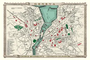
George Bradshaws Plan of Geneva, Switzerland 1896
This is a detailed Plan of Geneva showing the streets, canals, principal buildings, railways and railway stations. There is a key to 36 principal buildings to the bottom left of the plan

Background imageMaps Collection: Old Map of Switzerland 1852 by Henry George Collins

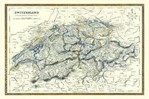
Old Map of Switzerland 1852 by Henry George Collins
This is a finely detailed map of Switzerland remastered from a rare Atlas of the World published in 1852 by Henry George Collins

Background imageMaps Collection: Switzerland 1851

Switzerland 1851
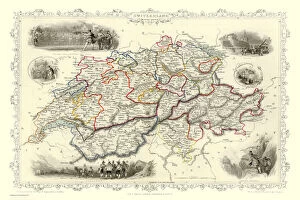
A fine facimile artworked from an antique original map of Switzerland, issued as part of the 1851 edition of John Tallis and Companys " The Illustrated Atlas and Modern History of the World"

Background imageMaps Collection: Dudley DY8 5 Map

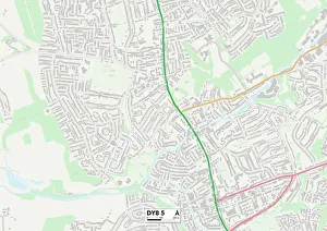
Dudley DY8 5 Map
Postcode Sector Map of Dudley DY8 5

Background imageMaps Collection: Map of the Austro-Italian frontier, First World War, (c1920). Creator: John Bartholomew & Son

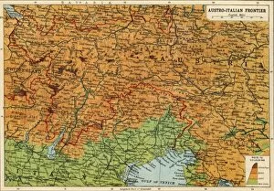
Map of the Austro-Italian frontier, First World War, (c1920). Creator: John Bartholomew & Son
Map of the Austro-Italian frontier, First World War, (c1920). Mountainous area between Salzburg, Trieste and Cremona, showing the Tyrol

Background imageMaps Collection: Map of Central Europe, c1914. Creator: John Bartholomew & Son

Map of Central Europe, c1914. Creator: John Bartholomew & Son
Map of Central Europe, c1914. Europe as it looked at the beginning of the First World War. From " The Great World War - A History" Volume I, edited by Frank A Mumby

Background imageMaps Collection: Gray watercolor map of Switzerland

Gray watercolor map of Switzerland
Rosana Laiz Blursbyai

Background imageMaps Collection: 13863147

13863147

Background imageMaps Collection: 13849201

13849201

Background imageMaps Collection: 13831499

13831499

Background imageMaps Collection: 13819795

13819795

Background imageMaps Collection: Western Europe, from the series Where Our Exports Go [6321242] (colour litho)

Western Europe, from the series Where Our Exports Go [6321242] (colour litho)
MAN464497 Western Europe, from the series Where Our Exports Go [6321242] (colour litho) by Grimmond, William (1884-1952); Manchester Art Gallery, UK; (add.info.: See 6320722, 452963, 452962, 464497)

Background imageMaps Collection: Map of Switzerland

Map of Switzerland
Marcus Ward's Home Atlas - London, 1894

Background imageMaps Collection: Old chromolithograph map of Switzerland, Western, Central and Southern Europe

Old chromolithograph map of Switzerland, Western, Central and Southern Europe
Antique Illustration, Copyright has expired on this artwork. From my own archives, digitally restored

Background imageMaps Collection: The Three Ore Jester, 1660-86 (brush and Indian ink on paper)

The Three Ore Jester, 1660-86 (brush and Indian ink on paper)
7308384 The Three Ore Jester, 1660-86 (brush and Indian ink on paper) by Stettler, Wilhelm (1643-1708); 11.5x10.5 cm; Ashmolean Museum, University of Oxford

Background imageMaps Collection: Copperplate engraving from Physica Sacra'by the Swiss scholar. Johann Jakob Scheuchzer

Copperplate engraving from Physica Sacra'by the Swiss scholar. Johann Jakob Scheuchzer
5306574 Copperplate engraving from Physica Sacra by the Swiss scholar. Johann Jakob Scheuchzer by Scheuchzer, Johann Jakob (1672-1733); Universal History Archive/UIG

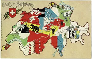
Background imageMaps Collection: Switzerland, Cantons (colour litho)

Switzerland, Cantons (colour litho)
7272466 Switzerland, Cantons (colour litho) by Unknown Artist, (19th century); (add.info.: Swiss territory and regions, 19th century); Fototeca Gilardi

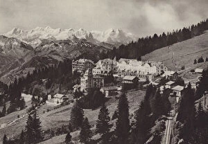
Background imageMaps Collection: Grand Hotel, Rigi Kaltbad, An der Zahnradbahn Vitznau Rigi Kulm gelegen (b / w photo)

Grand Hotel, Rigi Kaltbad, An der Zahnradbahn Vitznau Rigi Kulm gelegen (b / w photo)
7191930 Grand Hotel, Rigi Kaltbad, An der Zahnradbahn Vitznau Rigi Kulm gelegen (b/w photo) by Gaberell, Jean (1887-1949); Private Collection; (add.info.: Grand Hotel, Rigi Kaltbad)

Background imageMaps Collection: Rigi Kulm, Uber dem Nebelmeer (b / w photo)

Rigi Kulm, Uber dem Nebelmeer (b / w photo)
7191918 Rigi Kulm, Uber dem Nebelmeer (b/w photo) by Gaberell, Jean (1887-1949); Private Collection; (add.info.: Rigi Kulm, Uber dem Nebelmeer)

Background imageMaps Collection: Vitznau Rigi Kulm, Zahnradbahn (b / w photo)

Vitznau Rigi Kulm, Zahnradbahn (b / w photo)
7191912 Vitznau Rigi Kulm, Zahnradbahn (b/w photo) by Gaberell, Jean (1887-1949); Private Collection; (add.info.: Vitznau Rigi Kulm, Zahnradbahn)


All Professionally Made to Order for Quick Shipping


-

Maps Collection

Switzerland is a landlocked country located in Central Europe, bordered by France, Germany, Italy, Austria and Liechtenstein. Switzerland is known for its stunning alpine scenery and picturesque villages. Maps of Switzerland are essential for anyone travelling to the country as they provide an overview of the terrain and geographical features. It also show major cities such as Zurich and Geneva, transport links such as roads and railways, airports and scenic routes. They also indicate areas of natural beauty such as lakes or mountains that can be explored on foot or by car. In addition to physical maps of Switzerland there are also online maps available which provide detailed information about towns, villages and attractions throughout the country.
+

Our beautiful Wall Art and Photo Gifts include Framed Prints, Photo Prints, Poster Prints, Canvas Prints, Jigsaw Puzzles, Metal Prints and so much more

The Maps of Switzerland Europe collection from Media Storehouse offers a stunning array of wall art and framed prints that showcase the beauty and diversity of Switzerland's geography. Our collection features a range of maps, including topographical maps, vintage maps, and artistic renditions that capture the essence of this picturesque country. Each print is carefully crafted using high-quality materials to ensure longevity and durability. Whether you're looking for a statement piece for your living room or office space or want to add some character to your bedroom or study, the Maps of Switzerland Europe collection has something for everyone. From the snow-capped peaks of the Alps to the serene lakeside towns nestled in valleys below, these prints offer an immersive experience that transports you straight into the heartland of Switzerland. With its rich history and breathtaking landscapes, it's no wonder why so many people are drawn to this beautiful country – now you can bring a piece of it home with you thanks to our Maps of Switzerland Europe collection.
+

What are Maps of Switzerland Europe art prints?

Maps of Switzerland Europe art prints are high-quality reproductions of vintage and contemporary maps showcasing the geography, topography, and landmarks of Switzerland. These prints capture the beauty and intricacy of Swiss cartography in stunning detail, making them perfect for both decorative and educational purposes. These art prints showcase a range of styles including antique maps from the 16th century to modern-day satellite imagery. They come in various sizes, materials, and finishes such as paper or canvas with matte or glossy coatings. Maps of Switzerland Europe art prints are ideal for anyone who loves history, geography, travel or wants to add a touch of sophistication to their home or office decor. They make great gifts for students studying Swiss culture or people who have lived in Switzerland before. Overall Maps of Switzerland Europe art prints offer an excellent way to appreciate the beauty and complexity that is Swiss cartography while adding style to any space.
+

What Maps of Switzerland Europe art prints can I buy from Media Storehouse?

We offer a wide range of Maps of Switzerland Europe art prints that are perfect for anyone who loves geography or history. These maps come in various sizes and styles, including vintage, antique, and modern designs. You can choose from different types of maps such as topographical maps, political maps, physical maps, and more. Our collection includes highly detailed and accurate Swiss Alps map prints that showcase the stunning beauty of this mountainous region. We also offer city street maps that highlight the layout of major cities like Zurich, Geneva, Bern or Basel. Whether you're looking to decorate your home or office space with an eye-catching piece of wall art or want to gift someone who is passionate about cartography these Maps of Switzerland Europe art prints are sure to impress. With our vast selection available online at your fingertips it’s easy to find the perfect print for any occasion.
+

How do I buy Maps of Switzerland Europe art prints?

To buy Maps of Switzerland Europe art prints from Media Storehouse, you can browse our extensive collection of maps and select the one that suits your preferences. Once you have found the map you want to purchase, simply add it to your cart and proceed to checkout. You will be prompted to enter your shipping and billing information before completing the transaction. We offer a variety of payment options including credit cards, PayPal, and Apple Pay for added convenience. They also provide secure checkout processes to ensure that all transactions are safe and protected. In addition to purchasing individual maps, Media Storehouse also offers custom framing services so that you can display your new artwork in style. Whether you're looking for a vintage-style map or a modern interpretation of Switzerland's geography, we have something for everyone.
+

How much do Maps of Switzerland Europe art prints cost?

We offer a wide range of Maps of Switzerland Europe art prints that are perfect for anyone looking to add some geographical charm to their home or office. Our prices vary depending on the size and type of print you choose, but we strive to keep our prices competitive and affordable. Our Maps of Switzerland Europe art prints are available in a variety of sizes ranging from small to large, so you can find the perfect fit for your space. We use high-quality materials and printing techniques to ensure that each print is vibrant and long-lasting. Whether you're looking for a vintage map or a modern interpretation, we have something for everyone. Our Maps of Switzerland Europe art prints make great gifts for history buffs, travelers, or anyone who appreciates beautiful artwork. So if you're interested in purchasing one of our Maps of Switzerland Europe art prints, browse our selection today.
+

How will my Maps of Switzerland Europe art prints be delivered to me?

We take great care in ensuring that your Maps of Switzerland Europe art prints are delivered to you safely and securely. We use high-quality packaging materials to protect your print during transit and ensure it arrives in pristine condition. Your order will be dispatched from our printing facility and shipped directly to the address provided at checkout. We offer a range of delivery options depending on your location, including standard shipping or express delivery for those who require their prints quickly. Once your order has been dispatched, you will receive an email confirmation with tracking information so you can monitor the progress of your shipment. If there are any issues with the delivery of your package, please don't hesitate to contact us and we'll do everything we can to resolve the issue as quickly as possible. We're committed to providing our customers with exceptional service and quality products, so rest assured that when you order from Media Storehouse, you're in good hands.