
Maps Collection
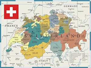
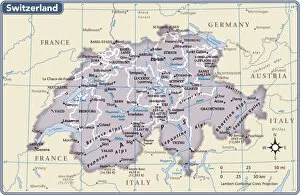
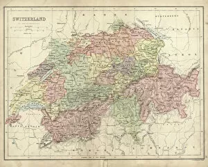
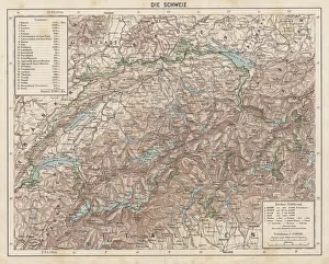
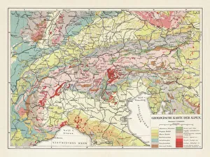
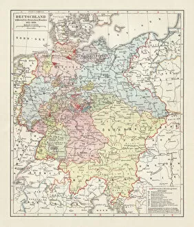
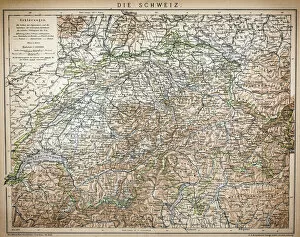
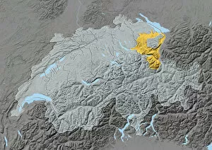
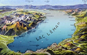
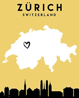
Switzerland is a landlocked country located in Central Europe, bordered by France, Germany, Italy, Austria and Liechtenstein
Choose a picture from our Maps Collection for your Wall Art and Photo Gifts
540 items


All Professionally Made to Order for Quick Shipping
-
Maps Collection
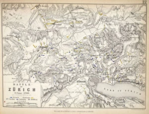
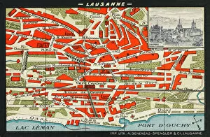
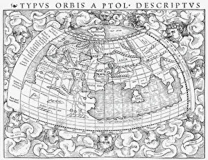
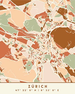
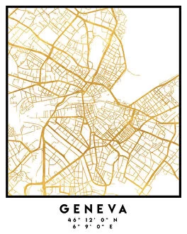
Switzerland is a landlocked country located in Central Europe, bordered by France, Germany, Italy, Austria and Liechtenstein. Switzerland is known for its stunning alpine scenery and picturesque villages. Maps of Switzerland are essential for anyone travelling to the country as they provide an overview of the terrain and geographical features. It also show major cities such as Zurich and Geneva, transport links such as roads and railways, airports and scenic routes. They also indicate areas of natural beauty such as lakes or mountains that can be explored on foot or by car. In addition to physical maps of Switzerland there are also online maps available which provide detailed information about towns, villages and attractions throughout the country.
+
Our beautiful pictures are available as Framed Prints, Photos, Wall Art and Photo Gifts
The Maps of Switzerland Europe collection from Media Storehouse offers a stunning array of wall art and framed prints that showcase the beauty and diversity of Switzerland's geography. Our collection features a range of maps, including topographical maps, vintage maps, and artistic renditions that capture the essence of this picturesque country. Each print is carefully crafted using high-quality materials to ensure longevity and durability. Whether you're looking for a statement piece for your living room or office space or want to add some character to your bedroom or study, the Maps of Switzerland Europe collection has something for everyone. From the snow-capped peaks of the Alps to the serene lakeside towns nestled in valleys below, these prints offer an immersive experience that transports you straight into the heartland of Switzerland. With its rich history and breathtaking landscapes, it's no wonder why so many people are drawn to this beautiful country – now you can bring a piece of it home with you thanks to our Maps of Switzerland Europe collection.
+
What are Maps of Switzerland Europe art prints?
Maps of Switzerland Europe art prints are high-quality reproductions of vintage and contemporary maps showcasing the geography, topography, and landmarks of Switzerland. These prints capture the beauty and intricacy of Swiss cartography in stunning detail, making them perfect for both decorative and educational purposes. These art prints showcase a range of styles including antique maps from the 16th century to modern-day satellite imagery. They come in various sizes, materials, and finishes such as paper or canvas with matte or glossy coatings. Maps of Switzerland Europe art prints are ideal for anyone who loves history, geography, travel or wants to add a touch of sophistication to their home or office decor. They make great gifts for students studying Swiss culture or people who have lived in Switzerland before. Overall Maps of Switzerland Europe art prints offer an excellent way to appreciate the beauty and complexity that is Swiss cartography while adding style to any space.
+
What Maps of Switzerland Europe art prints can I buy from Media Storehouse?
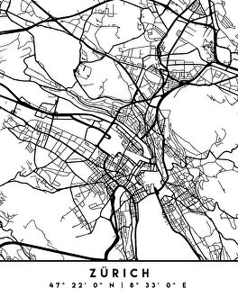
We offer a wide range of Maps of Switzerland Europe art prints that are perfect for anyone who loves geography or history. These maps come in various sizes and styles, including vintage, antique, and modern designs. You can choose from different types of maps such as topographical maps, political maps, physical maps, and more. Our collection includes highly detailed and accurate Swiss Alps map prints that showcase the stunning beauty of this mountainous region. We also offer city street maps that highlight the layout of major cities like Zurich, Geneva, Bern or Basel. Whether you're looking to decorate your home or office space with an eye-catching piece of wall art or want to gift someone who is passionate about cartography these Maps of Switzerland Europe art prints are sure to impress. With our vast selection available online at your fingertips it’s easy to find the perfect print for any occasion.
+
How do I buy Maps of Switzerland Europe art prints?
To buy Maps of Switzerland Europe art prints from Media Storehouse, you can browse our extensive collection of maps and select the one that suits your preferences. Once you have found the map you want to purchase, simply add it to your cart and proceed to checkout. You will be prompted to enter your shipping and billing information before completing the transaction. We offer a variety of payment options including credit cards, PayPal, and Apple Pay for added convenience. They also provide secure checkout processes to ensure that all transactions are safe and protected. In addition to purchasing individual maps, Media Storehouse also offers custom framing services so that you can display your new artwork in style. Whether you're looking for a vintage-style map or a modern interpretation of Switzerland's geography, we have something for everyone.
+
How much do Maps of Switzerland Europe art prints cost?
We offer a wide range of Maps of Switzerland Europe art prints that are perfect for anyone looking to add some geographical charm to their home or office. Our prices vary depending on the size and type of print you choose, but we strive to keep our prices competitive and affordable. Our Maps of Switzerland Europe art prints are available in a variety of sizes ranging from small to large, so you can find the perfect fit for your space. We use high-quality materials and printing techniques to ensure that each print is vibrant and long-lasting. Whether you're looking for a vintage map or a modern interpretation, we have something for everyone. Our Maps of Switzerland Europe art prints make great gifts for history buffs, travelers, or anyone who appreciates beautiful artwork. So if you're interested in purchasing one of our Maps of Switzerland Europe art prints, browse our selection today.
+
How will my Maps of Switzerland Europe art prints be delivered to me?
We take great care in ensuring that your Maps of Switzerland Europe art prints are delivered to you safely and securely. We use high-quality packaging materials to protect your print during transit and ensure it arrives in pristine condition. Your order will be dispatched from our printing facility and shipped directly to the address provided at checkout. We offer a range of delivery options depending on your location, including standard shipping or express delivery for those who require their prints quickly. Once your order has been dispatched, you will receive an email confirmation with tracking information so you can monitor the progress of your shipment. If there are any issues with the delivery of your package, please don't hesitate to contact us and we'll do everything we can to resolve the issue as quickly as possible. We're committed to providing our customers with exceptional service and quality products, so rest assured that when you order from Media Storehouse, you're in good hands.