Fraud Blocker Skip to main content

Home > Europe > France > Maps

Maps Collection (page 2)

Maps of France Europe are essential tools for travelers and tourists who want to explore the continent

13,079 items

Background imageMaps Collection: GREAT LAKES MAP, 1755. French engraved map of the Great Lakes, 1755

GREAT LAKES MAP, 1755. French engraved map of the Great Lakes, 1755

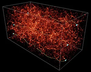
Background imageMaps Collection: Dark matter map

Dark matter map. Computer model of a dark matter (red) map in part of the universe a billion light years long, the first time the invisible dark matter between visible objects has been mapped
Background imageMaps Collection: 16th century world map

16th century world map made by Pierre Desceliers in 1546 on a commission by King Francis I for Henri II of France. Most noticeable is that the Northern hemisphere is upside-down
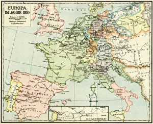
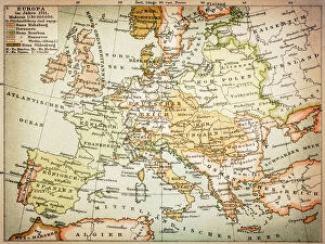
Background imageMaps Collection: Europe in 1810

Europe in 1810
Map of Europe in 1810, during the Napoleonic Wars (in German). Printed color lithograph reproduction of a 19th-century illustration

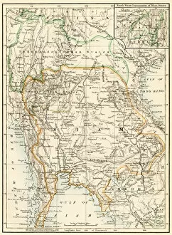
Background imageMaps Collection: GASI2A-00067

GASI2A-00067
Map of Siam (now Thailand) and the independent Shan States, 1870s. Printed color lithograph, 19th century

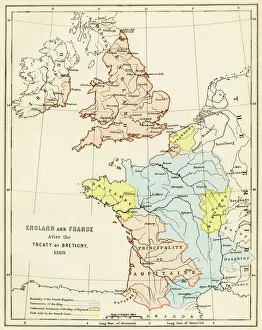
Background imageMaps Collection: Treaty of Bretigny territory settlements, 1360

Treaty of Bretigny territory settlements, 1360
England and France after the Treaty of Bretigny, Hundred Years War, 1360. Color lithograph reproduction of a 19th-century illustration

Background imageMaps Collection: WW1 naval blockades

WW1 naval blockades
Map of English and German naval blockades around Britain, France, Belgium, Germany, Denmark and Norway

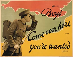
Background imageMaps Collection: World War I recruitment poster

World War I recruitment poster
Poster produced by the Parliamentary Recruiting Committee during World War I, depicting a typical British Tommy in uniform with bayonet fixed, calling across from France to England for more volunteers

Background imageMaps Collection: Map of Europe, 1700

Map of Europe, 1700
17th century map of Europe. Published in 1700, this map by the Dutch cartographer Frederick de Witt (1630-1706) shows the latest knowledge of the geography of Europe

Background imageMaps Collection: Europe, 16th century nautical map

Europe, 16th century nautical map
Nautical map of Europe, 1544 copy of Agnese Atlas. Several copies of this atlas were produced between 1536 and 1564, in Venice, by the Italian mapmaker Battista Agnese

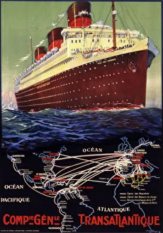
Background imageMaps Collection: Compagnie Generale Transatlantique

Compagnie Generale Transatlantique
Poster advertising Compagnie Generale Transatlantique, the French shipping company, illustrated by the S.S. Ile de France, its first ship to be decorated in Art Deco

Background imageMaps Collection: Map / Europe / France C1000

Map / Europe / France C1000
France in feudal times, with the country allotted to various nobles who bore more or less allegiance to the king, whose acquisitions are shown in map lower left

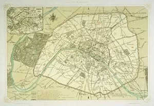
Background imageMaps Collection: Map / Europe / France / Paris

Map / Europe / France / Paris
Map showing the growth of Paris from its earliest origins to the latest projects under Napoleon III

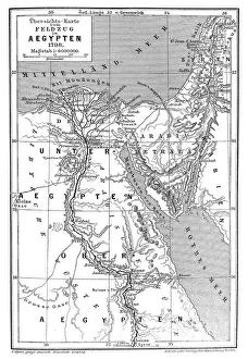
Background imageMaps Collection: Map of Napoleons Campaign in Egypt 1798 - French campaign in Egypt and Syria

Map of Napoleons Campaign in Egypt 1798 - French campaign in Egypt and Syria
Illustration of a Map of Napoleons Campaign in Egypt 1798 - French campaign in Egypt and Syria

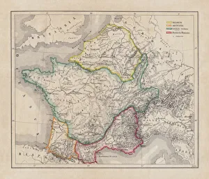
Background imageMaps Collection: Gaul in the time of Julius Caesar, published in 1867

Gaul in the time of Julius Caesar, published in 1867
Gaul in the time of Roman politican Gaius Iulius Caesar (100 - 44 BC). Steel engraving with hand-colored borderlines and Latin legend, published in 1867

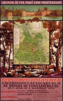
Background imageMaps Collection: Poster advertising French railways to Fontainebleau

Poster advertising French railways to Fontainebleau
Poster advertising French railways to and from the Palace and Forest of Fontainebleau

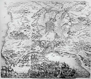
Background imageMaps Collection: Siege of La Rochelle (engraving)

Siege of La Rochelle (engraving)
XIR3050331 Siege of La Rochelle (engraving) by Callot, Jacques (1592-1635); Musee des Plans et Reliefs, Paris, France; (add.info.: The Siege of La Rochelle (French: Le SiAšge de La Rochelle)

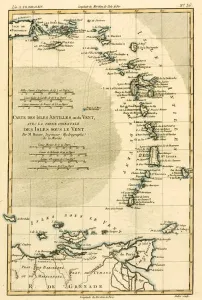
Background imageMaps Collection: The Lesser Antilles or the Windward Islands, with the Eastern part of the Leeward Islands

The Lesser Antilles or the Windward Islands, with the Eastern part of the Leeward Islands
KW205898 The Lesser Antilles or the Windward Islands, with the Eastern part of the Leeward Islands, from Atlas de Toutes les Parties Connues du Globe Terrestre by Guillaume Raynal (1713-96)

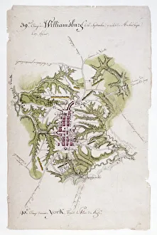
Background imageMaps Collection: Map of Williamsburg, Virginia, and the surrounding country. Drawing, 1781

Map of Williamsburg, Virginia, and the surrounding country. Drawing, 1781, by Louis Alexandre Berthier
WILLIAMSBURG: MAP, 1781. Map of Williamsburg, Virginia, and the surrounding country. Drawing, 1781, by Louis Alexandre Berthier, an aide to General Rochambeau

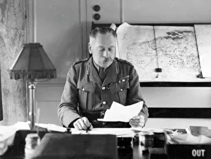
Background imageMaps Collection: Sir Douglas Haig in his headquarter train, France

Sir Douglas Haig in his headquarter train, France
Field Marshal Sir Douglas Haig (1861-1928) in his headquarter train in France during the First World War, with maps of France and Belgium behind him. Date: circa 1918

Background imageMaps Collection: Vietnam / Map C1930 French

Vietnam / Map C1930 French
Card produced when La Cochinchine was a French colony

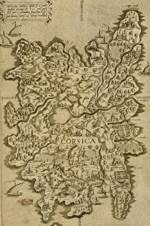
Background imageMaps Collection: Map of Corsica. Italian engraving. 16th century

Map of Corsica. Italian engraving. 16th century

Background imageMaps Collection: Map / Europe / France 1827

Map / Europe / France 1827
Map of France showing the departements

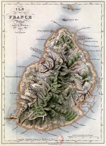
Background imageMaps Collection: Map of Mauritius, illustration from Paul et Virginie by Henri Bernardin de Saint-Pierre

Map of Mauritius, illustration from Paul et Virginie by Henri Bernardin de Saint-Pierre
XIR180649 Map of Mauritius, illustration from Paul et Virginie by Henri Bernardin de Saint-Pierre (1737-1814) engraved by Dyonnet, 1836 (coloured engraving) by Dufour, A.H

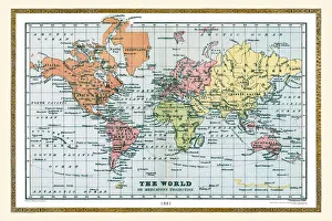
Background imageMaps Collection: Old Map of The World 1881

Old Map of The World 1881
Irish Land War (1879-1882); home rule movement led by Parnell. End of First Boer War (1880-1881). French establish a protectorate in Tunisia

Background imageMaps Collection: Official map of the stage of the Tour de France Cycliste 1950

Official map of the stage of the Tour de France Cycliste 1950
Presentation of the official map of the stage of the Tour de France Cycliste 1950 including 22 stages spread over a total course of 4812 kilometers

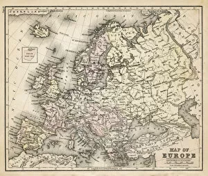
Background imageMaps Collection: old map of europe

old map of europe
an old map form 1883, showing european countries

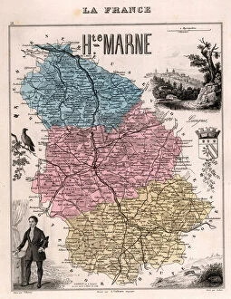
Background imageMaps Collection: La Haute Marne (Haute-Marne, 52), Champagne-Ardennes (Champagne Ardennes) - France and its Colonies

La Haute Marne (Haute-Marne, 52), Champagne-Ardennes (Champagne Ardennes) - France and its Colonies
XEE4144506 La Haute Marne (Haute-Marne, 52), Champagne-Ardennes (Champagne Ardennes) - France and its Colonies. Atlas illustrates one hundred and five maps from the maps of the depot of war

Background imageMaps Collection: ALPHABET OF BIRDS for... S: Serin, circa 1925 (illustration)

ALPHABET OF BIRDS for... S: Serin, circa 1925 (illustration)
7206958 ALPHABET OF BIRDS for... S: Serin, circa 1925 (illustration) by French School, (20th century); 25, 5x17, 10 cm; Private Collection; (add.info.: S: Serin, ALPHABET OF BIRDS for)

Background imageMaps Collection: Reproduction of Map of Routes of St. James of Compostel, originally engraved by D

Reproduction of Map of Routes of St. James of Compostel, originally engraved by D
CHT179600 Reproduction of Map of Routes of St. James of Compostel, originally engraved by D.Serveaux 1648 by French School

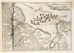
Background imageMaps Collection: Map of the Siege of Quebec by the British Fleet, 1670 (engraving)

Map of the Siege of Quebec by the British Fleet, 1670 (engraving)
STC190699 Map of the Siege of Quebec by the British Fleet, 1670 (engraving) by French School, (17th century); Private Collection; (add.info)

Background imageMaps Collection: France Alsace-Lorraine map 1887

France Alsace-Lorraine map 1887
Map from La Premiere Annee de Geographie par P. Foncin - Paris 1887

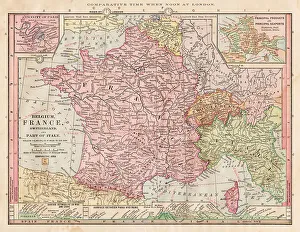
Background imageMaps Collection: Map of France 1886

Map of France 1886
Map of France Maps Monteith Physical Geography 1886

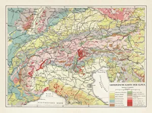
Background imageMaps Collection: Geological map of the European Alps, lithograph, published in 1897

Geological map of the European Alps, lithograph, published in 1897
Geological map of the European Alps. Lithograph, published in 1897

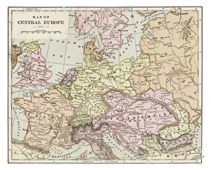
Background imageMaps Collection: Map of central Europe 1889

Map of central Europe 1889
Indiana Educational Series The Complete Geography - Indianapolis 1889

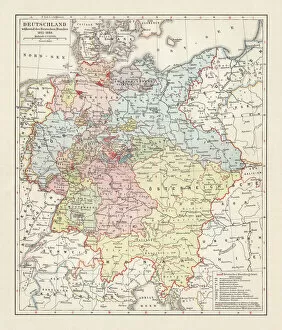
Background imageMaps Collection: Map of the German Confederation (1815-1866), lithograph, published in 1897

Map of the German Confederation (1815-1866), lithograph, published in 1897
Map of the German Confederation between 1815 and 1866. Lithograph, published in 1897

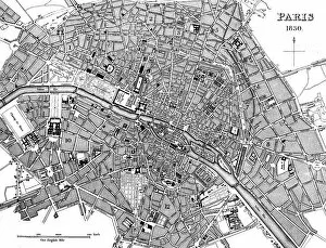
Background imageMaps Collection: Paris, France - City Map

Paris, France - City Map Date: 1830

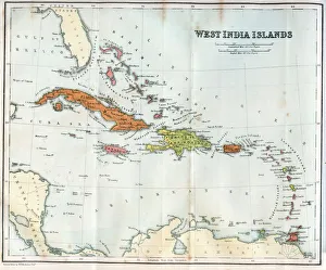
Background imageMaps Collection: Vintage map of the West India Islands 1860s

Vintage map of the West India Islands 1860s

Background imageMaps Collection: Map of Europe 1721

Map of Europe 1721

Background imageMaps Collection: Comic map of Europe by Frederick Rose, c. 1870 (litho)

Comic map of Europe by Frederick Rose, c. 1870 (litho)
XND76008 Comic map of Europe by Frederick Rose, c.1870 (litho) by English School, (19th century); Private Collection; (add.info)

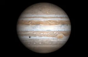
Background imageMaps Collection: US-JUPITER

US-JUPITER
This true-color simulated view of Jupiter released 30 December, 2000 by NASA is composed of four images taken by NASAs Cassini spacecraft on 07 December, 2000

Background imageMaps Collection: High Tor, Matlock, Derbyshire Peaks, MR poster, c 1910s

High Tor, Matlock, Derbyshire Peaks, MR poster, c 1910s
Le Pic du Derbyshire ; Midland Railway poster printed in French. Artwork by Clement Aunston

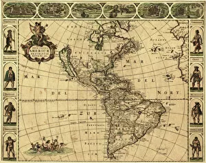
Background imageMaps Collection: Map of the Americas, 1660

Map of the Americas, 1660
17th century map of the Americas. Published in Amsterdam in 1660, this map by the Dutch cartographer Frederick de Witt (1630-1706) shows the geography of the Americas

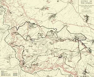
Background imageMaps Collection: Battle of the Somme, First World War, July 1916, (c1920). Creator: Unknown

Battle of the Somme, First World War, July 1916, (c1920). Creator: Unknown
Battle of the Somme, First World War, July 1916, (c1920). Map of northern France showing Successive Stages of Advance at the Fricourt Salient...British line in black, Enemy Defences [Germans] in red

Background imageMaps Collection: Map of France 1889

Map of France 1889
Comprehensive Geography by James Monteith - American Book Company 1882, 1889

Background imageMaps Collection: Map of Farther India, 1902. Creator: Unknown

Map of Farther India, 1902. Creator: Unknown
Map of Farther India, 1902. Southeast Asia, including Burma, Siam, Cambodia, French Indochina and Malaya. From The Century Atlas of the World. [John Walker & Co, Ltd. London, 1902]

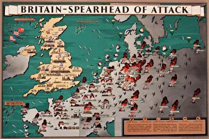
Background imageMaps Collection: Map, Britain -- Spearhead of Attack, WW2

Map, Britain -- Spearhead of Attack, WW2. Date: 1940s

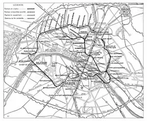
Background imageMaps Collection: Antique engraving illustration: Paris Subway Metro map

Antique engraving illustration: Paris Subway Metro map


All Professionally Made to Order for Quick Shipping


-

Maps Collection

Maps of France Europe are essential tools for travelers and tourists who want to explore the continent. They provide an overview of the country, its major cities, and its attractions and are show roads, rivers, mountains, lakes, and other natural features that make up the landscape. Additionally, they often include information about local customs and culture as well as points of interest such as museums or monuments, and are be found in bookstores or online in various formats including paper maps or digital versions that can be accessed on mobile devices. With a map of France Europe in hand travelers will have no trouble navigating their way around this beautiful country.
+

Our beautiful pictures are available as Framed Prints, Photos, Wall Art and Photo Gifts

The Maps of France Europe collection is a stunning assortment of wall art and framed prints that showcase the beauty and diversity of France. Our collection features an extensive range of maps, including antique maps dating back to the 16th century, as well as modern-day maps highlighting the country's cities, regions, and landmarks. Each print in our collection has been carefully curated by Media Storehouse to provide customers with a unique glimpse into French history and culture. From detailed depictions of Parisian streets to panoramic views of the Alps, these prints are sure to captivate anyone who loves France or European geography. Whether you're looking for a beautiful piece of artwork for your home or office or want to give someone special a thoughtful gift, Maps of France Europe offers something for everyone. With its high-quality printing techniques and durable framing options, our collection is sure to impress even the most discerning art enthusiasts.
+

What are Maps of France Europe art prints?

Maps of France Europe art prints are high-quality reproductions of vintage and contemporary maps showcasing the geography, topography, and landmarks of France and its neighboring European countries. These prints are perfect for those who love history, travel, or simply appreciate the beauty of cartography. The collection includes a wide range of styles, from antique maps dating back to the 16th century to modern designs featuring vibrant colors and intricate details. Some prints focus on specific regions or cities within France or Europe while others provide an overview of the entire continent. These art prints can be used to decorate any room in your home or office, adding a touch of sophistication and elegance to your space. They also make great gifts for anyone with an interest in geography or history. Whether you're looking for a unique piece to add to your personal collection or want to give someone special a thoughtful gift they'll treasure forever, Maps of France Europe art prints from Media Storehouse are sure to impress.
+

What Maps of France Europe art prints can I buy from Media Storehouse?

We offer a wide range of Maps of France Europe art prints that are perfect for those who love to travel or have an interest in geography. These maps come in various styles and designs, including vintage, antique, and modern versions. You can choose from different sizes and formats such as canvas prints, framed prints, posters or photographic prints. Some popular options include the Antique Map of France by John Speed which dates back to 1626; the Vintage Map of Paris which showcases the city's famous landmarks; and the Modern Map of Europe which highlights all major cities across the continent. Whether you're looking for a decorative piece for your home or office space or want to gift it to someone who loves history or geography- Media Storehouse has got you covered with their vast collection of Maps of France Europe art prints.
+

How do I buy Maps of France Europe art prints?

To buy Maps of France Europe art prints from Media Storehouse, you can browse through our extensive collection of maps and select the ones that interest you. Once you have made your selection, add them to your cart and proceed to checkout. You will be prompted to enter your shipping and payment information before completing the purchase. We offer a variety of sizes for their art prints, so make sure to choose the one that best fits your needs. The maps are printed on high-quality paper using state-of-the-art printing technology, ensuring that they look great in any setting. If you have any questions or concerns about purchasing Maps of France Europe art prints from Media Storehouse, our customer service team is available to assist you. They can provide additional information about the products or help with any issues that may arise during the ordering process.
+

How much do Maps of France Europe art prints cost?

We offer a wide range of Maps of France Europe art prints at varying prices. The cost of these prints depends on several factors such as the size, quality, and type of print you choose. Our standard paper prints are more affordable than our premium canvas or framed options. Additionally, some maps may be more intricate and detailed than others which can also impact the price. We strive to provide high-quality products at reasonable prices for all customers. Our Maps of France Europe art prints make great additions to any home or office decor and are perfect for history buffs or those who love travel. With a variety of sizes and styles available, there is something for everyone's taste and budget. We encourage customers to browse our selection online to find the perfect map print that fits their needs and preferences without breaking the bank.
+

How will my Maps of France Europe art prints be delivered to me?

We take great care in delivering your Maps of France Europe art prints to you. We use high-quality packaging materials to ensure that your artwork arrives in pristine condition. Your print will be carefully rolled and placed inside a sturdy tube for protection during transit. We work with trusted shipping partners who offer reliable delivery services. Once your order has been dispatched, you will receive an email notification with tracking information so that you can monitor the progress of your shipment. Our team is dedicated to providing excellent customer service, and we are always available to answer any questions or concerns you may have about the delivery process. If there are any issues with your order upon arrival, please contact us immediately so that we can resolve them as quickly as possible. You can trust Media Storehouse to deliver your Maps of France Europe art prints safely and efficiently straight to your doorstep.