Fraud Blocker Skip to main content

Map / Europe / France C1000

Map  /  Europe  /  France C1000
Sold 3
In Stock
We accept all major payment options so you can pay for the things you need in the way that is most convenient for you

Mary Evans Picture Library Photo Prints and Wall Art

Map / Europe / France C1000

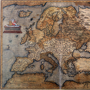
France in feudal times, with the country allotted to various nobles who bore more or less allegiance to the king, whose acquisitions are shown in map lower left. Mary Evans Picture Library makes available wonderful images created for people to enjoy over the centuries. © Mary Evans Picture Library 2015 - https://copyrighthub.org/s0/hub1/creation/maryevans/MaryEvansPictureID/10046920

Media ID 594579

1000 1500 Allegiance Allotted Bore Feudal Lower Maps Nobles Shown Times

SECURE PAYMENTS
We accept all major payment options so you can pay for the things you need in the way that is most convenient for you

Made in UK
Safe Shipping, Easy Returns

FREE PERSONALISATION
We are proud to offer a range of customisation including Cropping, Captions, and Filters. Zoom Cropping can be adjusted in the basket


EDITORS COMMENTS

Step back in time with this map print of Feudal France in the year 1000, as depicted in the historical map "France C1000" from Mary Evans Prints Online. This map offers a fascinating glimpse into the complex political landscape of medieval France, where the country was allotted to various nobles who bore more or less allegiance to the king. At the lower left corner of the map, the acquisitions of the king are shown, providing a clear illustration of the monarch's territorial holdings during this period. The intricate details of the map reveal the vast expanse of lands controlled by these noble families, each with their own distinct territories and domains. As you explore this historical map, you'll notice the intricate borders that mark the territories of the various feudal lords, each with their unique symbols and insignia. The map also highlights the major cities and rivers of the time, providing context to the political and geographical landscape of medieval France. This map is a testament to the rich history of France during the feudal period, a time when the country was a patchwork of territories ruled by powerful nobles, each with their own allegiances and loyalties. The intricate details of this map offer a unique perspective into this complex and fascinating era, making it an essential addition to any history or map enthusiast's collection. The "France C1000" map is not only a beautiful work of art, but also an invaluable historical resource, providing insights into the political and geographical landscape of medieval France during a time of great change and transformation. Whether you're a history buff, a map collector, or simply someone with an interest in the Middle Ages, this map is sure to captivate and inspire you.


Framed Prints of Map / Europe / France C1000

Discover the rich history of feudal France with our stunning Framed Print from Media Storehouse and Mary Evans Prints Online. This exquisite map depicts Europe with a focus on the intricate territories of France during feudal times. Witness the intricate allotment of lands to various nobles, each bearing varying degrees of allegiance to the king. The intricate details in this historic map are brought to life in the high-quality print, making it a captivating addition to any home or office. The vintage map design adds an air of sophistication and intrigue, making it a perfect conversation starter. Order your Framed Print today and travel back in time to explore the complex political landscape of medieval France.


Photo Prints of Map / Europe / France C1000

Discover the rich history of medieval France with our exquisite selection of photographic prints from the Media Storehouse range, sourced from the esteemed Mary Evans Prints Online. Witness the intricate feudal map of Europe, specifically focusing on France (C1000), meticulously detailed to depict the territories of various nobles, each with their degree of loyalty to the monarch. This captivating print offers a mesmerizing journey into the political landscape of the era, a must-have for history enthusiasts and art collectors alike.


Poster Prints of Map / Europe / France C1000

Discover the rich history of feudal France with our captivating Map / Europe / France C1000 poster print from Media Storehouse, in partnership with Mary Evans Prints Online. This intricately detailed map transports you back in time, illustrating the country during the era of noble alliances and the king's acquisitions. Witness the intriguing political landscape of medieval France, as various territories are depicted with their distinctive borders and regional distinctions. Bring history to life in your home or office with this stunning and authentic poster print.


Jigsaw Puzzles of Map / Europe / France C1000

Discover the rich history of medieval France with our captivating jigsaw puzzle from the Media Storehouse range, featuring an intricate map print from Mary Evans Prints Online. This exquisite puzzle depicts France during feudal times, where the country was allotted to various nobles, each with their allegiance to the king. Delve into the intricacies of the map lower left, revealing the king's acquisitions and territorial holdings. Assemble this puzzle to bring the history of medieval France to life in your home. Perfect for history enthusiasts, puzzle lovers, or anyone seeking a challenging and rewarding pastime.

diamond
Made With High Grade Materials
thumb_up
Professional Quality Finish
package_2
Carefully Packed To Aid Safe Arrival

You May Also Like


Map of Europe in 1360Map of Europe in 1360
Add to Basket
Medieval Europe at the start of the CrusadesMedieval Europe at the start of the Crusades
Add to Basket
Medieval Spain and Portugal mapMedieval Spain and Portugal map
Add to Basket
Map of Europe and coasts of the North of Africa, 1587Map of Europe and coasts of the North of Africa, 1587
Add to Basket
Map of Europe after the Peace of Luneville, 1801, from A Short History of theMap of Europe after the Peace of Luneville, 1801, from A Short History of the
Add to Basket
Map of Europe. Second half of the 19th century. Italian Atlas. Stabilimento CivelliMap of Europe. Second half of the 19th century. Italian Atlas. Stabilimento Civelli
Add to Basket
Map of Europe, 1870sMap of Europe, 1870s
Add to Basket
MAP OF EUROPE, 12th CENTURY. A 19th century map of Europe as it was politically constituted in theMAP OF EUROPE, 12th CENTURY. A 19th century map of Europe as it was politically constituted in the
Add to Basket
France country mapFrance country map
Add to Basket
Detailed map of EuropeDetailed map of Europe
Add to Basket
Map of France - VectorMap of France - Vector
Add to Basket
Map of Europe, 16th centuryMap of Europe, 16th century
Add to Basket

Gallery Wall Inspiration

D-DAY MAP 1944
Map of Cathay, China, from Catalan Atlas created for Charles V, King of France, attributed to Abraham and Jafuda Cresques Maiorca, circa 1375
Battle Of Waterloo
Reference Map of Spain
France Administrative Political Map
Map of France - Vector
Daily Mail War Map, WW1
WW2 poster, activities of 52 (Lowland) Division
France country map
Map of the Battle of Waterloo, 18th June 1815 (19th century)
Carte du Tendre: imaginary map by a character in the novel Cl├®lie
Map of Saudi Arabia with Flag
Europe Map with France, Portugal, Spain and Netherlands
MAP OF FRANCE, c1900. With inset detail of Paris and surrounding area
Street Map 1878
Battle Of Waterloo
Jersey Airways Poster
Oronce Fines world map, 1531
Poster for French railways to Morocco
Map / France / Belgium / Nethe
Map / Paris 18C
European Postcode Map
Battle of the Somme, First World War, July 1916, (c1920). Creator: Unknown
Poster for French railways to Morocco
Map of the Battle of Waterloo, Belgium, 18 June 1815
Spanish map of England, Scotland and Ireland
Angevin kings holdings in France and Britain


© Copyright Media Storehouse, All Rights Reserved 2003 - 2024
Facebook     Pinterest     100% Payment Secure     Reviews IO